
|
|
Mountain/Rock |
|---|---|
|
|
32.34825°N / 111.50828°W |
|
|
Pima |
|
|
Hiking, Scrambling |
|
|
Spring, Fall, Winter |
|
|
3830 ft / 1167 m |
|
|
Overview
Waterman Peak is the range highpoint of the Waterman Mountains and has about 1250 feet of prominence earning it the 244th spot on the Arizona prominence list. The peak lies about 25 miles northwest of Tucson and less than 100 miles southeast of Phoenix. Depending on the source different elevations can be found for the peak; the topo map shows a 3820 contour but no exact elevation for the summit whereas other sources (Wikipedia) list the summit at 3808. The summit elevation used here is given on peakbagger and listofjohn. The Waterman Peak lies within the Ironwood Forest National Monument and features some very interesting and endangered flora and fauna including the last population of big horn sheep indigenous to the Tucson basin. We were fortunate enough to see two separate groups of sheep on our hike. The hike itself is fairly short (<4 miles roundtrip) and can easily be done in about 2 hours even without rushing. The summit provides unobstructed 360º views of the surrounding mountains including nearby Ragged Top, Silver Bell Peak, Picacho and Newman Peaks in the immediate area as well as some of the well known higher peaks in the Tucson are like Mt. Lemmon or Mica and Rincon. Additionally, the summit provides are very unique view at 3 peaks with over 2000 feet of prominence to the East, Coyote and Kitt Peak with the summit tower of Baboquivari in the middle of them. According to the summit register, Waterman Peak does not seem to see a lot of visitors. The Southern Arizona Hiking Club (based in Tucson) seems to conduct an annual hike and the border patrol seems to chase up their recruits for training purposes.
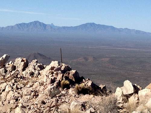
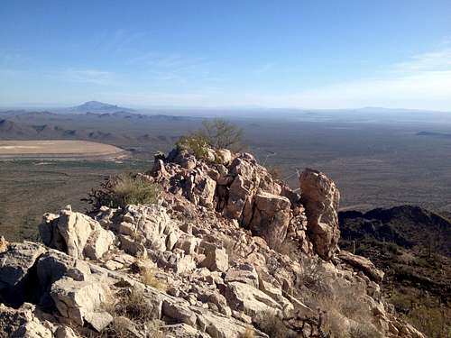
Summit of Waterman with Coyote, Kitt and Baboquivari in the background
Getting There
On I-10 take the Avra Valley Road exit (exit 242) and go west on Avra Valley for 20 miles. After initially going through farm land and passing the Marana airfield the road will eventually enter the Ironwood Forest National Monument. After 20 miles turn left onto Johnson Mine Road which is not signed (and my car's GSP did not show it!) but it is an obvious, paved main road. After 0.3 mile follow the paved main road to the left at a Y-junction. After 1.2 miles from Avra Valley Rd. you will reach the parking area at the trailhead to the left (this is the 2nd parking area on Johnson Mine Rd.). The entire distance from the interstate to the trailhead is on paved roads and should take only about 30 minutes.
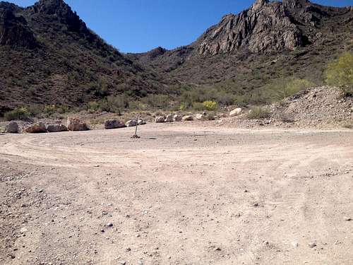
The parking area and the initial route up the valley in the background
Route
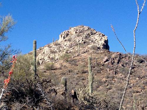
From the parking area following the old mining road up the valley for about 0.5 miles to a saddle. At the saddle turn right and follow a faint use trail on the left side of the rocky ridge. If you miss the use trail or just want more of a scramble it would also be possible to just stay on top of the ridge itself as the rock is very solid and stable. We chose to follow the easy trail here. Once you get above the ridge you will see a prominent rock pinnacle above you. Aim for the slopes passing the pinnacle at the right side of it. Again, you should be able to pick up a faint use trail here.
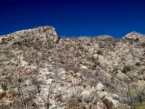
Aim for the slopes to the right of the rock pinnacle
You still can't see the actual summit from here and you will come to another saddle above the rock pinnacle. At that saddle turn left towards an obvious ramp which actually leads you to the final summit ridge.
View at the ramp
We chose to scramble up the ramp on the right side but it probably does not matter too much. The rock here is very sharp but also very solid which makes the scramble fairly easy and safe. The scramble does not exceed a low class 3. Once above the ramp you pop out onto the narrow summit ridge with dramatic cliffs and drop-offs to both sides. Follow the ridge over two bumps to the summit which is marked with a rock pile and a stick. To us it was not absolutely clear which of the three bumps was the actual highpoint so be sure to visit them all.
View along the ridge from the summit with Picacho and Newman Peaks in the background
Total round trip distance: 3.5 miles
Elevation gain: 1260 feet
Red Tape
The peak lies within the Ironwood Forest National Monument. No permits are required to visit the national monument. Vehicles must stay on existing routes. For further information check out the national monument website; see link below. There is a sign at the trailhead which suggests, but does not explicitly forbid, not to hike in the area from February to April 30 due to the bighorn sheep calving season. We actually chatted with a park ranger at the trailhead and he did not mention anything about this so hike at your own discretion.When to Climb
The best time to climb this peak is in winter but fall and spring may also be good options depending on the temperatures. Since he hike is fairly short, the peak can also be climbed in the shoulder seasons with an early morning start to avoid the warmer temperatures. When we hiked the peak at the end of April we started at 7:00am enjoying cool and pleasant temperatures but it started to get warmer on our return. Summer should be avoided as it gets very hot.Camping
According to their website there are no developed campsites with facilities within the national monument. Visitors can pick their own campsite, but please camp at least 200 feet from water sources and use biodegradable soap. Camping is permitted for up to 14 days.External Links
Ironwood Forest National Monument website
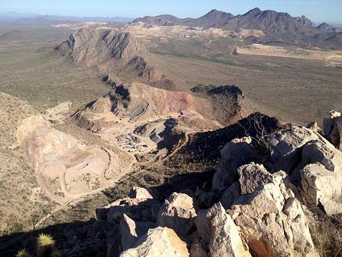
View west from the summit at Silver Bell Peak and Ragged Top as well as the open pit mines in the area
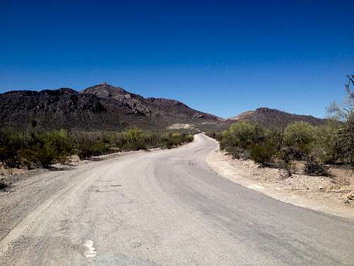
Waterman Peak as seen from Johnson Mine Road