Account of Events
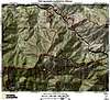
![Mount Lawlor South Ridge]() Steep ascent via the south ridge of Mount Lawlor
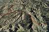
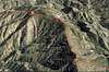
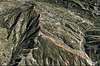
Steep ascent via the south ridge of Mount Lawlor![Vetter Mountain Southwest Ridge]() Vetter Mountain's Southwest Ridge
Vetter Mountain's Southwest Ridge The plan was simple but ambitious: hiking up to Mount Lawlor from the Red Box Trailhead, continue on Lawlor’s east ridge to Barley Flats, explore the northeast leading ridges down to the Upper Tujunga Canyon Road, and then directly ascend the southwest ridge of Vetter Mountain to the fire lookout on its summit. Originally planned as an in and out adventure we quickly realized that we would need a car shuttle if we wanted to accomplish our goal. There were some uncertainties though: we did not know what the snow conditions were on the use trail on the ridge from Mount Lawlor to Barley Flats. Previous reports described a partially overgrown trail and snow coverage would certainly not make the route finding easier. The main problem however seemed to be the descent from Barley Flats to the Upper Tujunga Canyon Road. The marked Alder Creek Trail leads from Barley Flats to the Road but it would connect with the road about 2 miles northwest of the ridge which we planned to take up to Vetter Mountain. Instead, we planned to find a more direct way from Barley Flats to the road closer to the southwest ridge of Vetter. Furthermore, there was no report about the ascent of Vetter Mountain via its southwest ridge, but the terrain did not seem to be too difficult when we studied the maps. Considering all the facts we knew we were up for some major exploration. However, our group consisted of six strong and enthusiastic hikers; so we were ready to go.
Part 1: The weather forecast predicted a mostly nice day with a small chance of snow flurries at higher elevations in the afternoon in the Mount Wilson area. We met at 7:30 am at our usual meeting point at the Angeles Crest Highway and car-pooled up to the Red Box trailhead. We took then three cars up to the Charlton Flat parking area and drove back with one car to the Red Box. Shortly before 9 am we were all set to go. We did not want to waste time and take the usual route to the saddle north of Mount Lawlor and hike to its summit via the northwest ridge. Instead we decided to take the direct and steep south ridge. After crossing the Crest Highway from the Red Box (~4,600’) we scrambled through some loose dirt and bushes to gain access to the south ridge. The first portion of the ridge is steep but not too difficult. There were some bushes and snow patches but after about 0.6 miles and a little bit less than 600 feet of elevation gain we reached the connection with the marked trail leading around the south face of Lawlor fairly quickly. From there, the steeper and definitely more strenuous part of Lawlor’s south ridge started (about 0.5 miles and 900 feet of elevation gain; 43% grade). It reminded us on Iron Mountain’s south ridge; shorter though but equally steep over loose dirt and rocks through sharp yuccas and other chaparral. After 45 minutes of scramble and ~ 1,500 feet of elevation gain we reached the summit (5,957’) where we took a breather and enjoyed a quick snack.
Part 2: We then continued on the east ridge, which was relatively easy to follow at first. Very soon, however, the ridge was covered in 1-2 feet deep snow and the chaparral got annoyingly thick. Luckily there were some wooden posts about every few hundred feet that marked the way. Despite those posts we found ourselves stuck in impassable bushes a few times. The ridge led first fairly straight to the east, but after about 1.2 miles turned to the northeast. At some point the water tank at Barley Flats became visible which certainly helped for our navigation. While making our way through the snow we saw abundant bear and cougar tracks. Eventually after about 2 miles and traversing a few bumps on the ridge we reached the water tank at Barely Flats (~5,600’), where we took a quick break. We then continued to the east and passed the former military installation at Barley Flats (which now seems to be a religious retreat) on the north side. A small but clearly visible use trail led along the fence and eventually connected with the road at the camp entrance. Our plan now was to take the Alder Creek Trail north and then find a passable way to the east down to the Upper Tujunga Canyon Road. The Alder Creek Trail starts about 20 feet east of the locked gate of the Barley Flat camp on the north side of the road. We hiked the surprisingly well maintained trail through some snow in north-easterly direction for about one mile. When we saw the Upper Tujunga Canyon road more than 1,000 feet below and several miles to the away we knew we still had a lot of terrain to cover. Unfortunately, we also realized that the ridges leading east down to the road were all covered in very thick chaparral which did not seem passable. No firebreaks or use trails were visible. On the other side of the road we caught a first glimpse of the southwest ridge of Vetter Mountain. We were somewhat slightly intimidated by its obvious length and elevation gain. We very soon realized that trying to find our way through the thick chaparral down to the road would certainly take a lot of time – if it was even possible. Considering that it was already past noon and we still had many more miles to go and elevation to gain, we decided to take the Alder Creek trail all the way down to the road and then walk up to the ridge leading to Vetter Mountain. Although this option would add a few more miles to our hike we thought that it would take much less time to get down to the road. We were still very determined to hike up Vetter’s southwest ridge. After a bit more than 3 miles and more than 2,000 feet of elevation loss we reached the Upper Tujunga Canyon Road. The Alder Creek Trail continued on the other side of the road towards Loomis Ranch. We then continued on the road about one mile until we saw a fire road winding its way above the east side of the road towards the ridge we wanted to take up to Vetter Mountain. After 1.2 miles and about 500 feet elevation gain we were standing at the ridge and prepared ourselves for the last but considerable ascent.
Part 3: The hike up the ridge started crossing some big transmission towers on a clear firebreak. It was steep but we pushed quite strong considering that we only had 3 more hours before sunset and dark clouds were creeping over the Crest Highway to the south. The lookout tower on top of Vetter Mountain was visible all the way but was still in far reach. After about 1,000 feet in one mile the ridgeline was turning to the south-eastern direction. We scrambled through some snow patches and low chaparral without problems. At some point there were large boulders on the ridgeline which you can easily climb over or bypass to the left. After that section we reached a small saddle where we took a breather for the last portion. Shortly before the lookout we scrambled over some large slabs of rock, which luckily were not iced over. Somewhat exhausted but proud of ourselves we grouped together on the lookout for a summit picture. The entire southwest ridge of Vetter Mountain was a little bit more that 2,000 feet of elevation in about 2 miles. After some chatting we strolled along the Vetter Mountain trail (~1.5 miles) over considerable but compact snow to the Charlton Flat parking area where dozens of groups (families) enjoyed some time in the snow. We were back at the cars at about 4 pm and ended the day at Newscomb’s Ranch and a good-size burger. Overall, the hike from Red Box to Charlton Flat totaled to about 13 miles and ~4,500 feet of elevation gain.
Disclaimer: The track was recorded on a Garmin GPSmap 60CSx with coordinate savings every 30 seconds. Mileage- and elevation readings were calculated after importing the gpx file into National Geographic’s Topo 4.0 software.


Comments
Post a Comment