
-
 13477 Hits
-
 86.3% Score
-
 22 Votes
|
|
Route |
|---|---|
|
|
46.12788°N / 8.01117°E |
|
|
Mountaineering, Ice Climbing |
|
|
Summer |
|
|
Most of a day |
|
|
PD, I- II, Slope Max 35° |
|
|
Overview
Weissmies traverse from NW-flank to SSE ridge
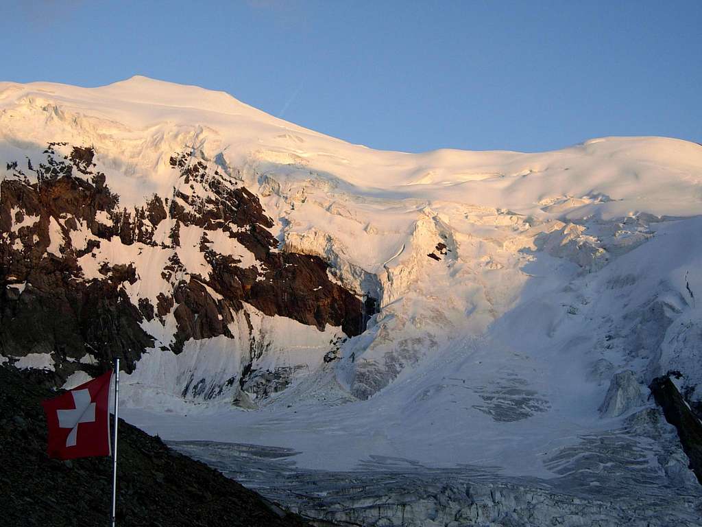
Weissmies 4017 m is a prominent mountain belonging to the Pennine Alps and surrounding the well known Saas valley, located in the Swiss Wallis. Weissmies is one of the 82 mountains in the Alps exceeding 4000 meters (UIAA-list) and therefore a sought after objective. Check here the complete list of the 82 alpine Fourthousanders and the 46 minor summits: Club4000. Weissmies is one of the 4000 most accessible in the Alps, since the route along the Northwest flank of Weissmies, which is considered the Normal route to the mountain, is graded PD. This itinerary is facilitated by the vicinity of the Hohsaas cableway. In theory this fact allows people to climb the mountain along this route in a single day, but it is advisable to stay overnight at high altitude for a better acclimatization.
There is a second route which can also be considered as a standard route. It starts from the Almagellerhütte and runs along the SSE ridge of the mountain. These two itineraries combined compose the grandiose and rewarded crossing described on this page. The itinerary can be done in both directions, although it is advisable the ascent from the NW and the descent along the SSE ridge. In this page the crossing will be described in both directions.
Together with the Lagginhorn, the Weissmiess dominates the east side of the Sass-Fee valley, while on the opposite side it stands the majestic Mischabel chain, with a string of 4000 among the finest in the Alps. The summit of the Weissmies is therefore a panoramic balcony over the Mischabel range and in general over the whole Valais. As for the name Weissmies, “Mies” is a local dialect for the German word “moos”, meaning “moss”. So the name “Weissmies” literally means “white moss”, which refers the glaciated summit of the mountain, resembling a white moss-like cover.
Getting there
The starting point for this crossing is the Saas valley. Starting point for the Normal route is Saas Grund. From Saas Grund it starts the Hohsaas cableway as well as the trails to the Weissmies Hut and Hohsaas Hut. The "next" village in the valley is Saas Almagel. From here a marked trail starts to the Almageller Hut, the refuge located at the end of the crossing.
The links below provide information about the Hohsaas cabelway and about how to get to Saas Grund and Saas Almagel. Also see the section ''Huts'' for more information about the huts surrounding Weissmies and how to get to them from the Saas valley.
How to get to Saas (Fee, Grund, Almagell): Click Here
Timetable Cableways: Click Here
Lift Prices: Click Here
Access to the high mountain huts
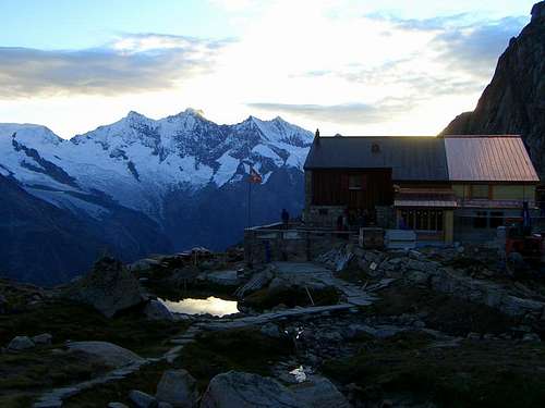
To Weissmieshütte 2726 m by cable car - From Sass Grund you can reach the Weissmieshütte or the upper station of Hohsaas: using the ski lifts to the middle station Kreuzboden 2400 m and from here to the Weissmieshütte in about half a hour on the mule track. Alternatively, you can use use the cable car up to the upper station of Hohsaas 3142 m, where it's situated a private refuge, shortening the climb by 1h and over 300 meters in altitude.
To Weissmieshütte 2726 m by foot - From Sass Grund (valley station of the mountain railways to Hohsaas 1550 m) on a marked trail to the Weissmieshütte 2726 m. Time: 3,30 hours
To Almagellerhütte 2894 m - From Saas-Almagell to Almagelleralp and Almagellerhütte Time: 3-4h - Drive to the village of Saas-Algamell and in the beginning there is a parking area at your left side after crossing a little bridge. It is situated between two hotels. From here the path starts climbing through the forest on the E side of the valley. After climbing about 400 meters you will cross a bridge in the wood and at this point you are about 1 Km from the "Stafel". A little bith further you'll pass the Almagelleralp hotel 2194 m. Follow the path upstream and keep on it when it turns left into the Wysstal. The Almagellerhut will be visible as the slope relents. Time to get there : 3 1/2 Hr.
Route Description
Weissmies traverse from NW-flank to SSE ridge
Difficulty: Alpine PD
Difference in level: 875 m from the Hohsass Hut, 1291 m from the Weissmieshütte
Exposure: North-West, then SSE
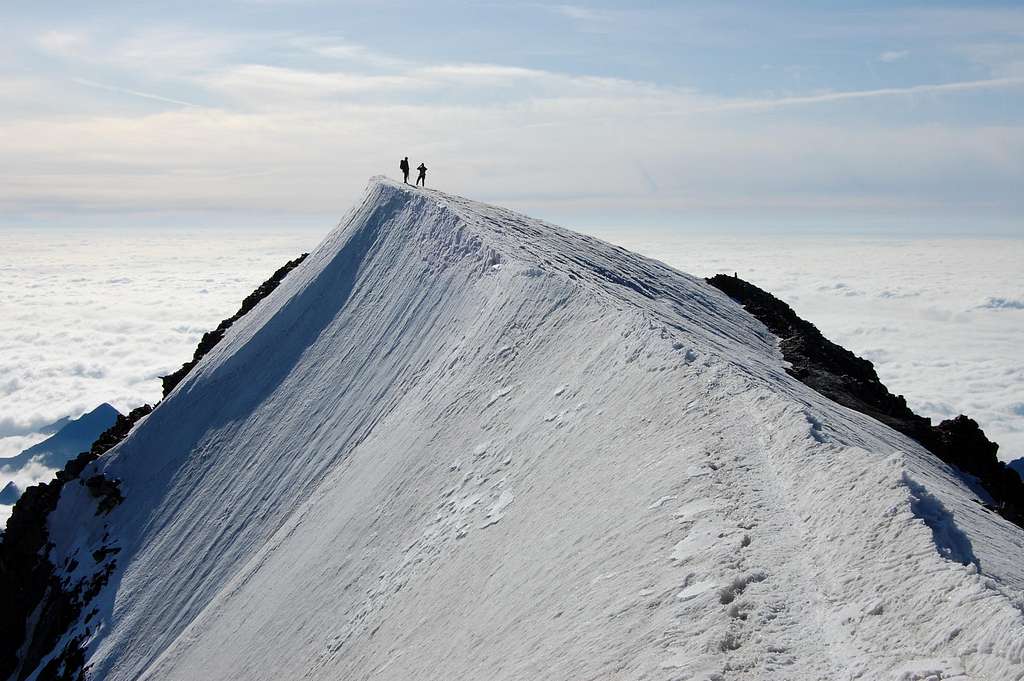
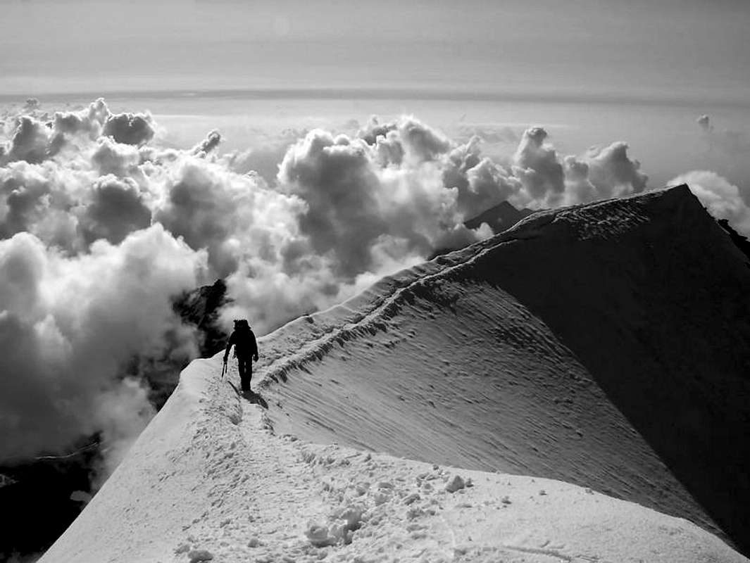
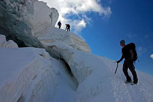
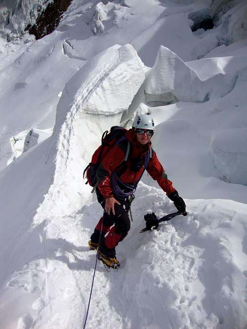
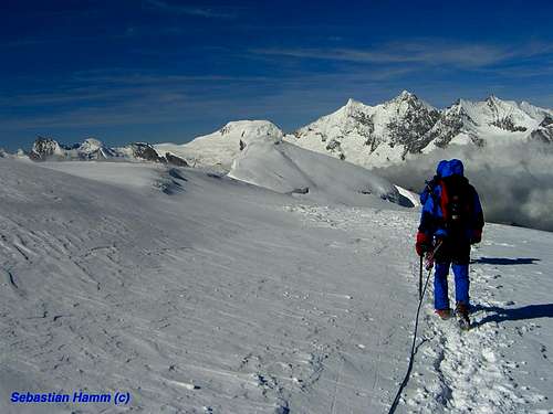
From the Hohsaas refuge on a slightly downhill dirt road you can reach the glacier in a few minutes, very crevassed in the lower part. You take the track that at first follows the left side (with respect to the direction of travel) of the glacier, winding between the crevasses. After a first not steep section, the track bends to the right (crevasses), traversing under an impressive series of seracs up to the foot of a steep slope (40-45°) that leads to a shoulder. Climb up this slope to reach the shoulder (tiring, steepest part of the climb). From here continue at first mainly on level and then more steeply, turning left and getting the altitude of about 3820 m. From here head still to the left towards the summit, at first on a mainly flat ridge with snow corniches on the right. Overcome then a slope again steep and finally the summit slope (max 35-40°) and the top.
Weissmies traverse from SSE ridge to NW flank
Difficulty: Alpine PD
Difference in level: 1123 m from the Almagellerhütte
Exposure: SSE, then NW
Start from the Almagellerhütte, down the stairs follow the direction of the "Zwischbergenpass" (signpost on a block, yellow arrow). You can't miss, there are everywhere "cairns" and red and white signs to follow. At about 1/1,30 hour you'll reach the Zwischbergenpass, there you'll turn left towards the SSE-ridge of the Weissmies.
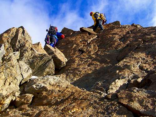
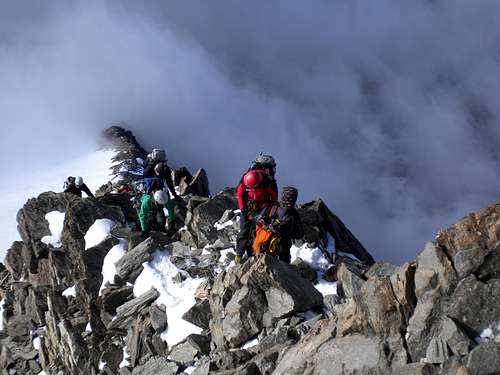
Follow the ridge till you reach a continuous, triangular snow slope ahead. We started at the beginning of that snow slope 3500 m climbing up the ridge. You can do the ridge without a rope if you feel confident, it isn't so difficult. Follow the ridge till you reach a snow slope. Cross this snow slope that change into a snow ridge and leads to the rocky forsummit. After that the summit is in sight over a snowridge for about 60 m.
For the descent you take the SW-ridge down (slope max 35°, steepest part of the way down). There is a lot of traffic coming up. There is a trench leading down, you can't miss. In bad conditions it could be very dangerous for route finding and because the glacier isn't a friendly one with a lot of deep crevasses. It takes about 3 1/2 Hr to reach the summit and another 2 hours to go down. When you reach the Hohsaashut you can take a gondola lift back down to Saas-Grund and from here it is about 4 Km back to the parking area in Saas-Almagell. Maybe you can take the bus but I did it on foot.

Essential Gear
Rope, crampons, ice-axe, some slings for the rock ridge, glacier rescue material, helmet, harness, some ice screws
Red Tape
No fees no permits required
Huts
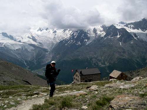
Weissmieshütte 2726 m - SAC Olten section
Almagellerhütte 2894 m - SAC
It is an attractive, modern hut situated below the S side of the Dri Horlini ( you can do some sportclimbing there ). Tel 027 975 11 79. How you can reach this hut ? Well you drive to the town of Saas-Algamell and in the beginning of the last town of the Saas-Valley there is a parking area at your left side after crossing a little bridge. It is situated between two hotels. It is about 5 CHF a day. From here the path starts climbing trough the forrest on the E side of the valley. After climbing about 400 Mh you will cross a bridge in wood and at this point you are about 1 Km from the "Stafel" ( mentioned at the map, I used it once as a bivouac, it was a shelter for cattle I suppose). A little bith further you'll pass the Almagelleralp hotel 2194m. Follow the path upstream and keep on it when it turns left into the Wysstal. The Almagellerhut wil be visible as the slope relents. Time to get there : 3 1/2 Hr.
Other accomodation
Camping
In the Saas valley there are 3 good options for camping. Camping Mischabel, Camping am Kapellenweg and camping Schonblick. All three are located in the vicinity of Saas Grund in the Saas valley.
Hotels
When to climb
Weissmies is climbed mostly during the summer months: July, August, September. Especially on the normal route, it can get quite busy during the summer months. The normal route is also climbed with skis during the winter season.
Meteo
Guidebooks and maps
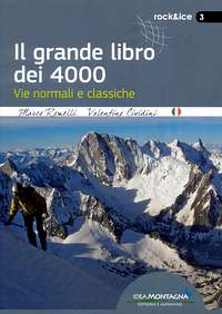
"Il grande libro dei 4000" by Marco Romelli, Valentino Cividini - Idea Montagna Editore, 2015
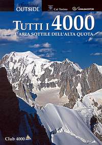
-“Tutti i 4000” – L’aria sottile dell’alta quota” – CLUB 4000 CAI TORINO – Vivalda Editori
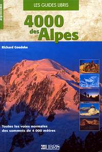
-“The 4000 of the Alps” by Richard Goedeke (CAAI) – All the normal routes to the 4000m. summits of the Alps – Libris Edition
-“I Quattromila delle Alpi” by Karl Blodig and Helmut Dumler – Zanichelli Editore
Maps
SAAS 1329 1:25000
Probemeister - Oct 30, 2003 9:29 am - Hasn't voted
Route CommentI would recommend traversing the Weissmies by climbing the NW flank whilst the snow is hard and descending the SSE ridge in the heat of the day. This is an excellent lower grade mountaineering trip, highly recommended, especially for less experienced alpinists wanting a big mountain experience