|
|
Trip Report |
|---|---|
|
|
38.39539°N / 106.24835°W |
|
|
Download GPX » View Route on Map |
|
|
Dec 26, 0000 |
|
|
Hiking |
|
|
Summer, Fall |
Finding Mt. Ouray's West Ridge "Trail"
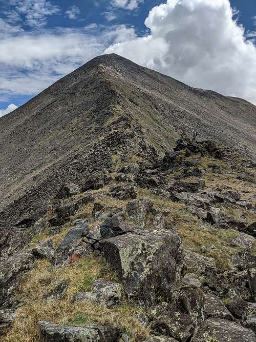
This report provides augmenting information as of July 26, 2020, for the standard West Ridge route of Mount Ouray, Colorado's 58th highest peak. See other reports for background, I'm just interested in conveying the latest route finding info here, since many seem to be confused on how to start. There are two good ways to attain Point 12685, which is the alpine beginning of this route to Mount Ouray. The standard route by Roach and others is shown here in a GPX file descent from the foot of the summit pyramid, to the Marshall Pass kiosks. As always, it's easier to find the beaten path once you are on the mountain, and we used a good alternative to go up, that you may prefer and which is described second here. Once you attain Pt 12685, it's not just a cakewalk, and Moderate hikers in our party found the West Ridge to be more bouldering than they were ready to traverse. Here is a good look at the variety of bouldering needed on the West ridge, which gets worse as you ascend, like most other Colorado mountains.

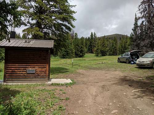
For the standard route, start at the public use cabin shown here, just 500' East of the CDT Kiosks below the summit of Marshall Pass, at 10880'. Continue past the cabin to find a relatively well-worn trail in summer, but with no marking other than a "No motorized use" sign to show it. Light snow would easily obscure this track, as there are no cairns or other markings on the trail, which winds uphill on the Western perimeter of the large meadows below Pt 12685. The GPX track should serve you well here, if you download it. Within a mile you will break free of forest, crossing ~ 5 downed trees on the trail, to break timberline directly South of Pt.12685, at 11,800'. Then scale the remaining grassy but steep slopes to reach Pt 12685, which is the beginning of the alpine fun.

However you may prefer to use a different route, courtesy of the rather unusual allowance of vehicle traffic on the first mile of the CDT North of Marshall Pass. Using this route will allow you to park at 11,360' if you are a good Suburu driver, at an old pit mine on the trail. From here you go straight uphill, (not on the CDT which continues on contour past the mine) on a rude track just before the pit with another "No Motorized Use" sign marking it. This track will start wide, but quickly narrow to a forest path which can be followed uphill winding through deadfall, until it peters out ~300' below timberline. Just make your way uphill through mostly open forest, and keep veering left since that's the way to the peak anyway, coming onto the ridge and finding the standard route on top as a lightly used track. Even if you choose to walk the CDT to this point of departure, you may prefer this route as having better trail to ascend the first 500', and a generally less steep climb to the ridge by traversing left above timberline.
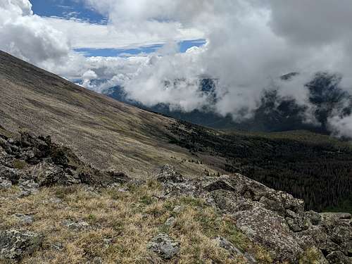
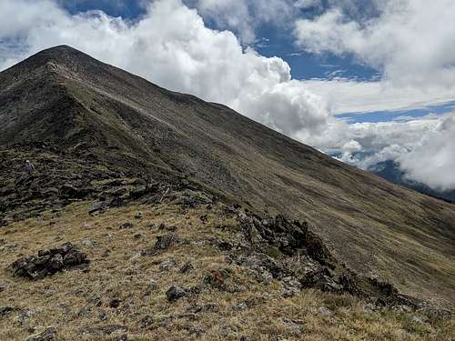
That concludes this brief report, which as usual for me, is about the journey more than conquering another peak. We found the West Ridge somewhat slower and more annoying than expected, and based on lots of use of hands to steady oneself on many rocky outcrops along the way, would call this a Class 2+ hike, not suitable for pole-dependent folks. Boulder hopping is required if you want to complete the route in 5 or 6 hours. This left us interested in a direct ascent of the SW slopes of Mt. Ouray from another old mine road that can be walked but not driven to 10,880', leaving the same half mile of open forest to ascend from the green spot seen at right in the second photo, before breaking out onto the grassy but steep slopes below the South ridge. Here are 2 pictures of the proposed direct route, taken from the West ridge. Not shown here is a bit of route finding into a wide chute that crests the South ridge in the visible dip, which has grassy margins and a boulder-filled center. This chute will help avoid the talus on the summit pyramid. But from timberline to at least 13,000 it looks to be the same short grass tundra tufts that make for great footsteps up and down.
 Next time, we may try this way, and then we'll be back to tell you about it. If you try it, please message me back and give a report.


