Toggle navigation
Mountains
Routes
Images
Trip Reports
Forum
What's New
People
Areas & Ranges
Articles
Trailheads
Canyons
Huts & Campgrounds
Albums
Logistical Centers
Fact Sheets
Lists
Custom Objects
Gear
Plans & Partners
WELCOME TO SUMMITPOST
SIGN IN
REGISTER
Harp Mountain
Additional Parents
Image
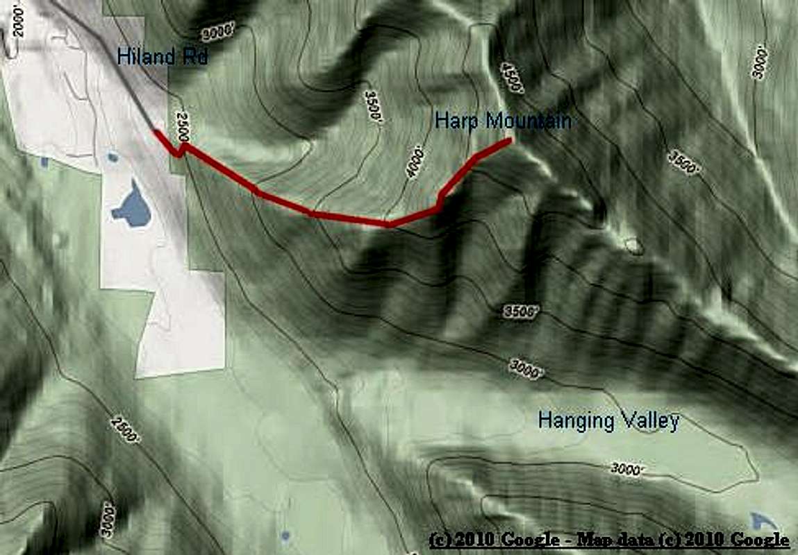
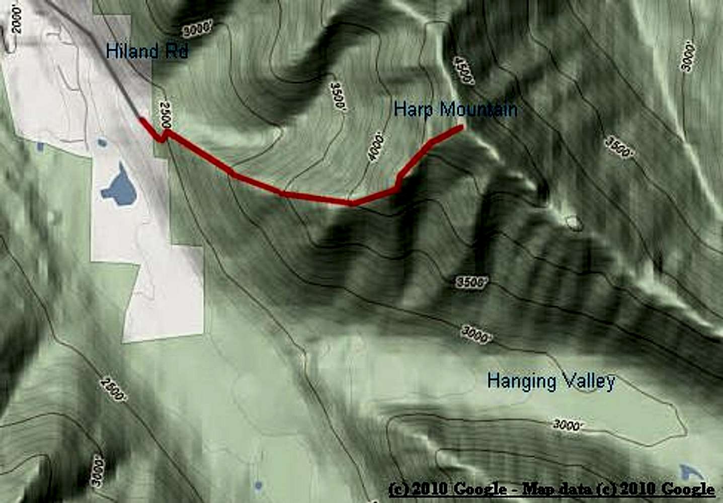
West Ridge Trail Map
View High-Resolution Image
West Ridge Trail Map
The red line shows the trail from the turnaround circle at the end of Hiland Road to the top of Harp Mountain (5001').
« PREV
NEXT »
chugach mtn boy
on
Nov 21, 2010 2:35 pm
Comments & voting
Other parents
Lat/Lon:
61.21903°N / 149.40651°W
Image Type(s):
Hiking
,
Topo/Diagram
Image ID:
680407
2523 Hits
74.01
% Score
4
Votes
Log in to vote
Comments
No comments posted yet.
to post!
Don't have an account?
Harp Mountain
(Mountain/Rock)
« PREV
Viewing
#15 of 15
GALLERY
You are at
the Last
Image
chugach mtn boy's Image Gallery
« PREV
Viewing
#543 of 713
GALLERY
NEXT »
×
You need to login in order to vote!
User Name
Password
Remember me
Forgot your password?
Log me out when I close my browser.
Keep me logged in all the time.
sign in as a user
Don't have an account?
Register now for FREE
Rating available
Suggested routes for you
People who climb the same things as you
Comments Available
Create Albums
Register Here


