-
 9939 Hits
-
 79.04% Score
-
 10 Votes
|
|
Mountain/Rock |
|---|---|
|
|
43.87580°N / 115.2996°W |
|
|
Elmore |
|
|
Hiking, Scrambling |
|
|
Spring, Summer, Fall |
|
|
8930 ft / 2722 m |
|
|
Overview
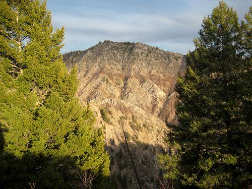
Location: East- Central Boise Mountains, between the North and Middle Forks of the Boise River, near Atlanta
Nearby Peaks: East Warrior, Swanholm Peak, Silver Mountain, Nahneke Mountain, Grand Mountain, Steele Mountain,
Linkups: Swanholm Peak
Difficulty: moderately rugged off trail ridge traverse
Usage: Hiking
Terrain: steep scramble up brushy slopes, rugged ridgeline, alpine style summit and lakes on north side not common for this area
Traffic: Extremely light most of the year
Summit Register: Yes, and large summit rock pile
History / Etymology: Traditional Mining, Logging and Hunting areas. Named (speculation) for Native American presence before 1800's Atlanta mining boom.

Getting There
Nearest Paved Roads: ID-21
Nearest Dirt Roads / Conditions: Middle Fork Road (seasonally variable), Swanholm Creek Road (above average), North Fork Boise Road (seasonally good), Edna Creek (seasonally good)
Approach Trails / Conditions: FST 051 from Swanholm (decent- often rutted out by Fall)
Routes
Main Route: South Ridge- From BM4512 on the Middle Fork (Boise) Road, climb to points 6170, 6795, 8246, 8094 before reaching summit. After initial scramble to 6170 this is a ridge traverse.
Main Route Stats: 8.2miles / 5412 (round trip)
Average RT Time: 5-7 hours
Secondary Route: North Ridge- FST 051 traverses over from Swanholm Peak toward Warrior Lakes. From near here a steep and rugged off trail ridge climb and traverse leads to the summit..
Secondary Route Stats: 20.5miles / 7041 (round trip)
Other Routes: West Warrior Creek

Red Tape
Jurisdiction: National Forest Service
Permit: No
Other Users / Issues: Hunters
MapMaps: USGS Quad Phifer Creek
Guide Book: Tom Lopez, Idaho: A Climbing Guide

When To Climb
Climbing Season: April through November- above average access because of Middle Fork Road access
Ideal Climbing Time: June
Nearest Weather Station: Atlanta, Graham Guard Station
Weather Relative to Region: Average, lower slopes and Middle Fork approach road slightly drier

Camping
Car Camping Sites: Middle Fork Boise River -numerous sites, Swanholm Road
Backpacking Sites: Not a traditional backpacking area, but beautiful spots near Warrior Lakes for North Ridge Route. Water sources are few after June on South Ridge route.

Flora & Fauna
Potential Wildlife: Elk, Mule Deer, Mountain Lion, Black Bear, Coyote, Wolf, Grouse
Confirmed Wildlife: Elk, Grouse, Mule Deer, Ticks
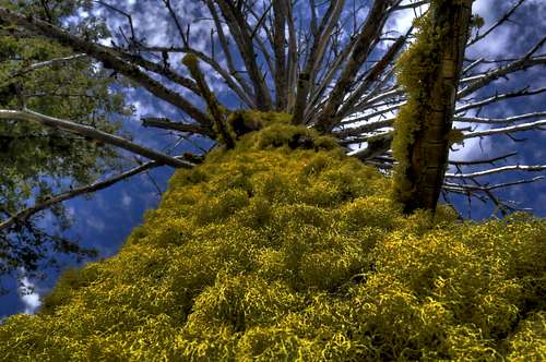
Vegetation: Ponderosa, Lodgepole, Buckbrush