Western Uintas Map

Western Uintas Map

The western half (maybe 2/3's?) of the High Uintas Wilderness Area, from Mirror Lake Highway on the left to Kings Peak and Anderson Pass on the right. From bottom to top, you can see Rock Creek Reservoir just left of center to just about the North Slope Road. For a sense of scale, the words "West Fork Blacks Fork" are about 10 miles long.
46and2
on May 23, 2006 4:23 am
Image Type(s): Topo/Diagram
Image ID: 195618

Comments

Post a Comment
Viewing: 1-2 of 2
Scott

Scott - May 30, 2006 8:30 pm - Hasn't voted
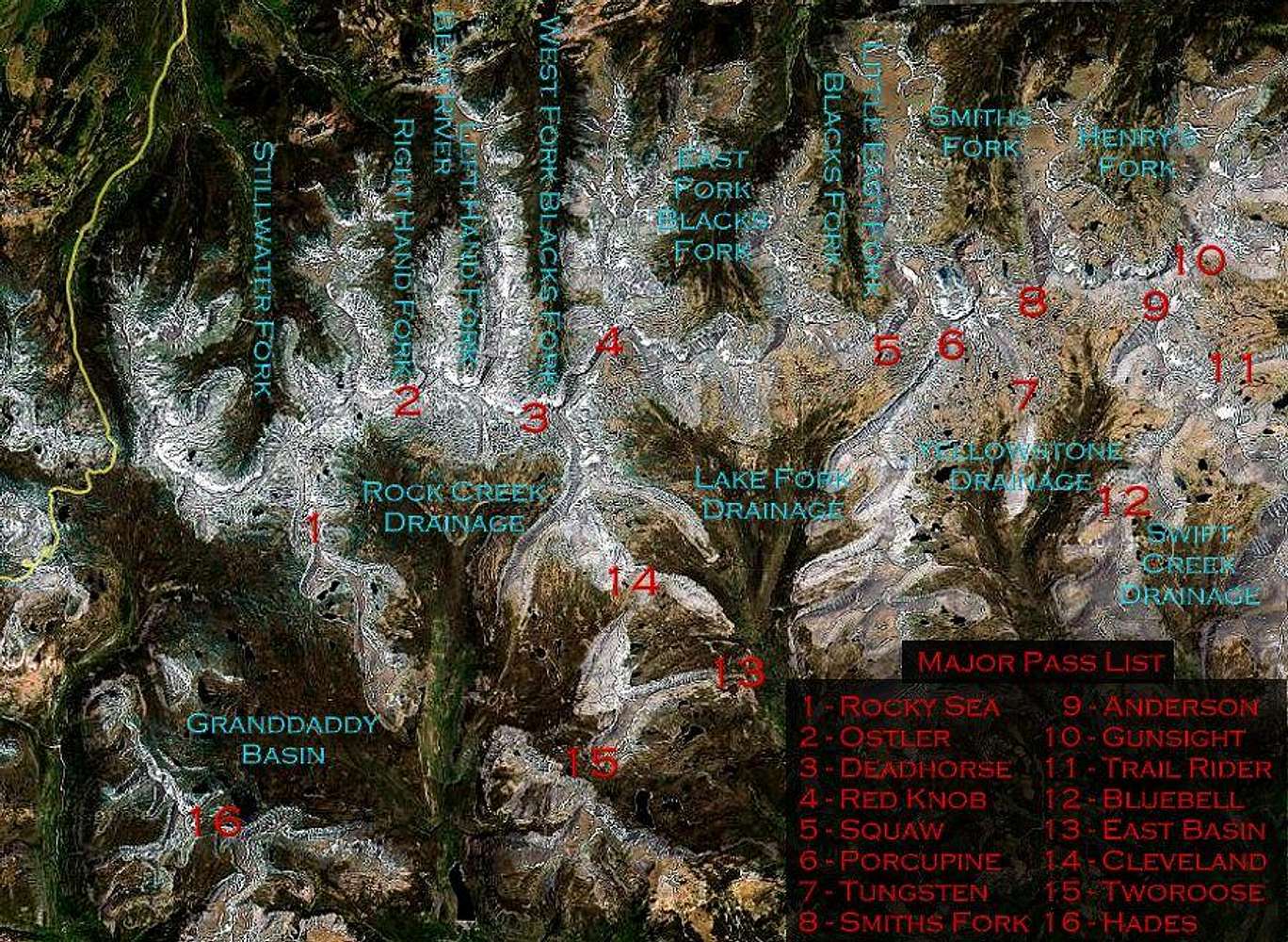
Rocky Sea Pass

It may be too hard to change, but just FYI, #1 is actually Rocky Sea Pass rather than Rock Creek Pass.

46and2

46and2 - May 31, 2006 3:05 am - Hasn't voted

no problem

not sure how I mis-typed that. thanks!

btw - I saved it as a object-embedded file so changes are a snap (just for times like this).

Viewing: 1-2 of 2