White Hill has been on my radar for a number of years. I grew up in Nova Scotia and moved to Colorado back in 1983. It didn’t take long for me to fall in love with the mountains. So it was only logical I would eventually want to make it to the high point of the province of my birth. Please see the main White Hill page for more detail on getting there, links to maps and red tape.
After some research I decided we would approach via Cheticamp Flowage. The other approaches are longer so this gave us our best chance for a day hike.
Our lodging was in Baddeck so we allowed about an hour to for the 75 kilometers to the turn off at Wreck Cove. Our first mistake was only allowing an another hour instead of two to drive the 33 kilometers from the main road to Cheticamp Flowage.
There isn’t anything labeled as a trailhead. From studying the aerial photos I knew a side road led to the outlet canal on the south side of the lake.
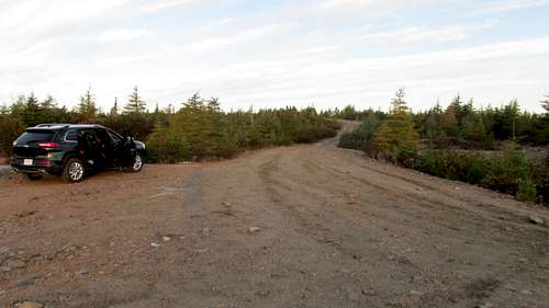
Jeep Parking 680952 5167722 475 6:37am UTM WGS 84 20 T elevations in meters.
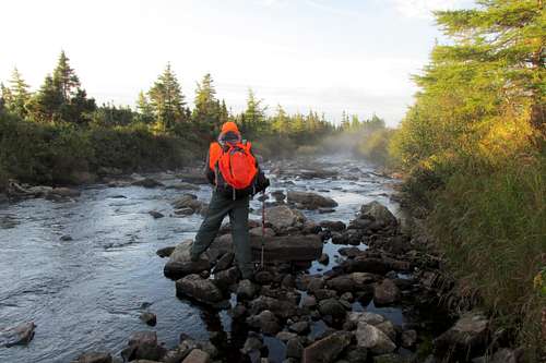
This meant we would have a stream crossing right away. We lost some more time heading downstream from where we’d parked looking for a good crossing. We found some possible crossing, but the rocks were slippery and tilted bad angles for landing the jump.
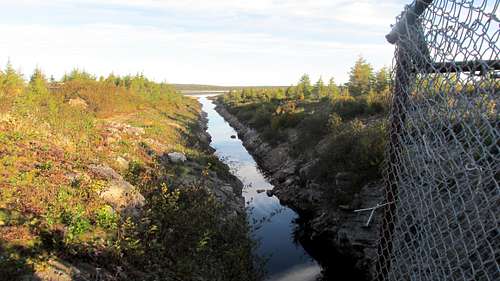
So after losing another half hour we backtracked to where we were parked. Here the stream is better described as a canal with vertical rock walls.
I had seen other trip reports where people crossed at a water control structure that straddles the canal. This wasn’t my first choice. There’s a fence on both sides. Not technically difficult to climb, but I had seen pictures of signs in trip reports admonishing people to keep out. Obviously they don’t want people messing with the water control stuff.
![Cheticamp Flowage outlet canal]() Cheticamp Flowage outlet canal
Cheticamp Flowage outlet canal
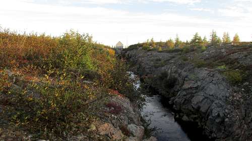
![Water Control Structure]() Water Control Structure
Water Control Structure
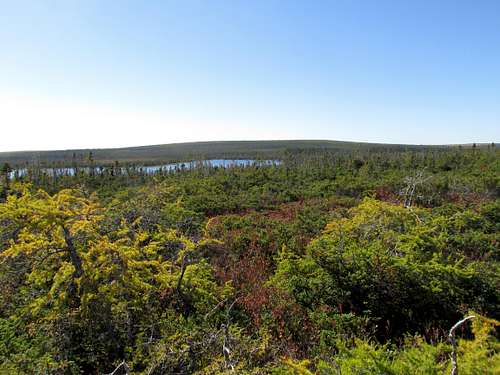
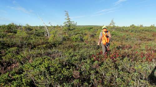
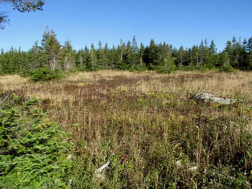
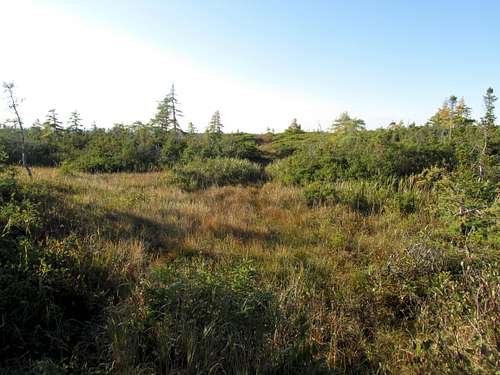
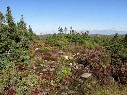
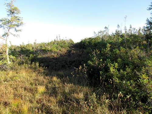
After crossing the canal we had to contend with the terrain. The low-lying areas are swampy, and the higher drier areas are choked with tuckamoors. Our strategy was to angle East North-east across the plateau toward Cheticamp Flowage. After meeting the shoreline we would then follow around the south and east sides of the lake. Then we’d meet up with an old overgrown road that we would follow much of the way to White Hill. We quickly learned the tuckamoors mean slow going.
![Bushes]() Bushes
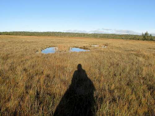
BushesCheticamp Flowage Lake Arriving 682217 5168138 462 8:10 am reaching lake
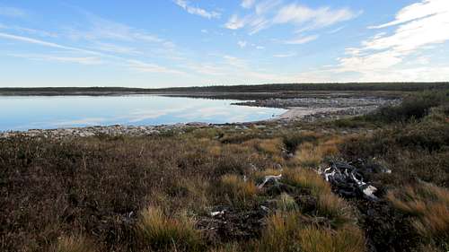
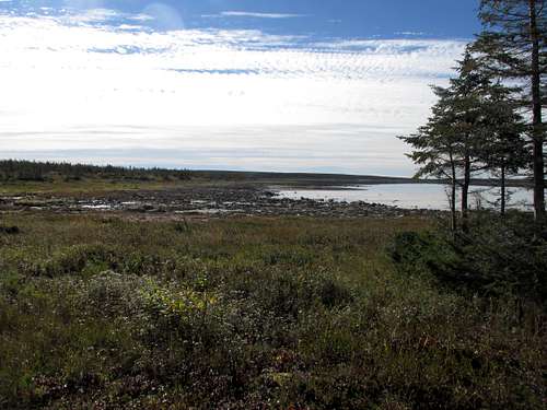
![Cheticamp Flowage]() Cheticamp Flowage
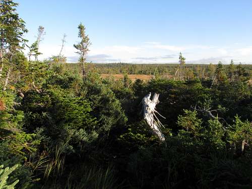
Cheticamp FlowageWith all the time we lost at the start combined with the slow going it was after 8:00 am getting to the lake. Once reaching the lake however we were finally able to make some time. The lakeshore has a lot of rock hopping – something we’re used to from the mountains.
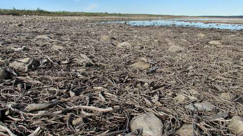
![Cheticamp Flowage Driftwood]() Cheticamp Flowage Driftwood
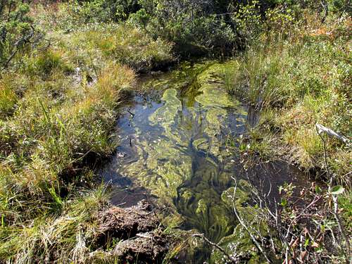
Cheticamp Flowage DriftwoodThere were stretches with a lot of drift wood and other areas with a maze of minor water courses. But after the tuckamoors it was great to cover a few kilometers in an hour. I feared we would be dealing with a lot of muck by any soft spots were avoidable with some care.
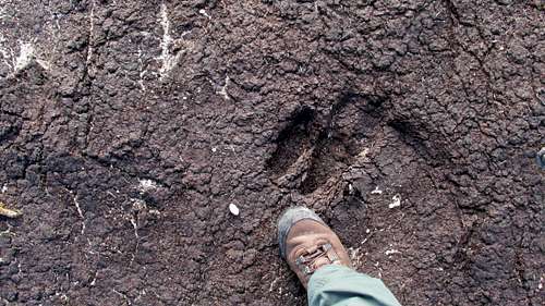
![Moose Print]() Moose Print
Moose Print
![Cheticamp Flowage Wet Area]() Cheticamp Flowage Wet Area
Cheticamp Flowage Wet Area
![Cheticamp Flowage]() Looking back at Cheticamp Flowage
Looking back at Cheticamp FlowageCheticamp Flowage Lake 682327 5170134 460 9:09 am leaving lake
![White Hill]() Leaving Cheticamp Flowage for White Hill
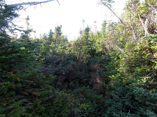
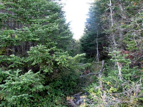
Leaving Cheticamp Flowage for White HillAbout an hour after reaching the lakeshore it was time to head into the woods and travel the old overgrown road. The problem was we couldn’t find it. The map showed it reaching almost to the shore. So I reasoned if we headed into the woods just inland from where the map showed the road terminating, we should intersect it. That didn’t happen. What did happen was we spend the next couple hours thrashing our way through the foliage with the GPS showing us following the general path of the road. The reality of this area is you can be just a few meters away from the road and not see it.
![Thick Bushes]() Thick Bushes
Thick Bushes
![Green Wet Stuff]() Green Wet Stuff
Green Wet Stuff
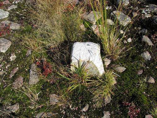
White Rd Int 682577 5171103 483 11:08am intersection survey cut line & road
![Survey Cut Line]() Survey Cut Line
Survey Cut Line
It was almost 11:00 am when we came to a survey cut line that isn’t marked on the map. I did know of its existence from studying the aerial photos of the area. I had a copy of the aerial photo with me. This survey cut line probably indicates the National Park boundary. I knew if the road still existed we had to be within a 100 meters of it along this cut line. Dorthe waited while I first walked about 100 meters in the direction I thought least likely, just to eliminate it. After getting back to Dorthe we didn’t have to travel very far in the other direction to finally meet up with this road. It was now a full 2 hours after leaving the lake. We had only gained about a kilometer in that hour with a lot of thrashing through the bushes.
![White Hill Road]() White Hill Road
White Hill Road
![Wet Stretch]() Wet Stretch
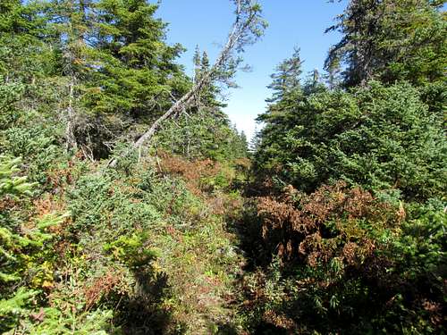
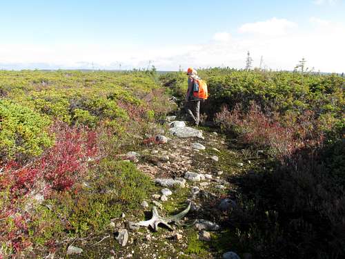
Wet StretchWe knew we would have to start making a lot better time to have any hope of reaching White Hill and making it back in daylight. And we were both resigning ourselves to this become a reconnaissance hike for a future attempt. But now we had found the road the going was much faster. The road is overgrown. There are places with an annoying amount of water. There is at least one spot where the alders have completely obliterated any evidence of there being a road. But with some determination, it is possible to stay with the road and make reasonable time.
![White Hill - Road]() White Hill - Road
White Hill - RoadWhiteBarrenInt 685932 5175306 475 12:57pm Intersection of roads at North Barren
In less than 2 hours we made it to the North Barren intersection. Our original plan had been to leave the road before reaching this intersection and head cross country to the high point. Our experience so far showed us any off road travel was extremely inefficient. It would be quicker to travel an extra couple kilometers on the road than a kilometer through the bush.
![North Barren Intersection]() North Barren Intersection
North Barren Intersection
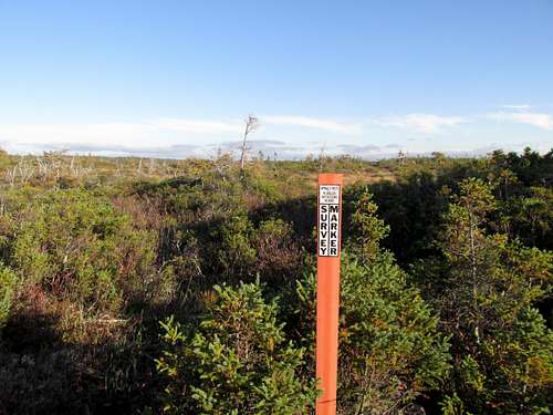
But having reached this intersection it was now almost 1:00 pm. With daylight savings time still in effect that would be a reasonable time to be reaching White Hill. Since we knew we lost a lot of time at the beginning of the hike, and we were sure we could be more efficient on the return, we declared 2:00 pm would be the absolute turn around time.
![North Barren Intersection]() North Barren Intersection Marker
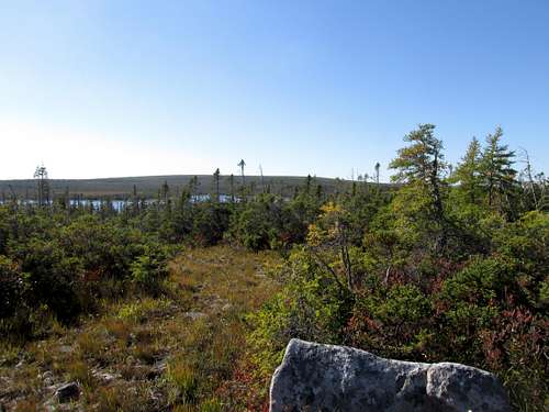
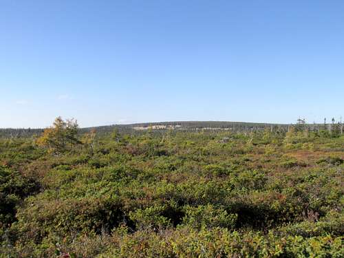
North Barren Intersection MarkerBut we still knew getting White Hill today would require some good fortune with route conditions. The east west road started off in reasonable shape. We could see White Hill a few kilometers away. White Hill Lake was off to the left.
![White Hill - West Road]() White Hill - West Road
White Hill - West RoadSince these trails apparently see more animal traffic than people, we started getting pulled toward the lake on game trails. After a couple times having to back track and having difficulty spotting the actual road we knew our turn around time had come. We would have burned too much daylight pushing through to the summit. So at 1:30 pm and still a couple kilometers from White Hill summit, we turned around.
![White Hill]() White Hill with White Hill Lake
White Hill with White Hill LakeWhite Rd 4 685138 5175585 496 1:30 pm turn around
The hike back across now familiar terrain went efficiently. Our first moment of decision came when we reached the survey cut line. We didn’t have confidence with staying on the road. Even though we now knew where it was we feared it would be more overgrown or perhaps just terminate the closer we got to the lake.
![White Hill - Cut Line]() White Hill - Survey Cut Line
White Hill - Survey Cut Line
![Survey Cut Line]() Survey Cut Line Marker
Survey Cut Line Marker
Although the survey cut line was never as wide as the road, it seemed to be newer. It also didn’t have to go as far before meeting a natural clearing that followed a drainage back to the lake. The unknown was how swampy it might be following that drainage.
![Cut Line]() Survey Cut Line Thick Bushes
Survey Cut Line Thick Bushes
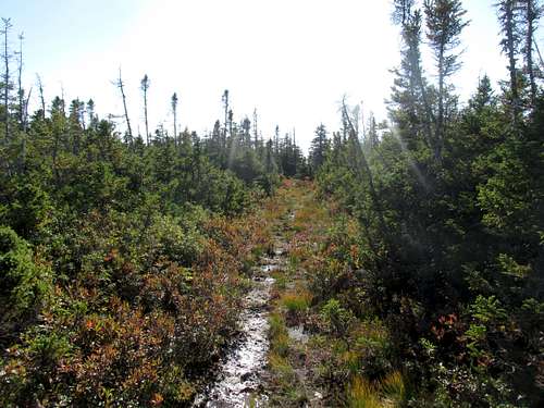
We decided to go with the cut line. The footing underneath was basically solid as it went up over a hill. The bushes are doing their best to reclaim the cut line so we had to push through in several spots. But in general the progress was pretty good and we made our way through to the drainage in reasonable time. It was now 4:07 pm.
![Cut Line]() Survey Cut Line heading to Drainage
Survey Cut Line heading to Drainage
WhiteRdCutEnd 682899 5170781 477 4:07 pm survey cut line meets drainage
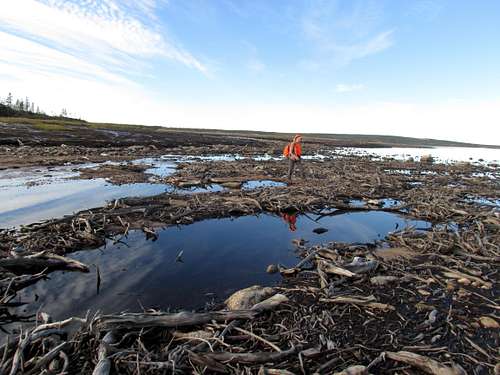
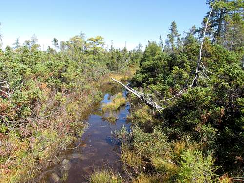
![Drainage to Cheticamp Flowage]() Swampy Drainage to Cheticamp Flowage
Swampy Drainage to Cheticamp FlowageAfter getting to the drainage it indeed did have some swamps. The strategy we employed was to stay to the side of the drainage clearing where it meets the woods. This seems to be the high shoulder where it’s above swamp level but below where the woods want to live. On our way back to the lake we passed where the road exits the forest.
![White Hill - Start of Road]() White Hill - Start of Road
White Hill - Start of RoadI give this waypoint so you can try that way if you like. We entered the woods too close to the lake in between this spot and where the map shows the road. So I don’t know if we ever crossed part of the road or manage to parallel it all the way to the cut line.
WhiteRoadStart 682399 5170326 473 4:24 pm The start of the road near the lake
We were thrilled to be back to the lake. Our plan now was to stay with the lakeshore all the way back to the canal. We knew there was a road on the other side of the canal that would take us all the way back to our vehicle. Although my boots had stayed in pretty good shape all day they were now getting saturated and muddy. So we just planned to stay with the shoreline and wade across what we figured would be shin deep water.
![Cheticamp Flowage]() Cheticamp Flowage Heading Back
Cheticamp Flowage Heading Back
We made good time in the dwindling daylight back around the shoreline. Some coyotes off in the distance were yipping away. We saw some fresh boot prints in the sand. That gave us hope others had crossed where the canal met the lake. We cut off the tip of the peninsula closest to the canal, but stayed out of any bushes. When we finally got to the canal we knew once across it was an easy walk along a road to be back.
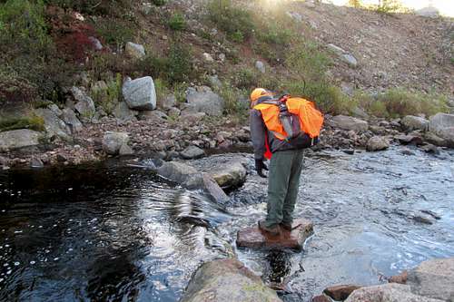
The canal wasn’t what I was hoping for. In hindsight it makes sense a canal is going to be deeper than the natural drainage would have been. When I got to the sharp vertical edge (not a natural shoreline) I lengthened my trekking pole and tested the depth. It was all of belly deep at the edge of the canal. It the low light of dusk there was no seeing the bottom to know how much deep it might be in the middle. Wading across was out of the question.
We started walking along the shoreline, starting to accept we would have to make our way back to the control structure. The bushes came right to the edge of the canal in places so there would be some more thrashing through foliage to get back.
Then we saw a canoe on the other side. People were over there. The first people we saw all day. They asked if we needed to get across. One of them paddled over and got us. That was huge! We gratefully chit chatted with them for a few minutes while digging out our headlamps. After everything we’d been through all day, to have less than a kilometer to walk on an actual solid road was luxurious.
![White Hill]() White Hill
White Hill


Comments
Post a Comment