Toggle navigation
Mountains
Routes
Images
Trip Reports
Forum
What's New
People
Areas & Ranges
Articles
Trailheads
Canyons
Huts & Campgrounds
Albums
Logistical Centers
Fact Sheets
Lists
Custom Objects
Gear
Plans & Partners
WELCOME TO SUMMITPOST
SIGN IN
REGISTER
Emmons-Winthrop Glacier
Additional Parents
Image
Winthrop saddle route
View High-Resolution Image
Winthrop saddle route
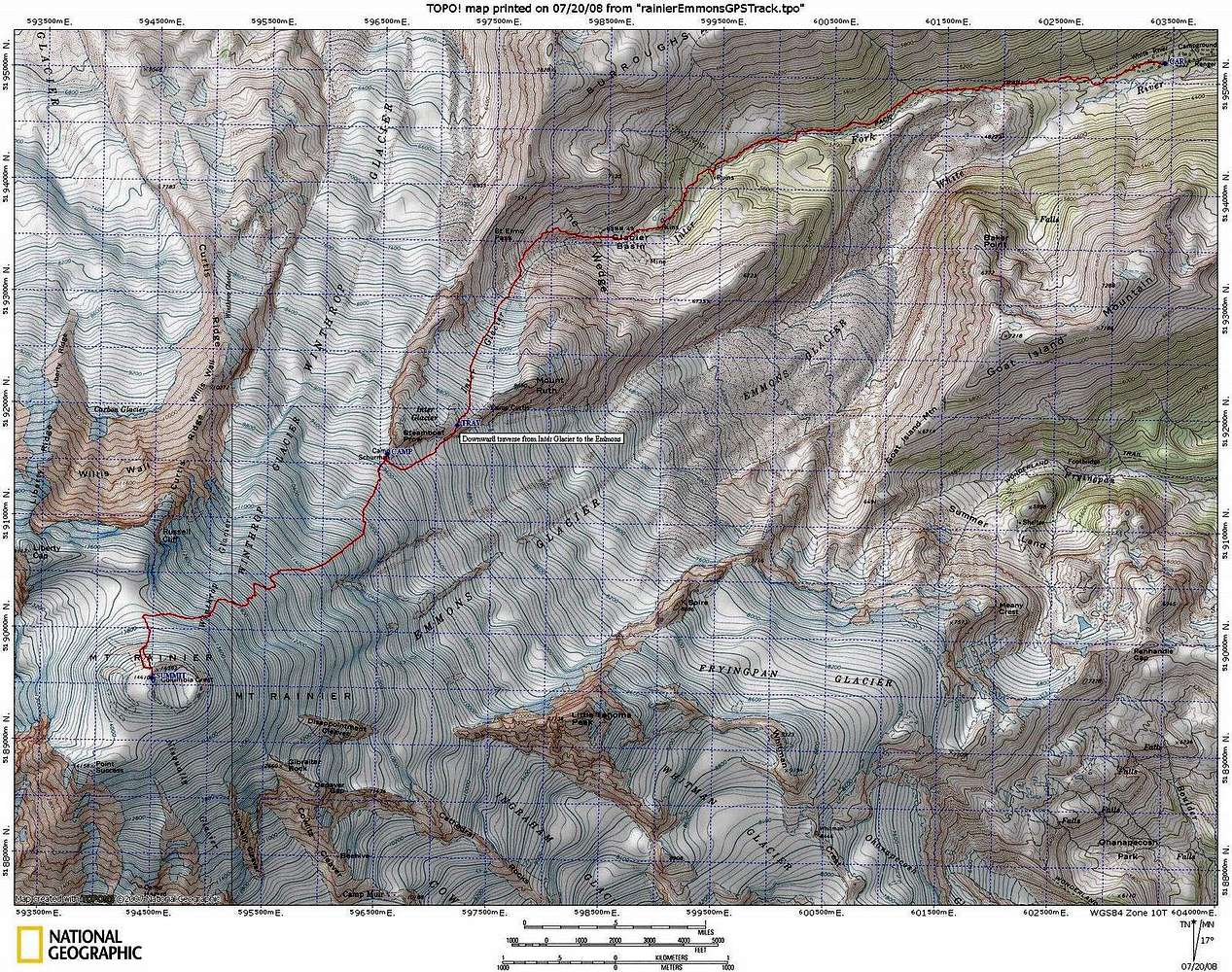
The Emmons route had to swing far to the rifht to avoid the bergschrund. Here's the GPS track of our route. It was about 6.5 mi, 5300' from the cars to Camp Schurman, and 3.0 mi, 4900' from camp to the summit. July 17-18, 2008
« PREV
NEXT »
larryN
on
Oct 2, 2008 12:20 am
Comments & voting
Other parents
Image Type(s):
Topo/Diagram
Image ID:
448582
1852 Hits
71.06
% Score
1
Votes
Log in to vote
Comments
No comments posted yet.
to post!
Don't have an account?
Emmons-Winthrop Glacier
(Route)
« PREV
Viewing
#137 of 150
GALLERY
NEXT »
larryN's Image Gallery
« PREV
Viewing
#176 of 267
GALLERY
NEXT »
×
You need to login in order to vote!
User Name
Password
Remember me
Forgot your password?
Log me out when I close my browser.
Keep me logged in all the time.
sign in as a user
Don't have an account?
Register now for FREE
Rating available
Suggested routes for you
People who climb the same things as you
Comments Available
Create Albums
Register Here


