
-
 5544 Hits
-
 81.18% Score
-
 13 Votes
|
|
Mountain/Rock |
|---|---|
|
|
45.05339°N / 110.00992°W |
|
|
Mountaineering, Scrambling |
|
|
Summer |
|
|
10479 ft / 3194 m |
|
|
Overview
Wolverine Peak isn't a technically difficult peak to climb in typical summer conditions, but it checks a lot of boxes for Yellowstone-area mountaineers and others who seek something more than crossing a name off a list:
- It's a beautiful peak from any position, and I've seen it from several.
- There are outstanding views.
- It fits most people's ideas of remote.
- It sits on the border between one of the world's greatest national parks and one of this country's finest wilderness areas.
- A wilderness feel permeates the summit and most of the approach.
- You're extremely unlikely to encounter other people on the way to or from the summit once you're off established roads and trails.
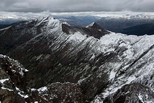
My first look at Wolverine was in 2011 when my friend Tim and I climbed Cutoff Mountain; I found the peak impressive and enticing from the valley of Pebble Creek.
Several times since then, I've admired it from other viewpoints and expressed a wish to climb it, and I finally got around to it on July 8, 2020.
I have no idea if the route I took is the "standard route" if there even is one for such a seldom-climbed peak. Considering that, I'm going to now cover 4 potential routes; the last of them is the one I took and the one the Getting There and Route Description sections here will describe.
- Start from the Warm Springs TH a short distance inside Yellowstone's NE entrance. Hike up to a broad, unnamed pass and then descend to Pebble Creek. Now strike out cross-country and find your way to the summit. I estimate the one-way distance to be around 9-11 miles, possibly more and not likely less.
- From Silver Gate, head up slopes and ridges to Mineral Mountain. Traverse what on maps and in person looks like a rugged ridge over an unnamed summit and then to Sunset Peak. After that, descend north and then head up the south ridge of Wolverine. This looks like 10-12 miles RT, but total elevation gain also looks to be around 6000' by the time the day is over.
- From Daisy Pass out of Cooke City, pick up a trail that heads generally west to Wolverine Pass and then go up Wolverine's north ridge. RT distance looks to be around 11-12 miles. You also have to drive 4-5 miles on unpaved roads that require high clearance but not 4WD in dry conditions. Elevation gain from the pass looks to be around 1500', but because of the ups and downs of the approach (and return), the day's total will be a lot more than that.
- From Bull of the Woods Pass out of Cooke City, climb Miller Mountain and then Sunset Peak and finally Wolverine Peak. The drive up is 4-5 miles on rough roads, and 4WD is necessary. One-way distance from the pass is about 4 miles, and elevation gain can be up to 2100' in all, but the return gain will be about 1500', so this is still a big day for most people.
Getting There
Just east of Cooke City, turn onto the dirt road for Daisy Pass. You can drive to either Daisy Pass or Bull of the Woods Pass (both are about 5 miles from the pavement), and you will need high clearance for either. The road to Bull of the Woods Pass is rough and steep in places and will require 4wd; although the approach from Daisy Pass is a little longer, you should not need 4wd unless conditions are wet or snowy. There is also a road connecting Daisy and Bull of the Woods. When clear of snow, it, too, is an easier alternative to the road up to Bull of the Woods.
Route
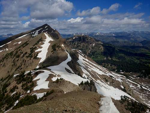
You will have to first climb Miller Mountain, and, unless the snow is melted out, its false summit.
From the pass, follow the ridgeline, surmounting or bypassing obstacles as necessary. It is not necessary to climb the false summit directly south of the pass if the snow is gone or if you have the equipment and experience for traversing steep snow slopes.
There will be some Class 3 terrain, but you should be able to avoid anything harder than that. However, beware crumbly rock. It's the norm in these mountains.
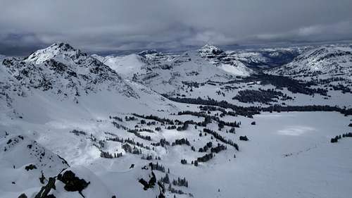
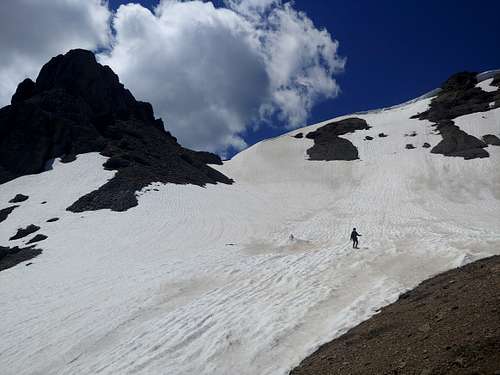
From the summit of Miller, descend west to a basin beneath Sunset Peak. Follow goat trails whenever you can. Expect some scrambling, but nothing too bad. It is, however, less direct and more challenging than it looks on a map or from Miller's summit.
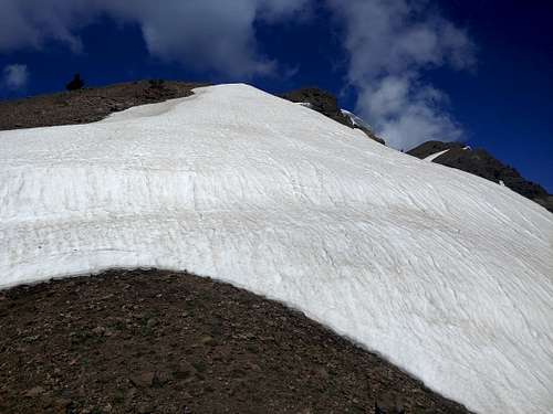
Now ascend slopes to the Sunset summit. When I climbed it, it was early July and there was a snowfield going almost all the way up, so I took that over loose Class 2-3 terrain.
From the Sunset summit, descend to a broad, obvious saddle. Once again, this is trickier than it looks from above, but it isn't hard. Just look for the breaks and follow them.
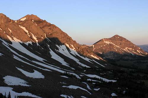
Finally, head up slopes that are steep but should be technically easy when they are snow-free. In early July, having ice axes turned out to be a good idea because we encountered a short vertical headwall of snow that required kick-steps and ice axes to surmount.
Enjoy the summit. The views are the kind that make you want to stay.
On our descent, we found a way down into the basin below and then to Daisy Pass, where we had parked because snow was blocking the way to Bull of the Woods Pass. That route was more direct and did reduce overall elevation gain, but it is for experienced route-finders only because it snaked its way through cliffs that were impassable just about everywhere else. At the time we did it, quite a lot of snow travel was involved, and we needed our ice axes.
Red Tape
There are some private mining claims about; try to avoid them.
This is grizzly country.
When to Climb
Summer and early fall are best. Because of heavy ATV and snowmobile usage around Cooke City, the passes may be accessible in winter.
Camping
Plenty of dispersed camping.