
-
 36851 Hits
-
 95.83% Score
-
 55 Votes
|
|
Mountain/Rock |
|---|---|
|
|
48.76739°N / 121.81379°W |
|
|
Download GPX » View Route on Map |
|
|
Hiking, Mountaineering, Skiing |
|
|
Spring, Summer, Fall |
|
|
10165 ft / 3098 m |
|
|
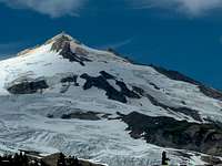
Overview

North West Face
 Alpenglow on Sherman | 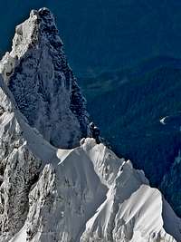 Assassin Spire View |  Mount Baker's Summit | 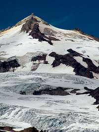 South East Face |  Black Buttes Sunset |
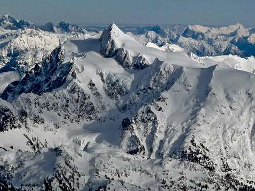
Sherman Peak from the Crater Rim
Getting There

Mount Shuksan on the Way

Twin Sisters from the Road
Schreibers Meadow : The Direct, Easton, and Squak Trailhead (South)
View Google Map Directions here.
From Seattle: Take I-5 for about 60 miles until you get to Mount Vernon, take a right at exit 230 onto Highway 20. After about .2 miles be sure to take a left onto S Burlington Blvd (this goes North). After .4 miles take a right back onto highway 20 (at this part of town it is known as Avon Ave). In about 22 miles you will see a road called "Baker Lake Road" which will be on your left, take this road for about 12.2 miles. From here there is a fork in the road, be sure to go left which goes onto NF Road 12. In 3.5 miles you reach another fork in the road, take a right onto NF Road 13. This road will take you to the trailhead.
Heliotrope Ridge Trailhead (North)
View Google Maps Directions here.
From Seattle: Take I-5 for about 60 miles until you get to Mount Vernon, take a right at exit 230 onto Highway 20. After about .2 miles be sure to take a left onto S Burlington Blvd (this goes North). After .4 miles take a right back onto highway 20 (at this part of town it is known as Avon Ave). In 5.1 miles take a left onto Highway 9 heading North. In 22.2 miles take a right at a fork in the road and take a right onto highway 542 (Mount Baker Highway). In 8.3 miles turn right (staying on Highway 542) in the city of Kendall. 11.5 miles further down the road is the city of Glacier where you take a right onto Glacier Creek Road (NF Road 39). This road goes on for 7.8 miles up a service road which the Heliotrope trailhead will be on your left.
The road is usually snow covered in early season making it a longer approach (usually around 3-5 miles). Many decide on bringing ski's to make traveling faster.
Routes

Sherman Peak Direct
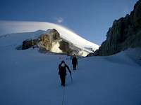
Approaching the Crater Rim
Hiking the Coleman Deming
Squak Glacier from Crag View
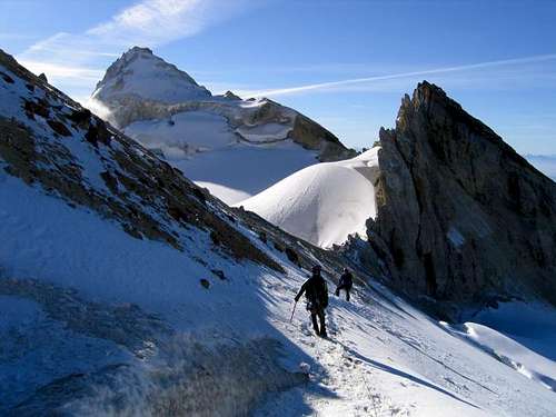
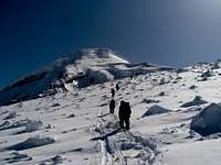
Easton Glacier/ Railroad Grade: This is perhaps the most common route up Sherman Peak considering that while climbing Mount Baker you could make a side trip up Sherman Peak. After hiking up most of the Easton Glacier you come to a spot known as "The Crater Rim" which most of the time you can see volcanic fumes coming up. The climbers path (if there is one) goes left up Mount Baker, go right if you want to give Sherman a try. Carefully traverse around a jagged high point. From here your on the West Ridge of Sherman Peak which now is a friendly ridge walk to the summit.
Coleman Deming: This is another common way people climb up Sherman Peak. Like the other routes it only requires basic glacier travel. The route starts out from the Heliotrope trailhead which the trail takes you to the Coleman Glacier. Follow the route until you get to the Roman Wall and then traverse over towards the Crater Rim. From here traverse to the East Ridge and go up to the summit.
Squak Glacier & Crag View: According to Tom Sjolseth this is the fastest route up the mountain. From the trailhead take the trail on the right which goes Northward most of the way up. Around 5,200 feet the trail ends, now we go onto the ridge that goes to "Crag View". From here go onto the Squak Glacier and go directly North all the way to the gap on the left side of Sherman's Summit. Keep in mind in later season there may be crevasses that make traveling this route more challenging. And like all the other routes it's a cake walk up the East ridge to the summit.
Sherman Peak Direct
The route starts out at the Schreibers Meadow trailhead using the trail on the left from the parking lot which is known as the Railroad Grade trail. After about a mile you come across a large creek crossing, during winter it is often covered up with snow. On a hot day of summer I've seen this creek swell up to perhaps 3 times it's original size from early morning to afternoon which required taking off boots for crossing. On your average day the crossing is fine. After the large creek crossing immediately take a right and start heading up the drainage. Road Walk During Winter |  Evening over Loomis |  Sunset over Survey Point |  Sherman during Late Season |
The easiest way to know where to go is to stay in the large carved out valley for a little while. On your right you will see a ridge start to form which is known as Metcalfe Moraine which you should get onto. This ridge takes you up to around 6,000 feet where you can find many flat places to camp or take a rest at. Then continue to proceed North, slightly east which travels onto and between the Easton and the Squak Glacier.
 Crevasses near the Route |  Twin Sisters Range |  Evening Light on Eldorado |  Looking Down Below |
Keep your eyes on the prize, it seemed as though if you go straight for the summit you end up avoiding most of the crevasses. This changes by the month so pick the path you feel is easiest and avoids the major crevasse fields. As you get very close to the summit start heading to the left where you'll find a gap. There are two gaps on the East Ridge which both of them take you to the summit, but the smaller gap (on the right) has a cooler looking entrance. From here it is a easy walk on the east ridge to the summit. Definitely a view worth climbing this mountain for!
 Lincoln Peak during Winter |  Rock near the Gap |  Views to the West |  Colfax and Lincoln Peak |
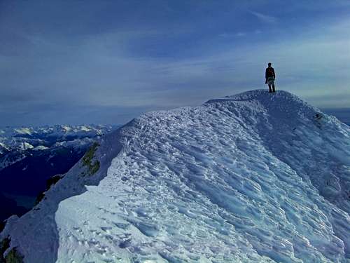
Sherman Peak's Summit
Mount Shuksan's Beautiful West Face
Red Tape

Sulfur at the Crater Rim

Water along Railroad Grade
There are no permits required for this climb, although you can fill out a trail register at the trailhead or ranger station just in case.
The Sedro Wolley visitor center can be reached at 360-854-7200 and are opened year round. During the winter months they are opened Monday to Friday at 8:00 a.m. to 4:30 p.m. They are closed on federal holidays. From late May to mid October they are open daily from 8:00 a.m. to 4:30 p.m.
Water Sources:
There are many places on the way up Sherman Peak in which one can obtain fresh water. The first one is a few minutes away from the parking lot, the second one is further up the trail where you come across the big creek crossing. Before arriving on Metcalfe Moraine there are other small creeks to obtain water from. Once past the moraine though most of the year there are snow patches which one could melt snow. Beyond that is the Easton and Squak glacier for snow.
Time it Takes:
Sherman Peak can be done in a day by most people experienced with Glacier Travel. Personally I would do this in two days to enjoy the mountain and climb Baker as well. If you have skis then you could easily do this in a day. When I did this as a winter ascent it took 28 hours total.
Camping

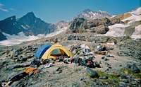
Sunset over Camp

Camping near the Easton
For those who go up via the Railroad Grade, there is camping along the Railroad grade at spots. At the end of the Railroad Grade is one of the most popular camping places on the mountain where there are several flat places to pitch a tent.
When to Climb

A Good Time to be Here

Snow & Ice on the Ridge
Mountain Conditions

Summit Ridge in Prime Conditions

Gloomy Weather over Sherman Peak
For current weather information on Sherman Peak check in with the Noaa Forecast.
For Avalanche Conditions, check in with the Northwest Avalanche Center. (Limited based on the season)
Check in with the National Forest Website for more information on the current road conditions which it will say for the "Schreibers Meadow" (#13). For trail conditions scroll down to "Railroad Grade" on the NF Website.
Gear for the Climb

Ice Axe, Rope, and Harness
Gear Scattered Around
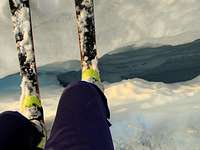
Skis over a Crevasse

Night Lights on the Easton
Mandatory Gear for the Climb:
- Ice Axe
- Crampons
- Helmet
- Rope
- Glacier Rescue Gear (prusiks, carabiners, webbing, ect.)
- 2 Snow Pickets (for standard glacier travel)
- Shell Jacket
- 2-3 Liters of Water Per Person
- First Aid Kit
- Glacier Glasses/Goggles
- Full Scale Mountaineering Boots (or plastics if your up to it)
- Plenty of Food
Recommended Extras:
- Nylon Shell Pants
- Sun Screen
- Map and Compass
- Long and Short Sleeve Shirt
Overnight Gear:
- Tent/Bivy
- Sleeping Bag
- Ground Pad
- Water Filter/Tablets
- Stove, Fuel, Pot, and utensils (for cooking)
Optional Gear:
- Bug Spray (Black Flies get Crazy during August)
- Camera
- Cover for your Backpack
- Tooth Brush and Paste
- Shorts
- Approach Shoes
- Toilet Paper/Blue Bag
- Trekking Poles
- GPS
Topographic Maps
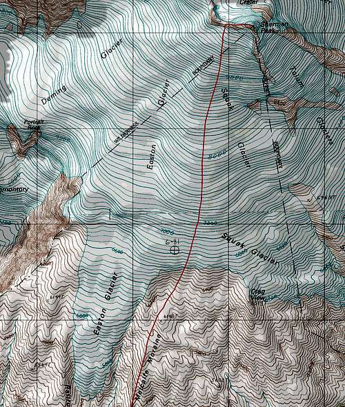 Sherman Peak Topographic Map | 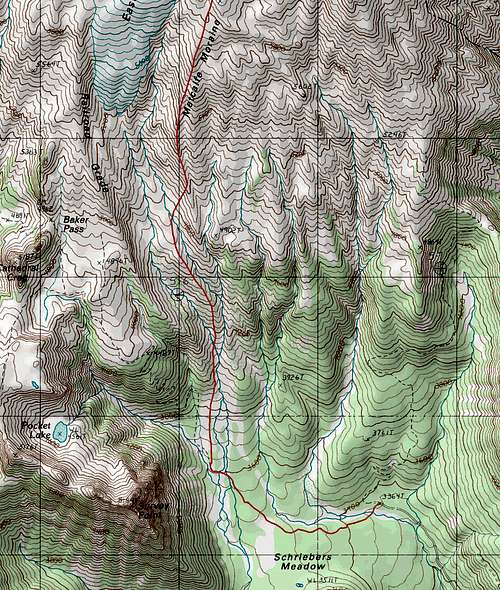 Matcalfe Moraine Topographic Map |
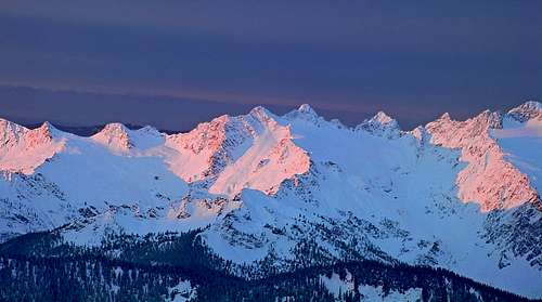
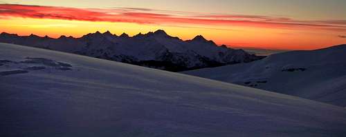
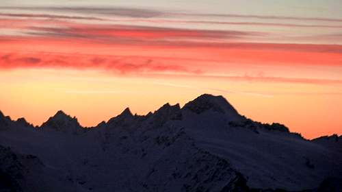
Sunsets and Sunrises
 Sunrise from Sherman Camp |  Pink Mountains to the South |  Morning from Camp |  Sunset on Glacier Peak |
Sunrise on South Twin
Sunset on the Twin Sisters
Sunset on South Twin
Video
Sherman Peak Winter Ascent Video
External Trip Reports
- Colfax and Sherman May of 2011: Plenty of Eye Candy of Matt's trip up Sherman via the Coleman Deming.
- Sherman Peak via the Squak Glacier: Tom Sjolseth describes a late November ascent with heavy winds and has some nice photo.
- Sherman Peak June of 2011: Another ascent via the Coleman Deming Glacier