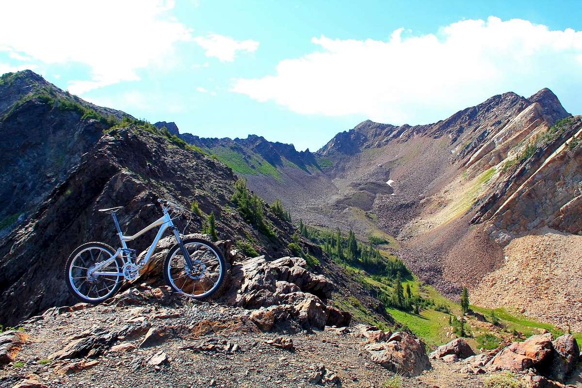
After hitting up the Cardiac Ridge two days prior, and seeing 4 wheelers in upper Mineral Fork, I checked out the Forest Service website. Turns out the Mineral Fork Road is open to vehicles. The wilderness boundary is directly on the ridge where the bike is on this photo, between Mineral Fork and Blanche Fork.
So, I headed up Mineral Fork on the bike up to the Regulator Johnson Mine. From that point it was a short scramble up to the pass just above the mine. Just west of the pass is a highpoint listed as 10,481, where this photo is taken from looking south into the easternmost portion of Blanche Fork. Peak 10,820 is far left, the Cardiac Ridge, Superior in the Middle, and Monte Cristo at the right. Beautiful area, can't seem to get enough.
I left the bike at the pass and scrambled up to the top of 10,820 since I was so close. Once getting back to the upper mine, I dropped back down about 1,500 feet on the road and checked out the Wasatch Mine down lower, with it's rust laden water discharge. Interesting sight to see. After that it was a jack hammer style descent on the bike back to the Mineral Fork trail head on the Big Cottonwood Canyon road below. Total elevation gain/loss stats according to the GPS was about 4,250 feet. Loads of rocks and fun. 7-28-2012.
Video:


