|
|
Custom Object |
|---|---|
|
|
2007 |
What's New 2007

This will be an evolving page throughout the 2007 climbing season. Use the Table of Contents to the right to view what's posted for the season.
My family has become a bigger priority. I'll spend less time writing mountain pages and more time concentrating on family, work and climbing.
I'll add a small journal or mini trip report of my most recent climbs. I'll also add a few thumbnail photos that will accompany my journal entries.
I'll post relavent information such as conditions, route suggestions (including TOPO maps,) route statistics, important GPS waypoints, and other personal notes. If I do not post GPS waypoints, figure there is no need for a GPS waypoint.
12-17-2007-Long Scraggy Peak
test11-17-2007-Spread Eagle Peak, UN13,524 & UN13,513 “Silver Peak”-Sangres
Spread Eagle Peak, UN13,524 & UN13,513 “Silver Peak”
11 miles & 5,130-ft
Gibson Creek TH
-Current conditions as of Sat 18th, 2007 for this range are DRY-
After working on a plan to climb Crestone Needle all week, I woke up at 3:45am Saturday and said goodbye to my lovely wife. “Sweetheart, I need the truck today. I’ll be home around 6:00pm.” “Be careful” she says. “Oh, I forgot to tell you the right front CV joint is broken…at least that’s what the mechanic said when I had the breaks worked on last week. So take it easy on the truck.”
Uh What? And I’m hearing about this right now? Driving the South Colony Road with a broken CV joint? Not so much. There was no way I was up for a 5 mile approach to the basin just to get to the peak. Driving most of the road was a huge reason why I selected the Needle. Otherwise I’ll save the Needle for an overnighter some day.
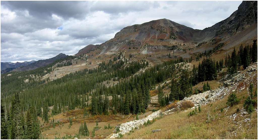
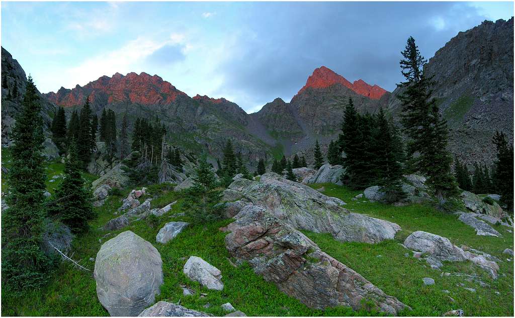
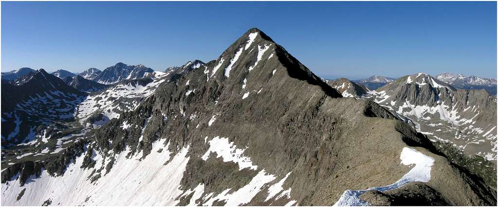
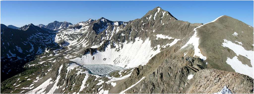
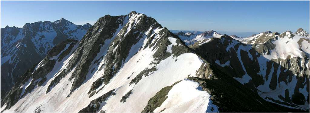
Change of plans: How about a nice hike up Spread Eagle and UN13,524. This one seemed a good “on the fly” idea considering I could drive my Camry instead to the Gibson Creek TH and just leave the truck at home. I quickly noted to my wife of the change and off I went.

On the way to Westcliffe I realized I forgot my map so I used my GPS with 24K to get to confirm the TH. I arrived at 7:00am and began my hike up the North Taylor/Gibson Creek Trail under partly cloudy skies. I have no idea if Spread Eagle has a standard route, so I just picked out a route that looked direct and fast. There’s a few different ways to do the 3 miles and 4,100-ft to its 13,423-ft summit. I made that summit at 10:00am. Spread Eagle hosts about 35-40 visitors a year. The weather slightly deteriorated in my first three hours to an overcast and breezy look and feel. It was certainly chilly but nothing I wasn’t prepared for. I didn’t stay long.
As expected, the ridge to UN13,524 looked fast and easy. There's a nice 20-ft, steep class 3 downclimb off the summit on Spread Eagles west ridge, a feature that could be an issue buried in snow. It took me about an hour to get to the summit of UN13,524, which is a nice looking pyramid shaped peak. This peak hosts close to 40 visitors a year as well, obviously

I knew the weather was stable and I felt strong so I entertained the idea of running the ridge to the next peak to the west of the Lake of the Clouds basin. I thought the peak was Mount Marcy, but my GPS confirmed it was an unnamed peak. I had no idea if it was ranked but it looked ranked so I decided to go for it. Not so fast, the northwest ridge of UN13,524 was steep and skinny. This ridge turned out to be an absolute blast. Knife edged in places, the ridge required total concentration for the 600-ft descent. It was definitely solid class 3 with a few nice class 4 moves, all on bomber rock. It turned out to be some of the best climbing (or downclimbing) I had ever done in this range.

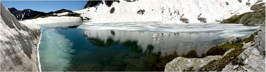
Lake of the Clouds was a nice place to visit. I had the entire area to myself and enjoyed some nice solitude while taking a 15 minute nap at one of the upper lakes.
In retrospect, this day ended up a good day in the mountains regardless of the overcast and chilly weather. I’m glad I passed on the Crestone Needle idea considering I want to save that peak for a bluebird day for optimal photo opportunities. A mountain like that deserves weather perfection.
11-4-2007- UN13,580A, Mount Adams, UN13,153, UN13,546-Sangres

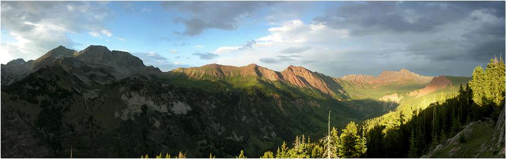
I’ve been watching the weather down in the Crestone area faithfully for weeks, hoping this Indian summer would hold out for another big trip to the Sangre De Cristo’s. It’s been since May of this year since my last trip to this range and I was beginning to feel its lure again.
The Sangres are special to me. For reasons unknown to me, I always feel completely rejuvenated after an adventure in these mountains. In fact, it’s a borderline “spiritual” event when I visit. Approaching the peaks from the west is especially powerful, likely due to the best sunsets I know. Catching a sunset here is about as close to actually watching the sun drop below the horizon from a tropical island somewhere in the Caribbean. Consistently, the suns rays turn such a brilliant orange while it dips below low horizon of the San Luis Valley. I also look forward to being the only one around during the climbing off seasons, enjoying predictable great weather in late fall into early spring.

I selected a two day affair with a few unnamed thirteeners in the Willow Lake area, in large part for the following reasons; good access to a familiar area, a previously discovered excellent water source in the high basin below Mount Adams southwest face, and great views for sunrise and sunset.
Currently, as of November 7th 2007 conditions are dry in the Sangres, with some lingering snow on north facing aspects of the range. It’s heating up during the day enough to melt snow, make ice at night and be an issue for early morning ascents.

My journal entry from the 3rd and 4th of November:
14 miles and 7,300-ft
I backpacked up into a tiny tundra ridden basin above Willow Lake, set up camp (12,500-ft) and watched the sun go down on the Kit Carson massif. It was an unbelievable experience and one I will never forget. Endured temps in the teens that evening, glad I packed in a second sleeping bag. The next morning made the summit of UN13,580A via the west ridge, and watched the sun come up. Next, I ran the ridge to Mount Adams (13,931-ft) via it's south ridge, and enjoyed another great view. A view I have already had back in May of 2005. Next, I ran Adams northwest ridge to UN13,153, a fine peak that has killer view of the South Crestone Drainage. Next I dipped down in the upper S. Crestone Drainge, climbed to the saddle between Adams and UN13,546 and climbed it. Used UN13,546's southeast ridge to descend back to my camp.
Another magical day in the mystical Sangre's "Blood of Christ"
Fall 2007 West Elks & Raggeds Wilderness
9-29-2007 Marcellina Mountain-Raggeds Wilderness
6-miles RT & 3,400-ft
Ruby Anthracite TH
Every year I patiently wait for the first week of October. When it finally arrives, I always head to the West Elks and Raggeds Wilderness area, a place that feels like a home away from home in the fall season. Spiritually it feels better than the Lost Creek Wilderness, another place that I can just feel good visiting without having to do too much planning. These are places that I feel no need to visit for an entire calendar year, but when it’s time to go…it’s time to go! For fall color, I don’t know of a better place. For that decaying fall smell, I don’t know of a better place. For that fresh smell of cow pies, unfortunately it is the worst place… my beloved West Elks. It is sensory overload, and you take in a lot more of the good than the bad.
I left early Sat, September 29th and secretly hoped that once I arrived around 1:00 pm I could sleep the rest of the day. I just didn’t feel motivated after driving in a constant downpour for about half the 5 hour drive. We had made informal plans to climb Marcellina Mountain in the evening, to photo the sun beaming across the miles and miles of golden aspens. I was to meet Aaron and Ellen Johnson, Jim Haley, and Jack Brauer www.widerange.org. Jim’s my climbing partner, Aaron’s a long time friend from SP and Jack is a dude that I had wanted to meet for a long time. Jacks landscape photography has inspired me for years, and I was highly intrigued to climb a peak just to get a shot, cuz that’s what he does. He can care less about making a summit; it’s all about being in the right place at the right time. Marcellina’s east ridge at around 5-6:00pm in early October, is the right place at the right time. But I was not too interested in a stiff 3 mile, 3,400-ft climb in the wind and clouds when I arrived, but they were.
I quickly got my shit together without bitching about wanting to sleep, and headed off into the woods with 4 very nice people. Jim and I climbed Marcellina 3 years prior and took for granted our approach, thinking we wouldn’t need a map. Turns out, the short approach is more complicated than I remembered. It’s a slight descending traverse for about a mile through thick aspens, ferns and downfall to a steep rock and grass filled gully. Using game trail after game trail gets you there. I was happy to have my GPS with 24K locked and loaded.
After a steep ascent to Marcellina’s east ridge the wind picked up. Actually we could hear it howling up there all day but it was time to actually submit ourselves to the Weather Gods. With too much cloud cover and constant bad lighting, I wasn’t expecting any nice photo opportunities. I just wanted to make the summit so Jim and I pushed on ahead while Jack, Aaron and Ellen set up for photos on the east ridge and patiently waited for some better lighting. Jack carries an impressive custom made pack that holds all of his camera gear which includes a big 4x5 camera. He found a place with nice composition and waited.
We made the summit and Jim did his panoramic thing, which includes setting up a complicated looking device that’s beyond me. Bad lighting or not, Jim always sets that thing up and fires away. I didn’t like what I saw up there, a big bank of dark clouds rushing our way from the southwest. It appeared to be snowing heavily on Mount Gunnison and I just wasn’t in the mood to hunker down in blowing snow so I headed on down and met up with Jack about 300 yards down the east ridge.
When I arrived to Camp Jack, that snow squall had just blown on by and carried a fair amount of the surrounding cloud cover with it. It was now snowing on the Treasure massif to the north. Bright sun beamed through the cloud cover from the northwest lighting up portions of the aspen covered west slopes of the Ruby Range. It was time to get some nice shots. Jim joined us and we decided it was time to head on down, it was getting dark. Jack wanted to stick around but we convinced him that the views from the grass gully are maybe just as good and we would have a good start on getting down the peak.
My best shot finally showed up when we descended the steep grass filled gully at around 6:00pm. We had an hour of light left so the sun was pretty low on the horizon which made for a killer photo. Dark wispy clouds loomed over the Rubies and saturated sun lit up miles of brilliant aspen trees. I had a feeling it would turn out well.
Aaron, Ellen and I enjoyed having the GPS do the work for us on the way out. Overall, I was happy to climb a great mountain again, this time with new friends. I was a little disappointed in the fall color considering the Kebler Pass area was nowhere near peak color. However, there certainly was enough yellow pop in those trees which in retrospect was enough for good photos. Also, considering there was a 70% chance of snow that day, I felt good about getting a summit.
That night it snowed 3 inches on us at camp, and up to 6 inches on the surrounding peaks.
9-30-2007 Ruby Mountain & Mount Owen-Ruby Range
6 miles RT & 3,100-ft
Lake Irwin area TH
For whatever reason, in my prior visits to the West Elks I had never been up the highest peak in the area, Mount Owen A (13,058-ft.) Owen is one of two 13ers (West Elk Peak is the other) that reside in the West Elk area. Technically Owen resides in the Raggeds Wilderness however the peak seems to stands guard over the entire Kebler Pass area which is mostly in the West Elk Wilderness. Regardless Owen is worth climbing and offers up splendid views of the Ruby Range. Easy access to a high TH makes this one perfect for those that want a shorter day.
Woke up Sunday morning to clear and crisp skies and 3 inches of new snow. It was officially fall season. Jack, Jim and I headed off to a good spot to photo sunrise on West Beckwith before a meeting Aaron and Ellen for a climb of Mount Owen. All of my shots came out underexposed. I’m still learning…. and forgetting, over and over.
Jim and I met the Johnson’s at the Lake Irwin turn off at 9:00am. We found a nice place to park not far from the base of Ruby Mountain (12,644-ft), a twelver that shows more prominently than its higher neighbor Owen from most vantage points along the scenic Kebler Pass Road. I bet a lot of photographers that shoot the massif from the road think they are shooting Owen, but they are not, its Ruby.
The weather was perfect fall weather, cool and crisp with 100% crystal clear blue skies with little wind. We spied a nice tundra ramp that would allow easy access to Ruby’s south ridge. This would allow us to easily combine Ruby with Owen and make the route into a loop route. We like loop routes and if necessary will do more work to make it a loop route.
We made quick work of the ramp and before we knew it, we had excellent views of our surroundings. It was a nice perspective of the area for me, one that I had never viewed before. The ridge to the summit of Ruby Mountain is class 1. Mount Owen was now in full view and I could see two climbers negotiating class 2 terrain along its south ridge. It’s not often I see others on peaks Jim and I climb. Must be somebody that likes the same stuff we like!
We descended to the saddle between the two peaks and Aaron decided that he and Ellen would call it a day and head off to have lunch in Gunnison. We briefly tried to convince him to continue but I’ve learned when Aarons done, he’s done. The man loves his mountains more than me, if he wanted to continue he would. If there’s a man that truly understands that mountains do not move and that they will be there for another time, it’s Aaron. I respect that and appreciate him bringing that to the table when we climb together.
Jim and I headed up the easy class 2+ south ridge of Owen and made good time to the summit. Along the way I observed the footprints in the fresh snow of the climbers before me. Often, I come up with these little quirky ideas while killing time doing uneventful climbing. I tried to understand why these climbers meandered up the ridge as they did. When I was on the ridge crest, they would be 5-10ft below on the trail. When I was on the trail, the prints would be 5-10ft higher on the ridge crest. Hmmm. I just don’t think the way these guys do. They hadn’t come down yet, so they must have headed off to Purple Peak.
From the summit, Jim began his ritualistic weird panoramic set-up. I began to get cold while observing two climbers headed up Owens north ridge back to the summit. We would meet. While hiding from the wind behind a rock, I heard “Hi Kane.” …Huh?
Before me stood a masked man in a blue jacket, I wasn’t sure if I just walked over into the twilight zone. What am I missing here, while sitting on a remote summit in the middle of nowhere? “I’m sorry, do I know you?” “It’s Ryan Schilling.” Oh lord have mercy its freakin Ryan and Erin Schilling. I sort of felt bad that I didn’t recognize Ryan, even if he was wrapped up Gore Tex.
Things quickly began to make better sense. I had invited Ryan and Erin on this trip however they responded saying they couldn’t make it. Saturday night they made a last second decision to head on down. They new we may be up on this mountain. But I had no clue it would be them. It’s quite ironic meeting friends on summits in the middle of nowhere. It just doesn’t happen very often.
The four of us retreated back down the mountain together and talked mountains for the next 2-3 hours. I invited them to stay overnight with us back at camp but they needed to get back to Denver to work the next day.
10-1-2007 Afley Peak-Ruby Range
15miles RT-4,200-ft
Dark Canyon Trail (830) to Oh-Be-Joyful Pass Trail (834) via Horsethief Ranch
I woke up Monday morning not very motivated to do anything. It didn’t take long to remember that fall only comes once a year and I better get my ass in gear and go climb something. Jim would leave early this day so I knew I would be solo for my climb. I selected a longer day adventure for Afley Peak (12,644-ft), a nice twelver connected to Mount Owen. Most do Afley Peak via the connecting ridge with Mount Owen however, I liked the looks of Afley’s tundra ridden west slopes from the summit of Owen the day before. Also, REALLY liked the idea of a long approach through a zillion aspens. In time, I want to climb all the twelvers that run north from Owen; however I’m in no hurry. I knew that Oh-Be-Joyful Pass would allow easy access to Hancock Peak or Richmond, and Augusta Peak. I just wasn’t in the mood for a 9 mile approach to the pass so I was hoping to leave the trail early and bushwhack up to the tundra covered basin below Afley’s west slopes and see what happens from there.

The weather was nice with just a few very high clouds coming from the east. Jim and I hiked for a couple miles to an outcropping that overlooked the Dark Canyon area. We filed this place away in the “must come back to for sunrise photo” category. We both agreed that this area would make a killer backpack beginning at Horsethief Ranch and ending at Erickson Springs. Jim left me and headed back home from here.
I continued on the scenic trail to a junction with the Oh-Be-Joyful Pass Trail and began a slight ascent up through more aspens. The trail is fast and has many water sources which seemed a little unusual for this area. Along the way I came to at least 3 different hunting townships complete with smokestacks coming from the house like tents. I don’t necessarily care for hunting or hunters, however I can somewhat respect the ones that do it without roads and ATV’s.
About 5 miles in I began to look for a good place to leave the trail and head east into a basin below Afley. Occasionally it was difficult seeing the peaks or other landmarks to get a good gauge of my whereabouts. The terrain was convoluted and the tree cover and other foliage was dense. Using my 24K GPS, I picked a good spot to leave the trail. The bushwhack was easy going and before long I entered a huge meadow below Afley’s west slopes. From here I spotted a number of attractive options for ascending the peak to its summit. The west face is broken up by moderate cliff bands the run the length of the peak. However, there are 2-3 places where tundra found a weakness between cliff bands to set up and grow. These tight, bottleneck chutes were perfect for getting from one bench to the next with minimal class 3 tundra climbing. After an 8 mile approach I finally found myself on Afley Peak’s summit. The summit register had John Kirks name on it from Sat the 29th, the day we had all that rain. Yikes. The peak sees about 8-12 summits a year, almost all from mount Owen.

The cloud cover had thickened up a lot in the last hour so it was time for me to go. I descended a slight variation of my ascent route and made the basin below the peak. I spied a line that I knew would save me about a mile of trail hiking for my return back to my car. I traversed the base of Owens northwest face and then went up and over Owens obscure west ridge, all on tundra. This worked well plus, I enjoyed surprising a herd of Elk hanging out high in the trees way above any hunting areas.
Under a completely overcast sky I found a great place to photo aspens. I learned last year on my trip up Storm Ridge that some of my best aspen shots came in overcast conditions. Again, I was happy with my results.
Overall, Afley Peak was exactly what I needed that day. I enjoyed the hike so much that I will have no problem going back for Hancock, Richmond and Augusta. I’ll just have to make it an overnighter for sure. That would defiantly be a long one.
9-9-2007-Capitol Peak via Pierre Lakes Basin-Elk Mountains
Round Trip-18 miles & 6,500-ft
More photos: 1 2 3 4 5
The following isn’t too much of a trip report. There’s already many accounts available on how to climb Capitol. This will be more of a personal account of the difficulty of climbing the peak from the Pierre Lakes. I’ll also add my two cents concerning Capitol’s reputation for “greatness.”
In 1996 a friend invited me to climb a mountain called Capitol Peak. At the time, I knew it was considered a difficult mountain to climb however I was young and full of testosterone. I remember down-climbing K2 and feeling the need to pee my pants. I had no idea what I was up against. Next, I did the butt scootin boogie across the knife edge and peed my pants; just joking…but it did scare the crap out of me. Pee and crap, I think you get the idea. Finally, I remember following some piles of rocks out onto the east face. And my last memory of Capitol Peak in1996 was gripping onto my life while balancing precariously inside one of the many steep loose and highly exposed gullies that rib the east face. Needless to say, that was a bad memory. Needless to say, I didn’t belong on that mountain.
Over the years I convinced myself that it wasn’t my fault, since today I would have to be a complete idiot to invite a human being with absolutely no mountain experience to take on an endeavor like Capitol Peak.
Fast forward, 11 years and 250 mountains later, I was having trouble coming up with a plan for my upcoming three day weekend. I opened Dave Coopers scrambling book and there it was, Capitol Peak. Hmmm. People ask me all the time “you climb them 14ers?” My reply “I’m pretty much done with 14er’s, but I do want to climb the hard ones.” Capitol qualifies as a “hard one.” My next thought was, “how can I make this a memorable and different adventure than the zillion available trip reports using the standard criteria for a summit bid?” Awe…yes…how about a nice torture fest of a climb from Pierre Lakes!! This was perfect since I had already been up to those lakes about a year after I attempted Capitol. Plus I was very much interested in going back to a place that I remember being the most beautiful place I had ever been.
I e-mailed Jim the idea and he had to get back to me. I had a feeling he would pass on the idea considering he’s not much into boulder hopping….and…there’s a few boulders in Pierre Lakes Basin. I asked Ryan Schilling to use a map and point out the ascent gully that gets one up and out of the basin. He replied quickly and wished me luck. I moved Ryan’s response to Jim and finally replied he was interested. Holy crap, it was on, I was committed to climbing Capitol from Pierre Lakes.
Overall, my main concern with this idea was the brutal 6.5 mile and 3,700-ft backpack up into the basin. We had packed for three days and two nights to break up the mileage and vertical and also to have plenty of free time to shoot our cameras. The first three miles does about 600-ft of gain; the last three does 3,100-ft. I wasn’t concerned with Capitol and it being something out of my league however as always I was concerned with being above treeline for 8-9 hours. I prayed for good weather.
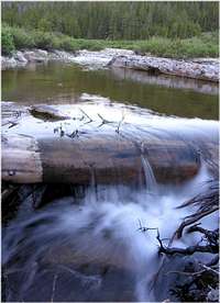
Jim and I started at 1:30pm on Sat and made the upper basin at 6:30pm, about one hour before sunset, about 5 hours. The Snowmass Creek crossing went without a hitch. Crossing the creek in September is key, or expect a difficult crossing in earlier months. Ryan reports of a log bridge of sorts, however we did not find this bridge going up or coming down. I have a GPS waypoint for this crossing; e-mail me if you are interested. Once across the creek, there is a trail escorts you all the way to the lakes even though it fades to nothing from time to time. The trail is not used often and not maintained whatsoever. The ascent of the Bear Creek waterfall is class 3 in spots, very grown over with willows and aspen trees, and difficult with a full pack. The last 1,000-ft is especially memorable in a painful sort of way. There is a ton of camping at 11,900-ft on tundra. Like Ryan noted, the ascent gully out of the basin is not difficult to locate across the basin. It just looks far away because it is.
As I remembered, Pierre Lakes Basin is massive and insanely pristine. It is difficult to come up with the right words to describe this place. When you peer down into the lakes and basin from nearby peaks, it looks like a massive place and make no mistake about it; when you’re actually down within the greatness, the encompassing area seems even bigger, or more immense. Grey is the color of the day…every day. And erosion is a slow process here; only the skinny, sweeping, fractured ridges seem to be falling apart. The lakes are a clean emerald green and harbor big trout.
It’s close to a mile of boulder hopping to the gully leading up to a notch in ridge line and out of the basin. The gully is loose class 2+ and some class 3. There is a permanent, steep snowfield that resides on the east side of the notch which is bulletproof ice during September. Down climbing this snowfield without an ice axe is too dangerous, thus an ascending traverse from the notch up and over the fields will be in order. It’s easiest to just make the climb back up to the ridge crest and run it all the way to K2. This climb and traverse will likely be the sketchiest section of climbing all day, expect loose, steep, class 4 climbing on ledges covered with dirt and scree.

The climb of Capitol went well. The route has been cleaned up pretty good over the years.
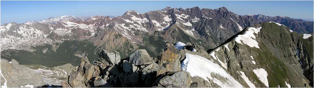
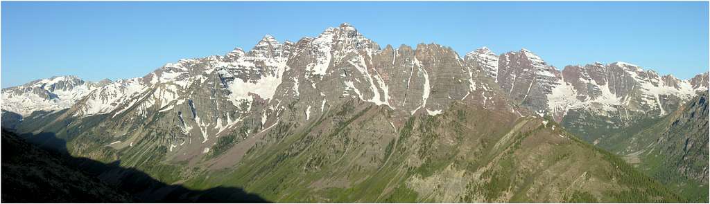
So here’s my account of Capitol. This is a great mountain indeed although I feel like Capitol is better to look at rather than climbing it. Capitol is the king of the entire area. It’s far and away from a lot of places but easily identifiable from peaks that are far and away. It’s the centerpiece of many spectacular views. Capitol is stunning to look at from every perspective. It resides in the heart of the most gorgeous wilderness I know, the Maroon Bells Snowmass Wilderness.
The standard route on Capitol seemed a bit arduous to me, especially past the wonderfully solid knife edge. I may have been a little tired from the previous boulder hopping from the Pierre Lakes to the summit. While on route, I’m not sure I encountered any class 4. Maybe a move or two but nothing exposed. There is constant scrambling, and good route finding is the key to making this route safe. Capitol requires ones constant attention to the details of route finding. I had my head on a swivel the entire climb. Losing focus could mean losing your life. I believe that Capitol Peak should be known as a peak that will seriously challenge ones focus on the details. It should have a reputation for its length and vertical gain, which are two huge factors in focusing on the details.
Overall, I think I’m most proud of the fact that we climbed Capitol from the Pierre Lakes Basin, and not necessarily the idea of climbing the peak itself. I really feel like I did Capitol the right way for me. I never felt a sense of redemption considering my failed attempt 12 years ago. I’m sure I was more happy that the weather held out all day. That night it rained on us for almost 7 hours.
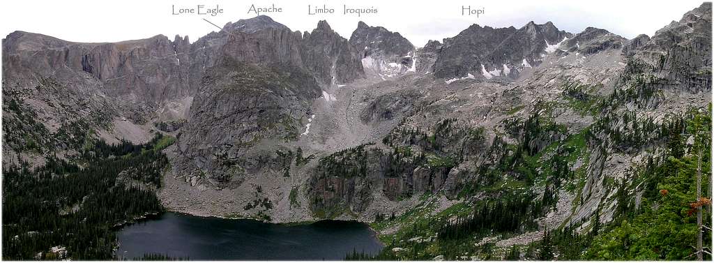
8-26-2007-"Iroquois Peak"-UN12,799-Indian Peaks Wilderness
Southwest Face-RT 18.6 miles & 7,150-ft
via Arapaho Pass and the 4th of July Trailhead
Back in 2003 I climbed every other weekend in the IPW thanks to Gerry and Jennifer Roach’s IPW guidebook. I was obsessed with that place, often perplexed why so many were climbing 14ers and only a fraction was climbing in this beautiful area, especially the peaks residing within the Lone Eagle Cirque. I climbed everything on the east side of the cirque and then I took on my first peak on the west rim, Achonee Peak. In return, I quickly learned what it takes to execute a climb of anything from that side of the cirque. These summits do not come easy, most involve at least 13-14 miles RT and 4,500-ft of gain. Every year after 2003 I have made an effort to at least get into the IPW at least once a year. In 2005 I climbed Cherokee another fantastic peak located on the west rim which required a huge effort. Ideally these peaks would work better with an overnight camp.
After 28 IPW summits there was one left for me that has always mentally teased me with its potential view and scary obscurity, “Iroquois Peak.”. Jennifer Roach describes the summit view: “The best view in the Indian Peaks awaits you on the summit of Iroquois. If you have never been on top of this peak, make it your next outing.” She goes on to say “The view will knock your socks off.” Reading this over and over, I knew there was something special awaiting me in the IPW. In the end however, I always cringed imagining what my knees would endure when I read the stats for the climb. Every time I nonchalantly put it off for another day, like I was getting any younger.
Another day happened to be Aug 26th 2007. Feeling strong these days I was ready for the one day ascent of Iroquois from the 4th of July TH, west of Eldora ski area. I packed light, envisioned good weather and had my GPS loaded with waypoints.
Ok, this is where I’m switching things up. Yes, I was successful in my climb of Iroquois. Yes, it was brutally long. Yes, having to re-ascend Arapaho Pass on the way back might have be the most mentally challenging section of class 1 trail I’ve ever hiked. Yes, the view did knock my socks off. And lastly yes, it was worth the effort, in a big way.
There’s no need for me to describe the route if you own the Roach’s IPW book. The route description (by Jennifer) is one of the more detailed in the book and is flawless in basic, needed beta to get you to the summit. Something to highly consider when Jennifer speaks of the summit pinnacle: “The summit appears abruptly and is highly exposed. Actually standing on the highest point requires a lot of nerve. Consider the probability of the entire summit block disappearing with you on it." I had one look at the damn thing and about blew chunks when I imagined the sick exposure climbing that rickity sucker to actually summit the peak. I couldn’t even get my hand on top of it, missing its real high point by about a foot. It’s one spooky block, sitting precariously, and balancing for who knows how much more time.

I’ll add some of my own insight that should be useful.
-First I wouldn’t attempt this one when spring run-off is high. There are many primitive creek crossings that will need to be negotiated.
-Do not underestimate the length of this climb. Ascending to Arapaho Pass is the warm up for this one. Having to ascend back over the pass later in the day, likely after noon, potentially gets you highly exposed to the elements. The hike up and over the pass keeps you exposed to lightning for up to two hours. That’s hiking fast too. Weather should be your number one issue to consider when climbing Iroquois; don’t worry the route go’s well.
-After you leave the Arapaho Pass Trail and begin a traverse into the

Pass Trail at 10,300-ft. A GPS works well for this one.
-Once across Arapaho Creek, locating the “rough trail” is of paramount importance for your ascent into the remote Wheeler Basin. The lower area of the basin is ridden with cliffs and downfall. This is one of those trails where you have no idea how it got there in the first place, maybe mining? It has to be maintained by game considering Wheeler Basin isn’t exactly a place that your casual day hiker wants to visit. The trail is a Godsend when you find it on the other side of the creek.
-The lost Tribes Lakes are as pristine a place you will ever visit in all of Colorado. Most visitors are on their way to get Iroquois. Iroquois sees maybe 1-2 ascents a year. I was the first this year to sign the summit register, left behind by Jennifer Roach in 1999.
-Jennifer is right-on when she notes when viewing the southwest face from the lakes, the route will be obvious. A 24k topo will not show the inset, steep, grassy gully to ascend. The traverse out of the gully is also easy to locate.
8-20-2007-Mount Powell-Gore Range

It was time to get back to the basics. For me, the Elks and the Gores are my basics; the places I go to feel good again. I've planned many trips to the Gores this year but for whatever reason I didn't follow through. Usually it’s the lure of something different that makes it easier to forget the Gores for a while. To me, the Gores are peaks that are familiar and make feel at home. With only 4 thirteeners left to climb in the Gores, it seems I know exactly what I’m getting when I do go. And in typical fashion, this solid, rugged and pointy range of peaks always delivers a great adventure.
I planned a two day climb of Eagles Nest from Kneeknocker Basin. I had been to this basin on two occasions but had never stayed overnight up there. Kneeknocker Basin is above tree line with granite boiler slabs intermittently breaking up the endless tundra. Peak C and Mount Powell tower above and face west capturing evening alpen glow daily. The place is alive with beauty and well worth visiting more than once.
The backpack up to Kneeknocker is a tough one. It’s short in distance at 3 miles but requires 1,800-ft of vertical gain; 1,500-ft of that coming in the last mile and a half. My sore back was not working with me once I reached a spot to set up an over night camp underneath Peak C. I began to entertain the idea of climbing Powell instead of the longer route to Eagles Nest. Never been up Powell so I guess it was time to climb the big daddy. That night I set up the camera and tripod, enjoyed a beer and watched the sun go down on both towering summits that grace the view.

Woke up at 5:15am and made Kneeknocker Pass at 6:30am. Entertained thoughts of climbing that southeast ridge from the pass and quickly understood what I was up against; way beyond my abilities, lots of class 5. Found a pair of old Scott ski poles up in there, likely left behind by a tempted climber that got into terrain he/she wouldn’t want to get back to.

From the pass, I descended 200 vertical and next ascended 1,000-ft to Powell’s huge summit area. I signed the register at 7:45 am. The early southeast sun was exploding and made it tough to shoot south across the silhouette of shapely peaks. Overall, the route up Powell is technically easy however; doing this peak in one day would likely be strenuous for most. In my opinion the Gores harbor better peaks than Powell but there is something to attaining the highest point in the range. I have a feeling that I will enjoy Eagles Nest more than Powell after eyeing the potential route from Powell and upper Cataract Basin.
From the summit I descended northwest a few hundred feet to have a look at a potential route down the northwest face of Powell. I was entertained by the thought of not having to re-ascend back up to Kneeknocker Pass and potentially visit the gorgeous Cataract Basin, another place I had not been before. My past experience descending the nearby Ripsaw Ridge a few
While descending, I had trouble taking my eyes off of the impressive “Cataract Points.” Nice peaks indeed. I made tundra down in the basin after connecting gully after gully and made my way to “Game Pass.” The hike back to camp was fast. The pack back to the TH was uneventful.
The weather that Monday was perfect. It was cool and breezy all day and reminded me of climbing in September. Maybe the yearly monsoon is over? I hope so.
8-12-2007-A glorious evening in the heart of the Elks
From our camp in the Lead King Basin area, I hiked 1,800-ft with all my gear and a beer to a nice spot on the northwest ridge of UN12,655. Here's what I'll remember seeing for the rest of my life.
8-13-2007-UN12,655-Elk Range
The prior night Aaron, Ellen and I decided on a short hike up the uniquely situated UN12,655. Everything about a potential climb seemed to fit our tight schedule to be back in Denver by 5:00pm. We also concluded this fine peak would offer up more great views of the surrounding terrain.
We researched a route that would ascend a mystery trail up into the basin south of UN12,655, and Point 12,525 and north of Schofield Pass Road. This mystery trail showed on the Topo however it was not maintained. I liked our chances in locating it, even if we discovered it later on. There’s a boat load of game trails in the area and at the very least we could connect game trail after game trail to assist our ascent up through the knee and waist high vegetation.
Donning head lamps, we began our search for the mystery trail with the aid of my GPS, which did show a trail. I stood directly on the GPS trail and nothing resembling an actual trail presented itself. So I headed straight up the steep wildflower ridden slope. After about 200 vertical, I heard a waterfall off to the right and it clicked; “most waterfalls have a trail leading to it.” Maybe I would find the mystery trail around this waterfall. I found the falls and finally found our trail.
In retrospect, I find it humorous when I convince myself that the GPS will always lead me to the promise land. Occasionally those damn things cause me more pain than they’re worth. There’s something to be said about trusting our inner instincts, and not some little palm sized computer loaded with outdated beta.
The skies were clear and the lighting magical as we ascended a perfect, hardly used trail up into the basin south of UN12,655. Aaron imagined a class 1 stroll up grassy slopes to the saddle between Point 12,525 and UN12,655 and he was right. I called it “cupcake slope.” He and Ellen called it “perfect.” I chose a different route that presented a longer, more stiff climb up the southwest ridge of UN12,655. I wanted those views of the Schofield area and the huge view of Treasure Mountain. They could care less about my photo influenced idea and headed up the more direct route to the saddle between the two summits.
The hike to the summit went fast and so did my last photo for the trip. My battery died. I saw it coming and forgetting my charger didn’t help my situation. I made the summit of 12,655 and enjoyed a nice view of the surrounding peaks. I especially enjoyed my perspective of the Schofield Pass area, a place I have yet to visit. I was to meet Aaron and Ellen at the saddle between my peak and the point 12,525. When I arrived Ellen was gracious enough to lend me her camera so I could head off along the ridge to another point to capture more perspective.
It seemed Aaron was really happy with our decision to hike this peak. He kept gushing about the view. I wasn’t blown away considering I attained this view from my evening hike two days prior, plus I was spoiled to have had the view with the sun going down. Overall, I was a happy camper however, the day was about to end and I had it in me to go all day. Even if I had all day I’m not sure the weather was going to hold up anyways, the clouds were building upward, a much different pattern than the day before.
8-12-2007-UN13,062 B & "Trail Rider Peak"-Elk Mountains
 UN13,062B
RT-11.5 miles from the Lead King TH
Vertical Gain-3,800-ft
Last winter I researched more of the Maroon Bells Snowmass Wilderness for potential hidden gems with big views. Leaning slightly towards a 13er for higher elevation, I came up with UN13,062B, a forgotten peak residing on a long ridge running west from the Maroon Bells. This ridge resides deep the heart from the Maroon Bells and overlooks two of Colorados most impressive and vast basins, Fravert Basin and Hasley Basin. If that wasn’t enough, additional views include an awesome perspective of the Maroon Bells massif, the Snowmass/Hagerman massif, and the Treasure massif.
Aaron Johnson and I made a deal a while back to get into Lead King Basin. I had never been in there and desperately wanted to check it out. We planned a trip up Siberia Peak and maybe a visit to 13,062. Instead, Aaron liked the 13,062 idea so we made that peak priority and the loose, messy west face of Siberia a consolation prize.
I met Aaron and Ellen at his place and off we went; 4.5 hours later we set up camp for the next two night stay in maybe the best camp site in all of Lead King Basin.
I had the bug to get some sunset shots and didn’t mind working for it since the weather was wonderful. I packed my gear and made an 1,900-ft climb to a spot above the Devils Rockpile on UN12,655’s rugged northwest ridge. My vantage of the Hagerman/Snowmass massif towering above the picturesque lower Fravert Basin was perfect. I set up the tripod, busted open a double IPA and enjoyed a stellar sunset that only I was lucky enough to witness. I shot 70 photos.
>
The alarm woke me up at 5:00am and it was time for a long hike to Trail Rider Pass. Our route would ascend “Trail Rider Peak”/ UN12,961 from the pass and continue to a saddle in between the twelver and thirteener.
My earlier research of this peak included a dialed route description from Kirk M from one of his trip reports from 14erworld (see attatched Topo map). I wanted to make this a loop route as he and Teresa G made back in 2005. I confirmed the route with a short discussion with Teresa G. She talked about an obvious game trail that descends west from the saddle between 062 and “Trail Rider Peak” all the way back to the trail leading to the pass.
On the way Aaron, Ellen and I noticed a fine looking twelver to the south towering above the Geneva Lake TH. UN12,655 is the highpoint of the ridge of gentle peaks that tower over Hasely Basin. The unranked and unnamed point just north of UN12,655 has distinct character. Its north face is ribbed with vertical, cylinder-shaped rock, a look that sets itself apart from the entire encompassing area.

We made good time to Trail Rider Pass. I was feeling like shit, likely the byproduct of not getting out in the past 18 days, plus I wasn’t hydrating. I didn’t like the weather either. Too much cloud cover at 9:30am. Aaron liked the escape route options if we continued up and over “Trail Rider Peak”, so I whacked down some food and water and we made good time to the summit. UN13,062 looked far away, but I figured it to be closer than it looked. I was feeling better and was ready to cruise. In no time we made the saddle and began to weigh our options up the loose UN13,062.
 Route Photo
I do have something on Aaron. He can’t keep up with me and my longer stride while descending. Plus, he and Ellen have this little problem excepting the fact that using trekking poles are superior for descending than not using them. Ellen likely would use poles if Aaron used them since she worships the guy (married) but he just doesn’t use em. Maybe he thinks trekking poles are for sissies. He should know that sissies get to take naps while they wait for their pole-less climbing partners on descents.
After about a fifteen minute nap, Aaron and Ellen met me back at the saddle. We easily picked up the huge game trail that leaves the saddle and descends down and across the south face of “Trail Rider Peak.” When we reached a tiny lake that resides about 600 vertical below Trail Rider Pass the weather began to stabilize just as Aaron had suspected. Chalk up another good call for my experienced trekking pole-less friend A Johnson.
We enjoyed a nice stroll back to camp, discussing potential options for the next day. Meadow Mountain, UN12,655 seemed to dominate our thoughts for a short excursion for departure day.
 Aaron on the summit of 13,062B
7-22-2007-Mount Sneffles-Southwest Ridge, San Juans
I was considering a long drive home after the Golden Horn climb. All indications earlier in the day had me on my way back to Denver. I had been away from home for almost a week, had climbed on 3 out of the past 4 days and I was certainly missing my family. And, the weather had been weird; to say the least. Lastly, I didn’t really have a mountain idea that seemed to fit my needs. I wanted something short and interesting and nearby.
Mike (Chicagotransplant) had along Dave Coopers Colorado Scrambles book and introduced the idea of climbing Mount Sneffles. He and Chris (Vanny37) sort of threw the idea out there to see if it would stick. I’ve never had too much interest in Sneffles except for a stint about a decade ago when we were rained out on an attempt from Blaine Basin. I suppose all those trip reports I had sifted through over the years had me thinking I had been on that summit before. Despite my reservations, I was interested in the southwest ridge. I didn’t know too much about the route, only that it had been recommended by good friends with big climbing resumes. After these considerations and the fact that the route fit certain criteria for a fast day, the southwest ridge on Sneffles was the plan. BJ and Jeff were also interested, however they wanted the standard route, but we all agreed to meet at the Weehawken TH the next morning at 5:30 am and carpool up the road together.
The next morning we awoke to partly cloudy skies and Mike and I headed off to meet Chris, BJ and Jeff. We arrived at the upper TH and off we went. The weather looked very good.
The southwest ridge route begins at Blue Lakes Pass which is an easy and scenic 2 mile hike from the parking area. Gilpin Peak is showcased quite well along this tundra stroll.
Arriving at the pass Chris, Mike and I enjoyed stellar weather and great views of the Dallas Divide. After some fun conversation and something to eat we donned helmets and started up the southwest ridge of Mount Sneffles. The route ascends relatively stable talus and bypasses the towering rock pinnacles that frequent the lower areas of the ridge. After the initial class 2+ scramble, the ridge leads to a notch. It is here where things get interesting. Climbing out of the notch seemed beyond our capabilities, so a 80-ft descent into a messy gully was necessary. This gully connects to another gully which ascends back to the ridge crest. The trick is ascending this gully when its upper area is packed with soft snow. I climbed to the right of the snow and soon left my comfort zone by having to pull a couple of semi exposed class 4 moves to attain safer ground. This was my crux for the day. I recommended to Chris and Mike to cross the snow and climb the left side. Both made good time up this crux.
From here, we entertained some fun class 3 to a place where the ridge narrowed and jumps to the summit. All of us were excited to finally reach this portion of the climb. This is where the loose stuff has fallen off to either side and has left a clean, narrow, solid ridge to the summit. What I would pay to find a climb that resembled this portion of the ridge but instead of 300-vertical, ascended 1,500 vertical. I went first, enjoying every second of the solid rock. I popped out on the summit at around 9:30 am and began to say “hello” over and over. Then Mike and Chris followed, both sporting wide smiles when they reached the summit. The weather was holding up so we laid around chatting with other summiteers soaking up the good views.
We decided early on that we wouldn’t have any of that ascent route for the descent, so we began down the standard Lavender Col route, saying “hello” over and over.

It didn’t take long for me to get a little cranky with what I was seeing on the mountain. Mike and Chris put up with my grouchiness very well. You have to understand, I don’t climb 14ers too often so I couldn’t help but formulate goofy little opinions about what I saw. Worst of all, I let it effect my mood. Here are a few observations, some are good and more are bad.
-A dude in Levis lecturing another nice individual for offering him trekking poles after he slipped on his ass, saying” Those things are a waste of time, I can’t believe all these people using them. What do they even use them for?”
-A party of three heading directly up the center of the ridiculously soft snow-filled couloir without helmets or ice axes . Ten feet to the left was a safe melted out trail all the way up.
-A party of two talking about descending the southwest ridge when they ascended the standard. Why would one do that? That would be a very bad
-I applauded a mother with her two kids hiking up the gully, all with helmets. What I thought was especially cool was the kids were wearing bike helmets. I commented to her that I liked the innovative and smart idea of using bike helmets; smart lady.
-From the summit, the view down the mountain upset me. It looked pounded to death. I knew why after watching a lot of people exercise bad route finding decisions. Met a guy that bypassed the giant snow filled couloir by accident and ascended the steep, rocky bowling ally type of a slope below the summit block. Lot’s of people traversing the slope he was climbing to get to the summit and of course he wasn’t wearing a helmet. This where and when I knew I was off route.
The best part of climbing Sneffles was the company. I really enjoyed Mike and Chris, both are great guys that love the mountain as I do. I liked the fact that they don’t sweat the little stuff as I do. I need to hike with those guys more often.
7-21-2007-Golden Horn-SP Gathering, San Juans
For the annual Summitpost gathering we selected Golden Horn Peak, a handsome mountain residing in the Ice Lakes Basin outside of Silverton Colorado. I had never been up in the Ice Lakes area and over the years I had been privy to many positive conversations concerning the beauty which encompasses that area. I was eager to see what all the hoop-la was about…rain or shine.
After a messy dinner at Romero’s Mexican Restaurant with the group I made the 15 minute drive to my primitive camp near the Mineral Creek. The day prior it had rained like hell and everything up to and including the air I was breathing felt wet. It rained all night too, and when I woke up at 5:00 am and poked my head out of my tent I observed what was expected, cloud cover…and lots of it. A few minutes later the morning sun beamed through the low clouds, pushing a few rays of light my way just before I entertained thoughts of heading home instead of enduring another day in the rain. It certainly did not look promising but oh well, I was getting used to this reoccurring theme. Little did I know that weather for our gathering would not be the crux of our outing, instead most of us spent the day cursing Romero!

We met and carpooled up to the TH and began the short trek up into Lower Ice Lake Basin. We agreed to have a fast group and a slower than fast group. I quickly made my way into the fast group. We enjoyed one another’s company while swimming through the air all the way into the Lower Ice Lake area. That’s when I realized that something wasn’t right. Almost instantly I needed to unleash the hounds. I peeled away from the trail and made like a wild banshee into the woods. I inherited a nice wet bushwhack to a place where I would remain for about 20 minutes while others enjoyed the calm before their own little storm.
I was sick and at the same time worried I wouldn’t make the climb up Golden Horn. I was afraid to drink water too. Finally I gathered the strength to set back out on the trail. I was way behind the slower than fast group and light years away from the fast group. About 5 minutes after I began hiking, I had to endure another wet bushwhack to a private place in the woods.

Over and over, I met the trail to soon have to leave the trail. I was miserable. I was very concerned that I was about to leave the wooded area and be introduced to the above tree line area where there's no where to hide. On the way back to the group I kept passing the same hiker. Seeing me pass him over and over was enough to give it away. My final time I passed him he said “I wish I had some ammonium AD for you.” I laughed and off I went into tundra land.
I finally caught up to the slower than fast group and noticed Aaron Johnson missing. I turned and saw Aaron pop out of the deep wildflowers about 200 yards behind me. He had been hiding. Hmmm… I looked at Ellen and said “Romero’s?” She said “yep.” It was official; I had a serious case of Romero’s Revenge. That’s all I needed to know to assure me that last nights dinner was a tick away from food poisoning. It was also my first clue that it may be a long day for the rest of them. I was feeling so much better and began to feel the strength in my legs again. I was hopeful my bout with Romero’s was over.
The lower Ice Lake Basin is a nice preview for the upper basin. It’s almost two different worlds; the sub alpine ecosystem and the upper alpine ecosystem. The wildflowers that grace the lower Ice Lake basin are the tallest, and most densely packed I have ever seen. These plants seem to be genetically superior in every way compared to flowers in other mountain ranges. I confided in Aaron that going forward, when we debate which mountain range has the best whatever, I will say “the San Juans have the best wildflowers.”
At last I had caught up to the fast group in the upper basin. The flowers were outstanding, but I wanted to kick it into gear, and leave the shutter bug mentality for after I could get my summit. The clouds were still around and seemed to be slowly building, so off we went. Mike (Chicagotransplant) and I decided to split from the fast group and forge ahead. Mike was interested in Vermilion since he had already climbed Golden Horn and I didn’t care which one to go for. He had an ice ax too. I previewed the snowslope up to the saddle of Vermilion and without ice ax I wasn’t going for it, so I selected Golden Horn. We a planned to meet one another after our climbs and descend the upper and lower basin together and wait for the rest of the group at a later time. .
Descriptive route Golden Horn’s Southwest Ridge Route
Golden Horn is not technical and just maybe hits easy class 3 in a few spots. As always, I searched out solid rock to climb instead of laborious scree and talus. My route was likely off standard route but it was nice to actually get some scrambling in. I peered over at Vermilion and saw Mike had made his summit too. We exchanged distant arm waves. I will say this about Mike, the dude really moves. He had a longer route to his summit and he made it as I made my summit. I don’t think I ever heard deep breathing coming from that guy the entire day, must be supremely conditioned.
I could see the rest of the group heading up the loose slope but I needed to head on down so I could whip out the camera and go photo crazy in that basin around the lakes. I met up with Mike in the talus ridden basin below the peaks and we made quick time to our goal. I proceeded to torture Mike with a serious case of shutterbug fever. We wanted to wait for the rest of the group in the lower basin so I just shot about 100 photos over the course of about 2 hours.
The upper Ice Lake Basin is also very impressive; complete with a vibrant turquoise lake, numerous smaller lake-lets, a zillion wildflowers and of course a couple of waterfalls. Now I know what all the fuss is about, Ice Lake Basin is everything you could want for outstanding scenery. It’s certainly a place I won’t hesitate to visit again.
In time the rest of the group met up with Mike and I and it was there I realized that everyone with the exception of one lucky soul, got sick on the hike. All of us at one point felt like our insides had been ripped out of us with a butter knife. Most of us were over it but a few still had to endure Romero’s Revenge for the rest of the day.
In time we leisurely made it back to the trucks. From there, we made plans to meet at the Handlebars Bar and Grill and have a beer and dinner.
I arrived a little late but everyone was nice enough to wait for me. Handlebars is where we should have been the night before. I loved the miner influx within the décor. I felt more at home here. In addition, all of us were pleased the day turned out to be a huge success. I was especially happy for Aaron, the mastermind behind this huge project. We hung out chatting about the day and dreaming up future outings with one another. To end a memorable day, we were treated with a surprise Barber Quartet singing sweet ole fashioned melodies. I remember thinking to myself that I was exactly in the place I needed to be. Chalk it down, another great memory stamped in my memory bank forever.
7-20-2007- Potosi Peak- San Juans
After 3 days at the McClure Pass Campground, which BTW is an awesome campground at 8,900-ft, it was time to head to the San Juans for the yearly Summitpost gathering. My destination would be Silverton; where I would find a camp spot somewhere up the Mineral Creek Drainage for the next four days and three nights. Approaching Montrose I could see exactly what I didn’t want to see, dark ominous cloud cover blanketing the entire Sneffles Range and Cimarron area. I wasn’t surprised but rather disappointed since I’m what you would call a bluebird day climber.
Reading the map near Main Street in downtown Ouray, my cell phone rang. I was a bit surprised that I was getting reception in Ouray, and happy to hear Ellen Johnson’s voice asking me where I was. Ellen is the wife of Aaron Johnson, a close longtime friend from Summitpost. I noted that I was in Ouray and hadn’t reached Silverton yet. Her response, “we’re about 100 yards down the road from you.” I was elated to hear they were in Ouray so I quickly drove the hundred yards and found that familiar blue Pathfinder harboring two of the nicest folks I know.
Aaron mentioned plans had changed and had an offer I couldn’t refuse; he asked me if I would be interested in climbing Potosi Peak (13,786-ft) with him and Ellen in the morning. It took all of about one second to drop my plans to drive to Silverton and say “oh yea!” You see, in the past, Aaron has been turned back three consecutive attempts on Potosi. He was beginning to feel as though mountain Gods had cursed him from ever gaining that summit. I couldn’t resist getting that summit with him, especially when he knew the route.
I stayed in the Amphitheatre Campground ($18.00!!!) that night and met them at the Weehawken TH at 5:00 am the next morning. It had rained off and on all night and I awoke to more cloud cover. I jumped into Aaron’s truck for the bouncy drive up to the Yankee Boy when I noticed an eerie quietness about Aaron’s demeanor. Ellen says “Aarons feeling cursed again.” I said “I don’t blame him; the weather looks shitty of course. We must be going to climb Potosi, since bad weather and that mountain go hand and hand.”

Digital photo by Aaron Johnson
Our route would ascend to Coffeepot first. Do a nasty descending traverse southeast to the saddle between Coffeepot and Potosi. From the saddle, continue a long traverse from the northwest face to the southeast face on loose terrain beneath the huge summit block of Potosi. The southeast face harbors an easy class 3 scramble up a huge gully to the summit plateau. Our descent would utilize the southwest slopes of Potosi, to attain a steep, super loose gully that would deposit us right back at our vehicle. It would be a nice loop route. For a fantastic route description in better detail see Aaron’s write up on Summitpost.
Potosi Peak
We arrived at our starting point, packed our stuff and began a stiff tundra and scree haul up Coffepot, a sub summit of Potosi Peak. The skies were still cloudy however it seemed to be clearing up a bit. We made good time up the southwest slopes of Coffepot and before we knew it we were snapping up photos of beautiful Teakettle and super imposing Potosi from the sandy and very broad ridge crest of Coffeepot. I made a quick comment that the weather might hold up however I had no idea how much of a traverse we had in store. Aaron, told me to not get too excited. Not getting too excited, I enjoyed this spot immensely. The plateau-ish area looked untouched due to its sandy nature. After a stiff downpour, the rain must always wash away any residual footprints from past climbers.

The traverse all the way to the southeast face of Potosi took about an hour and a half. We finally found the ascent gully under cloudy skies. At this point, I wanted to watch my friend ascend the summit gully and finally conquer his mountain nemesis. And he did.
I felt lucky to make this quite summit in such unstable conditions. Also, I knew we had a long way to go to get back down. We took some summit shots and off we went.


Overall, Potosi goes down as one of my most satisfying climbs to date. The peak is absolutely stunning to look at. It is a very real mountain, as others are in this fantastic Sneffles Range. The route finding was a lot of fun and the views all day were top notch. It was especially satisfying climbing with two good friends, one with an agenda and another that just wanted to see her husband achieve that agenda.
7-18-2007-Marble BM, Ragged Mountain, & UN12,522-Raggeds Wilderness
Round Trip 12.6 miles
Vertical Gain 6,400-ft
Yule Trailhead, Marble Colorado
I needed a last second idea to make up for a change in camping plans with the family. The first plan was to head for the San Juans for a few days and camp at the Matterhorn Campground, and from there I would drive to Silverton later in the week to meet up with others from Summitpost for the big, yearly gathering. The plan changed when dad called me up and said we were camping in Redstone instead. At first I was disappointed but it wasn’t long I realized I would be around the corner from the freakin awesome Raggeds Wilderness. My last climb in this Wilderness was Chair Mountain, one of my all time favs for sure.

I found an interesting route that would potentially get me a ranked elevener in Marble BM, three ranked twelvers, Ragged Mountain (not to be confused with the more technical Ragged Peak), UN12,522 and UN12, 580 B. These peaks reside southeast of Chair Mountain along the same twisting, skinny ridges that make the Raggeds what they are. I knew this route would assist me in a good view of Deep Creek, which is another place in the Raggeds that I want to visit to climb the beautiful Ragged Peak. I really didn’t know what to expect with this route since there’s nothing on the net describing the terrain. Again, I just went with it and it turned out to be a success. Just the way I like it.
The Yule TH was easy to find via a nice improved dirt road that provides
The view of UN12,522 from Ragged Mountain looked great. I was still feeling ok, andI needed this peak to get that view of Deep Creek, so off I went. The ridge between the two is about a mile of minor class three and a lot of class two ridge crest hiking. About half way I began to feel the effects of the long day but I pushed on, leg cramps and all.

The view from UN12,522 was exactly what I needed to sooth my soul and realize that my efforts would be celebrated. UN12,580 is a great looking peak, reminiscent of Chair Mountain. Unfortunately I hadn’t enough gas to make the short traverse to this fine looking peak; however I did spy a nice line from the Deep Creek area. Getting both Ragged Peak and UN12,580 B on a future climb up that drainage would certainly be worth my time.
From UN12,522, I spied a line down into the pristine Milton Creek upper basin. The tundra covered basin was loaded with elk. Attaining this basin would allow me loop around and bypass the ridge between the two twelvers and just hook back up with thee trail that would get me back to Marble BM.

Overall, this trip whipped me. I wasn’t expecting 6,400 ft of gain and in the end I was feeling it. That’s a lot of gain for a ranked elevener and two twelvers. Three days later I would do 2,700 feet to get Mount Sneffles summit, a fourteener. Isn’t it supposed to be the other way around?
7-1-2007-Truro Peak & West Truro Peak-Sawatch Range

Truro Peak and UN13,140 “West Truro” via Galena Creek
7 miles and 3,400-ft
I was in the preplanning stages of a climb of Ribbed Peak when Ryan Schilling e-mailed me inviting me to join him and his wife Erin for a climb of the very intriguing Truro Peak and West Truro. Truro has been on the to-do list for over a year and I couldn’t resist the temptation of climbing these rugged little beauties with good people. I had been climbing solo a lot this season, so finally meeting Ryan and Erin would be worth the trip on its own.

 Truro Topo
Truro Peak and “West Truro” reside in the remote, deep Lincoln Creek area. Both of these officially ranked thirteeners are surrounded by other remote and unamed peaks with unofficial names like, “Anderson Peak,” “Petroleum Peak,” “Tellurium Peak,” and “Tabor Peak.” Truro is about as rugged looking as a Sawatch peak gets and certainly get your attention from any vantage around the Grizzly Reservoir. Its likely Truro gets its official name because of its memorable profile from the reservoir making it one of the very few named peaks in the immediate area. Truro harbors the secretive alpine gem Truro Lake and the freakishly protected Jack Lake, a small lake tucked into the gnarly east face about 1,500-ft above the Lincoln Creek drainage. A climb of Truro and descent from its summit into Jack Lake would likely be the best way to experience its pristine shores.
Truro’s best route has to be the west ridge. The west ridge is loaded with solid, blocky granite which makes for some great scrambling. The three of us absolutely loved the climbing on this ridge/face. The route reminded me of the excellent rock within the central Gore Range. If you like peaks like the Partners, the Ripsaw Ridge peaks, Peak L and the Spider, then Truro is your kind of peak.

 route photo
“West Truro” rests just a half mile west from the higher Truro Peak. Like Truro, it is well guarded on all sides by steep cliffs. The connecting ridge between the two is one nasty, tower-ridden pile of junk. Connecting the two peaks via the above mentioned ridge is not recommended. However, there is a way to traverse from summit to summit without losing a dreadful 1,500-ft and skirting the south cliffs of West Truro to get to the west ridge. You will need to drop about 500-600-ft first, then begin a traverse around the cliffed out south face of West Truro, eventually connecting to a north facing spur ridge that will ascend to the standard west ridge route. The route requires careful routefinding within a precarious assortment of ghastly rock couloirs with massive loose blocks of granite teetering above. See route photos and submitted topo
 route photo
The Truro’s come highly recommended. The route up Truro Peak is a ton of fun but I wouldn’t recommend this route for the timid or the inexperienced. It is steep and again, requires good routefinding to keep the route safe. Only experienced climbers with strong route finding skills that can tolerate freakishly steep dirt couloirs should attempt the traverse. Oh, BTW don't go up into Galena Basin, you won't like it since it's not a very beautiful place. It's too pristine and has too may wildflowers, too many cascading creeks and too many alpine lakes and tarns.

In summery, it was great to finally meet Erin and Ryan. I would highly recommend a ride in Erin‘s 4x4 when she drives. The ride up Lincoln Creek was quite efficient. Also, do not let Erin attempt to throw any odd shaped objects like Crocs across a rushing stream, for those odd shaped objects will likely go away forever. Also, I think it’s safe to say that

6-24-2007-UN13,282 "Tabor Peak" Sawatch Range

Tabor Creek Trailhead via Lincoln Creek
UN13,282 "Tabor Peak" North Ridge
7 miles and 3,660-ft
I had wanted to climb UN13,232 for a while, but wanted to save it for a day when I wasn't interested in a huge commitment. Sunday was the perfect day. I have to admit that averaging 15 miles and 5,000-ft the past 3 weeks was beginning to take its toll. My legs and lower back still hadn't got back up to speed from Keefe last Tuesday so getting motivated for another climb was tougher than usual.
I took on Tabor Peak with virtually no route beta whatsoever. No trip reports, and no old photos from other nearby peaks. Just a nice response from Teresa G that informed me that the north ridge was the way to go. That just confirmed my thoughts considering it's rugged appearance on the topo map. My thought was to hike up to Tabor Lake then ascent a steep slope to a shoulder, and from there take the north ridge to the summit. I was expecting anything and was prepared to turn around if the ridge became
Slept overnight at the Tabor Creek TH and began my day at 5:30 am with clear blue skies. Locating the initial trail across the Lincoln Creek crossing was a bit tricky (marked with waypoint #1 on submitted topo) but didn't take too long.
The hike into Tabor Basin is short and before I knew it I was pass the second creek crossing. Looking at the tundra covered east slopes of Point 12,770 I quickly made the desicion to forget my original plan of getting to the lake first. I selected a route that would get me high quick and then run the ridge to Tabor Peak. That way I could take advantage of early lighting for my photo opportunities and I knew Tabor would look impressive from that perspective. I also, knew that a descent from the north ridge down to Tabor Lake would be a great way to end the day.

The ascent up the east slopes of Point 12,770 went without a hitch. This is precisely the spot I realized some truth to the idea that this small section of mountains may actually reside within the Elk Mountain region. According to Ormes and Jacobs, the Elk Range begins at Lincoln Gulch and runs west to the Capitol Snowmass ridge. I had never bought into that idea prior since it just didn't make sense when looking at a map. Now, after my day on Tabor Peak, more than ever I'm thinking they may have a point. I discovered this was no ordinary Sawatch peak, if it were a Sawatch peak. I observed a concave, sweeping, bowl like feature that resembled peaks in the Raggeds Wilderness. Next I realized I was hiking on fractured whitish granite. The same stuff Capitol Peak and Snowmass are made of. This was all very strange and I began to wonder if the other nearby peaks where made of the same stuff.
I attained the ridge crest and quickly got my first glance of Tabor Peak off in the distance. It was imposing, to say the least. It was also an impressive looking peak too, so I marched on. The closer I got to the north ridge the more uneasy I became. The north ridge began to resemble an old scary friend called West Beckwith. Except I didn't see any notches in the ridge, which was a good thing.
I packed my trek poles and began to ascend the narrow sidewalk in the sky. Drop offs were considerable on both sides however the west side of the peak seemed more like the place to go if I had to do a down climb to traverse a crux. I realized that this was not a place to be in bad weather, especially wind. The ridge continued to be narrow all the way to the summit however the rock was of good quality. I made the summit to be relieved that what I had come up shouldn't present any difficulties for my descent.
The register was placed in July of 2006 by Jennifer and Gerry Roach and had been signed by one other party afterwards.
The descent went well and locating the loose gully to descend down to Tabor Lake was easy too.
Tabor Lake is a special place and one of the best high alpine lakes in the entire Sawatch area. The lake rests at 12,300-ft and at that elevation has a difficult time losing its winter ice and snow. From a distance it appears that a meteor blew out a crater and later a lake formed. Given the location, the lake is larger than I thought it would be. Even krummholz was nowhere to be found. A thick carpet of wildflowers and some talus from the steep walls of Tabor Peak were the only sights around. The lake is also the source of the largest waterfall around that I know of. I'm guessing the freefall to be around 100-ft and the cascade to be close to 250-ft. It was stunning to look at.
In all, the day was exactly what I needed. A short and memorable one that introduced me to a new area of the mountains that I know I need to get back to soon. The climb was exhilarating and the loop route efficient.
6-18-2007-Keefe Peak, Elk Range
Keefe Peak's northwest ridge via East Maroon Creek-
19 miles and 5,400-ft
 Route Topo
It is the inevitable; yearly I experience a climb or two that just don't go as planned, it's the nature of climbing peaks that are so remote. You just can't 100% trust Topo maps , there's mistakes in those maps. And when you discover Topo mistakes that change the plan of attack, you have to come to grips with the fact that climbing the unknown and obscure can easily lead to obstacles that can lead up to and include blowing the plan to pieces. Yes, I could have picked out something with more available route beta but where's the adventure in that?
My only beta on Keefe(13,516,) Hilliard(13,409) and UN13,537 was that I remember reading somewhere that these peaks combine well and should be attempted together because of the very long approach. A few years ago, from Thunder Pyramid, I spied a potential route up the East Maroon Creek drainage and further up into a tundra ridden basin that would eventually escort one to the summit of Keefe Peak via its northwest ridge. The ridge between the two looked good too, according to my map.
It was nice to partner up with my friend Jim H for this one. We hadn't been out yet this season and he was excited to soak up a serious Wilderness experience. Our plan was to summit Keefe first, run the ridge to Hilliard and tack on UN13,537. We got going with loaded packs at 9:30 a.m on Monday. A few miles in, we ran into a bear chomping on wet moss
 Route photo
A bit of research introduced a creek crossing 5 miles into the trek. My source spoke of a first crossing to the west side of the creek and a second crossing a mile later back to the east side. Our USGS Topo showed no creek crossing. Our map just showed the trail continuing on the east s

We were far and away from everything. It crossed our minds that this basin probably gets a visitor or two every decade. It's what Jim and I live for; we crave true Wilderness no matter how spooky it can be. We explored the basin, with our cameras and later fell asleep at 9:00 pm.

The next morning Jim made the call to ascend the slope directly north of us and reach the ridgecrest before sunrise to shoot the Pyramid Peak massif during sunrise. His plan worked to a tee, thus ending up with killer photos of a saturated alpenglow exploding from the obscure east face of the Pyramid massif. The composition and lighting was inspiring and best of all, memorable.

 Route photo
The ridge to Keefe went well with a fun class 3 finish on solid rock. It was time for Hilliard, so we descended the easy south ridge and made our way to a surprise, nasty rock tower residing in between the two 13ers. Observing this tower all morning, we didn't think it would be an issue after all, it doesn't show on the USGS map so how hard could it be? Frustrated, we realized the tower was beyond our climbing abilities so we descended west down a wicked loose slope and traversed below it, eventually connecting to the gentle ridge to the south of the tower. I felt relieved to get that traverse out of the way safely without a helmet.
Soon we arrived at the 400-ft ascent to the summit of Hilliard. Our Topo map showed a likely class 2 hike to the summit of Hilliard. I was

I went first and began to sweep off the ledge with my boots as I traversed

In my precarious situation, I saw Jim come around the corner and observe me struggling to down climb the ledge and back around the gravel block to a safer spot to talk things over. He noticed me struggle with the loose mess and had a hunch that I was very uncomfortable with what lie ahead. Over the years, I have developed a bad habit of relying on Jim to make a call on a mountain crux. In all, it's because I trust him. He made the call without hesitation, without even seeing the crux. "If your not comfortable doing it then I'm certainly not going to try making something work for us." It just made sense. Boy, we were so far away from any help plus, a minor slip on that sand-like gravel substance or the bullet proof snow would send one of us sailing away for good. Upset, I slowly realized he was right. Hilliard and UN13,537 was not worth dying for. It just sucked having excellent weather, and having to leave the high mountain ridge at 8:30 am. We would have to descend 2,000-ft to get another route up Hilliard.
We descended the exact loose slope that we had traversed earlier around the surprise rock tower. Once back down in the basin I went off on a photo shooting spree of Precarious Peak and Jim packed up and waited for me. Finally we began our 8 mile trek back to the trailhead. This time we crossed the swift East Maroon Creek on two occasions. Should have done it the first time. Yes, it was challenging but we probably would have been good to go the first time.
In all, Hilliard is not a very attractive mountain however UN13,537 is attractive. I'll likely go back to get the attractive one some day and maybe have a look at the connecting ridge to Hilliard. I'll at least know from experience that Hilliard is a mess of a climb. Also, I now know that Keefe and Hilliard should still be combined but later in the year, when that snow on the north face of Hilliard melts off.
Chalk it down as another great adventure deep into the heart of the Elks.
6-10-2007-Hunter Peak & UN12,740D-Elk Range

Like I envisioned, the East Maroon Creek drainage is a lot more of the same rugged, and colorful beauty that I have come to expect from my favorite mountain range in Colorado. And once again, I endured the familiar three and a half hour drive home completely inspired for more of the same. Not one second while on this trip did I regret my decision to visit this place again.
I've shared a powerful relationship with this range of mountains including many areas of the West Elks and the Raggeds Wilderness. It seemed strange that I had never been to the often overlooked and very quite East Maroon Creek Valley. It also seemed strange that just 2 miles west resides West Maroon Valley; probably the most visited mountain valley in Colorado. Looking at a map one can figure on another perfect mountainous scene, and the potential for all day huge views was too much to pass up. If I didn't make my summit I would still come away with a new perspective of one of the most beautiful collection of summits in all of Colorado, the Pyramid Peak massif.
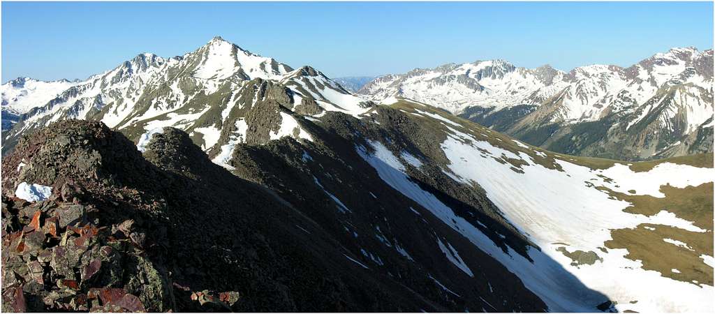

So Hunter Peak was the idea. A pointy peak that reaches 13,491-ft on a ridge line of stately and unfrequented peaks that divides the Conundrum Valley from the East Maroon Creek Valley. From the summit register, Hunters summit hosts maybe 2 ascents a year. It was left behind in 2004 and registered 4 signatures. My route would be one that allowed for the following: good access to the TH, good overnight camping, a good early on water source, a snow less and direct ascent from the valley floor to the ridge crest that would include a ranked twelver, and lastly, would keep me up high for a long period of time so I could keep an eye on weather and escape routes. I had no idea of what to expect from Hunters northwest ridge, but everything else was in place for a safe solo ascent.
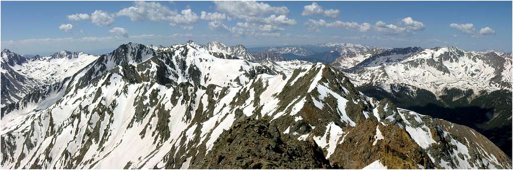

The following is a brief description of my day, for better route details see the submitted topo map.
13 miles and 5,600-ft
Ascended a steep, narrow avy path (39°06.492' N, 106°54.668' W) 3,500-ft in 1.3 miles to the summit of UN12,740 D. The view of Hunter off in the distance looked forever and a day away. The ridge between the two summits is mostly talus hiking with an easy class 3 tower or two to climb. Not much tundra, so going is slow at times. The rock is Maroon Bells/Pyramid rock. Many of the high points on the long ridge can be bypassed easily. There is virtually no snow along the entire ridge crest (June.)

The north face of Hunter is draped in snow through June however the northwest ridge crest gets blasted by sun and is void of snow. Hunter Peak also has an ominous and mysterious summit block that you get to stare at and wonder if it goes while you ascend. I won't give it away, I'll just say that it does go but expect a loose mess.
Hunter has a very real wilderness feel to it and you really get the sense that you are far away from everything. Feeling the mountain and its remoteness made me realize that one bad decision could mean a long wait for help.
Use the expansive basin northwest of Hunter for a nice descent. Not sure if this basin would make for a good ascent route due to a load of chip-rock to negotiate for about 1000-ft. The lower basin is pleasant tundra and feels great with Pyramid looming above. There is also a good water source available here and plenty of game trails to help descend all the way down back to the East Maroon Creek Trail.

6-3-2007-UN13,500, Mount Champion & UN13,736-Sawatch Range
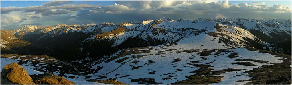
UN13,500, Mount Champion & UN13,736
Combined 8 miles and 4,400-ft
Key Points-
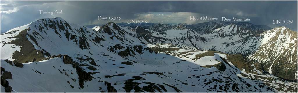

The objective was to climb Mount Champion and UN13,736, my last two 13ers that encompass the North Fork Clear Creek area. I picked up UN13,500 Sat evening from the highest paved pass in the state, Independence Pass. I hadn't been in the Sawatch this year so the lure of a paved TH in a very familiar area was too much for me to pass up.
Every year I try to enjoy some time in and around the Massive and Hunter Fryingpan Wilderness. After this trip, I know I'll be back again soon, maybe as soon as next weekend because of current conditions and the easy access of a bunch 13ers.
Encountered an unexpected downpour driving over Freemont Pass and began to

Made summit at 6:30pm and enjoyed wicked scenery over Grizzly Peak and La Plata to the south and Deer, Massive to the north. I shot off close to 60 photos.
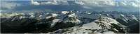
The night prior I spied a snow less line on the steep west face of Mount Champion. It wasn't my original plan but it looked good to go, plus the strong possibility for not needing snowshoes was huge. It had been a

Crossing Lake Creek was problematic. I was a little upset with myself considering I had left an extra pair of shoes back at the car for the creek crossing. Been up this drainage on four different occasions, however it seems as though I haven't learned yet that there is a creek to navigate and that it may be running high since it's early June. It was actually too swolen to continue looking for a series of connecting iced over rocks or to use an iced over log to cross, so I took the boots off and barefoot crossed the swift stream. It was cold. Enough of that crap already and never again! Frozen feet at 5:15 am; not exactly what I had envisioned for a good start.
The west face of Champion works very well for an ascent. It's steep as hell but it doesn't require much route finding and it's direct. Lot's of old mining equipment left around up there. Made the summit and enjoyed nice weather and quickly headed off for UN13,736. The ridge to 736 is easy class two. It appears longer than it really is and only requires around 30 minutes to make the summit from Champion. The view from this summit is pretty darn good, offering a nice perspective of Massive and Deer. In addition, the unnamed 13ers to the west of Mount Oklahoma were calling my name.
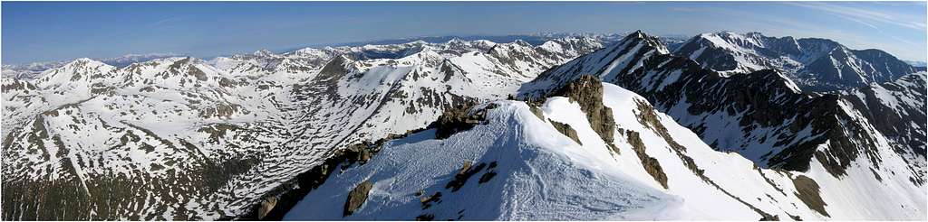
5-27-2007-UN13,541 Sangre De Cristo's
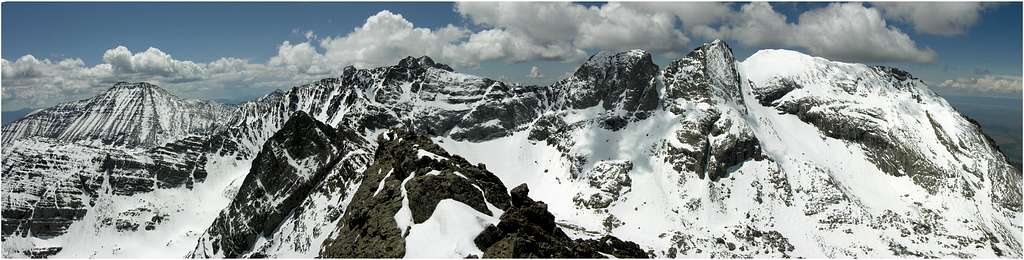
UN13,541 via Little Baldy Mountain
13 miles & 5,300-ft
After an uninspiring ascent of Copeland Mountain last weekend I knew it was time to be inspired. So I pulled out my "great idea list." It's a list of potential climbs that I've researched over the long winter and for whatever reason have declared the peak and route a great idea, or an inspiring idea. UN13,541 fit the bill to a tee, I just had no idea if the route via Little Baldy Mountain would go without incident. Little Baldy Mountain is not a ranked peak, so in reality, the route ascends UN13,540 and UN13,580 A's northeast ridge.
I selected this peak and route for a few reasons. First, I needed a peak in the Crestone area, it had been too long since my last visit. My TOPO 3D feature suggested UN13,541 probably has the best view of the Kit Carson massif in the entire area. Second, I wanted a route that was ambitious and committing. I discovered the route first by studying my topo and confirmed it might go when I climbed Colony Baldy earlier in late March. Lastly, since it's May I wanted a route that gets above tree line fast so I wouldn't have to put up with a nasty post holing affair down in one of those drainages. Being solo, I also wanted to have a birds eye view of any developing weather issues.


I began the day at the Horn Creek Trail head and enjoyed the snow less terrain until about 10,500-ft. Endured one of the worst post holing experiences ever while ascending up treed northeast ridge of Little Baldy Mountain. I considered turning around at least 20 times while torturing myself up that slope. I later realized that these kind of post holing drills are potentially dangerous, often leading one into waist deep nooks and crannys surrounding dead fall.

Above tree line the going was fast and efficient, however Little Baldy reminded me of one of those kiddie roller coasters at Elitches that sort of go up and down with no end in sight. But the views of Mount Adams and the two enormous cirques that flanked my route were enough for me to keep pushing forward, reaching the narrow, ridge-like summit of UN13,541 at 12:30 pm, six hours after I started my day. I was pleased that my route actually went since I wasn't sure it would be notch free. A deep notch in the ridge would certainly put an end to my day. I did not bring

The summit view is huge, to say the least. It was as advertised and hopefully my photos will convey the vast and dramatic terrain well.
I will admit that upon finally reaching my summit, I may have been close to falling over and dying quickly due to exhaustion. I definitely don't ever remember being that tired. Thank God I have a short memory. It got to the point that I dropped my snowshoes and pack for the last 200-ft to the summit. That's stuff I used to do a decade ago when the massive talus ridden central Sawatch called my name. Maybe I'm getting old. Naw...had to be the 6.5 mile, 5,300-ft escapade into the heart of the Sangre De Cristos. Chalk this one down as a top ten memory this summer and clearly the best one this year.
5-20-2007-Copeland Mountain-RMNP
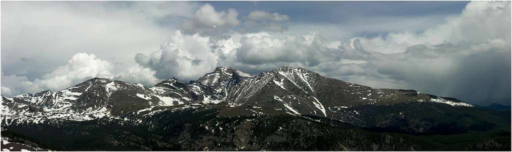
Current conditions (May 20th) calls for a 10,000-ft snow line in the trees. Be ready for soft snow in the trees. Snowshoes are a must right now.
I selected Copeland (13,176-ft) since I made a pact with myself a long time ago that getting to the Park once a year or more should be high priority, especially the St Vrain and the Wild Basin area. I subconsciencely group the Park and the IPW in with the Front Range and for whatever reason I have a hard time motivating myself to get back to the Front Range. So I often forgo any ideas to hang out in the Front Range. Actually, the Park and the IPW are logistically part of the Front Range however these two ranges pretty much rule the "idea factory" in my head when it comes to climbing anything in the Front Range. To me, the Park and the IPW are the Front Range. Sure I'll climb other stuff in the Front Range but I just don't get too excited about it. Just my opinion.
Copeland was a last second decision following a very difficult initiation with the common cold. Picked up the Copeland idea from Sarah at 14erworld.com and decided I could handle her experienced conditions for mid May day in the mountains.
I got sick two freakin days before the weekend and pretty much threw in the towel for a potential climb Sat or Sun. Instead of feeling sorry for myself, I set myself up for a day in Wild Basin Sat night and set my alarm for 3:50am....just in case I toughened up a bit. Woke up to the same brutal sore throat that had been kicking my ass in the days before. I rolled out of bed, had a nice hacking session in my bathroom and made some HOT coffee. Wow, I had toughened up, I was good to go.
Arriving, I quickly revived great memories of time well spent in the Wild Basin area. I also realized... again, that Rocky Mountain National Park is a spectacular place to be...again. These mountains always do a really good job at making me feel their power. Therefore I bow in absolute respect. Furthermore, Wild Basin is so vast. It's an immense place. And a place that can suck you in spiritually. It certainly has a bit of a grip on me.
Copeland's Northwest Slope Route is a lark technically speaking, however attaining the slope from the Bluebird Lake Trail requires good route finding skills. I enjoyed the comfort of my GPS in that densely treed region that had to be negotiated to get to the goods. In addition you're still looking at 11 miles and 4,700-ft of v-gain to get that nice view of the big mamma to the north.
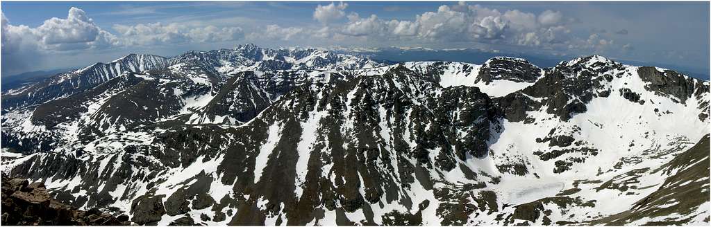
5-12-2007-Mothers Day Sunrise on Sniktau
Still nursing a bad ankle from my UN12,485 climb of two weeks ago, and the fact that Sunday would be spent with the family for Mothers Day I selected Sniktau for a few good reasons. First, It's a short drive and climb. Second, it's a ranked thirteener I hadn't climbed in the past. Lastly, in the past I had climbed the nearby two ranked thirteeners Grizzly and Cupid saving Sniktau for a day when I needed a high summit for a good sunrise photo opportunity, conditions permitting. And Yes, conditions were prime for a good sunrise.A small blanket of high stratus clouds partially covered the star-ridden sky when I awoke to my alarm at 2:30am. It took maybe an hour to drive to Loveland Pass and get situated for my quick climb of Sniktau in very mild temps and virtually no wind. My GPS pegged 5:48 am as sunrise so I needed to be on the summit by twighlight, so no later than 5:15. I headlamped fast and within an hour I was setting up my tripod at 13,234-ft to watch a sunrise. I had a half hour of twighlight to enjoy before things got very interesting and very memorable.
The following images are 3 and 4 photo pano's. So, here's what the mountains looked like From Stiktau's summit on Mothers Day morning 2007.
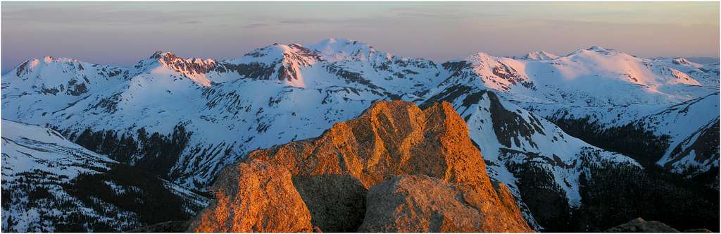
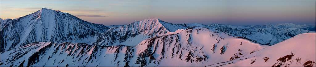
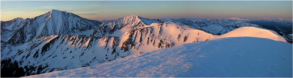
4-30-2007 UN12,485-Gore Range
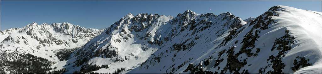
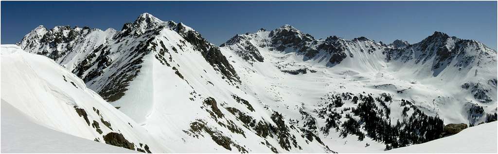


10 miles & 4,500-ft
Deluge Lake Trailhead
True to form, the twelvers residing within Colorado's rugged Gore Range consistently offer up fantastic views of their big brothers and sisters. This is my third snowy ascent of a southwest ridge of a ranked twelver via the west slope of the Gore Range. Bald Mountain, Outpost Peak and now UN12,485, all have impressed me with excellent views of the surrounding terrain. These smaller peaks require a lot of work, like most Gore Range peaks, however, it's those views that keep calling me back. UN12,485 is the toughest one yet.
The following is an account of an ascent of the southwest ridge in April conditions. Copious amounts of snow typically blanket the higher elevations of the Gore Range until late May to mid June.
UN12,485 is the high point residing on a long ridge running southwest from the beautiful Grand Traverse Peak (13,041.) This ridge has phenomenal views of the Bighorn and Deluge Lake Drainages. At first glance, an avy safe route that looks inviting gains the southwest ridge early on, close to Point 11,530 and definitely before 12,305. An avy safe route is always first priority. I left the trail at about 10,600-ft to ascend to the southwest ridge. Do not attempt this route. The ascent up the west ridge/slope of Point 12,305 is loaded with slide potential. I found this out first hand. I had to drop almost 700 vertical, and traverse around a snow covered lake and finally meet up with the south ridge of Point 12,305. This major route finding blunder cost me about an hour of work.
Instead, stay as close to the Deluge Creek Trail to about 11,060-ft, leave the trail area and ascent up into a tiny drainage just southwest of Point 12,305. Gain the wind scoured south ridge and ascend to Point 12,305. Avy danger, especially in April, is minimal here. The route form Point 12,305 to UN12,485 is fun and requires a bit of interesting class three scrambling to its tiny summit. In April, the summit of UN12,485 is a coned-snow cornice, nothing that looks too safe to stand on. However, you can get close enough to at least reach out and touch it.
4-1-2007-Colony Baldy-Sangres
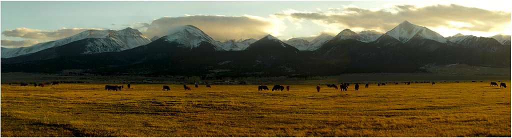
12.6 miles Round Trip
5,000-ft Vertical Gain
I've been looking at Colony Baldy (13,705-ft) as a nice winter/spring hike for quite some time. Recently, I became obsessed with the potential summit view from this mountain, to the point I considered an overnighter at tree-line so I could make the summit by sunrise. Many of you know I often plan my climbs so I can get that special, once in lifetime photo, good lighting is always key. For me, current obsessions only last a few days before I find another mountain to obsess about, so after seeing a mostly sunny forecast for Sunday it was time for another trip to the Sangre De Cristo Mountains.


At tree line, things changed…. it was windy. During my approach I could tell the wind was picking up and I prepared my ego over and over that attaining this high summit might not happen today. I noticed the summit area socked in with spin drift and new that it wasn’t going to be a “pretty picture” day. You win some, you lose some.

The route up Baldy from tree line is a no-brainer. Nothing exposed to deal with, just me against the wind. I had it in me that day, I really felt strong so I just went until I reached the summit. No views today, just a good sense of accomplishment.
Never got knocked over, but I do remember a few times where I had to quickly kneel and become a tripod to brace myself. The worst part of my day may have been when the wind was powerful enough to actually pull my pants down. I constantly missed my skiing suspenders. I’m glad I was solo, a photo of me with my pants hanging off my ass would be a bad one in time.
Overall, Colony Baldy is a very nice option for this time of year (March/April.) Not sure I would want this summit in the summer or fall but it certainly makes for a killer workout. Plus, its summit view has serious potential for once in a lifetime view with the right lighting. I may go back.
3-19-2007 Mount Owen A, Sangres
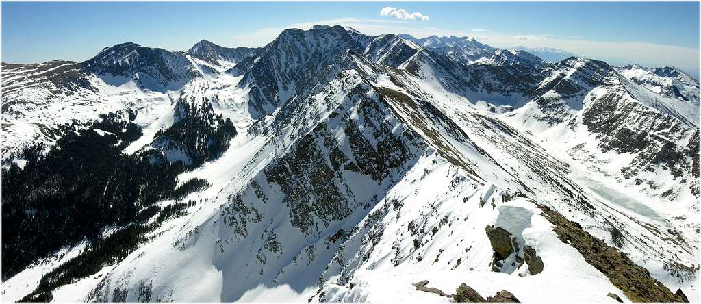


RT-11 miles
Vertical Gain 5,000-ft
Two weeks after Twin Peaks it was time for another overnighter in the Sangres. I considered an attempt of Blanca Peak since I think its currently doable, however I opted to check out conditions in the northern portion of the range. I knew if I could safely ascend a peak in the area then it would open a bunch of options for the upcoming weeks.
John Bradford and Jim Haley climbed UN13,490 via the Wild Cherry Drainage in fall of 2005 and both came back with rave reviews. It was John’s second trip up into the Wild Cherry, the first was an ascent of Mount Owen A. They spoke of a drainage choked up with a zillion aspen trees and since I’m a sucker for aspens I had Mount Owen A on my list for over a year.
I also have this little obsession of visiting every major drainage residing on the west side of that range. The last two years, I spent time in the South Crestone, North Crestone, Cottonwood, Willow, and San Isabel, climbing various named and unnamed peaks. So I began researching a visit into the Wild Cherry to climb Mount Owen A (13,340-ft.)
I came up with a cool loop route that would venture a few of the ridgelines that extend south off of Owen’s west ridge. The route would allow me to view and photograph Owens and UN13,121 from different and unusual perspectives.
The trip went well, to say the least. I started things off by watching another mystical sunset beaming across the never ending San Luis Valley. Sunsets down there are beyond beautiful, for me, they have reached the hard to reach “mystical” benchmark. That night I slept like a champ in 40 degree temps at the TH, with the Milky Way in full force. The following morning I began my day at 6:00am to crystal clear skies; I wouldn’t see a cloud until 1:00pmthat day.
I was pleasantly surprised to finally hit snowline at 10,300-ft, almost 3 miles from the TH. I thought about ditching the slowshoes but new better. I usually take a different way down thus; leaving them behind would only restrict me to the same route back. Surveying my route possibilities I had a good feeling I wouldn’t need the snowshoes the entire day. Anything with south, southwesterly exposure was basically void of snow.
I left the trail at 10,566-ft and gained a southern spur of the west ridge. The snow was consolidated and allowed for a steady and speedy ascent. After 4,750-ft, I reached the summit of Mount Owen at 10:30am.
As usual, my descent was a result of what I discovered on the way up. I ended up descending the west ridge back over Point 12,318 and continuing all the way along the ridge crest to Point 10,913. Once back in the trees an awesome game trail aided my progress. From here it’s an obvious descent down another spur back to the trail at 9,900-ft. Along this portion of the route, I discovered a perch from an outcropping which provided an outstanding view of the aspen laden Wild Cherry Drainage. I sat there imagining what this view would look like in peak fall season. I marked a few waypoints, so I’ll be back with my tripod at sunset this fall for UN13,490 and UN13,121. Refer to submitted topo for useful route beta and GPS waypoints.
3-4-2007-Twin Peaks-Sierra Blanca massif, Sangres
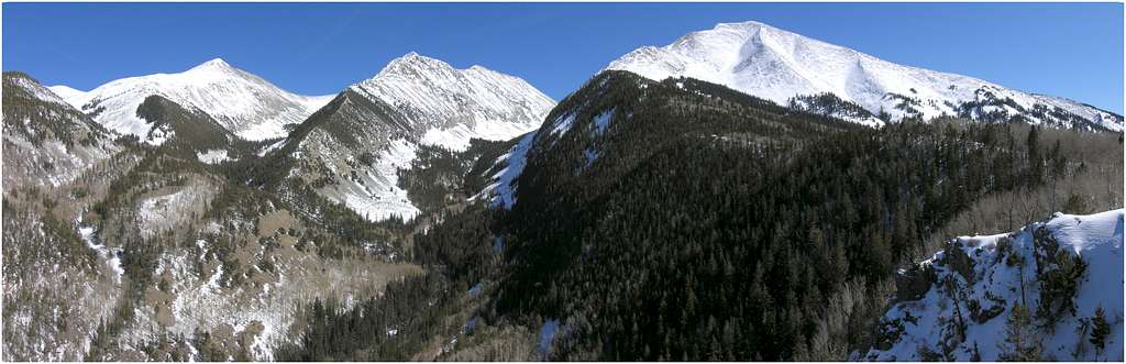


RT-8 miles
Vertical gain-4,500-ft
Credit-Dave Cooper, Sarah T, Dwight S & others"
Twin http://www.3movs.com/Peaks nestles up to the great Ellingwood, Blanca, and Little Bear Peaks in the very southern tip of the Sierra Blanca region of the linear Sangre de Cristo Range. Twin Peaks (13,580-ft) is a bicentennial peak and ranks in at number 199 in Colorado's highest 200.
The Sangres are quickly becoming one of my favorite places for the late winter months and early spring time. They have been quite dependable for safe winter and spring ascents. You just have to really research the right route and be willing to pay the physical price of a 4,500-5,500-ft climb. Add in some deep untracked snow en route to your ridge crest and it's easy to see why sleeping well that night will not be an issue.
Long ridges begin way down in the San Luis Valley and many run unabated all the way to the summits of numerous nice mountains. Thus, the objective is to locate your ridge crest and attain it as early on as possible. Often, this will lead to a blown clean ridge crest that will deliver you to the goods. Not every mountain showcases this weakness, but enough to keep one busy in the early months of March, April, and May. Watch out for cornices.
I selected this peak mainly because it resides in a land of greatness. The views of Blanca, Little Bear, and Ellingwood are special. Plus, the added bonus of the nearby Great Sand Dunes National Park was the clincher for me. I drove down the night before and hiked out to Star Dune to photograph the sunset over the dunes and mountain backdrop.
Twin Peaks is one of these mountains that has an avy safe route that begins way down in the valley at the Zapata Lake TH. The Northwest Ridge is attained very early in the hike. In march expect deep unconsoladted snow to tree line. You will be digging a trench. Treeline seemed especially high on this ridge at 11,930-ft Maybe it was the arduous trench excavating. From treeline its easy class 2 talus hiking. See TOPO.