2008 Trip Log
This is just a simple log to keep track of our 2008 trips.
DECEMBER
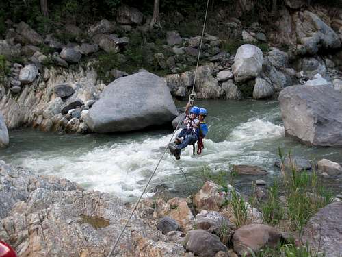
December 31: Pico Bonito (Honduras)
Shaylee, Kessler, Kimberly and I did a really nice hike in the Parque Nacional de Pico Bonito though the thick rainforest. We also rode the zip lines part way down and across the river.
See the trip album:
Pico Bonito
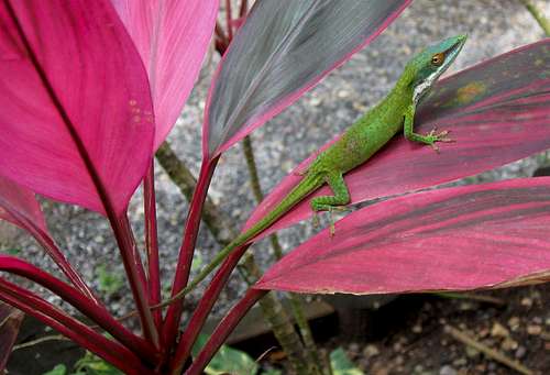
December 30: Cerro Carambola (Honduras)
Shaylee, Kessler, Kimberly and I climbed Cerro Carambola (a.k.a. Carambola Mountain) on the island of Roatan. Cerro Carambola is a small but interesting peak. We completed the loop hike and much of our climb was in the pouring rain, but the trail was not overly slick and the rain isn´t cold at this elevation and latitude. If anything the rain felt pretty good.
See the trip album:
Cerro Carambola and Roatan
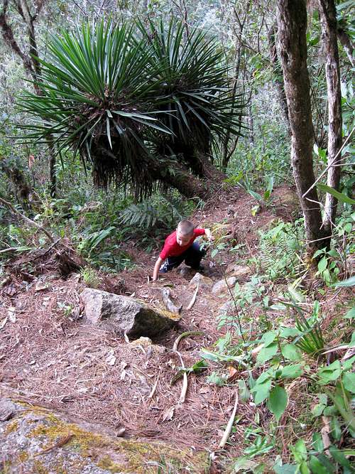
December 24-26: Montaña del Celaque (Honduras)
Shaylee, Kessler, Kimberly and I spent Christmas climbing in the Montaña del Celaque National Park. Shaylee and Kimberly did not make it to the summits, but did climb to campiemento Don Tomas (where we spent two nights camping), quite a good accomplishment for four year old Shaylee. It was a rugged climb, but Kessler and I climbed three summits in Celaque including Cerro Las Minas, the highest mountain in Honduras.
Montaña del Celaque
![Climbing Montaña de Celaque]()
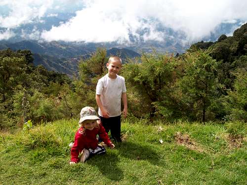
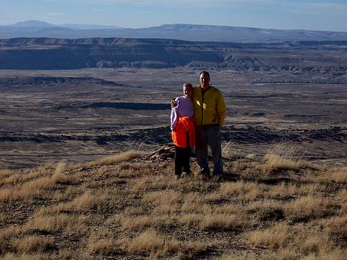
December 22: El Pital (El Salvador)
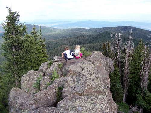
I climbed the peak from Rio Chiquito with Shaylee (my four year old daughter), Kessler (my six year old son) and Kimberly (my wife).
Since the top is in both countries and a monument marks the border, Shaylee wanted to eat lunch in El Salvador, Kessler wanted to eat lunch in Honduras, Kim ate lunch in both counties and I paced all over the place all over the top. We completed the round trip on summit day in six hours. It was a steep eight miles round trip, but Shaylee was on a mission to prove that she is as tough as her brother.
![El Pital]()
See the trip album:
El Pital
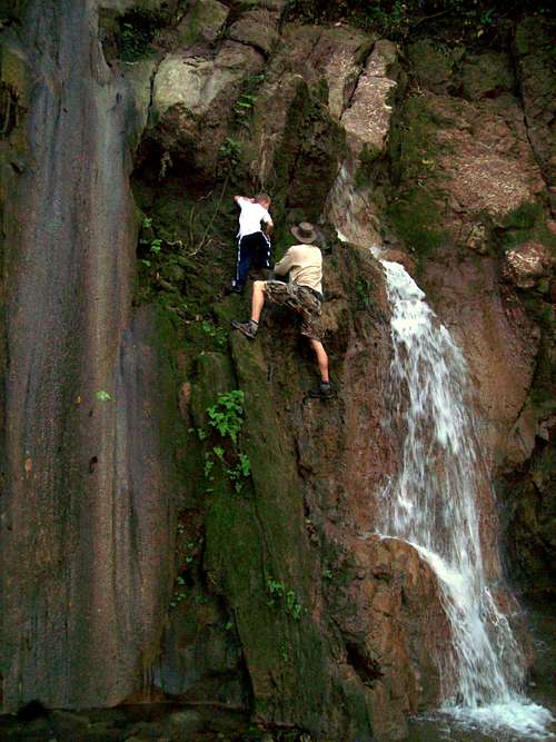
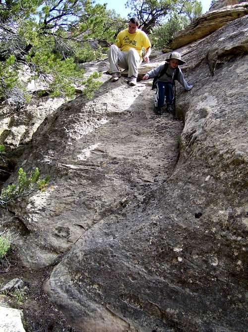
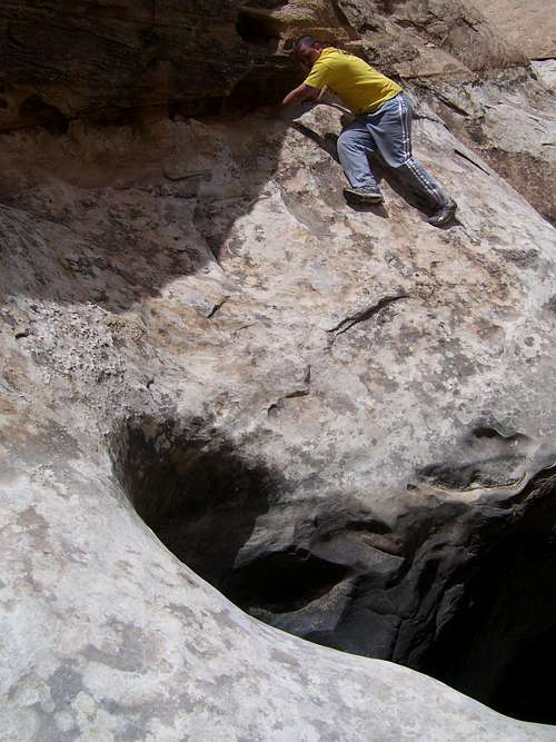
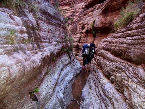
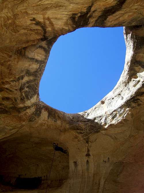
December 20: Cañon de Sapo (Honduras/Guatamala)
Kessler, Shaylee, Kimberly and I hiked to and climbed through the Cañon de Sapo. It is an interesting canyon near Copan Ruins right on the Honduras/El Salvador border. While many people visit the main ruins in Copan few make the trek into the canyon. Along the way are other lesser known Mayan ruins (such as the fertility site) and some nice forest and scenery. The canyon itself is a real challenge and has several slippery climbs to get all the way through.
See the trip album:
Cañon de Sapo
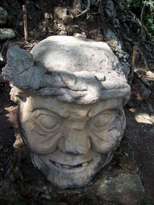
December 19: Copán Ruinas (Honduras)
Kessler, Shaylee, Kimberly and I walked through all of Copán Ruinas and visited all the archeological sites. We also saw lots of wildlife including many tropical birds, coati, augoti and capybara.
![Smoke Jaguar]()
See the trip album:
Copán Ruinas
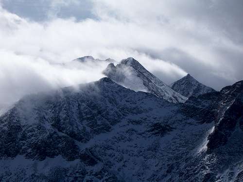
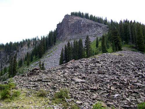
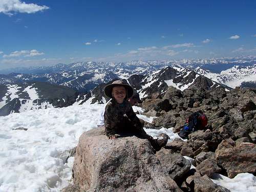
December 6: Missouri Mountain (Colorado)
After I slept at the trailhead, Jeff Goodwin and I met at the Rockdale Trailhead at 5:15 AM for our attempt on Missouri Mountain (14,073 feet elevation). We waited around until 5:30 just in case anyone else showed up since there were some more people interested in climbing it. At 5:30 we drove through the treacherous stream crossing and drove part way up the road and we found that with very careful 4wd driving we could make it to the first parking area along the road.
We broke then broke trail to Clohesy Lake (part way on snowshoes), but found it to be much easier than expected so the going was faster than we thought it would be. After taking a break at the frozen lake we headed for the mountain. The weather was on and off with brief bouts of snow and some occasional views of the snowy peaks.
The climbing up to timberline was quite steep, but we found scraps of a climbers trail that shown through the snow. Since the entire gully was full of solid ice we stayed on the north side of the gully all the way to timberline. The climb was then just a slippery climb up snowy and grassy slopes to the crux boulderfield just before Point 13,690. The steep boulderfield was a challenge since the rocks were all covered with hoar frost, but we persevered and made the summit after about six hours. There was no visibility at all from the summit and it was just cold and misty, but still interesting because of all the ice covered rocks.
On the descent the sun began to peek through and the clouds and we got some fantastic views of some of the mountains with swirling clouds around their summits. The descent was pretty challenging as well, but we made it back to the vehicle before sunset. It was a great climb.
![Ice mountain/Three Apostles]()
See the trip album:
Missouri Mountain
NOVEMBER
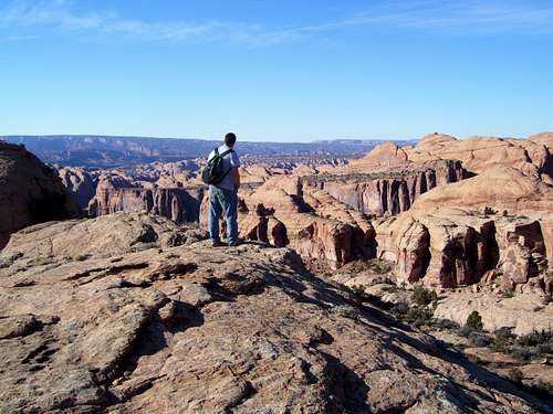
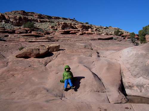
November 29: Pritchett Canyon and Behind the Rocks (Utah)
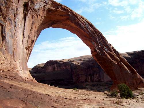
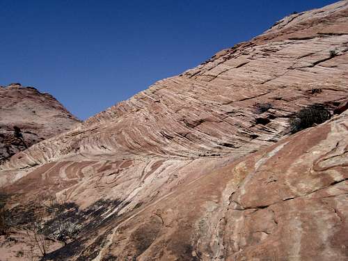
Today we all (see November 28 entry) hiked up Pritchett Canyon south of Moab. After following the canyon for a few miles we headed north up a side canyon and followed it to its end. Mark and the kids headed back down towards the trailhead, but Richard, Dad and I climbed to the head of the canyon and to the rim. Richard and I then climbed up some nameless domes for a fantastic viewpoint while dad waited just below the top. There was a great view of arches, fins and canyons from a different angle that not too many people see. We then returned to the trailhead.
![Domes]()
See the trip album:
Corona Arch, Bowtie Arch, Gemini Bridges and Behind the Rocks
November 28: Corona and Bowtie Arches, Gemini Bridges (Utah)
Kimberly flew to Boise for the Holiday so it was time to go camping with Kessler and Shaylee. The plan was to leave Wednesday night for a trip into the desert, but the weather was bad so we didn’t leave until Thursday night. We ate a Thanksgiving dinner of hotdogs the night before. My two brothers, Mark and Richard joined us, plus Marks kids Matthew and Josh and my Father.
Friday morning started out rainy but cleared up and we visited the short hikes to see the dinosaur tracks and petroglyphs and then hiked to Corona and Bowtie Arch near Moab. It was a nice hike to two impressive arches.
After Corona and Bowtie Arches we drove to Gemini Bridges and visited the two arches before hiking and scrambling to various viewpoints on the Bull Canyon rim.
![Corona Arch]()
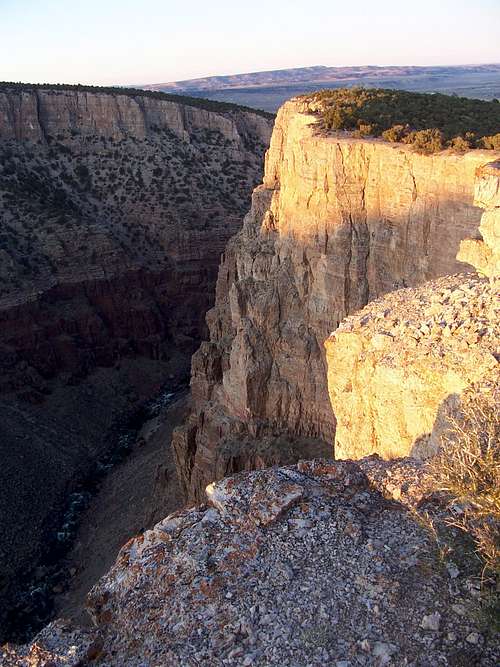
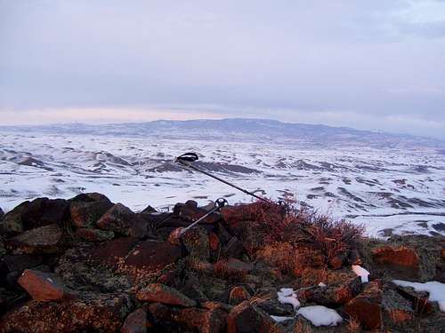
November 23-24: Outlaw Peak and Outlaw Canyon (Colorado)
After thousand of days spent in the wilderness, last night was the first unplanned bivi I’ve experienced. We were well prepared, but it would have been much worse had we not brought an emergency kit.
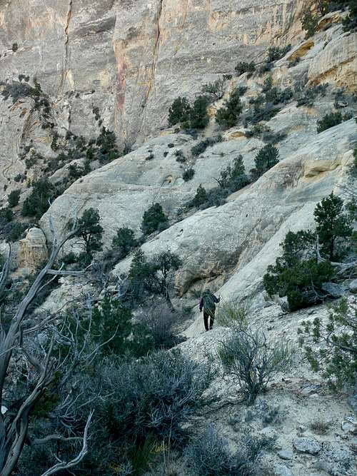
The Division of Wildlife Resources contacted me for help to retrieve a radio collar located high on Outlaw Peak in Dinosaur National Monument. The DWR and National Park Service were unable to find a route up there (or to get a helicopter to retrieve it) so they contacted me for help since I have explored the area extensively and had climbed Outlaw Peak (which has had only two known ascents). We retrieved the collar and descended Outlaw Canyon, but had to spend the night out on the plateau.
No real mistakes were made to cause us to get caught out overnight, but it was a series of small events.
The first event was that we got a flat tire just before reaching the trailhead in the morning which cost us over an hour of valuable daylight. I have been in the area several times, but in August and September with longer days and warmer mornings and nights and because we were going in late November, we were carrying a lot more extra gear (all of which was used and needed) and had much heavier packs. We were also carrying the collar locating equipment. Because we would be wading (or swimming!) the Yampa River twice we brought along full wetsuits, which are bulky and relatively heavy. It took us an hour to locate the collar. It also Justin also got a minor sprained ankle just before we descended Outlaw Canyon, which we thought would be the quickest route back to the river. Last time I did the Outlaw Canyon route it was dry, but this time it had several ice covered potholes and one huge swimming pool sized pool of water at the bottom of the rappel. As mentioned, we were prepared with wetsuits, but this all slowed us down. Navigating through the boulder jams in the lower end of the canyon was a trial in the dark and ripped up my wetsuit and backpack. I also thought I could find the route back to the trailhead in the dark using a map and compass but somehow our compass ended up breaking and finding the route back was hard on a moonless night.
Anyway after we located the route up seven cliff-bands by headlamps we thought we were home free and just had to walk across the plateau and drainages back to the vehicle. With the broken compass however, this was not easy. I thought all as we had to do was follow the rim of a nameless canyon to a ridgeline and follow that back until have to cross several drainages and head for a hill where the vehicle was parked. It was dark enough however; that every canyon and drainage looked the same and we couldn’t tell which hill was which on the skyline. We wandered around until just after 10 PM until we were walled in by a cliff on the left. I thought we were following the correct canyon, but this confused me and as soon as we were walled in I knew that I had no idea where we were and that it was pointless to continue wandering without daylight or an idea of our location.
We spent the night on the plateau next to a couple dead trees. In my emergency kit for fire starting items I had two lighters and two boxes of waterproof matches and a fire starter. We spend an hour and a half gathering a large pile of wood to get us through the night (it is rare that I have a campfire anymore, but this one was needed). We quickly got a fire going and ate some snacks and were grateful that we had the sense to bring extra water (1-1.5 gallons each) to replenish our dehydrated bodies.
Dinosaur National Monument is a cold desert at this time of year and has a different climate than the deserts farther south. Even when we stopped for the night it was noticed that our water bottles were already frozen. The temperature dropped quickly and bottomed out at 8F degrees and we spent the night either lying around, standing around or sitting around the fire. When you lay down one side of your body was very warm and one side very cold depending on which side was facing the fire, so it was hard to sleep (the ground itself was also freezing). I think I slept about a total of an hour and Justin 2-3. We had wood, but it was small branches rather than big logs so it had to be replenished every 30 minutes or so. I had an emergency bivi sack, but it was noticed that after only a few minutes condensation started so I just slept on top of it. It was a long night, but we were no worse for the wear and we were safe. We also enjoyed several shooting stars.
In the morning when it got light it was rather easy to figure out where we were after a few minutes (since it was so dark we had somehow got turned around ended up at the rim of the river canyon rather than the side canyon we thought we were following). We returned to the vehicle tired, but safe.
We also brought along extra clothing and both had hats which came in very handy. We had also left a detailed plan of where we were going (though the terrain is rugged and it would have been difficult to locate us in places along the route). We had stopped when we knew we were off track.
To sum it up, always bring an emergency kit along and always be prepared to survive a night out. I hate to think of how thing could have turned out if we didn’t have one. Always take one along. Despite having to spend the night out, I think we made all the right choices and returned unharmed.
![Approach]()
See the Trip Report:
Lost in the Darkness
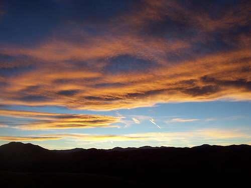
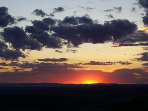
November 18: Green Mountain (Colorado)
I was stuck in Denver on business for a few days. After classes, I decided to climb Green Mountain since it was the closest peak to downtown Denver. I arrived about an hour before sunset and hurried to the highest point to watch the sunset. After walking highpoints in both directions, I completed a loop hike and returned by headlamp well after dark. I saw several deer, both bucks and does.
![Sunset]()
November 15: Sand BM (Colorado)
Shaylee, Kessler, Kim and I did the easy hike up the Sand BM. There were lots of deer, but no hunters up there.
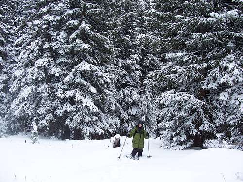
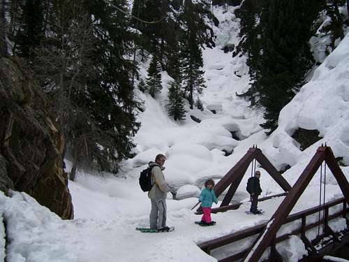
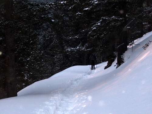
November 7-8: Shrine Mountain (Colorado)
Having never been on a Colorado Hut Trip, it seemed like it would be a good adventure for my six year old son Kessler and I. The plan was to snowshoe to and stay in the 10th Mountain Division Hut and climb Shrine Mountain (to the pinnacle) and Point 11977 to the south. The weather forecast was good and we headed off to Vail Pass. The plan was to start in the morning, but things came up and we didn’t start until early afternoon.
With recent snowstorms, the snow is just deep enough to use snowshoes. Finding the route to the cabin was actually quite the adventure because we found the route was not marked for winter use yet and there was light snow, but very low visibility and heavy fog. We lost the trail several times and got caught in some willows, but eventually reached the hut right at dark.
In the morning it was still snowing (it snowed the whole time even thought the weather forecast was good!) so we decided to forgo attempting Shine Mountain and surrounding peaks. We decided to hike the peak north of Shrine Pass instead. We got to the summit area but were blocked by fallen timber and returned since visibility dropped really low again. We broke another trail back to the car at Vail Pass before driving home.
![Trail Breaking]()
See the trip report:
Shrine Mountain
OCTOBER
October 25: Bald Mountain (Colorado)
I got off work a bit early today so it was time for a peak. Justin Kuhn, a coworker had mentioned that he wanted to climb Bald Mountain since I mentioned that the top was all covered with fossils. Kim (my wife), Justin and I decided to climb the peak and we left the kids with another coworker Debbie who decided not to climb the peak. We left in the afternoon, climbed the peak via the Anthill Ridge and spent a bit of time on top viewing all the fossils before returning.
![Bald Mountain Summit]()
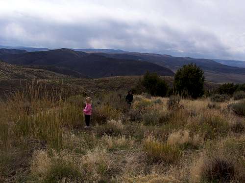
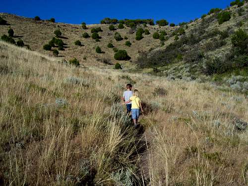
October 23: West Fork Sage Creek (Colorado)
Since I got off work early I had hoped to go climb a peak with the kids (Kessler and Shaylee), probably descending in the dark. I had hoped Hillberry Mountain would make a good destination, but we might have to look to climb it on a route with few hunters.
We found hunters crawling all over the mountain so we decided not even to try it even though we had brought all orange clothing. We actually instead hiked up the canyon across and to the west of the mountain for a ways before heading back. We only hiked for two hours round trip because I was worried there might be bambi killers around.
I have to admit that this is my least favorite time of year. The greenery of summer is gone, the autumn leaves are gone and yet there isn’t much snow around yet and the mountains take on a drab appearance. Any time of the year is OK for being in the mountains, but from now on we’re sticking to Cedar Mountain for evening hikes until the hunters are gone.
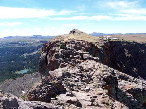
October 13: Cross Mountain (Colorado)
At work, my project at work got shut down early because of cold temperatures, but since the sky was blue it was still good hiking time that couldn’t be wasted. I suggested to my coworker Justin Kuhn that we should climb the South Summit of Cross Mountain. It isn’t the highest summit in the area, but it is one of the most dramatic and most spectacular. Kessler and Shaylee wanted to come as well and joined in.
We left after Kessler got out of school and drove to the trailhead. We hiked to the top of the peak and ate a late dinner on top. After viewing several of the spectacular viewpoints and enjoying the sunset we hiked back under a full moon before driving back home.
![Cross Mountain]()
October 11: Castor Ridge (Colorado)
The weather forecasters said a storm was coming but we woke up to clear blue skies in the morning. We decided to get away for a quick climb before the rain and snow began. We hoped to get to the summit before any rain or snow, but we brought full bad weather gear just in case.
Shaylee, Kessler and I drove to near Hamilton in the Williams Fork Mountains for an attempt ofclimbing the Castor Ridge. It was sunny when we left to climb the peak, but it was a bit breezy. We hiked up a rugged gulch before climbing to the ridgetop. The ridge was rather rugged and Shaylee and Kessler enjoyed climbing through the minor cliff bands. We got to the summit of the peak under darkening skies and decided to head down after just a short time. We took a more rugged route down and I had to lower Shaylee down some short cliffs. We had a few sprinkles but reached the vehicle five minutes before the rain started, thus we timed everything perfectly. It was a good little hike.
![Castor Ridge]()
October 5: Cedar Mountain (Colorado)
A very stormy weekend put an end to any serious plans. The heavy rain (snow in the mountains above 8000 feet) finally briefly let up the evening of the 6th. It was mostly cloudy, but a few patches of blue sky were visible. I climbed to the summit of Cedar Mountain where you could see a wall of clouds coming in. The second half of the ridge loop was done in the pouring rain mixed with a little snow.
SEPTEMBER
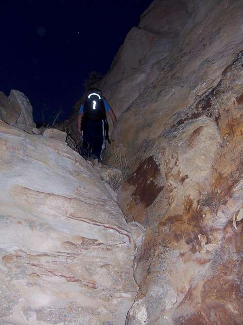
September 28: Un-Named Peak [Williams Fork Mountains] (Colorado)
Kessler and I decided to do a bit of night scrambling/climbing in the Williams Fork Mountains. We drove to an un-named gulch off Highway 13 and headed up the mountain. We started just a few minutes after sunset. We followed an old road for a short distance and then found a game trail heading up the mountains. We skirted west and found a place to climb the cliff bands before summitting an un-named peak. The stars were out and we could see the city of Craig in the distance. Using a flashlight we circled around and climbed down a different route and found a steep game trail through one cliff band. It was a great little night hike and we saw a few rabbits, a badger and heard coyotes.
![Night climbing]()
September 27: Black Mountain (Colorado)
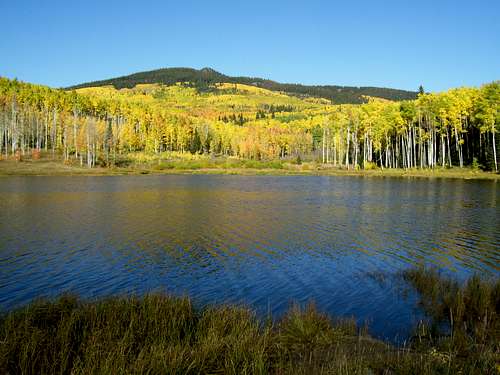
Shaylee, Kessler, Kimberly and I decided to climb Black Mountain from Freeman Reservoir. Since Black Mountain is below timberline it was suspected the fall colors would be at peak. We were right and the colors were spectacular.
We climbed through all the colors and ate lunch near the west summit. Kessler, Shaylee and Kimberly played around near the west summit while I went on to various viewpoints on the summit plateau. It was a pretty long hike for Shaylee, but was a nice day with perfect weather.
September 21: Cedar Mountain (Colorado)
Kessler and I left for a late evening climb of Cedar Mountain. We left the trailhead at 5:30 PM and did the entire loop. We had a spectacular sunset from the summit ridge and then descended in the dark.
September 20: Storm Peak and Mount Werner (Colorado)
Originally I was thinking of heading down to Gold Dust Peak or the Gore Range, but a bad weather forecast forced a change of plans. We decided to climb some peaks in the Park Range, namely Mount Werner and Storm Peak since they should be safer from lightning storms.
Kessler, Shaylee, Kimberly and I rode the Steamboat gondola before climbing Storm Peak and Mount Werner. The weather was cloudy and with a few sprinkles and we could see dark clouds, but the storm passed to the north of us. The autumn colors are beginning to be quite nice in some areas while others are still quite green. It was a pretty long hike for Shaylee, but a good day.
![Mount Werner]()
September 14: Castor Gulch [Williams Fork Mountains] (Colorado)
After church, Shaylee, Kessler and I headed for the Williams Fork Mountains just south of our house. We started with a little bouldering. From the state wildlife boundary, we headed SW along the jeep trail to the ridge between Castor Gulch and Williams Fork River and then east along the ridge to near Point 7010 before returning.
![Bouldering]()
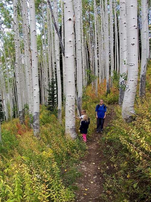
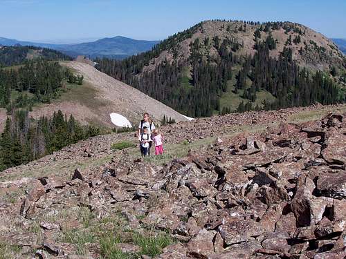
September 6: Devils Causeway (Colorado)
After getting the weekend off last minute, we hurried and packed the gear Friday night to head off to the Flat Tops. We arrived fairly late and camped just below Stillwater Reservoir.
In the morning (sort of chilly, but not cold: 31F), Shaylee (four years old), Kessler (six years old), Kim and I set off for the Devils Causeway. It was very windy and somewhat chilly so Shaylee and Kim decided to head down at timberline and just below the saddle north of the Causeway. Kessler and I went up to and over Peak 11820 to the Causeway and he had a lot of fun crossing it. I made sure he held my hand the entire time.
After crossing the causeway, we headed SW and completed the entire Causeway Loop (10.5) miles. It was a great day; quite windy and chilly but with zero threat from thunderstorms.
![Devils Causeway]()
See the trip album:
Devils Causeway
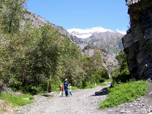
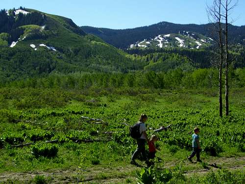
September 1: Battle Creek (Utah)
As mentioned on the August 31 log, we had to bail on our planned climb of Mount Timpanogos because a large storm hit the Wasatch. On September 1, our last day of the Labor Day weekend, we decided to visit the lower slopes of Mount Timpanogos on the west side of the mountain. We (Shaylee, Kessler, Kim and I) hiked up Battle Creek to the nice twin waterfalls and a little beyond. We had some great views of the newly snow covered mountain after the big storm.
See the trip album:
Mount Air, Lake Mountain Peak, Battle Creek
AUGUST
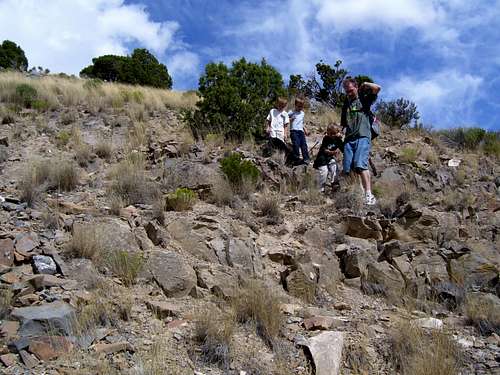
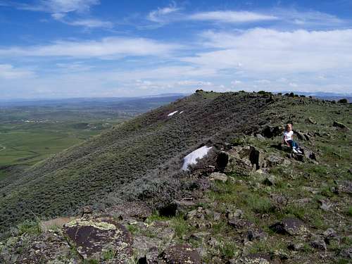
August 31: Lake Mountain Peak (Utah)
Today we had big plans to start the climb of Mount Timpanogos, sometimes called the most impressive mountain in the US Rockies. Unfortunately, a large storm was forecasted to hit the Wasatch Mountains, so we had to change plans. Since we were staying with my brother Mark, we chose to attempt Lake Mountain Peak which rises right outside his house. It is a less spectacular mountain than Timpanogos, but would be safe.
Shaylee, Kessler, Kimberly, Mark (brother) and nephews Josh and Matthew started up the peak after church. The route was very steep and Shaylee and Kim turned back early. The rest of us made one of the northern summits of Lake Mountain Peak before it was obvious that the forecasted storm was approaching rather quickly, so we turned back before the main summit was attained. We still had some nice views and the storm hit not long after we returned to the house.
![Lake Mountain Peak]()
August 30: Mount Aire (Utah)
After a family reunion, Kim and I left the kids with the relatives and headed off to climb Mount Aire. Mount Aire is one of the lower summits in the Wasatch, but since it has great views and since we didn’t start up the trail until 4:30 PM, it was a great choice. It was a nice late evening hike and we saw several horned toads along the way. After enjoying the fine views, we descended the mountain arriving to the trailhead around sunset.
![Mount Aire Summit]()
August 23: Sand BM (Colorado)
Just another night climb of Sand BM.
August 17: Mount Oliphant (Colorado)
The wife and kids were out of town for the weekend, so it was time for another solo climb. Mount Oliphant was chosen this time. Church got out at 2 pm, so I left home after eating lunch and packing and arrived at the trailhead at 3:30 PM. There were high clouds, but I had great weather all the way to the summit and back. The summit register only had two other signatures in more than five years, so the mountain isn’t climbed that often. I saw two bald eagles, deer and almost stepped on a little porcupine. It was a great climb.
![False Summit]()
August 16: Sand BM (Colorado)
I had to work a long day today, so it was another night climb of Sand BM. I left well after dark, but the moon was nice and bright.
August 15: Sand BM (Colorado)
Another routine hike up Sand BM in the late evening. It was well after dark by the time I got back, but the moon is full and very bright.
August 13: Sand BM (Colorado)
I climbed Sand BM alone leaving just after sunset and arriving back well after dark.
August 12: Cedar Mountain (Colorado)
I got of work fairly early today, so Kim, Shaylee, Kessler and I headed for Cedar Mountain in the evening. Kim cooked dinner at home and we ate it at the trailhead before climbing Cedar Mountain. We did the shorter loop arriving back at the car near sunset.
![Cedar Mountain]()
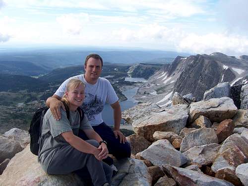
August 9: Medicine Bow Peak (Wyoming)
I have been informed that I’m probably working most weekends for the next couple months, but Kim and I had to break away to celebrate our 15th anniversary. We chose to climb Medicine Bow Peak in Wyoming since we went to Wyoming on our honeymoon and since I hadn’t climbed or attempted a peak in Wyoming since December 2001 even though we live only 40 miles from the border!
We drove to a lodge at Saratoga Hot Springs Friday evening in very heavy rain and were worried about the next day. Because of the weather we scrapped our plans of sleeping in and headed for the mountain early in the morning.
We had planned to do the entire loop hike starting at Lake Marie and ending at Mirror Lake while climbing over the top of Medicine Bow Peak, but we were worried about the weather, so we started the climb at Lewis Lake.
Medicine Bow Peak was a beautiful mountain and we climbed it in great weather. People on the summit informed us that they had snow and sleet on their hike the night before. The weather held for us all the way until we descended and just started driving back. Not long after that a severe thunderstorm hit the area and we high tailed it to Saratoga Hot Springs since the sky began to clear. Right after we changed went to soak in the hot springs though, a very severe thunderstorm hit so we got to spend less than a minute in the pools before having to get out. We drove home in heavy rain, but it was snowing on Battle Pass.
It was a great way to spend our 15th wedding anniversary.
![Medicine Bow Peak Summit]()
See the trip album:
Medicine Bow Peak
JULY
July 26: Sand Mountain and Meaden Peak East (Colorado)
After camping not far from the trailhead Friday night, Kessler, Shaylee, Kim and I set off to climb Sand Mountain in the Elkhead Mountains. We saw lots of wildlife on the approach (elk, deer, a fox, grouse and porcupine). We climbed to the summit in perfect weather and in contrast to Black Mountain earlier this week, only a couple mosquitoes. The views were great from the summit and the kids had a good time walking on the snow.
After climbing Sand Mountain, Kim, Shaylee and Kessler headed back down while I followed Sand Mountain’s north ridge before dropping down to the saddle and then climbing Meaden Peak East. The original plan was to have Kessler come with me for Meaden Peak East, but he wanted to stay with his little sister (Shaylee), so I did the climb alone before meeting back with them at the trailhead. Great day; great weather.
![Approaching the summit]()
July 20: Black Mountain (Colorado)
In the morning Kessler, Shaylee and I decided that we should climb Black Mountain after church. After attending church we arrived home at 2:30 PM, at lunch and left just after 3 PM and starting the hike up the peak at 3:45 PM. We had to hurry because of the very late start and we took headlamps just in case.
We started the climb passing some illegal motorcyclists along the way that were really ripping up the trail. Unfortunately, they didn’t have license plates and it was amazing how much damage only thee motorcycles could do the trail (i.e. ripping out the rock steps).
The worst part of the climb was the mosquitoes, so we couldn’t stop long and arrived at the summit at 6:30 PM. Kessler and Shaylee had fun playing on a snowbank and sitting on the top, though there were mosquitoes even on top of the peak so we didn’t stay long. We ate a dinner of canned fruit and Captain Crunch before heading down the mountain. I carried Shaylee (almost half) much of the way, not because she needed to be carried, but so we could quickly get to the car and out of the mosquitoes which got even worse. We arrived at the car just after 8 PM and not long before sunset. It was a great hike other than the motorcyclists and mosquitoes.
![Black Mountain summit]()
July 19: Sand Benchmark (Colorado)
It was another long week at work without Saturday off, so it was just another fairly short hike in the late evening. I climbed Sand BM leaving just before sunset. It was dark on the way down and I almost stepped on a deer lying on the trail, scaring both of us.
Anyway, it’s been a hard summer. I haven’t even visited the Park Range (other than Fish Creek Falls), the Gore Range, the Elkhead Mountains and only one trip to the Flat Tops this summer. I guess I am suffering from mountain withdrawal.
July 13: Cedar Mountain (Colorado)
I had to work a long day Saturday so we couldn’t do anything big. After church we had dinner guest so we couldn’t get away until 6:30 PM. Kessler and I climbed Cedar Mountain, completing the 3.5 mile loop in 1 hour 45 minutes.
July 3-4: Mount of the Holy Cross (Colorado)
Six year old Kessler left the trailhead in the afternoon and backpacked over Halfmoon Pass and over to Cross Creek where we camped. There were several snowfields to hike across. The stream was really high which made for an interesting crossing. We had a nice camp at Cross Creek.
At 6:15 am the next morning we left for the summit of Mount of the Holy Cross. We reached the top just before 11 am, but spent over an hour on the summit on a bluebird day. We hiked down the mountain and packed up camp and at an early dinner before climbing back over Halfmoon Pass. We had a second dinner on Halfmoon Pass and didn’t arrive back at the trailhead until 7:30 PM, over a 13 hour day, though we took our time on the climb out over Halfmoon Pass and down to the trailhead. With 4300 feet (1310 meters) altitude gain and 4800 feet (1460 meters) of descent on day 2 the peak was a hard earned prize for any six year old.
![Summit of Mount of the Holy Cross on July 4 2008]()
See the trip album:
Mount of the Holy Cross
JUNE
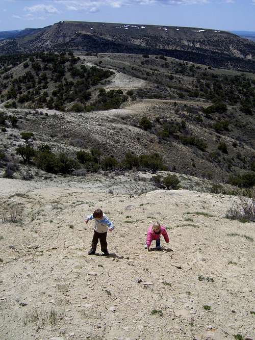
June 20: Baldy Mountain (Colorado)
After camping overnight at the Morapos Creek Trailhead (8200 feet), Shaylee, Kessler, Kim and I headed up for Baldy Mountain in the Flat Tops. We didn’t know if we would make it because of snow. After passing many beaver ponds, seeing many frogs along the way and hiking through some muddy areas we got to more and more snow, especially above 9200 feet. We found a dry meadow to eat lunch at. While the kids and Kim were eating lunch, I thought I would give Baldy Mountain a try since it wasn’t that far away. After the first attempt, I thought I could contour over to the top of the peak to the dry south slopes, but I ran into lots of snow and downed trees so I headed back since I told them I would only be 45 minutes. Even though we didn’t reach the top, it was a great hike and the weather was perfect. We completed 7-8 miles (6 hours including lunch), but since the map doesn’t show the trail we were on, it’s hard to measure.
![Baldy Mountain]()
June 17: Cedar Mountain (Colorado)
At 8:13 PM, I started a quick climb of Cedar Mountain. Because of haze (must be from forest fires-there are no big cities around here?) the sunset was quite spectacular and the full moon red. I hurried as fast as I could finishing the climb (via the 3.5 mile loop) at 9:24 PM just before it got really dark. Tired.
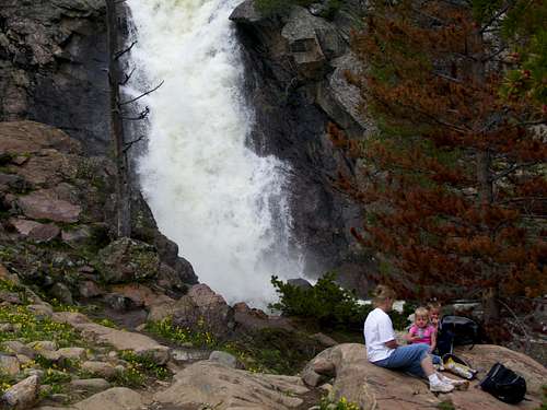
June 15: Fish Creek Falls and Upper Fish Creek Falls (Colorado)
Today was my first day off in 14 days. Kim, Kessler, Shaylee and I went to church in the morning until noon and then got ready and left for Fish Creek Falls (near Steamboat Springs), starting our hike at 2:18 PM. We hiked to Fish Creek Falls and then up to Upper Fish Creek Falls on a beautiful day. With the late start we didn’t have much time to stop and we made the round trip hike fairly quickly arriving back at the trailhead at 7:00 PM. There was only a little snow to walk through and everyone had a great time.
![Upper Fish Creek Falls]()
June 8: Cedar Mountain (Colorado)
Lately, 7 day/80-90 hour workweeks have been a serious setback to hikes and climbs among other things. This morning I got some time off to go to church before heading to work until late afternoon (lately I’ve been leaving home for work just after 6 AM and getting off 8-9 PM on most days). Since I got evening off I played with the kids until bedtime before setting off for a hike. I climbed Cedar Mountain (since it's so close to my house) arriving back down well after sunset. I’ll be more tired tomorrow, but it’s worth it to finally get out on a summit after almost two weeks.
MAY
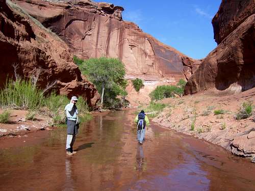
May 24-26: Jones Hole to Island Park (Utah)
After meeting my brother Richard and my father, Kimberly, Shaylee, Kessler and I shuttled our cars for our big trip in Dinosaur National Monument from Jones Hole to Island Park. On day 1 and after late start we hiked down to the junction of Ely Creek and Jones Hole where we dropped the packs to hike down to the Green River and back. It was a scenic hike with pictographs, high walls and a clear running stream.
On day 2, Kessler, Richard, my dad and I tried exploring the Labyrinths (tributaries of Ely Creek) from the bottom, but our ledge got eventually pinched out to where the exposure was too great and the canyon bottom was too much a bushwhack to make it to the head of the canyons. We then joined back up with Kim and Shaylee and hiked up to the rim of Big Draw. From there Kessler, Richard, dad and I explored the rim of Big Draw for some fine views and climbed a small peak near the rim for some more fine views before heading back to Shaylee and Kim. We then hiked over to Sage Creek where there was supposed to be some running water and a spring, but unfortunately it was bone dry and we couldn’t camp so we hiked all the way over to Island Park climbing “Red Wash Peak” on the way back. It was a long day since we expected to camp along the way and Shaylee (whom just turned four) completed eight (?) miles while the rest of us did more. On day 3 we had planned to head up on the Harpers Corner road for more hikes, but the night of day 2, I had very severe allergies while camping in Jensen, so we had to pack up in the middle of the night and head home, arriving just before 4am.
![Exploring Ely Creek]()
See the trip album:
Jones Hole to Island Park
May 20: Cedar Mountain (Colorado)
I took the day off so I could have done the last day of my oral surgery and after the appointment climbed Cedar Mountain with Shaylee. It was a nice hike on the warmest day of the year so far. We saw several deer and antelope and the spring wildflowers are out.
![Cedar Mountain]()
May 19: Sand BM (Colorado)
I climbed Sand BM alone and it was nice and quiet. The snow and mud is completely gone.
May 14: Centennial Cone (Colorado)
At 4:15 I met a 14ers.com member Ryan at the Double Tree in South Denver and we headed up towards Centennial Cone. We met Summitpost member Pete at the trailhead for our planned climb of the Cone. The summit area was closed due to elk habitat, so we did a 5 mile hike around the southern slopes of the peak before returning to Denver.
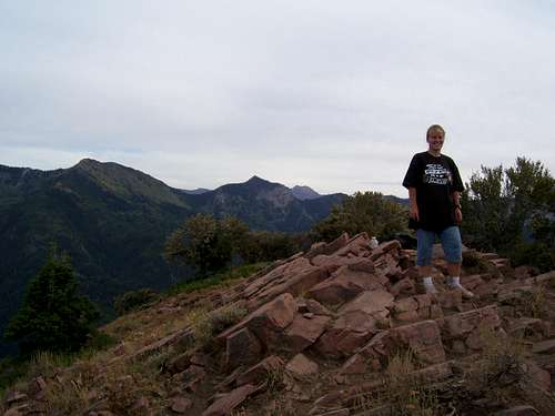
May 10: Bald Mountain (Colorado)
Kessler, Shaylee and I climbed Bald Mountain in NE Colorado. It was cold and windy at first with some snow falling. The climb was steep in places, but all three of us made the summit along via what we called the Anthill Ridge because it had three of the largest anthills that we had ever seen. We saw a scorpion on the very summit and played around a bit and looked at the views before heading down. We saw at least 100 elk on the way out. It was a fun little trip.
![Climbing Bald Mountain]()
May 4-6: Moqui Canyon (Utah)
When Steve Allen, the legendary canyon country author/adventurer invited me to join him for a trip, I couldn’t turn it down. Also joining us were James Knipmeyer, author of the book “Historic Inscriptions” and Dave Pimeltal. We took a leisurely three day trip to visit various Anasazi ruins and old inscriptions. We followed the mellow canyon down to fairly close to Lake Powell and thenexplored Camp Canyon with its two nice waterfalls. After day 2, we took an old cattle trail out after a short class 3 scramble to the bench below the canyon rim. It was a good leisurely trip with many good stories shared from everyone.
![Moqui Canyon]()
May 3: Miners Hollow/Knotted Rope Canyon (Utah)
My brother Richard and I made a loop by climbing up to the head of the Knotted Rope Crack, down Miners Hollow/Knotted Rope Canyon and back out via the Muddy Creek Gorge. We made good time and climbed Point 6180 along the way for some great views before heading over to Knotted Rope/Miners Hollow. Since there was a fatal accident last year in the first pothole in the canyon, we brought all kinds of gear including pulleys ala crevasse rescue style and were prepared for anything by taking all kinds of climbing gear. The canyon turned out much easier than expected and we were through in no time. Just fun little climbs (however, you don’t want to fall into the first pothole). It was quite fun and the walk back was beautiful though there were some signs of illegal motorcycle activity on the way back.
![Deadly traverse]()
May 2: Baptist Draw and Chute Canyon (Utah)
Bad weather thwarted previous plans, so my brother Richard joined me for a loop in this beautiful canyon. We didn’t start until late afternoon and didn’t bring a watch in the canyon, so we really hoofed it through fast. We had to rap once, but could down or upclimb everything else without a rope. Unfortunately we had to pack some trash out of Baptist, but the rest of the loop was good. It only took us 2 ½ hours; all non-stop except for at the top of the rap to harness up.
APRIL
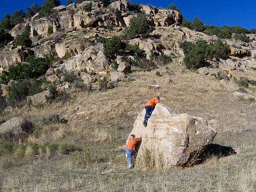
April 26: Signal Butte and Duffy Mountain (Colorado)
I climbed Signal Butte and Duffy Mountain with Kessler and his kindergarten friend Kayden Herring. We parked right at the Yampa River before climbing Signal Butte. The peak has a few short cliff bands, all of which have bypasses, but the children wanted to climb them all directly. They had a lot of fun climbing the cliffs.
After climbing Signal Butte, we headed over to Duffy Mountain and climbed it. We followed the crest for several miles before dropping down the north side a bit to see the big cliffs on the south face. We spent some time hiking along the top of the face before returning back to the car.
It was a cold day and a bit windy at times and a little snow fell on the drive. The second half of the hike however was nice and sunny if a bit cool.
![Climbing Signal Butte]()
April 25: Lay Peak (Colorado)
Plan A was to do an overnight trip to Dinosaur NM with Kessler and Shaylee. A snowstorm put an end to that. No problem, we had a plan B; a day hike of Cross Mountain out in the desert west of Maybell. We drove out towards Cross Mountain and when it was seen how much snow was up there, I knew we wouldn’t be able to climb it without snowshoes nor likely not able to even drive the roads surrounding the mountains. We made a climb of Lay Peak (plan C?) since it had little snow on it. It isn’t very high, but it was cold and windy on top. I suggested we might climb a second peak, but Shaylee (who turns four years old in a week) had enough of the cold and wind and suggested we go home. We all climbed down the mountain and headed for home.
![Signal Peak]()
April 20: Tunnel and Zebra Slots (Utah)
After getting cleaned up I attended church in Escalante until noon. After that I headed southeast for more canyon adventures in Tunnel and Zebra Slot. Zebra was completely filled with tumbleweeds and I couldn’t get through until another flood reams it out. Too bad since I was excited to see it again since I hadn’t been for 16 years and since I was the one that named the now famous canyon (local ranchers had certainly known of it, but I don’t know if they had a name for it or what that name was). Tunnel was scenic as always.
See the trip report for all of April 11-20:
Trip Report
![Slickrock]()
April 17-19: Round Valley Draw, Hackberry Canyon, Stone Donkey Canyon, Sam Pollock Canyon, and Yellow Rock (Utah)
Todd, Aaron, Rich and I did Round Valley Draw, Hackberry Canyon, Stone Donkey Canyon and Yellow Rock all in one shot in three days.
On day 1, Round Valley is a really nice slot and great fun with some easy climbing. We also tried to climb up Booker Canyon. Though the first falls does have a bypass we enjoyed some rock climbing to surmount it more directly. Aaron (a much better climber than me) made a direct hit of the falls and climbed directly up the crack. I couldn’t do it in non-sticky shoes. Rich (a better climber than me) made a climb just to the left of the crack and then a tricky traverse to the falls. I asked Rich to take off his sticky shoes and throw them down the cliff so I could climb. I succeeded in climbed the wall right near Rich’s route, but on the way back could not climb Aaron’s route, at least not with the borrowed shoes that were over a size too big. They kept slipping out of the crack. The only person to attempt the climb up the second fall was Todd (he is also a better climber than me). He made it pretty close, but it looked too risky and I wouldn’t try it. We continued downcanyon and made 13.5 miles this day and camped below the Hackberry spring.
On day 2, Stone Donkey Canyon was incredible and a very hidden slot tucked way away in the backcountry. I believe we (Brownwyn Adams, Kimberly Patterson, Rusty Northrup and I)did the first documented descent of the canyon from the top some ten years ago. Todd had wanted to do the canyon for a while as well, but had been unable to find anyone interested in an overnighter. The Cathedral Rap, the tight narrows (so dark you need a headlamp in some sections) and downclimbing made the canyon a lot of fun and everyone was very impressed with the canyon. I had forgotten how good it was. After Stone Donkey, we hiked down canyon and dropped the packs at Sam Pollock Canyon. We took a trip up to Sam Pollock Arch. One “interesting” even was that Todd, Rich and I noticed some large cougar footprints in the canyon. What was more “interesting” was that Aaron was a few minutes ahead of us and some of the cougar footprints were inside his. After seeing the arch we returned back to the mouth of Sam Pollock Canyon.
The next day (day 3) we hiked the rest of the beautiful Hackberry Canyon and climbed Yellow Rock, a fantastic wonderland of multi-colored rock. The other three headed home to Phoenix and I headed north to the Escalante area.
See the trip albums:
Round Valley Draw
Hackberry Canyon
Stone Donkey Canyon
Yellow Rock
![Cathedral Room]()
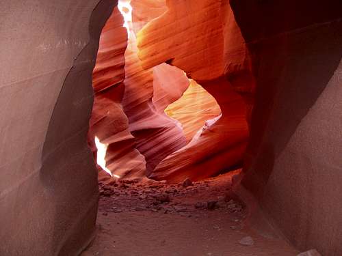
April 16: Antelope Canyon (Arizona)
The original plan was a four day trip to Saddle Canyon. Saddle Canyon is a pretty popular river stop, but apparently no one has connected the entire rim to river route yet. It was our grand goal for last week, but we gave up on it after being thrashed and beat by the other two routes we did in the previous days.
We attempted to obtain a Navajo permit for Aztec Creek, but were unsuccessful and so we headed to the Hackberry Canyon area of Utah. Before that we did a Quick trip through Lower Antelope since none of us but Aaron had seen it yet.
See the trip album:
Antelope Canyon
![Corkscrew]()
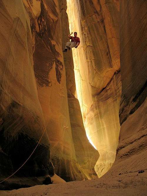
April 15: Shinumo Wash/Silver Grotto (Arizona)
Todd Martin, Aaron Locander, Rich Rudow and I did Shinumo Wash/Silver Grotto, another Grand Canyon gem (Marble Canyon section). It was a straight forward, but long trip down to the Redwall where the canyon became technical. We brought six ropes and left one behind at each drop. A piton was pounded on the first drop, but we were able to extract it later as so to leave no trace. There were some raps and some quite difficult downclimbs and swimming to the top of the Silver Grotto. By the time we reached the Silver Grotto (known by river rafters coming up canyon, we were out of rope, so couldn’t descent into its depths.
The hard part was coming back up the canyon. The other three ascended the rope but we decided to rig a haul system just for the heck of it I guess, but I didn’t mind since I don’t consider jugging to be much fun anyway. I climbed up the cliffs and when I couldn’t a haul system with pulleys was used. Excellent crevasse rescue practice for sure and the canyons are the only places where crevasse rescue is usually practiced. Anyway, we arrived back at the rim of the canyon at sundown.
See the trip album:
Silver Grotto/Shinumo Wash
![Shinumo Wash]()
April 13-14: Buckfarm Canyon/Eminence Break (Arizona)
After meeting and spending the previous day on a long car shuttle, Todd Martin, Aaron Locander, Rich Rudow and I started on our grand adventure down Buckfarm Canyon in Grand Canyon National Park. The climbers from the dam builder crew around the year 1950 came in here with a mess of huge metal rebar spikes to try and rig a route through Buckfarm Canyon. Whether or not they succeeded in completing the entire canyon or just to the waterholes isn’t entirely clear (but I think they did go all the way through), but since then only two known groups have succeeded getting all the way through this remote canyon. Our group would be the third. This would also be Todd’s third attempt of the canyon and Aaron’s second.
Our route (or more accurately Todd and Aaron’s) down to the Redwall required crossing several “ledges of death” and was quite scary. A few years ago I came down to the Redwall via a less exposed route. We succeeded in getting all the way through Buckfarm and even did the Muav section direct. The only really difficult sections were the “ledges of death” well before we came to the Redwall slot and the technical section itself was actually quite easy. After reaching the river and in the afternoon we explored Bert Canyon, named for Bert Loper who lost his life here while running the Colorado. We had a nice camp on the beach.
The next morning we headed down river until visiting the Bridge of Poles, an old footbridge that is over 1100 years old and on a technical and very exposed route. The Anasazi were quite the climbers and Rich made the comment that judging from routes he had seen, if you weren’t born a 5.10 climber back then, then you were dead.
We then crossed the river one at a time on a small raft we carried down and Rich would retrieve it each time with his high strength fishing line. I ended up breaking the paddle on my crossing due to it getting snagged in the fishing line.
After crossing the river we climbed to the rim via the steep and rugged Eminence Break route. The route is only rated class 4, but is long and steep and it was hot for April with temps in the mid-90’s. It was a great route and traverse.
See the trip album:
Buckfarm Canyon
![Buckfarm Canyon]()
April 11: Sand Canyon (Colorado)
Today I hiked Sand Canyon in Southeast Colorado while alone. There are some nice ruins in the canyon and it’s a nice hike. I had a pretty late start and got back right at sunset.
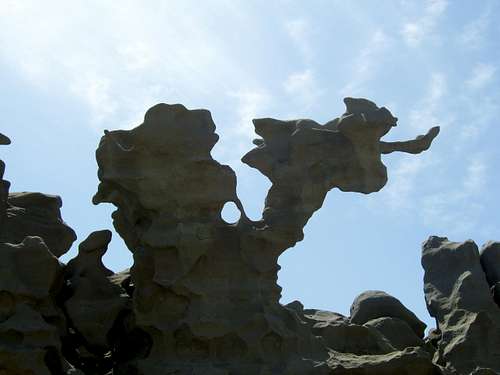
April 6: Desert Voices and Fantasy Canyon (Utah)
Today Shaylee, Kessler, Kim and hiked the Desert Voices trail on Split Mountain. After that we headed to and explored Fantasy Canyon in NE Utah. It sits in an area with a lot of oil wells in the vicinity, but is quite a nice place with some of the weirdest rock formations that I have seen.
See the trip album:
Fantasy Canyon
April 5: Sounds of Silence (Utah)
Bad weather and bad avalanche conditions foiled our (Kim and I) plans to do some climbing in the Wasatch and to do the Beatout. We headed for the desert instead and took Shaylee and Kessler. We chose the Vernal area so we could listen to our church conference on the radio. We visited the dinosaur exhibits and then hiked the Sounds of Silence on Split Mountain. We camped at Split Mountain.
Sounds of Silence/Desert Voices
April 4: Sand BM (Colorado)
I climbed the Sand BM alone to get a break from doing the income taxes! It was a mix of mud and snow and the drifts are still deep. It was pretty messy and I slipped in the mud on the way down.
MARCH
March 29: Fish Creek Falls (Colorado)
Kim, Shaylee, Kessler and I snowshoed to Fish Creek Falls in the Park Range. It was Shaylee’s first snowshoe trip and on some of the steep side hills, she and Kim turned back. Kessler and I continued towards the Upper Falls, but since I had forgotten to give the car keys to Kim we turned back a bit early in order to avoid having Kim and Shaylee sit outside for too long without being able to access the car.
![Fish Creek Falls]()
March 28: Sand BM (Colorado)
Kessler and I climbed Sand BM, this time without having to use snowshoes. Much of the slopes were bare with some mud and the snow was nice and hard so we didn’t sink far. We counted 28 deer on the hike and lots of signs of elk too.
March 21: Cedar Mountain (Colorado)
I climbed Cedar Mountain alone after dinner and on snowshoes though there are now a few sections of exposed ground on south facing slopes. I reached the top right at sunset and in a cold wind. I watched the sunset and hurried back down. The sugar snow was softer than expected and harder to break trail through than I thought it would be.
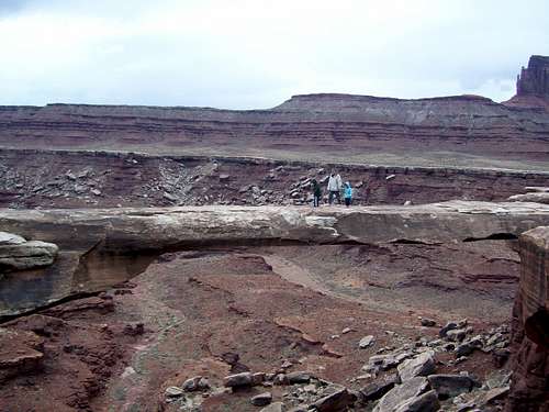
March 17: Musselman Arch and Walking Rocks (Utah)
After camping near the Airport Tower (rock tower) Kessler, Shaylee, Kim and I visited Musselman Arch and hiked the Walking Rocks. After that we did some shorter hikes along the Potash Road (near Moab) before returning home.
March 16: Monument Basin (Utah)
After camping at Murphy Hogback, Kessler, Shaylee, Kim and I did the rugged hike down into the Monument Basin on a cold day. There was much scrambling up to class 3 and we had to lift Shaylee up some places. Monument Basin is one fascinating place.
Later that day we explored the North Fork of Buck Canyon. The lower end was easy and the upper end had some interesting scrambling though a tunnel. We passed the children up the tunnel on the way back.
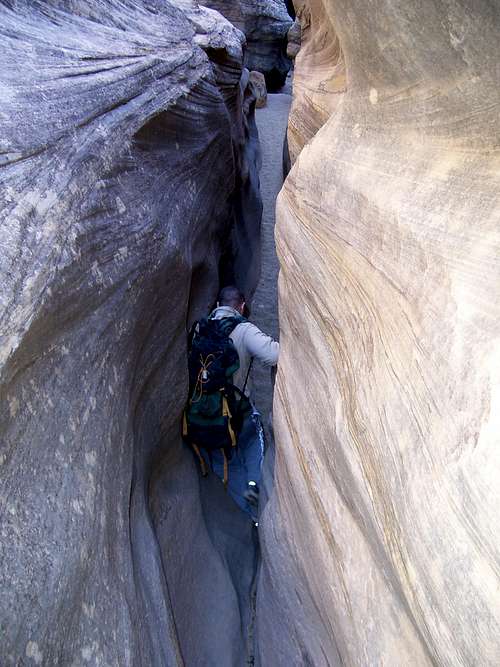
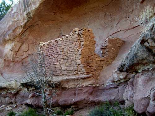
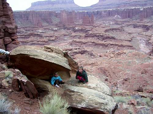
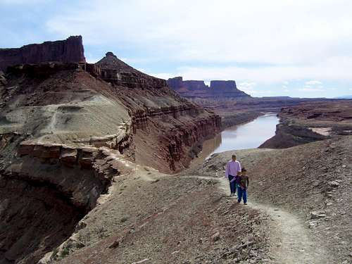
March 15: Fort Bottom, Moqui Butte and Holeman Slot (Utah)
Today was the first on our trip to Canyonlands National Park. For this trip we visited the White Rim in the Island in the Sky section. Our first hike of the day was to Fort Bottom, the Moqui Butte ruins and the Outlaw Cabin. It was a fantastic hike.
In the afternoon Kessler and I scrambled the semi-technical Holeman Slot. It is a short but nice slot with some challenging scrambling.
![Fort Bottom Butte]()
See the trip album:
White Rim-Canyonlands National Park
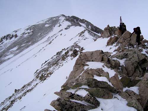
March 7-8: Mount Yale (Colorado)
Some friends and I climbed Mount Yale (14,202 feet), my first 14er of the year. Five of us (Dan, Brandy, Austin, Pete and myself) met at the Avalanche Gulch trailhead and we began hiking at 1:30 pm. One person (Pete) turned back earlier, but the rest of us continued to 11,860 feet before camping (we also met Clint there who left earlier than the rest of us).
After a mild (9 degrees F) and rather windy night, we got a late start at 8:30 am. Five of us climbed to the summit of Yale via the East Ridge and were met by two others whom had started earlier that day. The ridge was rather long and tedious in winter and we didn’t get any views from the top because it was snowing, but after the morning it was eerily calm without hardly any wind.
It was a pretty good climb, but Yale is definitely a rather tedious choss pile. On the way down Austin and I decided to push a more direct route down part of the lower section of trail, but that was a mistake.
![Climbing Mount Yale]()
Here is the trip album:
Mount Yale
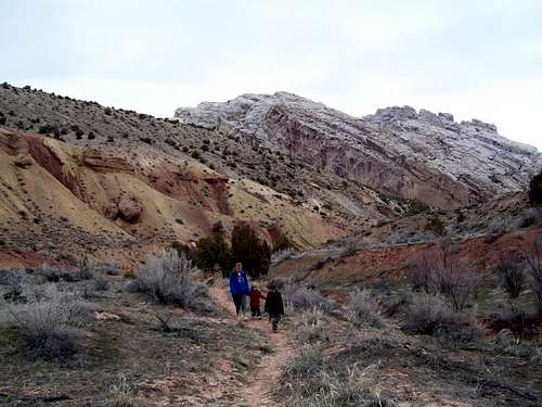
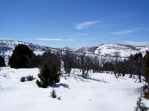
March 1: Williams Fork Mountains (Colorado)
The rest of the family was out of town for the weekend, so alone I headed out to the Williams Fork Mountains to do some exploring. I parked at Castor Gulch near Hamilton and headed more or less straight north to the main ridgeline of the range. Since this was by far the warmest day of the year so far and since the slope faces south it was a battle between mud and cliff bands so I decided to ditch the snowshoes. That was a mistake as there was some serious postholing once I reached the ridge. Anyway I followed the ridgeline up to an un-named peak for some good views.
It was a sunny and warm day, but very windy. The peak was harder than normal because of all the mud and postholing through the snow, but it was a nice hike/climb.
FEBRUARY
February 23: Duffy Mountain (Colorado)
The original plan was to climb something in the Park Range, but it was snowing in the morning and I didn’t feel like driving on snowpacked roads during a storm, so I turned my eyes to something closer. I climbed Duffy Mountain SW of Craig.
In winter, it was a longer than expected hike on snowshoes across the flats to reach the mountain. Pretty easy, but I sank in the sugar snow in places. I climbed the peak and traversed a long way west along the crest to get various views since the weather had improved and there was blue sky peeking through the clouds. I looped back north to view the Yampa River and completed a loop down the east side of the mountain. Deep snow was a bit tedious in the trees on the east side, but for most of the trip, there were good snow conditions.
It was a good trip and I ended up seeing lots of wildlife. Falcons, hawks and eagles were seen as well as many deer and elk on the mountain plus lots of antelope on the drive out.
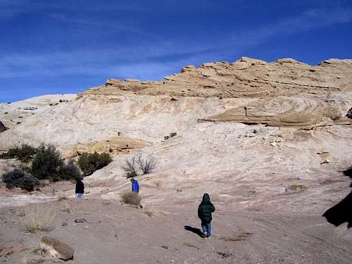
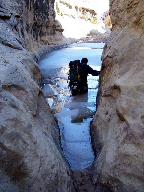
February 18: Temple Wash (Utah)
The entire crew above hiked through Temple Wash, but the rest of the group didn't make it as far as Dad and I.
![Temple Wash]()
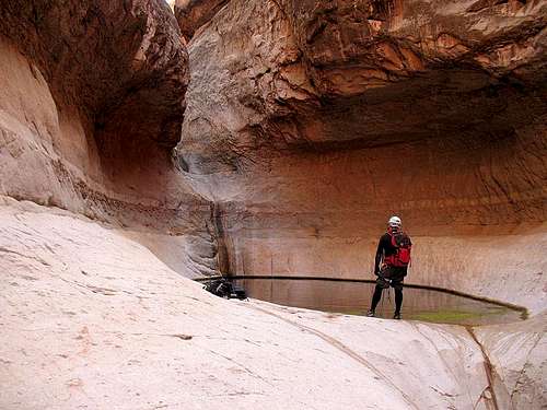
February 17: Wildhorse Creek and Mollies Castle (Utah)
I had hoped to do a loop down Quandary Canyon and up Ramp, but Richard had enough of technical canyons so we hiked through Wildhorse Creek with the entire crew in the day above. Dad and I also went to Wildhorse Window and went back to Goblin Valley to hike to Mollies Castle.
![Wildhorse Window]()
February 16: Farnsworth Canyon and Old Woman Wash (Utah)
Richard (brother)and I completed a loop up Farnsworth Canyon and down Old Woman Wash in the San Rafael Swell in Utah. Old Woman, Ramp and Temple Wash were the last canyons cutting through the San Rafael Swell that I still haven't gone through.
The children Kessler (son), Matthew (nephew) and Josh (nephew) along with Mark (brother) and my father went most of the way up the Farnsworth Canyon narrows until stopped by a pool. They spent the rest of the day exploring Goblin Valley.
Richard and I continued the loop up Farsworth and down Old Woman. There were lots of petrified logs on the benches in the upper end and it was found that Old Woman Wash has a pretty good but fairly short slot. There are two raps, 10 feet and 15 feet (but we carried 350 feet of rope since we had no beta) along with several nice icy downclimbs. The deepest pool was almost chest deep. Richard was crossing one of the frozen pools and busted through the ice (about 3" thick) to chest deep. I put on my wetsuit before crossing (so did Richard)! The loop up Farnsworth and down Old Woman took us 7 hours, but with snow, mud and ice covered rock to slow us down.
![Busting through the ice!]()
Here is the trip album:
Farnsworth Canyon and Old Woman Wash
February 9: Sand BM (Colorado)
Kessler and I climbed Sand Benchmark in NW Colorado on snowshoes. I had to be somewhere in the morning until after lunch so we got a very late start. It was a very warm day compared to what we've been having, but it was a bit chilly on top because of the breeze.
February 8: Juniper Mountain (Colorado)
I climbed Juniper Mountain alone and on snowshoes. I didn't leave until noon because I waited until Kessler was out of Kindergarten, but he decided that he didn't want to go this time. It was cold, windy and mostly cloudy, but there were still some nice views. Trailbreaking was mostly easy, but also challenging in a few places with drifts.
February 1-2: Mount Princeton (Colorado)
Some friends and I attempted Mount Princeton (14,203 feet). After starting the climb near Mount Princton Hot Springs at 8900 feet, two other friends and I camped at 10,200. Shawn and I didn't end up meeting at 11 am because it took so long for me to drive through the blizzard (the worst part of the trip), so we didn't make it that far up on day 1. There was no trail at all so we broke it. Mark came along an hour or two later by headlamp. It was good weather in the evening with a star filled sky. It snowed very lightly later in the night and was cloudy, but that just kept the night warmer and the overnight low was 4. I guess the cold dry air brought my cold back too. My cold got worse as the trip went along and I have a very sore throat.
Three more people joined us in the morning, but three turned back early before reaching camp. Another two from another group passed us; they were climbing very fast.
Shawn and I packed up camp while everyone else continued, but Shawn mentioned that one slope we crossed was an avy path, though a minor one. I agreed and even though it was stable and just a short slope, I was wondering if it still would be if it snowed a foot on it as we wouldn't get back to it for several hours if we went to the summit. At another place that was only a small opening in the thick trees (thus too small to slide) we heard a loud THUMP when we crossed it. Everything was a slab snow over a sugar layer. Shawn said we should turn back soon and I suggested we go a bit higher to see the rest of the group and where they were and then go back. We went up higher up for a while on Tigger where we met Drew as he headed down off the Tigger Ridge and we went down with him. Chefrel and Mark plus the other two outside our group were still way up high, but by then it was cloudy and we couldn't see them, though I tried to look back several times (but the clouds prevented a view).
I thought about sticking around, but I wasn't feeling well, plus Shawn had to pick up his wife at 6pm (we carpooled and left one vehicle in BV), so we really couldn't.
Anyway, it was a pretty good trip even though no one in our group summitted.
![Lower slopes of Mount Princeton]()
JANUARY
January 26: Cedar Mountain (Colorado)
I climbed Cedar Mountain alone and made a traverse of the mountain. The western half of the loop was pretty easy, but the eastern half required some tough trailbreaking. It was a great though short (3 hour) trip in perfect winter weather.
January 18-21: Fourmile Canyon and Ticaboo (Utah)
I spent four days in the remote Fourmile Canyon/Ticaboo area in Utah with Kessler. Nights last weekend were cold at 0.8 degress and 4.1 degrees at our camp a Fourmile Springs. On the plus side, it helped us not need too much water to go out exploring cross country. We found some really deep and impressive slot canyons out on the remote benchlands.
Fourmile Canyon is mostly shallow and open in the upper half and just ordinary, but has some interesting cowboy camps and indian artifacts. There was lots of ice as well. The middle section is best and is really nice. The lower end is just open but pretty.
The benchlands between the Fourmile and Ticaboo complex are really great for exploring and very scenic. We found some really cool stuff.
![Resting in Fourmile Canyon]()
Here is the trip album:
Fourmile and Ticaboo Canyons
January 12: Sand BM (Colorado)
Kessler and I climbed Sand Benchmark in NW Colorado in cold but clear weather.
January 5: Cedar Mountain (Colorado)
Kessler and I attempted Cedar Mountain in NW Colorado. High winds and snow turned us back 2/3 of the way up.
Accumulated Totals and Goals
Accumulated Totals for 2008:
Days spent hiking or climbing: 98
Summits Climbed: 57
Summits Attempted: 65
Technical Canyons: 10
Technical Canyons Attempted: 10
Overseas Climbs: 5
Goals for 2008:
Days spent hiking or climbing: 100
Summits: 75
Summits with the kids: As many as possible!
Technical Canyons: 20
Overseas Climbs: At least 1
Elevations
Highest Elevation Reached
14,202 (4329 meters) on Mount Yale (Colorado); March 8.
Highest Elevation Reached in USA
14,202 (4329 meters) on Mount Yale (Colorado); March 8.
Highest Sleeping Altitude
11,860 feet (3548 meters) on Mount Yale Saddle (Colorado); March 7-8.
Highest Sleeping Altitude in USA
11,860 feet (3548 meters) on Mount Yale Saddle (Colorado); March 7-8.
Highest Elevation Climbed To By Month
| Month |
Feet |
Meters |
| JAN |
7546 |
2300 |
| FEB |
11,850 |
3612 |
| MAR |
14,202 |
4329 |
| APR |
6800 |
5960 |
| MAY |
7800 |
2377 |
| JUN |
9218 |
2810 |
| JUL |
14,012 |
4271 |
| AUG |
12,013 |
3662 |
| SEP |
11,820 |
3603 |
| OCT |
7500 |
2286 |
| NOV |
11,209 |
3417 |
| DEC |
14,073 |
4290 |
Highest Outdoors Sleeping Altitude by Month
| Month |
Feet |
Meters |
| JAN |
5100 |
1554 |
| FEB |
10,200 |
3109 |
| MAR |
11,860 |
3615 |
| APR |
5960 |
1817 |
| MAY |
6063 |
1848 |
| JUN |
8350 |
2545 |
| JUL |
10,820 |
3298 |
| AUG |
|
|
| SEP |
10,240 |
3121 |
| OCT |
|
|
| NOV |
11,209 |
3417 |
| DEC |
9940 |
3030 |
Personal Records Set
December 25
Highest ascent in Honduras; Celaque at 9347 feet (2849 meters).
December 22
Highest ascent in El Salvador; El Pital at 8957 feet (2730 meters).
December 6
Highest December ascent in Colorado, Missouri Mountain at 14,073 feet (4290 meters). Previous December record was 14,040 feet (4280 meters)on Mount Sherman on December 23 2006.
August 9
Highest August ascent in Wyoming; Medicine Bow Peak at 12,013 feet (3662 meters). Previous August record was probably around 10,700 feet (3261 meters) on The Wall saddle in the Tetons, sometime in the mid-1980's.
April 13
It wasn't much of a record, but the hike at Buckfarm Point at 5960 feet (1818 meters) might have been the highest I have hiked in March in Arizona.
April 12-13
Highest April Camp in Arizona; 5960 feet (1818 meters) at Buckfarm Point.
March 8
Highest March ascent; Mount Yale at 14,202 feet (4329 meters). Previous March record was 14,065 feet (4287 meters) on Mount Bierstadt on March 12 2005.
March 7-8
Highest March Camp; 11,860 feet (3615 meters) at the saddle east of Mount Yale. Previous March record was 10,900 feet (3322 meters) near Guanella Pass on March 11 2005.


Comments
Post a Comment