
|
|
Custom Object |
|---|---|
|
|
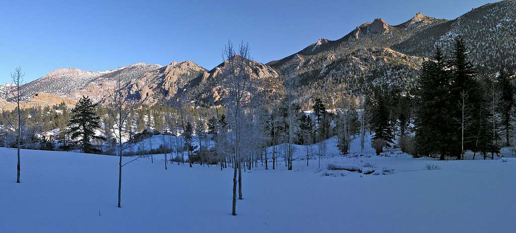
2008 |
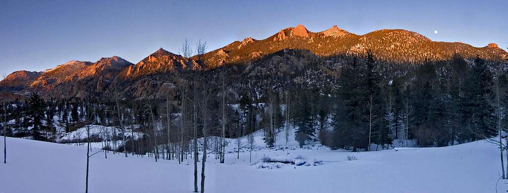
What's New 2008
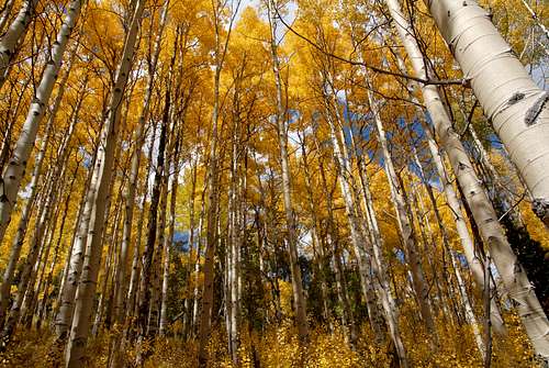
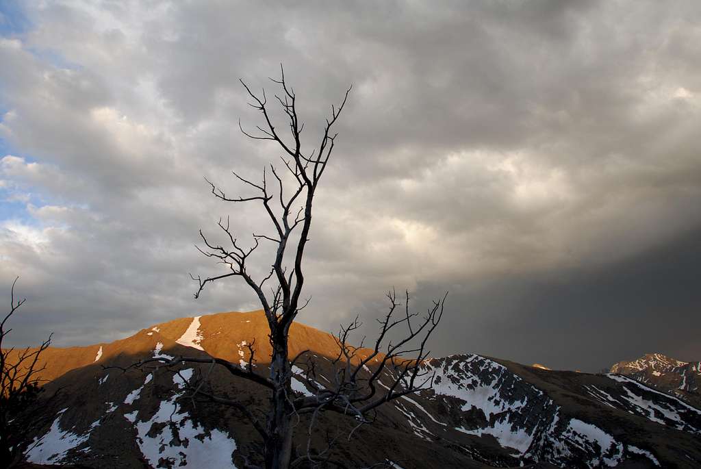
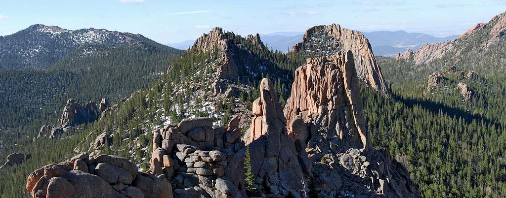
 Pitkin Creek, Gore Mountains
 |
 |
 |
 |
This will be an evolving page throughout the 2008 climbing season. Use the Table of Contents to the right to view what's posted for the season.
I thoroghly enjoyed maintaining my 2007 page and look forward to another great year of meeting other climbers and climbing great mountains here in Colorado and Utah...yes Utah!
My family is still my number one priority so it's very likely that I'm done with individual Mountain and Range pages on Summitpost. They take too much time, plus our Colorado mountain database is immense already.
I'll add a small journal or mini trip report of my most recent climbs. I'll also add a few thumbnail photos that will accompany my journal entries.
I'll try posting relavent information such as conditions, route suggestions (including TOPO maps,) route statistics, important GPS waypoints, and other personal notes. If I do not post GPS waypoints, figure there is no need for a GPS waypoint.
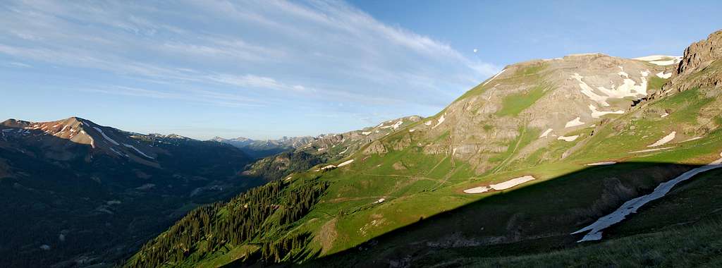
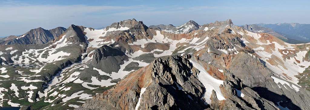
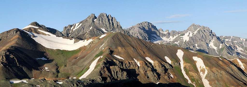
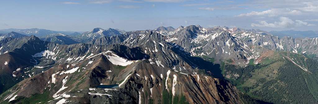
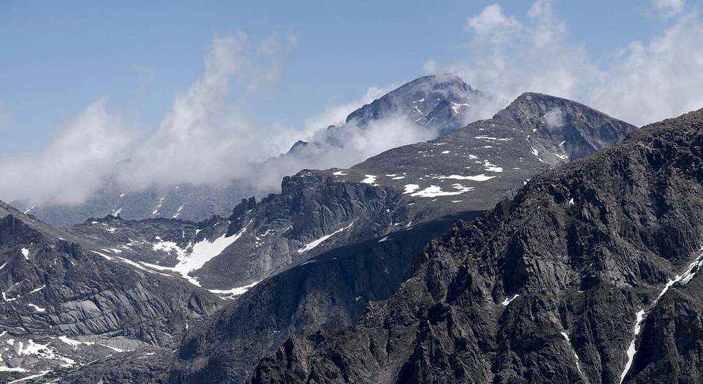
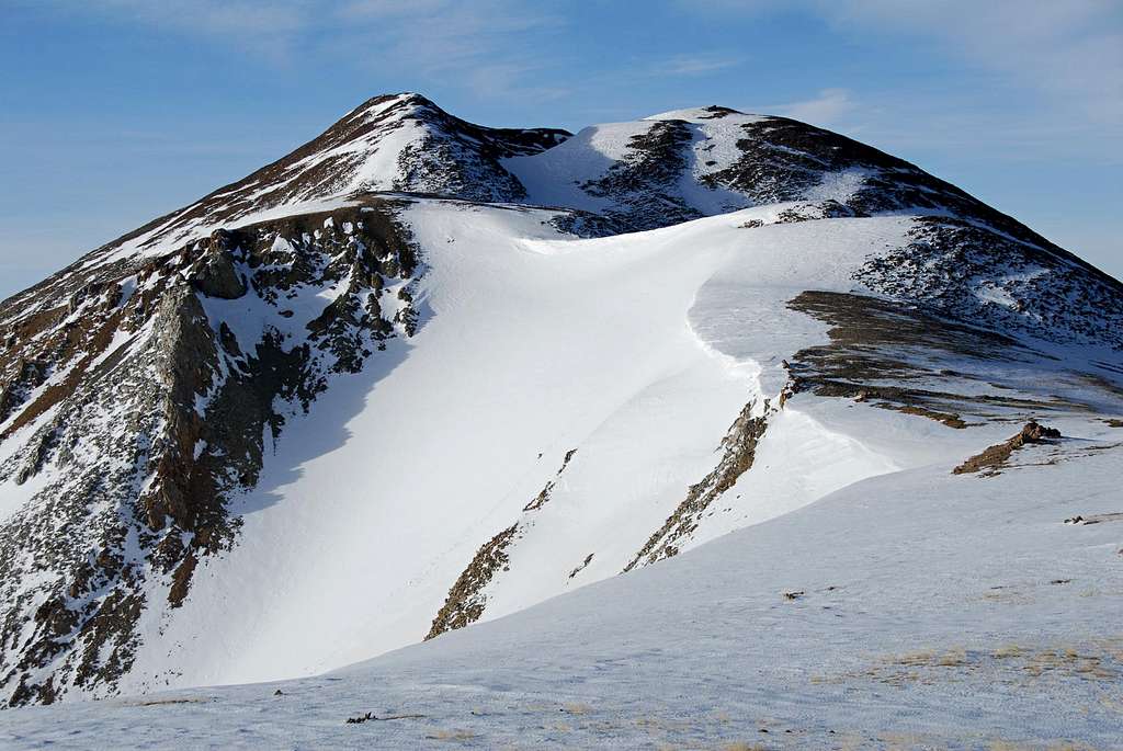
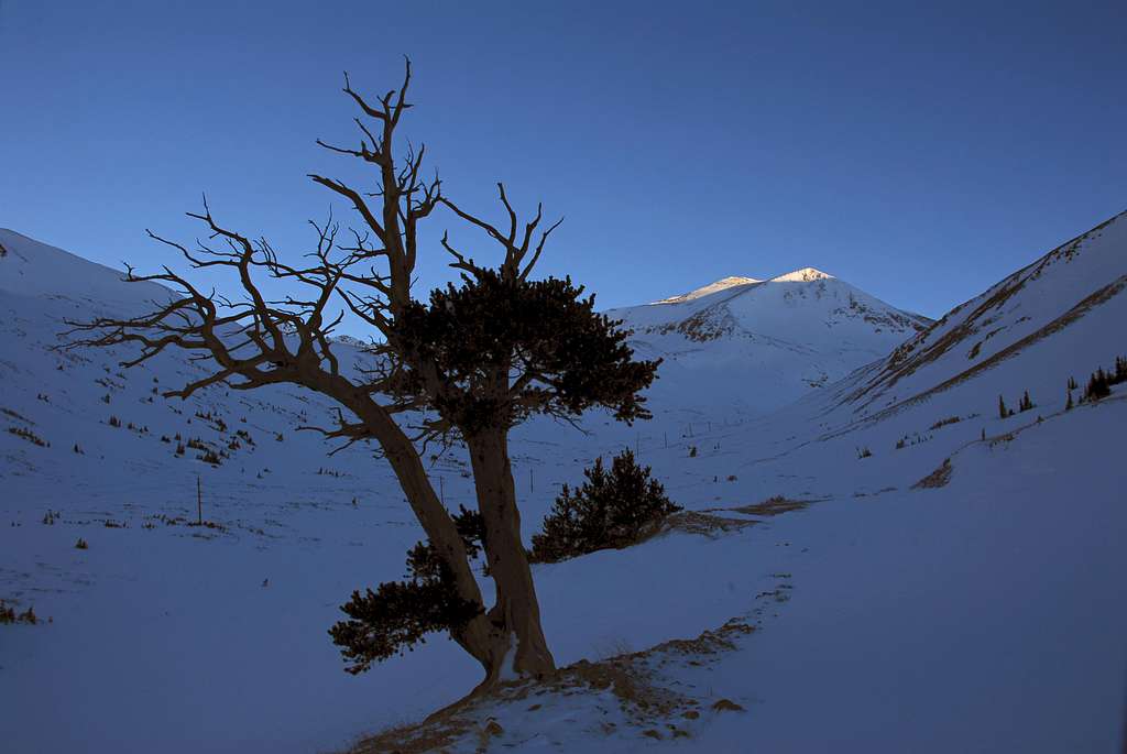
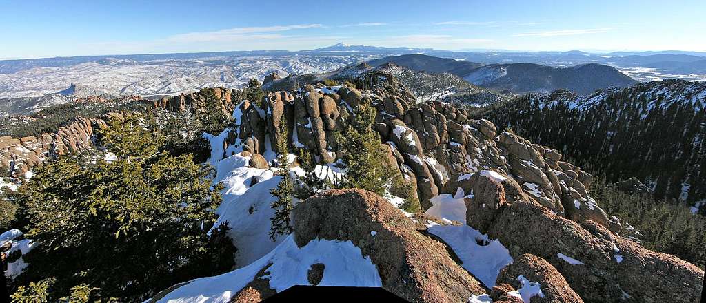
9-25-2008-"Peak X"-Gore Range
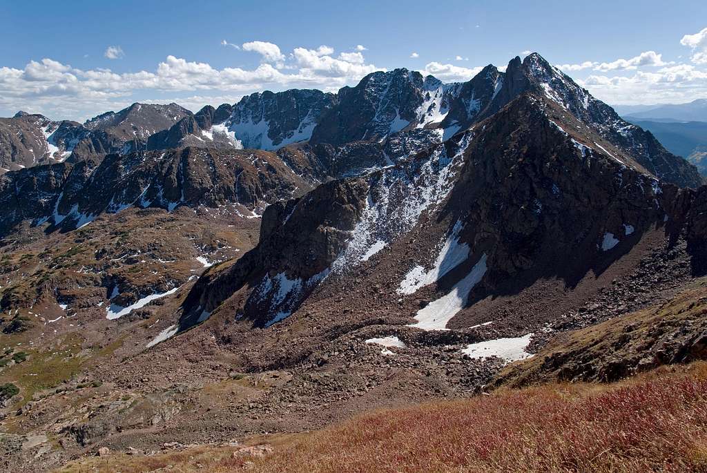

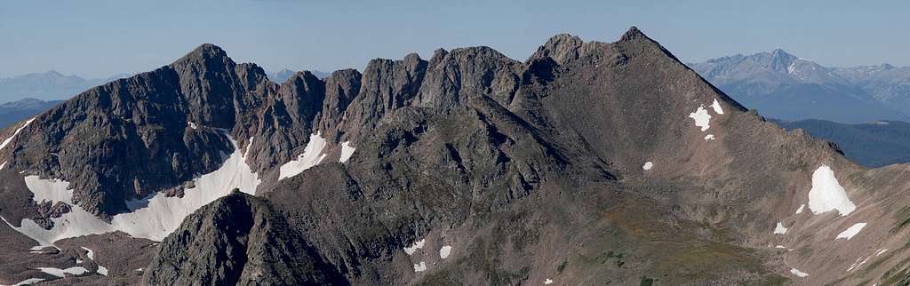
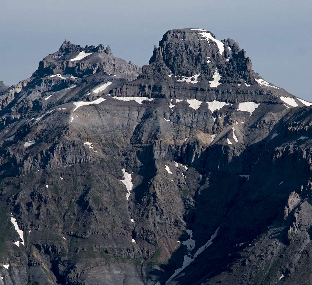
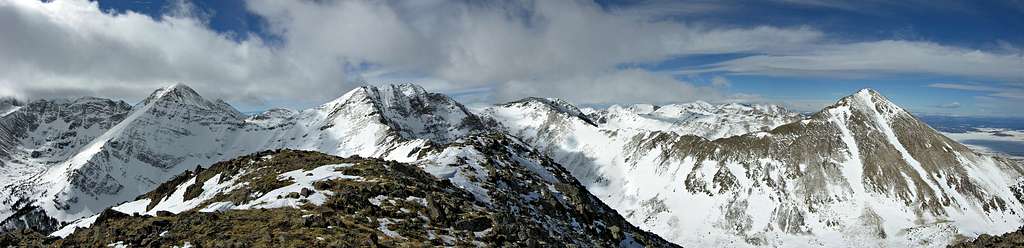
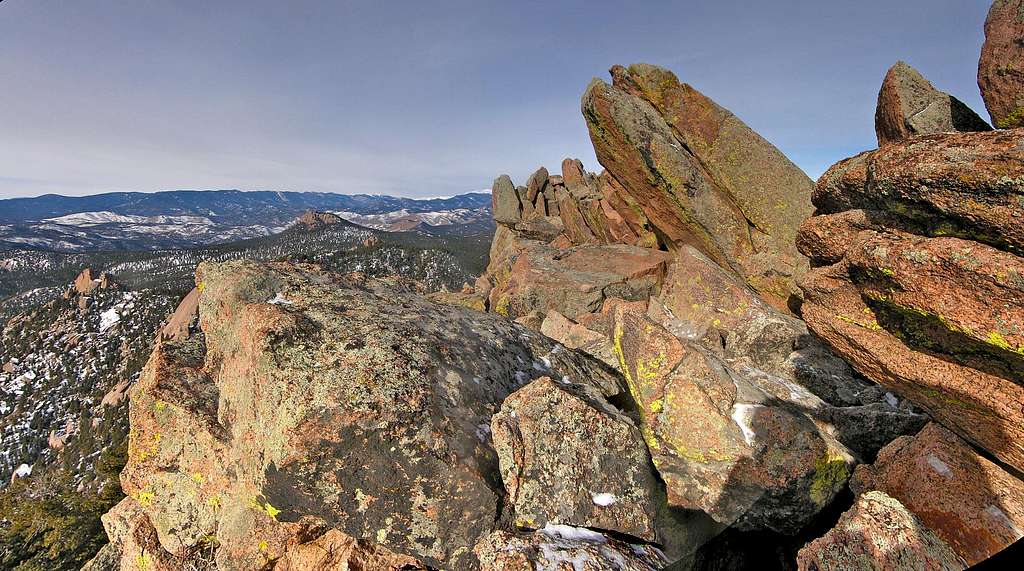
Gore Range
UN13,085 “Peak X”
Southeast Face to South Ridge via Boulder Creek Drainage
16 miles & 4,800-ft
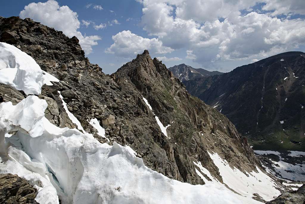
I new at some point in time I would climb Peak X. I just didn’t know how I was going to climb Peak X. The peak itself is non technical however; it’s approaching Peak X that’s the tough part. Do I climb it from the east or west? Either side makes for a long approach. I could go back to the beautiful Pitkin Drainage for a forth time and manage “Usable Pass” to get to the upper Boulder Creek basin, or I could explore the mysterious Boulder Creek drainage from the east. Usable Pass is the safe option,
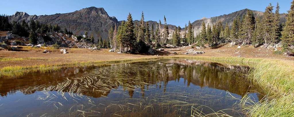
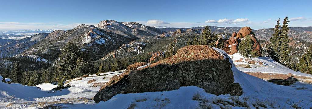
 Upper Boulder Lake
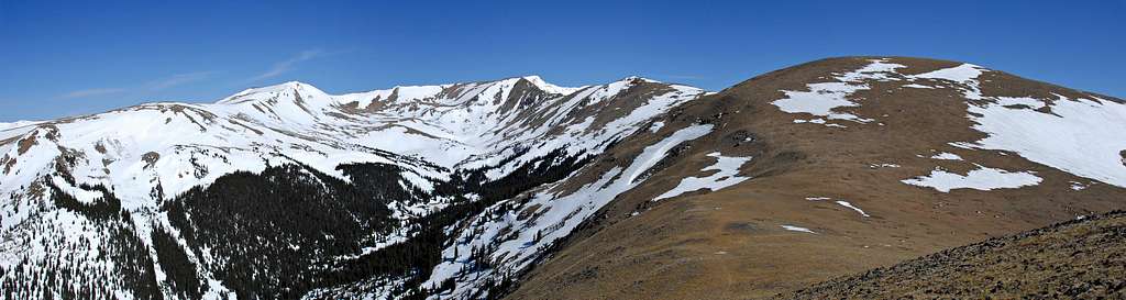
A few weeks ago I climbed Keller Mountain and had great view of the upper Boulder Creek Basin. I was reminded how beautiful it viewed from my Peak Z climb a few years back. Loaded with alpine tundra, tarns, granite domes and hosting three large pristine lakes, I knew it was time to take on the entire drainage from the east, regardless of a potentially hazardous or hideous bushwhack. Bring on the class 4 willows, bring on the class 4 swamps! For those that know me, it my surprise you that I finally made up my mind!
 Keller Mountain
Climbing Peak X from the east requires good weather; 16 miles RT and 8 of it residing in shadowy and sometimes baffling terrain can make the day go fast. I would also recommend doing it in Fall when the waist high vegetation surrounding the creek has suffered through some freezing overnights, thus it begins to break down and lay low, making it much easier to locate the primitive trail. Fall also means less water, so less mud in the low swampy areas and fewer if any mosquito’s as well.
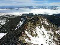
I began my day at the Rock Creek TH. The nearby Boulder Creek TH is an option that will save you 2 miles RT. However, you cannot park day or night there because it’s located on private property. BTW, the Rock Creek TH is doable for passenger cars, but it’s not improved and will be rough in spots.
 Vista Peak
Locating the Gore Range Trail is trivial and the 2 mile hike to the Boulder Lake was uneventful. Arriving at Boulder Lake I got the privilege of listening to a large group of campers shouting school spirit chants. I was thinking at least 20 people, maybe more. I thought I was at a football game at the quaint Boulder Lake at 8:00 am! I avoided the breakfast party when I easily located the trail that boarders the north end of the lake. I was finally headed west, into Boulder Creek Drainage. I past a few open meadows and finally came to the point where my map and GPS shows the trail stopping. Before the trip I read Theron Welch’s ten year old route description to verify I was in the right spot.
From here there are two options; the first option is to continue straight on a trail, on the north side of the creek. Theron says to cross to the south side of Boulder Creek and locate a camping area. I crossed the
 Peak Q
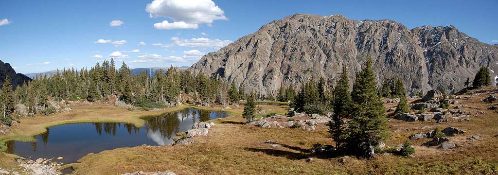
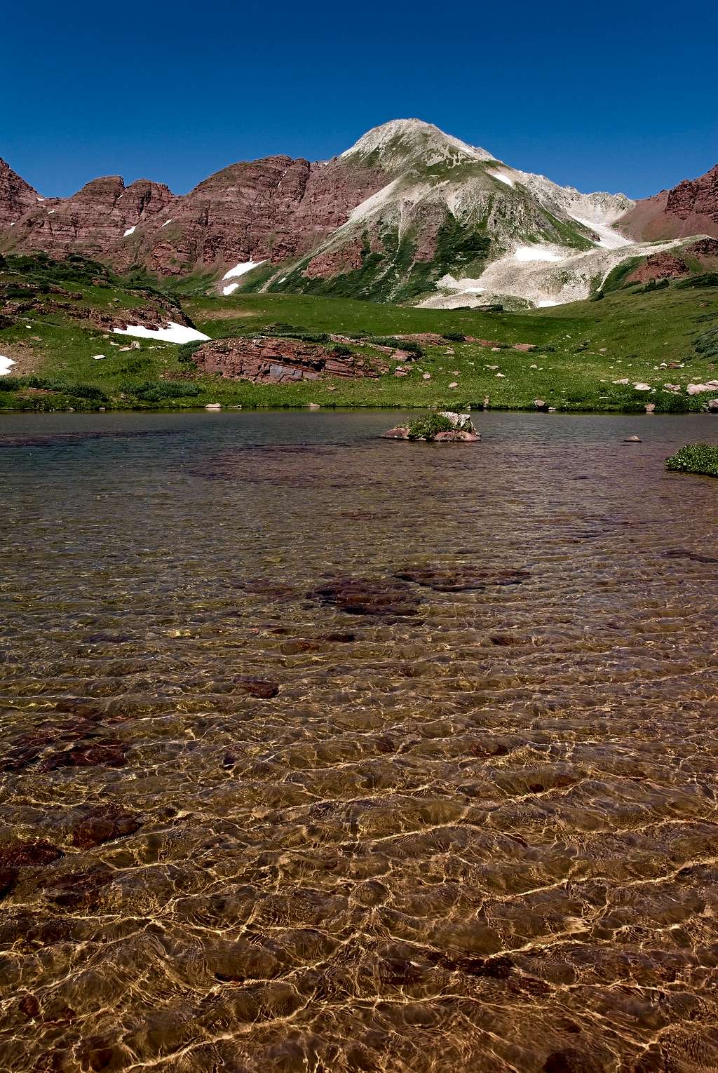
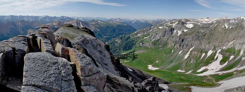
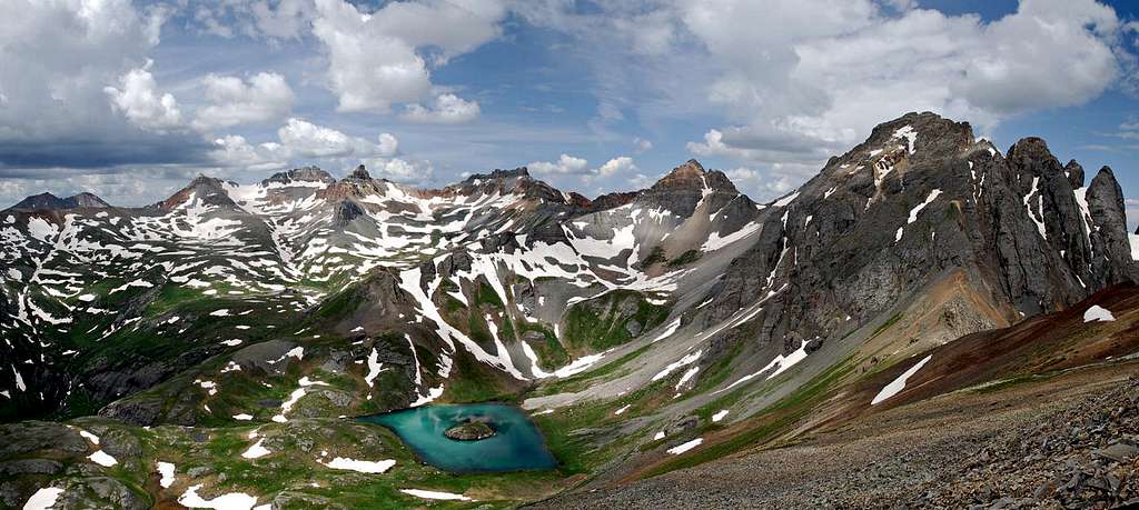
I arrived at Upper Boulder Lake and was surprised with its size. It’s a big lake. And it’s an extremely scenic lake too, complete with an actual sand beach. I felt lucky to be alive in this place. Upper Boulder Lake is located at about tree line which means that going forward to Peak X, getting around via tundra and granite boiler slabs isn’t too tough. I shot a few photos of the lake and I was off to “Secret Lake,” the next objective.
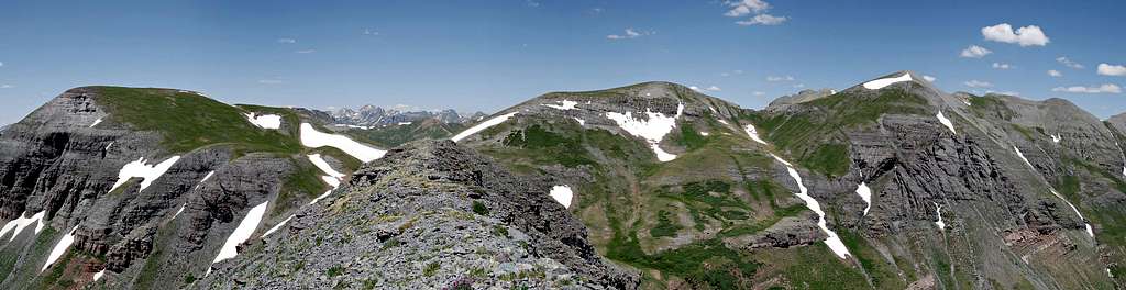
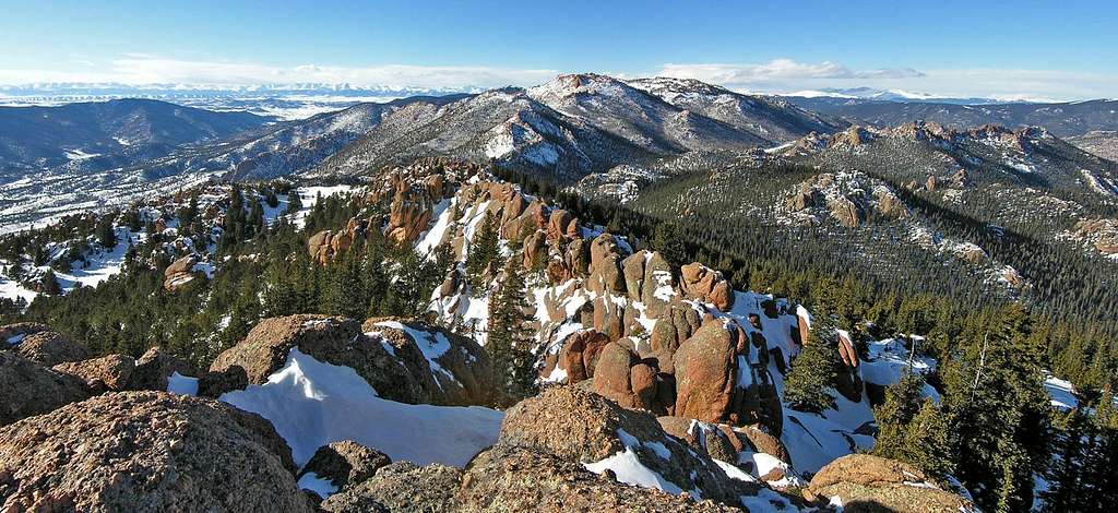
Just north, about 300 vertical feet above the Upper Boulder Lake resides the smaller “Secret Lake,” another alpine lake that feels pristine and has better camping possibilities due to the less frequent tree cover and more tundra. From here I got a great view of Peak X and the many tundra ramps that lace the southeast slopes. I spotted different options and made my way over a few minor boulder fields and began my ascent up the steep but easy slope.
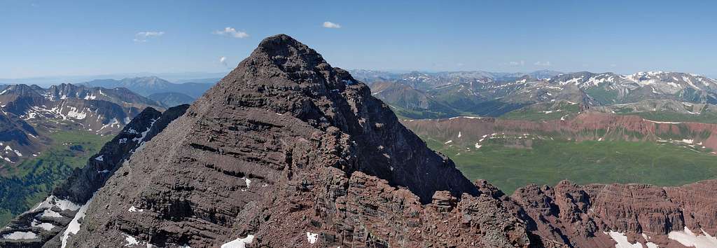
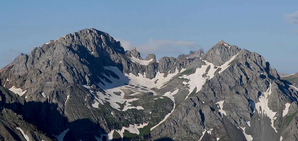
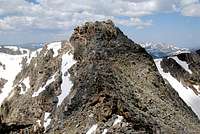
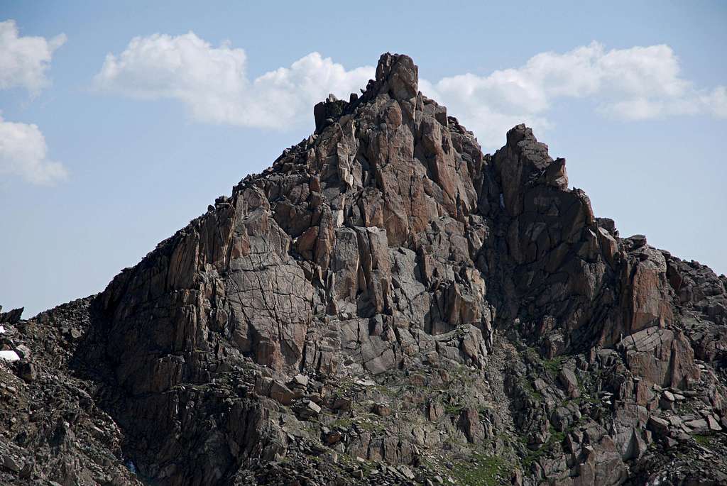
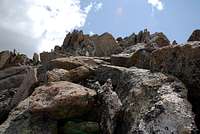
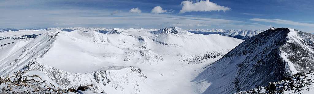
About 1,200 ft later I arrived on the south ridge of Peak X. It was finally nice to get some rugged mountain views with the Partners (east and west) especially standing out. Of course the view of my second favorite mountain in the Gores, Peak Q was outstanding as well. Staying directly on the solid ridge crest to the summit flirts with some 3rd and 4th class scrambling. However traversing the southwest face can bypass most of the difficulties of the ridge crest.
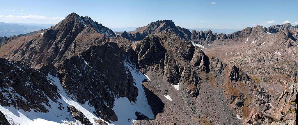
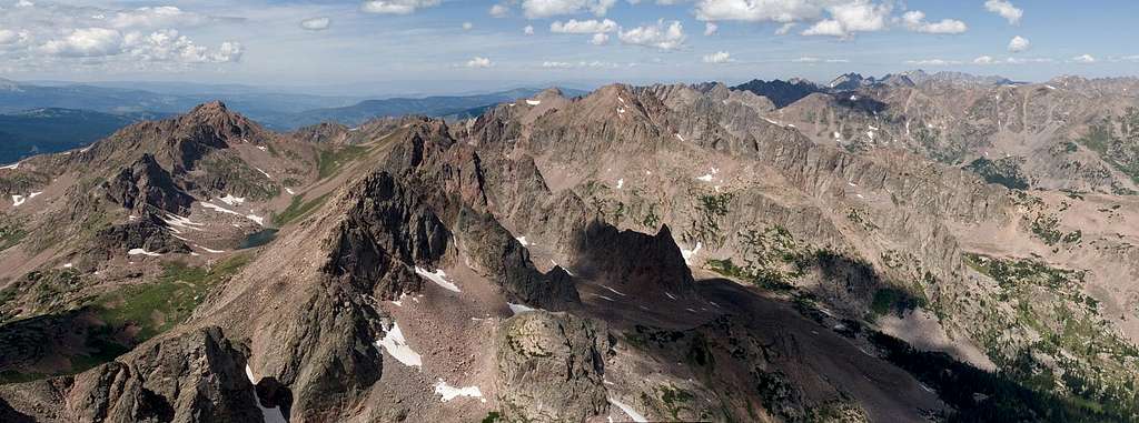
I made the summit at 2:00 pm. The view from Peak X is outstanding and one of the best in the Gore Range. Not as good as Peak R but at least as good as Peak Z. The ridge to Peak Y furthering to Peak Z looks too technical for me, but Peak Y looks like it goes via its steep southeast face.
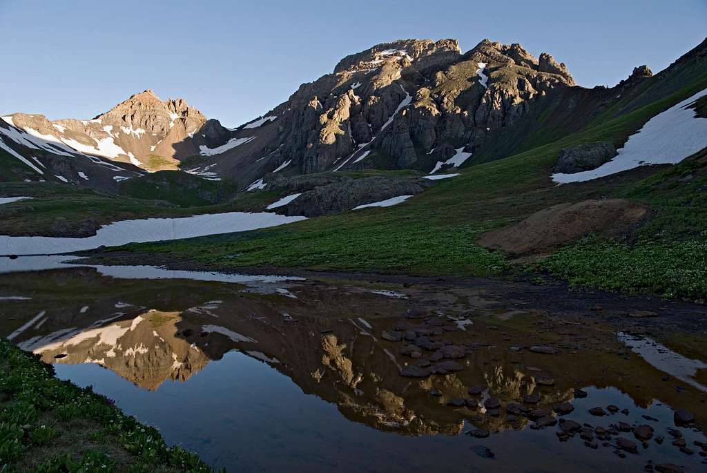
I forgot my headlamp so I needed to pick it up a bit to make it back to lower Boulder Lake by sundown. I still wanted to stop at some cool tarns I spotted from the summit and I also wanted to make another trip to Secret Lake. Descending back into the basin didn’t take long and it crossed my mind why I wasn’t staying the night up here. I can come back for Peak Y with an overnighter some day. The sun was lowering to the western horizon and the light was beginning to turn into that spiritual light I love so much. That stuff is really good for photos too. I hung out at some awesome tarns for about 20 minutes and came to the conclusion it was time to go. I packed all the gear, filled my water bottles and off I went.
I made it back to the car at 7:15 in the dark, 11 hours after I started. Now it's only Eagles Nest Mountain that stands between me and finishing the Gore Range thirteeners.
Another huge day in Colorado’s best “bang for the buck” mountains, the Gore Mountains!
9-13-2008-Cyclone Mountain, Carbonate Mountain A & Tabeguache Peak
coming soon9-7-2008-UN13,026,UN12,801,UN13003-Fryingpan Wilderness
coming soon8-30-2008-"East Thorn" & "Mount Silverthorne" Gore Range


”East Thorn Peak” & “Mount Silverthorne”
via North Willow Creek Trailhead
12.5 miles and 5,200-ft
How can you miss the iconic “East Thorn”? Its ruggedness literally soars over the mountain town of Silverthorne while sharing the skyline with a dome shaped Buffalo Mountain and the elegant Red Peak. East Thorn is especially prominent from I-70 while descending the Eisenhower Tunnel. Aside from a few local thrill seekers desire to reach East Thorn’s summit, the peak welcomes few visitors. However, the ones that do climb it, usually combine it with the ranked neighboring “Mount Silverthorne” or Willow BM.
For years, I had this idea that getting to Salmon Lakes required a long backpack because of all the private property that encompasses the area. I've known of the Mesa Cortina TH which runs to the Gore Range Trail, and eventually gets you to the Salmon Lakes Trail; but I had no idea about the Willowbrook subdivision’s North Willow Creek Trailhead,(Dave Cooper’s “Colorado Snow Climbs”) a trail that doesn’t exist on USGS topos. You can’t overnight park at the TH because of private property but for a dayhike/climb it sure beats the longer Mesa Cortina alternative.
I recommend a GPS for the early portions of the approach. The North Willow Creek Trail offers up a bunch of local “social trails” to choose from and not enough signing to get you to the Gore Range Trail without wondering if you’re on the correct trail. The Gore Range Trail goes well to Willow Lakes Trail which, goes well to Salmon Lake and Willow Lakes. Salmon Lake is about two thirds surrounded by boulders which doesn’t bode well for access however there are some nice campsites at the west end of the lake. From here the trail fades in and out for the rest of the climb due to intermittent tundra and boulder fields.
There’s a massive headwall that protects the upper alpine basin which accesses East Thorn and Mount Silverthorne. This headwall goes easy class 3 on grassy bench's and good rock. Staying just south of the tiny creek you can find good slab scrambling up this headwall. Try to mark you entrance to the upper basin since locating your exit/entrance point for the later descent can be challenging.
It goes without saying that Mount Silverthone, from above the headwall, goes easy class 2. For East Thorn, head directly up a minor gully composed of loose talus and scree to an obvious saddle that separates Thorn from a high gendarme on the west ridge. From here you get the in your face view of East Thorn’s pyramid-shaped upper area and summit. It looks rugged and loose, but going forward the rock is surprisingly solid. There’s a steep gully that splits the summit area, sort of making it appear to be two summits. These two summits are bridged together by an exposed arête. There are two options to make the summit. First, you can scramble your way up and over a minor ridge into the gully and climb the gully to the arête (class 4.) Second, you can make your way to a somewhat obvious window on the upper section of the north ridge. Here you can peer down into the Salmon Lakes area about 1000-ft below. Turn around and locate a steep ramp system that leaves the north ridge and zigzag ascends (class 3) up broken ledges and again makes the north ridge crest. Locate a smooth wall and either climb it (unexposed class 4) or traverse around and ascend the crest of the north ridge (exposed class 3) to the arête. Here’s is where both routes connect. The arête goes exposed class 3+ with a few options to overcome a rock pinnacle that at first seems to block the route. Some might prefer a rope for this arête.
My friend Jim came up the gully route, which required one tough class 4 stretch move. He opted to descend my route which flirts with portions of the upper north ridge. Overall I enjoyed the scrambling on the solid rock and the arête was exhilarating. But I wouldn’t recommend this route unless you are comfortable making a few awkward moves with exposure. There’s not a lot of it, but what exposure there is, is significant. I suppose the rope idea makes sense for those not comfortable with the exposure however forget the rope if you like that kind of stuff.
8-23-2008-Keller Mountain-Gore Range
10 miles RT & 3,940-ft
East Ridge ascent
Rock Creek Drainage descent
via Boss Mine & Rock Creek Trailhead
I finally climbed Keller Mountain. This one’s been on the list forever because a long time ago I made a commitment to climb every ranked thirteener in the Gore Range. I’ve always known the East Ridge Route on Keller would make for a good dayhike mostly because of great logistical access in two important ways. The Rock Creek TH can be accessed with a 2wd and for the best part, it’s only an hour and a half drive max from Denver. Also, the east ridge is accessed easily from the Boss Mine area. It only takes about an hour and fifteen minutes to make tree line from the Rock Creek TH. Thus, you get to keep a close eye on cloud build up.

The east ridge on Keller is not technical when conditions are optimal. When the snow is gone, it’s an easy class 3 route. The ridge scrambling is solid and there was very little loose rock to move through. Overall I enjoyed the route but it doesn’t go down as a classic for me. This one falls into the North Traverse/Red Peak/Snow Peak/Peak C/ East Partner category, nowhere near Peak L, Q, R, Spider, G, Z, West Partner, D and C-Prime category. I wasn’t feeling well; I had a head cold plus I suffered from a pinched nerve in my neck from a recent overnight sleep. Despite my below average physical condition, I’m sure it didn’t have anything to do with my opinion of the mountain.
The descent into the North Fork Rock Creek Drainage goes well but the hike back out doesn’t go too well. I made a side trip to the unnamed big lake directly under North Traverse. I was expecting the bushwhack part, because it’s no news that the drainage is trail less but, I wasn’t expecting the drainage to be uninteresting, which to me it was. Compared to other nearby drainages, this one doesn’t have the ample tundra/ rounded granite domes and water tarns the others have. In addition to the tedious bushwhacking, there’s a big area of stinky mud to negotiate. Plus there’s a bunch of avy debris from a different decade that makes from some bland scenery.
To the north of Keller resides the Boulder Creek Drainage and while on the summit, I had a great view of what I expect to be an awesome place to visit. It’s everything that the North Fork Rock Creek isn’t. The upper Boulder Creek basin supports three large and deep lakes within a vast alpine meadow, dotted with rounded granite domes. Now that’s a place I need to visit. And it just so happens that one of my remaining three Gore thirteeners is Peak X.
8-12-2008-UN13,020 B-Elk Range
UN13,020 B
via the Minnehaha drainage & Willow Lake Basin
9 miles & 4,500-ft
After the strenuous day on North Maroon, I needed a tundra hike to sooth the soul. I picked UN13,020, a peak that teams up with Buckskin BM and Willow Peak to form the northern rim of the long ridge of peaks that eventually connects to the Maroon Bells massif. I was excited to have stellar weather considering the area had 14 consecutive days of monsoonal moisture prior to my North Maroon trip. I was also excited to have the opportunity to visit one of Colorado’s most beautiful places for my third time, the incredible Willow Lake Basin.
I started hiking with headlamp at 5:15 am and made the Crater Lake area at 6:10. A turn north on to the Buckskin Pass Trail netted a brilliant sunrise on the Maroon massif. I continued and made Willow Pass at 8:20 and descended into the Willow Lake area, and so my religious experience would begin.
Words can not describe how beautiful this place is, its pure sensory overload. It’s like Mother Nature jacked up the color saturation level, to mimic the Emerald City look in the land of OZ. When it’s sunny, there’s so much bright color even my Nikon D-200 has trouble metering a correct exposure. You just have to go and see it for yourself.
UN13,020 is easy to locate, so I traversed the upper basin to a single-track trail that ascends to a pass in between UN13,336 and my objective. Before the trail bends around and ascends to the pass I left it and began a steep tundra hike up a grassy, shallow gully. Above the gully, I found a lot easier ground to ascend on a grassy ridge crest that eventually turns into another grassy slope. After the slope the summit ridge appeared and with a minor class 2 rocky gully to negotiate, I stood on the summit at 9:45 with a view to die for. I had incredible weather, with zero cloud cover for as far as I could see. Usually I only haul a cheap small tripod, my camera and one lens for my climbs but I was thrilled to have lugged my big tripod and my additional 55-200mm for summit photos. I set up shop and took photos for an hour.
The view from UN13,020 is one of the better ones I’ve seen. The highlight views include great perspectives of North Maroon, Pyramid, Buckskin BM, Snowmass and Capitol Peak.
I descended the easy slope back down to the tundra ridden basin and spent another two hours exploring every nook and cranny I could. Many of these places seemed familiar from previous vists. There are many smaller lakes to explore including the very large and deep Willow Lake. I still have trouble understanding how so many people visit Maroon Lake and how so few of them ever make the hike to the Willow Lake area. For some beautiful reason, word hasn’t gotten out, and that’s ok by me.
There’s a small grassy ridge that rises above Willow Lake and connects to Sievers Mountain. From there you can peer straight down 2,500-ft on a thousand tourists. If you count me among them, that makes a thousand and one of us. It’s interesting to think that every one of them and me feels great about what they are sensing and seeing. Knowing this makes me feel confident I’m the luckiest one of all.
8-11-2008-North Maroon Peak-Elk Range
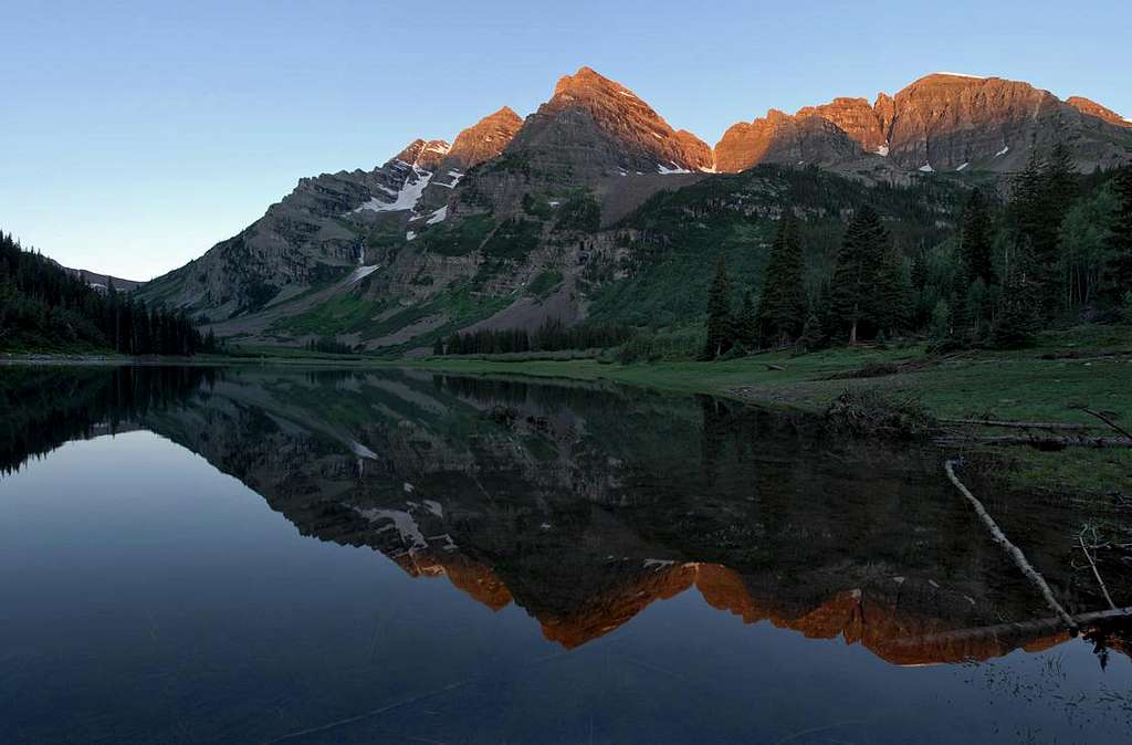
It’s official, I finally finished the Elk Range fourteeners and it only took me 15 years. Not that I ever worked hard to finish them, but I suppose it’s semi cool to think that 15 yeas ago I wouldn't have thought I would ever have the confidence to climb peaks like Capitol, Pyramid, and both Bells. Fifteen years ago I moved to Aspen from Houston TX, and didn’t even know what mountains were. I liked footballs and helmets, not trekking poles and helmets. I remember looking up at the Bells with tourist eyes and couldn’t believe that people actually climbed those mountains. Of course the “Deadly Bells” signage at the lake didn’t motivate me either.
Capitol Peak was the first mountain I ever attempted. That day didn’t go too well. I climbed Pyramid and South Maroon on consecutive days 4 years ago. That was a breakthrough moment for me. I attempted North Maroon two Septembers ago to be turned around by ice and snow at the crux. Last year, I did Capitol Peak the right way when I climbed it from Pierre Lakes. Monday, I soloed North Maroon, and spent most of my time wondering if the weather would hold, and less time thinking about my climbing abilities. I suppose my confidence has peaked these days. After 300ish summits, I know my limits...most of the time.

North Maroon set me straight again, sort of brought me down to earth. I need this kind of ass kicking occasionally. It’s when I go into a climb too confident and end the climb feeling whipped. It never crossed my mind that 4,600-ft in 4 miles after not climbing in three weeks might be pretty strenuous. Plus I brushed off studying the route prior to the climb thinking my crappy memory of my first attempt 2 years ago would be enough to get me to the summit. Lastly, I’m pretty sure I had some of that elitist “14erbashing” attitude and thought all I had to do was follow the cairns if things got interesting.
North Maroon will humble those that underestimate its difficulty like me. It’s been since winter climbing that I was so winded. This peak is very steep. It’s basically a staircase that never seems to end. Also, the routefinding is not easy, and should require at least a good research before attempting. Most folks do plenty of research but only a few idiots like me think they can just figure it out as they go. The middle and upper terrain is a mesmerizing sea of blocky ledges; getting off route is easy due to the countless ledges that present game trails and other trails from off route climbers. Yes, there’s a climbers trail but at times it fades into other trails that tend to traverse across the face. Cairns will help in the more difficult areas.
The crux was easier than anticipated. It’s only class 3 with routefinding. It seems as the 14ers become more popular, their class ratings go down after alternate routes are discovered and cleaned up. Case and point; Pyramid Peak and North Maroon are rated class 4, but today they’re not class 4, but class 3 with routefinding.
 |
 |
 |
An interesting observation
I witnessed something interesting at the crux area on North Maroon: A guide with three clients roping up for the descent of the original class 4 crux. I spent a few moments engaging a short conversation with them and it was my observation these three clients very much needed the guide. Afterwards, I assumed they ascended this class 4 crux with rope too. If this is so, I wonder if the guide was actually providing the safest route option. There certainly was potential for the clients to see me cruise up the safer class 3 alternate route a few feet beyond the old class 4 route and question their own choice. Did the clients even know there was a safer route a few feet away? I’m pretty sure the guide new of my safer route; he mentioned he had been climbing North Maroon for years. Bottom line is; I wonder if his clients would pay for a guide if they knew of the class 3 route? Later I over heard the guide speaking in a firm voice that Pyramid is A LOT more difficult than North Maroon. The clients seemed to be in awe of Pyramid. Personally, I thought Pyramid was easier than North Maroon and certainly wouldn’t try to scare anyone off from climbing it, after they just ascended North Maroon. I concluded he was trying to get hired for a climb of Pyramid. All this seemed unethical to me, however I certainly could be wrong in my overall assessment.
7-20-2008-"T-8" UN13,315, San Juans
T-8, Northeast Ridge
via Richmond Pass & Trailhead
7 miles & 3,800-ft
I selected the Richmond Pass Trail because I needed a peak with easy and fast access, and with paved access from Hwy 550, the Richmond Pass Trail fit the bill to a tee. Locating the actual trailhead from the highway might be difficult if you’re not looking hard for it. It shows up suddenly and it’s easy to drive on by the turnoff. Try setting up a waypoint in the GPS, then you won't miss it. There’s ample space for car camping at the trailhead and likely enough space to set a tent up if you feel compelled.
The trail ascends steep aspen laden lower slopes to a massive tundra ridden upper slope. This is a place where tundra seems to go forever and may be one of the most beautiful places I have viewed that’s so close to a paved highway. Once above tree line the trail faded in and out. It was easy to find a trail but at times I had no idea if I was on the correct trail or a game trail. I used my GPS to help me angle up the correct slope to the Richmond Pass area. Once in the upper basin the trail becomes obvious and ascends to Richmond Pass where you get a good view of South Hayden Peak.
Richmond Pass gets you South Hayden Peak or for a little more work you can hike south to a peak called “T-8.” I thought the view potential to the south was better so I selected T-8 instead of S Hayden Peak.
The ridge to the rounded, flat summit area of T-8 is actually technical if taken head on. A topo map doesn’t suggest a loose, blocky knife edge but that’s what it is. I had to drop to the right and traverse this section of ridge on loose talus. After the ridge, it’s an easy stroll to the massive summit area of T-8. The view of the Imogene Pass area, Yankee Boy Basin area and Sneffles Range is comprehensive.
For the descent, there’s a few different options that can get you back to the Richmond Trail or all the way down to the highway, where a short hwy walk will deliver you back to the trailhead.
7-19-2008-Grand Turk, Sultan Mountain &UN12,849, San Juans
The Sultan massif
Annual Summitpost Summer Gathering-
Grand Turk, Sultan Mountain & UN12,849
via Little Molas Pass TH
After my climb of US Grant, the latter part of the afternoon was spent trying to get my truck started at the trailhead. I left a light on for eight hours and I needed a jump. After two different set of jumper cables, my truck still wouldn’t start. I was stunned. The consensus was that I either needed a new battery or there was something very wrong with the electrical components of the truck. I got a ride to Silverton and was dropped off at the Conoco automotive repair shop and met Bill. He guaranteed me there was nothing wrong with my battery, it just needed to be jumped again with a 12 volt heavy duty, transportable jump starter. I was not optimistic considering I had just spent 2 hours trying to jump my Jeep with actual cars. Now he wanted me to use a tiny red box with cables attached. He was convinced the jump cables I was using were not “beefy” enough and that $5.00 cables from Walmart don’t work. Aaron was nice enough to drive me back out to my truck and I quickly attached the Jump Starter and Poof! It started right up; huge relief, to say the least. The moral of this story; you get what you pay for in battery cables. Bill says if your not spending $50-70.00 on jumper cables then you run a high risk of not ever getting your car started with another car. I have to give it up for Bill, he easily could have had me for hundreds of dollars, and I was ready for the towing process. However, Bill has integrity and he came through for me that day.

After consecutive peaks that required hard scrambling, I was ready for the annual 2008 Summitpost.Org gathering which included some nice tundra covered peaks residing in the Molas Pass area.
The night prior I had a nice dinner at Handlebars Grill with Aaron & Ellen Johnson, Alan and Jackie Ellis, other nice people from Summitpost. We were optimistic for good weather for the forecast was getting better everyday. We agreed to meet at the tourist center in Silverton at 6:00 am the next morning.
Woke up to clear skies and headed over to Silverton. I found Mike R (Chicagotransplant) first, little did I know he had stayed overnight just down the road from my campsite. It was good to see Mike because right then I knew I had someone that hikes close to my pace. I say “close” because I can almost keep up with him. Soon after, Ryan Schilling showed up. I had forgotten that he and Erin had committed to the gathering a few weeks back so it was a pleasant surprise to see him. Again, I felt even better, now I had three others that I could keep up with. The beginning of the “fast group” was assembling quickly.
The “fast group” is a term that came from someone else last year. I don’t consider us fast; it’s more in line with hiking with a bigger sense of urgency. I practically kill myself to move my pace. I’m lucky my pace is brisk enough to climb peaks before bad weather builds. One day, I’ll slow down a bit and take in more on ascents, but for now I’m super respectful of the weather Gods. There’s nothing worse than lightning above tree line. I think Mike and I think the same, get the summits and take your time on descents.
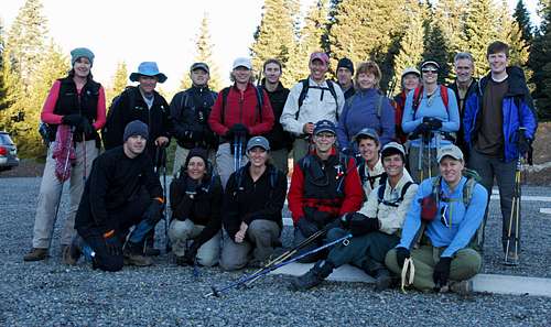
Before long we had a group of 20 on the way to Little Molas TH for a class 1 hike of Grand Turk and Sultan Mountain, a couple of nice thirteeners with a great view Silverton and the encompassing mountains. I appreciated that Mike offered to drive, so I jumped in and we were off to Little Molas Pass, chatting it up, getting caught up. We arrived at the trailhead, took a group photo and headed off to gain tree line. Mike and I agreed the weather seemed stellar so we needed to visit UN12,849 later in the day.
The group of 20 quickly split up into 4-5 smaller groups. I was trying to keep up with Mike, Alan and Kevin. For some reason early on my legs took longer to gain my cadence. Once above tree line I felt much better. The views above tree line were perfect, and the company was even better. This time was well spent catching up with Alan Ellis, a good friend from Oklahoma. I was happy for him because I knew he was having an awesome day, feeling ultra fresh and strong. We were all impressed with Alan coming from sea level to 13,000-ft and cruising the mountain.
The early morning light was beautiful, so of course I was having trouble letting go of my camera. Kevin caught me in a vulnerable photo opportunity trying to get “the shot.” Of course he couldn’t let me get away with it; “there’s Kane rolling around in the flowers again.” This was the kind of bantering that made up the rest of the day, all in good fun. I excel in ball busting so I made Alan my target the rest of the day considering he thinks I’m his “base-camp Bunny.”
We made the summit of Grand Turk, took a few shots and before long I was eager to get over to Sultan Mountain. Mike and I made the summit of Sultan Mountain and was here that I realized the weather would be perfect for a long time. It was here where I dropped my guard and started to relax. I set my tripod up and shot panos for about 20 minutes as others started showing up on the summit. I remember peering out over the entire route, seeing all of us spread out, and saying “it’s Summitpost day on the Sultan massif.”
I packed up the gear and started the long traverse to UN12,849, a rounded, tundra-ridden peak that we bypassed on the way up to the thirteeners. The hike up was pleasant and it wasn’t long before the four of us were relaxing in different ways with the perfect weather. Alan and Kevin took naps, Mike read a book, and I shot photos of them relaxing. We enjoyed our time up there, we knew it was something to take advantage of considering it’s not often that you get clear skies in mid July at 2:00 pm in the San Juans.

In time the rest of the group was gathering below so we gathered our stuff, hiked down to meet them and began the short trek back to the cars.
This gathering could not have worked out better. My compliments to Aaron Johnson for getting this one together and making it happen.
7-18-2008-Ulysess S Grant Peak-San Juans
Ulysses S Grant Peak (13,767) & “V2” (13,309)

Last year I climbed Golden Horn located dead center in the wonderful Ice Lakes Basin and while on the summit, my eyes were fixated on a massive peak a bit north called Ulysses S Grant Peak. Everything within Ice Lakes Basin is beautiful; especially Pilot’s Knob and Golden Horn, but this one very much intrigued me. In a sea of rugged mountains, the hulking US Grant seems more prominent than the rest. With V-3 supporting its north slopes, US Grant is its own massif. Its bulk is obvious from all over the Silverton area. The view of US Grant, V-3, V-5 and South Lookout Peak is particularly impressive from the Ophir Pass area.
The following is detailed information regarding the last 200-ft to the summit of US Grant. Some people like the “less is more” idea including myself, however there are times when I want more. US Grant was a peak that I wanted more because I knew the crux was my max comfort level without having a partner or rope. The approach to US Grant is beautiful as well as trivial. I submitted a topo map of the straight forward approach to Island Lake. Study the spot where you leave the Lower Ice Lakes Trail to make your way to Island Lake.
US Grant is hard class 4. Some will say low class 5. Here’s the catch, its only class 2 all the way to 13,550-ft until you reach a 15-ft wall with a crack in it. At 13,550-ft, there’s a major cliff band that rings the mountain. This cliff band harbors the headwall crux and is ribbed with heinous scree gullys. The headwall is the more technical of two cruxes. The second crux involves traversing a narrow, slightly sloping ledge with about 40-60-ft of exposure. The ledge traverses the top of the cliff band mentioned above. The ledge may or may not be an actual crux, but I call it one because of exposure. If you are new to this kind of thing, don’t be surprised if a case of “popcorn knees” invades your comfort zone. If you don’t know what “popcorn knees” are, try not to discover it on US Grant. These cruxes are serious and committing; a fall would likely be the end. The headwall crux on US Grant is a lot more difficult than any consecutive moves on Capitol Peak.
After reading many accounts and viewing many photos of the 15-ft headwall, I still wasn’t mentally prepared for it when I arrived. Just 15-ft from the wall I was thinking it was the end of my day. I didn’t like the tiny, suspended platform where the crack climb starts because it made the crack climb look commiting. The climb crack veers to the left, slightly away from the platform. I knew a fall here would be bad. I also began to worry about down climbing the wall in the event that I successfully climbed it.
This was one of those situations where the closer you get, the more confidence can be had. I mean this to a degree of actually getting your chest right up against the rock. Once there I found comfort in the excellent handholds and a couple of decent footholds. Two thirds of this crack requires difficult moves on good rock. The last third is tough class 3.
After I made the ledge, I began my traverse to the right. Again, I wasn’t expecting the slight slope and narrowness of the ledge in places, as well as the slight overhang above the ledge at the beginning of the traverse. My poles poking out of my pack made the traverse in spots more interesting than it needed to be. This ledge would really be dangerous with snow or ice.
After the ledge, I found the obvious short rock gully above the cliff band. The gully leads to the summit area. The gully is easy to negotiate but has zero runnout in the case you climb it with a bunch of verglass or ice.
The summit view was staggering.
I had one more surprise to negotiate, the down climb of the headwall crux. BTW, with good weather I worked hard for making the traverse to V2. I reached a point where a steep, super freaky loose downclimb to a tiny col area was needed. The potential for large blocks smashing my head was real so I gave up. After climbing back up to the summit, I made my way down the gully to the ledge, and around to the headwall crux. To my surprise the face- inward decent was more reasonable than the actual ascent. Isn’t it the other way around? Maybe my adrenaline played into the down climb, who knows.
Overall, US Grant is likely one of my top 5 toughest climbs in my life. It doesn’t go higher than that because I never felt threatened, like I did on Ice Mountain, the buttress route on Cooper Peak, the ice in the gully up Tijeras Peak or the traverse between Keefe and Hilliard last year. It’s always nice when you dream of making a summit and one day you do make that summit. US Grant; case and point.
7-17-2008-Lookout Peak-San Juans

Lookout Peak via Ophir Pass
2 miles RT &18,00-ft
It was finally my time to go down to Silverton and test my patience with the up and coming monsoon season. Like last year I timed my trip around the annual Summitpost gathering on Sat for a hike up Sultan Mountain and Grand Turk. Like last year, I showed prepared for daily rain. Coming back to Mineral Creek is easy; it’s one of the top three places in Colorado in my book. Ice Lakes Basin falls short of Pierre Lakes and Glacier Gorge in the “most amazing” category. I have my reasons.
Wednesday I set up home for the next four nights about a quarter mile east of the South Mineral Creek Campground within a primitive (free) site that boasted a huge flat area surrounded by tall willows, and next to the clear, swift running Mineral Creek. I proceeded to build my water proof fortress and in the end I envied my work.
Thursdays Silverton forecast was the worst at 50% rain; which means in mid July to mid Aug expect rain for about half the day. Friday’s forecast was better at 30% and Sat & Sunday looked really good at “slight chance.” My best chance in getting a summit Thursday without having to dodge massive electrical currents from God was to get the early start and forget an approach. I picked a short climb of Lookout Mountain (13,661-ft) from Ophir Pass. These days’ guidebooks seem to be losing momentum to the sharing internet, however I was thrilled to have this idea from Cooper’s Colorado scrambling book. The short route to a spectacular view worked out perfect. It would begin to rain at 9:30 am.
From the east, Ophir Pass is attainable with high clearance. Never used 4wd for the ascent, but needed Low for the descent. I started the ascent at 6:00 am at 11,800-ft above tree line. Attaining the south ridge of Lookout Peak and running it to the complicated summit block is the objective. There’s some annoying mine tailings to negotiate initially, however once above ths mess the footing gets better.
It doesn’t take long to understand why they call this one “Lookout Peak.” In the upper tundra covered basin the views of South Lookout Peak and US Grant Peak will sooth the soul. It’s highly unusual to have two peaks that make your “top ten” most beautiful peaks list so close to one another. South Lookout is stunning to look at; too bad I’ll likely never climb it (unless someone wants to take me up…hint, hint.)
There’s some lingering snow on the east slope of the south ridge. I found a short section to kick step snow to better ground and attained the solid ridge crest of the south ridge. Following a climbers trail to the summit block is easy at loose class 2+. Awe yes, the summit block. Coopers book speaks to complicated route finding, keeping the route at loose, slightly exposed class 3. He is correct. This is not a hiking route. The ground is loose and dangerous to those that want to climb up as fast as they can. Patience is key to getting to the summit from here. Every option needs to be considered.
I enjoyed the maze of ups, downs, and traverses and recommend this route to those who have a healthy respect to “working it out.”
As expected, the summit makes for a Lookout view. Hmm, that US Grant Peak sure looks nice. Is tomorrow finally the day? Its 8:30 am, the clouds are building and it’s already raining over the Wilson’s.

7-9-2008-Desolation Peaks..... a few thirteeners & a twelver
Desolation Peaks… and some other mountainsRT-12.5 miles and 4,500-ft
TH-Chapin Pass
This one turned out to be the best rock scrambling route I've experienced in years.

For whatever reason I had trouble coming up with a plan for Weds the 9th. I settled on a few peaks that reside in the Mummy Range, a sub range of great Rocky Mountain National Park and a place I have yet to visit. I fell in love with the Chapin Pass idea where you get to begin your day above tree line! My plan was to climb Chapin, Chiquita, Ypsilon and Fairchild. I even had a good plan to descend to Lawn Lake to have a look at that flood devastation, and then hitchhike back up to Chapin Pass.
I woke up at 2:30 am for this one and I felt it all the way to 11:00am. That’s about when I decided to change my plan and go have a look at Desolation Peaks. I couldn’t snap out of my sleepy funk all morning. In fact, I almost felt nauseous, I was so sleepy. Mount Chapin, Chiquita Mountain just made it worse. The hazy sky, the arduous nondescript terrain just made me uninterested. Ypsilon felt better to me because Blitzen Ridge allowed me to descend about 200-ft to a place where I had a nice view of the massive chasm encompassing the special looking Spectacle Lakes area.

All morning long I couldn’t keep my eyes off the stylish Desolation Peaks. Now there’s some composition that will certainly wake me up! On Ypsilon I realized I wasn’t far away from these beautiful peaks and it took me maybe 5 seconds to change my plan and forgo another heap of tundra in Fairchild.
I love having SPOT, my personal satellite transceiver, and my wife loves it too. Yes, I provided a topo map of my original plan which did not include Desolation Peaks, however if I switch up my plan all I have to do is send an “OK.” In return, she gets two messages, one text message on her cell phone, and an e-mail with a link to Google Earth providing my lat/long coordinates and showing exactly where I am. I got home that night and she says, “How was Desolation Peaks?” I remember sending three signals to her on my way to Desolation and she received all three.

OK, now it was time to wake up. Desolation Peaks means business. Weather was good so off I went. Desolation has two summits, west and east summit, the east summit being the true summit, the east summit looking awfully pointy, looking awfully interesting. Fosters book says exposed class 3+, what’s class 3+? Never heard that before.
Initially I was surprised how tedious the traverse to the saddle between the two summits was. Traversing the west summit didn’t look too tough from a distance, but it was tough. In fact, this traverse made me evaluate and hone down on my route finding skills. I haven’t done anything like this in a while, time to concentrate. I came to a point where I needed a weird mantle move to continue. There must be another way. I ended up climbing the east summit (class3) to survey other options, nothing there. I went back to the weird mantle move and
I liked the looks of the rest of the route but was little nervous about the summit block. Ya see; Desolations true summit is a true block. For me, solid blocks are hard to climb. But, there were cracks! I was also in that “stupid mode” where I needed to check my testosterone. I had made it this far nothing would stop me!!! I kept saying “going up…easy…coming down…not so easy.”
I made the summit block with a few exposed class 3+ moves. I now know what a exposed class 3+ move is, and it was borderline uncomfortable. Most Colorado books would call that class 4. The good foot and hand holds may have made this one more comfortable. A shorter individual would call this one class 4. Attaining this summit was my absolute max comfort level without a rope. I didn’t stay long after I signed the summit register (2nd one this year) and headed on back. I finally made the safe tundra. It took me 1.5 hours RT to do .75 mile and 600-ft! This one really chews up the minutes.
Instead of returning via your high up and down traverse route past Chapin, Chiquita and Ypsilon, and back to Chapin Pass; descend the grass slope west to the big tundra bench below Desolation. This tundra bench will run north all the way back to Chapin Pass. Just stay between 11,400-ft and 11,500-ft and skirt some willow stuff and you will be golden.
6-28-2008-Ptarmigan Mountain, Andrews Peak & "Ptarmigan Beak" RMNP


20 miles RT & 6,000+ vertical gain
A few years ago, a view from Isolation Peak and Mount Alice had me inspired to visit the Andrews massif one day.
It’s been almost a week since I ventured into the East Inlet to climb some ranked twelevers that seldom host visitors. I remember it all coming back to me; that feeling of wonderment that frequents my senses when I visit the west side of the Indian Peaks Wilderness or Rocky Mountain National Park. The feelings I have for that area are unforgettable. A week later, and more research, I’m prepared for another visit; this time a trip

First, if you haven’t been in the East Inlet drainage you’re really missing out on one of the most rugged and wild drainages in the entire Colorado Front Range. The trail purveyors had their work cut out for them when they built the East Inlet Trail. This is also the place to be if you enjoy being around rushing, cascading water; more specifically, the Grey Jay campsite located a few miles up the trail. This campsite is completely surrounded by cascading water tributaries of the East Inlet Creek. The site resides on a small granite island and requires a log crossing to get to its shady grounds. Also, the East Inlet is host to many big beautiful lakes, more specifically the huge Lake Verna. What an awesome lake! Verna has to be the one of the largest in the Park.

I accessed Ptarmigan Mountain via a nasty cliff-ridden slope that ascends above Lone Pine Lake. I found this route or route “idea” in Lisa Fosters RMNP book. I remember surveying the slope from Lone Pine Lake and wondering how I was going to ascend it. I just figured it would go somehow. Yes, the slope went, but not without intense bushwhacking and route finding through the numerous bands of cliffs. Throw in some class 3 scrambling and afterwards I came away thinking I can’t recommend this slope unless one knows what they’re getting into. Above that hideous bushwhack resides miles of gentle sloping tundra.
My first summit was Ptarmigan Mountain (12, 324-ft,) a peak that’s likely best climb from the north around the Lake Nokoni area. From that side, I think Ptarmigan would represent well with the Ptarmigan Towers keeping one

Andrews Peak (12,565-ft) is an awesome mountain a long way from about everything, and it has a view to die for. Its summit resides in a pristine place that shows unusual perspectives of big mountains like Longs, Chief Head, Mount Alice, Isolation and McHenrys Peak. Best of all, Andrew’s boasts a comprehensive view of the entire North Inlet drainage, which may be the roughest one of them all.
It little further away from civilization rests UN12,241 or “Ptarmigan

The descent to Lake Verna isn’t as rough as the ascent slope above Lone Pine Lake however it’s not trivial either. There are more cliff bands to negotiate and plenty of downfall to keep things interesting. Locating the trail on the south shore of Lake Verna was easy and provided me comfortable, fast trail hiking 8 miles back to my car. Another memorable day in RMNP.
6-18-2008-California Peak

9 miles & 4,800-ft
Zapata Falls Trailhead
While staying with my parents at the Great Sand Dunes National monument I needed a quick climb before my wife showed up at 3:00 pm with my son Dutch. I selected California Peak hoping that the route was faster than it looked from both, photos and a topo map. Nervous about a nasty bushwhack that would slow me down thus making me late for her arrival, I new I couldn’t be late. In the end, this route ended up going very well, and presented no problems. Once above tree line, California is a world of tundra, which makes for fast hiking.
I actually enjoyed this route quite a bit. Most of what I new about this route was the information available in Roach’s thirteener book. Luckily I didn’t follow his directions because his route is slightly off in my estimation. And being slightly off makes all the difference in the world sometimes. It makes me wonder if he even climbed California by HIS route because he missed a few very important pieces of the puzzle. Being slightly off is the difference between what he calls a “hefty hike that will augment your training program,” and what I call a “easy 4,700-ft hike.” If you can do 4,700-ft then this is an EASY hike.
Roach’s route is dead on until you have to leave the South Zapata Lake Trail (he calls it “Zapata Creek Trail”) just after crossing California Gulch. He makes it sound like you just leave the S Zapata Lake Trail and begin off trail hiking. Which means to look out for a bushwhack. He mentions nothing about locating a spur trail that leaves the S Zapata Lake Trail, which there is, plus there is an old weather worn sign firmly entrenched in front of a aspen tree with a huge carving saying” North Fork Trail.” This is where you leave the S Zapata Lake Trail and take the much less traveled North Fork Trail 1 mile east to California Gulch. This trail will first escort you through aspens and soon climb to a slight ridge that provides a great unabated view up the North Fork Drainage. When you get to California Gulch you will know it.
The next issue I have with Roach’s route is what to do when you get to the gulch. He speaks of quickly gaining the ridge just south of California Gulch and taking it to tree line. When I arrived I easily spotted where this ridge starts, but MAN, I didn’t like the looks of all that nasty steep and loose talus. It looked like an absolute pain in the ass to reach tree line. I liked the much more obvious tundra ridden, gently sloping California Gulch. It couldn’t be this easy could it? I mean after all how could Roach miss this one so bad? I decided to go for a tundra stroll along the nice creek up California Gulch until I could leave on better ground to gain the ridge Roach speaks of. There’s a game trail up through this drainage too. About a half mile up the drainage I found more tundra that I could hike to gain the important ridge that leads all the way to California’s summit. This tundra slope sure beat the heck out of a steep and loose talus pull. BTW, on the decent from the tundra flats above, I decided to drop directly into California Gulch and follow the creek all the way back to the North Fork Trail.
I have submitted a detailed map showing the exact route.
6-16/17-2008-Eureka Mountain & Venable Peak
Most of my trip up the North Crestone can be found on the following mountain page.
Venable Peak
5-31-2008-UN11,180B, Lost Creek Wilderness
 |
 |
 |
 |
 |
I met Steve Knapp at his house in Highlands Ranch at 3:30 am to begin another trip out to 11,180B which resides deep in the heart of the Lost Creek Wilderness. This highly remote summit is one of the best, if not the best summits in the LCW. It's remoteness and pristine terrian makes this one special.
This trip proved that even having a big, beautiful mountain page devoted to 11,180B on Summitpost doesn't mean people will go climb it. I remember my mental debate back in 2004 wether I should submit this peak to SP thinking it may increase the traffic. Possibly 8 maybe 9 people have climbed this peak in the past 12 years and nobody new since 2004. After this ascent, I have been up there on two different occasions, which should keep me in check for another three years, then I'll need to head on back to check that summit register.
5-25-2008 Pt. 11,379 Lost Creek Wilderness
12 miles and 3,800-ft from Twin Eagles TH
It’s been a while since I had been to the LCW without snow. In fact, it’s been so long that I forgot how convenient for me the LCW is in the month of May. I decided last second to make another visit to Point 11,379, a craggy little peak that has a very unique position within McCurdy Park’s craggy layout. I remembered it to have a very good view, with one view in particular to the west to have great composition.
I don’t think 11,379 sees too many visitors and I wouldn’t be surprised if nobody has climbed it since I last climbed it a few years back. It’s not a ranked peak and it looks very difficult to climb from down in the park. In reality, the erosion Gods made 11,379 a delightful short, class 3 scramble with plenty of visual interest including an array of strange and awkward looking granite domes and spires. This is one of those places that if I wasn’t confident that my insight on this peak would mostly be ignored, I likely would have trouble sharing information about it. If somebody wants to go up there and visit, then they must be incredibly passionate with the LCW, like me; so have at it.
Current conditions are mostly dry in McCurdy Park with a few small patches of snow residing in the trees, especially on north facing aspects where snowshoes will be needed. Any aspect that gets sun will be dry. McCurdy Mountain from McCurdy Park can be done without snowshoes.
5-17&18-2008- "Madonna Dome" & Boreas Mountain
18.7 miles & 4,200-ft via Boreas Pass
Jima and I climbed Boreas Mountain and "Madonna Dome"(UN12,331) from Boreas Pass this past Sun/Monday. Packed snow on the Boreas Pass road still resides and has a long way to go before it's gone; likely mid to late June before that road will open. The pass is still under a lot of snow as well. We were expecting some dry spots to set up camp but had to sleep on the front porch of the Section House where it was dry and somewhat protected from the howling winds. If you stay the night on the pass, the Dome is a very nice place to watch the sunset. It's an easy 1 mile and 600-ft to the summit from Boreas Pass. It has better views than you may think.
Boreas Mountain has a bunch of different avysafe routes. We did a loop route combining the north ridge for the ascent and the south ridge as the descent. This one had a little more personality than I was expecting.
Didn't have the time, gear or energy to do Bald from the pass. It's a better looking mountain for sure than Boreas and Bald is what I would consider to be a huge mountain. You get a good feel for Balds girth from the pass area. Currently, it's our belief that crampons would likley be a good thing for the south ridge on Bald right now. It certainly looked nice though.
5-4-2008-Whale Peak, UN12567, UN12088 & Glacier Peak


Whale Peak, UN12567, UN12088 & Glacier Peak
Loop Route-ascent-Whale’s southeast ridge-descent-Glacier’s southeast ridge
15 miles & 4,500-ft
TH-gate closure at 9,900-ft on CR37
Thanks to Kevin Baker; his “Whale” idea rekindled an old idea of mine that never materialized earlier in the season. Whale Peak and the unnamed twelvers are all ranked peaks however Glacier Peak is not. The western summit of Glacier is the actual highpoint by a few feet. My route did not encompass the west summit.
This is a great hike for May. Virtually the entire route is south facing, so it melts out fairly early in the season. Above treeline, I enjoyed fast tundra almost all day, very little wind, and never had to use my snowshoes. If you’re looking for a wide open tundra haul, with absolutely no avy risk, then this is your route. Be aware that this one would be rough in windy conditions. The area is notorious for wind.
4-19-2008-Cottonwood Peak & UN13,123 B
West Ridge via Hot Springs THRT-11.2 miles & 6,400-ft
Partner: Pete Krzanowsky
Friday I drove south to the west side of the Sangres and found nice camping at the Major Creek TH. The objective was a Sunday climb of Cottonwood Peak (13,588-ft) and possibly combining it with other nearby thirteeners or a nearby twelver. I selected Cottonwood’s west ridge a few years back, mostly because of an avy safe route, which makes for a good option for winter or early spring. I arrived around 1:00pm, set up my tent and had the rest of the day to explore the area. That would be after I fixed a flat tire at the campsite. Razor blades don’t belong in tires. The weather was a perfect 65 degrees with no cloud cover so I decided to drive to Crestone and people watch, more on that later.
On the way back from Crestone I was pulled over for speeding and did not receive a ticket. I was lucky and I still know it. Pete K showed up and we hammered out the last details of the climb of Cottonwood Peak.
We got going at 7:00 am to clear and calm skies. About 1.5 mile we spied a southwest, snow less slope that would ascend about 1,500-ft and deposit us on Cottonwood’s lower, tree covered west ridge. The valley floor was narrowing and snow was going to quickly become a factor so we made an easy decision to take advantage of this fast slope. Once on the ridge crest we saw that another mile of the ridge was basically void of snow. We made good time negotiating sparse tree cover and hard patches of snow and finally made tree line where snow was now a factor. We knew there wasn’t a chance to actually make the summit without using snowshoes; except, the snow was well consolidated and made like a concrete sidewalk. The snowshoes stayed stored away. Currently the west ridge below point 13, 047 is mostly blown clean and where snow resides the hiking was still class 1.

After attaining 13,047 we had a good look at the last 500-ft to the summit. The ridge continued to narrow and steepen, plus it was loaded with snow and potential cornice action. We both agreed that while the remaining west ridge seemed doable, what’s the point when a traverse across the southwest face to the wind swept southwest ridge looked like a safer option. The hike across the face and up the southwest ridge was uneventful however we were certainly happy to be on the summit after 5 miles and 5,400-ft.
While on the summit the wind began to intensify. Pete and I considered a traverse north UN12,658 but decided that UN13,123 B seemed safer and shorter so off we went. While descending the snowy ridge, the Jetstream hunkered down and settled into a sustained 35-50mph clip. The ridge to

An hour later we finally made it back to the southwest ridge. Both Pete and I were absolutely spent. The wind had sucked every ounce of energy from our beat up bodies. All we could do was rest and try to laugh it


Crestone
I’ve always been curious as to how folks make it work in Crestone. I drove away from Crestone with a different feeling than before I arrived; I don’t think there are too many rules and regulations for people to abide by in Crestone. I’m sure that’s an appeal for some, and for others, maybe not so much. The innertown seemed made of two kinds; bikers, hippies and the outskirts made up of two kinds; 2nd home owners and the ranching type. I observed a big bonfire in the center of town frequented by a rather large group of bikers, 16oz Budweiser seemed to be the drink of choice. I saw one guy throw a big beer across the bonfire. They seemed

4-6-2008- UN13,345 "Tincup Peak"
TH-St ElmoRT-13 miles and 3,400-ft
Partner: Pete Krzanowsky

When good weather goes Bad
Tincup Peak resides just a mile north of Tincup Pass. It combines well with other nearby peaks like Emma Burr, Fitzpatrick and UN13,050. Pete had this one in mind because of an avy safe route to its summit. And it certainly doesn’t hurt to have a snowmobile track to follow almost all the way to Tincup Pass.
My prior experience in the southern Sawatch was almost nothing so I was excited, had never been in the St Elmo area before plus I had read stories about many avy safe routes in the area that maybe I could spy for later trips. The idea was to combine Tincup with UN13,050 and use a drainage south of 13,050 to descend back to the road. Weather called for 20% snow.
Without going into great detail, the weather pooped out on us and the trip didn’t go as planned. That 20% was more like 80% snow and the wind was brutal, almost too much for any living matter with a beating heart. The hike from the pass to Tincup Peak was an exercise in mental toughness, for we had the honor of meeting once again with Mr Jetstream, and he’s not nice. I remember saying to myself, “at least my remaining days in the mountains this year will be better than this one.” It had been a while since I felt wind like that, maybe this was a first, all I know is that it doesn’t get much worse Also, it was snowing so visibility was zero. Needless to say we trashed the idea to run the ridge to 13,050 considering visibility was zero.
The hike out was uneventful but definitely better than the hike in. Pete and I filled up the 6 mile trip back to the car with good mountain conversation and future plans.
Unfortunately I still feel like I haven’t been to the St Elmo area. I certainly haven’t seen it yet. Personally, I like mountain scenery, it's pretty important to me.
3-23-2008-Easter Day & Pikes Peak
Northwest Slopes via the Crags Campground TH
12 miles and 4,200-ft
The Church Easter egg hunt is always complete chaos, add in all that sugar and watch my kids just go completely nuts all day. It’s a highly stressful day which requires much pain management. Somehow I talked my wife into letting me take advantage of a rare bluebird day this year in the mountains and pass on the Easter stampede. What a great women I have!!!
Easter’s forecast was to be clear all day all over Colorado. Easter eve, I woke up at least three times to check the satellite. All of Colorado was clear of clouds except for Colorado Springs where it was snowing all night. It snowed here in Denver maybe an inch but I had no idea what to expect for my drive down south.
This morning I was to get a late start because of the great forecast so I woke up and got out of the house at 6:30 am. The I-25 drive south was a white-knuckle event. There was so much de-icing going on that I ran out of washing fluid and pulled off the road. I suppose there may have been around 4-5 inches that fell over night. Of course I pulled off an exit where I couldn’t get back on. Instead I had to drive through a small town and continue all the way to Palmer Divide on an untreated single lane hwy, and continue back to Monument before I could get back onto I-25, what an absolute mess. This set me back at least 20 minutes. Most of the snow landed on the east side of Pikes, thus it wasn’t much of an issue from Woodland Park to the TH. I finally made the Crags Campground and got going around 9:00am.
I didn’t bring a map of the exact TH whereabouts hoping I could locate it with my GPS, 24k topo software. I must have missed loading the Co Springs Quad because my GPS wasn’t showing the contour lines I needed. Peeved once again, I went looking for the TH. I followed a pair of fresh boot tracks into the campground and lucky for me these folks where good route finders. I quickly found the TH and easily picked where ft 664A leaves the Crags Trail; a notoriously tricky place where many keep on cruising the Crags Trail into the wrong drainage. The trail was hard-packed and the going was easy all the way to tree line. I never used my snowshoes and stashed them at some interesting rock formations just above tree line and about the place where the wind really picked up.
Pikes northeast slopes are massive and presented no route finding issues. Most of the fresh snow had been blown off the mountain in the hours prior to my arrival. There was intermittent blowing snow and it was a down coat and goggles kind of day but visibility was always good and not once did I ever feel uncomfortable soloing this peak in winter conditions.
Every now and then I chuckled at the HIGHLY informative signs that lined the road to the summit. Clearly they were targeting either my 8 year old daughter or Cecil and Edna from Kansas. Most of the signs came surrounded by a parking area where folks can pull off the road and read about “How the Bighorn Sheep survive up here.” When I reached the summit parking lot, I got a another hoot from all those pay telescopes that line the over look. It was blowing so hard up there I never had a look at how much those things cost, anyone know? Lastly, I finally saw in person the giant sign the screams PIKES PEAK 14,000-ft! It’s the sign that thousands of yearly visitors get there picture taken with. I’m still upset I didn’t think to set the timer and get my hero shot.
Overall it was a great day to be in the mountains and now I can finally say I have climbed Walt Disney’s Pikes Peak!!
3-20-2008-Alone on Mount Democrat
Mount Democrat, East Ridge and East Slopes via Kite Lake
RT-9 miles and 3,400-ft
Plan A was to drive to the Sangres to attempt Cottonwood Peak. Got to Kenosha Pass and again it was closed due to an accident and high winds down in the South Park Valley. From December to March, I have been stopped three out of four trips up on Kenosha Pass. After sitting in my car for 30 minutes I went with Plan B and decided to give Windy Peak another turn. I u-turned and drove to the Rolling TH just outside of Bailey. After 2 miles of slogging the Colorado Trail through late afternoon wet concrete, I gave up Windy Peak. Called wife, switch to Plan C.
Plan C was Mount Democrat, drive to Fairplay, check out the Kite Lake Road to see if my Camry would make it, get hotel and sleep. The road is plowed and suitable for 2wheel drive to the Paris Mine.
Over the years I really hadn’t given much thought to Mount Democrat. It just never seemed like enough of a challenge, plus I was just over the whole crowded 14er thing. By the end of my day, my opinion would change. Earlier this year I began to entertain thoughts of a possible winter condition ascent, due in part that Democrat has a winter safe route. I also liked the accessibility and its proximity to Denver.
The route of Democrat is fairly obvious, it follows an old miner’s road to Kite Lake, plus the route is all above tree-line. Normally the road to Kite Lake is well packed however, I was hiking on a Wednesday and it last snowed on Monday, thus there hadn’t been much recent traffic. I was maybe the second/third person to hike that road so snow-shoes were necessary from the beginning.
At 7:00am I enjoyed watching a powerful sunrise from the miner’s road from a fairly nice perspective, likely the best composition along the road at the best time of day (see above photo.) It was nice being there as Democrat was in full view and finally out of the way of some annoying power lines that parallel the road. I made the lake area in good time and headed north on nice sastrugi snow pack in the basin south of Mount Cameron. From there, I made my way up into another wind swept basin below Democrat’s east slopes. Now I could see the route to the summit. The east slopes were mostly blown clean all the way to the summit area. Thus, I was thrilled that I wouldn’t have to use slow shoes for at least the last 1,000-ft.
At this point I was beginning to feel the affects of not being in the mountains in over a month. In fact, it’s safe to say that Mount Democrat was officially working me over. That cupcake 14er that only newbie’s get excited about was kicking my ass and…handing my ass to me on a platter. Over and over I kept asking myself “why, why, why...” Over and over I kept responding “because I love this, because I love this...” It just doesn’t make sense. I'm sick. I almost stashed my snowshoes to lose some weight but am I glad I didn’t. When I intersected the east ridge from the east slope the snow on the ridge crest was bulletproof and steep enough to warrant alternative traction. Crampons would have been better but the sharp claw on my snowshoes did the trick.
Made the summit at 10:00am and didn’t stay long due to an approaching storm I was privy to based on the night prior forecast. I took a few shots and hustled back down to the east slopes. On the ascent, I spied a nice line that split the east slope and descended from the tiny summit plateau all the way down to the basin that would allow for plunge-stepping. This worked perfectly. What took my an hour and half to ascend, took me maybe 20 minutes to descend in the soft snow, never post holing more than mid calf.
The winds picked up and the clouds moved in and my bluebird day was history. That’s ok, I was satisfied with the nice view up there before the clouds settled in, and I must have timed it perfectly. The hike out was painfully uneventful and the flat lighting made me sleepy.
I suppose I did Democrat the way I wanted to. The deep snow and cold wind was about all I could handle that day. I was also humbled once again. Every year I forget how difficult these mountains are with a mantle of deep snow. I don’t think I’ll ever get used to it. But hey, I keep coming back, so there must be something to it?
Mount Democrat all to myself, that was kinda cool.
2-11-2008-Little Horn Peak, Sangres

Sangre De Christo Mountains
Little Horn Peak-13,143-ft
RT-8.5 miles and 4,200-ft
Northeast Ridge via Horn Creek Trail
Horn Creek TH
As of Feb. 11th, current conditions in the Sangres:
There is a lot of snow in this area, more than I’m used to. It’s evident that it’s been windy for maybe two months straight. It’s also clear that it hasn’t snowed in maybe two weeks due to nice snow consolidation for this time of year. Even in the trees the snow pack is consolidated,

I do feel lucky to have made this summit solo. The lack of post-holing got me up to the summit. With a coat of new snow, I’m not sure it would have gone for me, due to my lack of conditioning. It was an exercise in pain management, but as usual, worth it in every way. Little Horn made for a good memory.
Little Horn Peak is a better mountain with a better winter and summer route than the higher Horn Peak or Colony Baldy, two peaks that bookend and tower above Little Horn. One of my winter favorite peaks has been Marble Mountain, which resides a few miles south from the Horn Peak area. I think Little Horn is on par with Marble Mountain for different reasons.
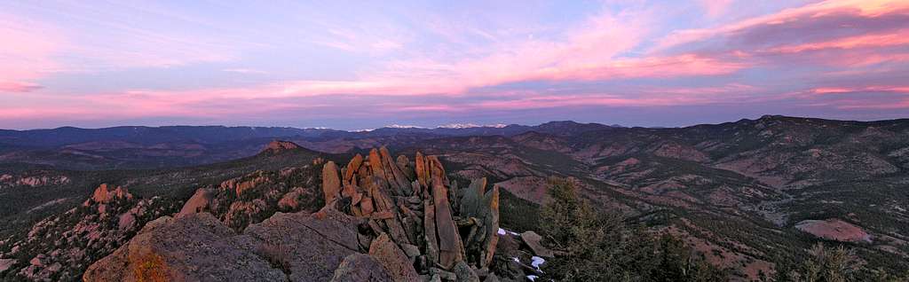
2-3-2008 Cathedral Spires
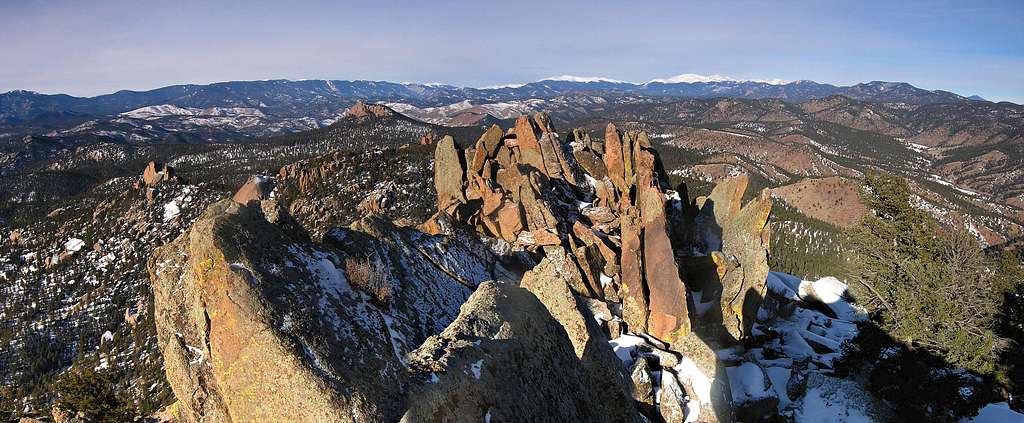

Cathedral Spires
RT-3 miles & 2,100-ft
Again, I climbed Cathedral Spires. This time I got to walk out onto the frozen South Platte River and enjoy a new view of this neat little peak I had never had before; a perspective worth setting up the tripod.
For reasons unknown this summit just doesn’t see too many visitors. I can’t explain it. Due to the easy access, stately look, solid class 3 scrambling, unabated view, and extremely interesting summit block, Cathedral Spires is my favorite peak within 45 minutes of Denver. November 23rd, 2006 was the last time I visited, and I spent the night on the summit where a huge flat slab of granite resides among the summit pinnacles. I watched the sunrise that Thanksgiving morning while sipping hot coffee.
I was likely the first one on the summit in 2008 due to the lack of any tracks in the deeper snow on its north shoulder. Once again the summit cone provided just what I needed; a nice stiff class 3 climb to the wide open summit.
Of note: there are two ways to attain the block. I prefer a nonstandard easy class 4 variation southwest side of the block, especially in winter when there is only measurable snow due to sun exposure. The standard line goes up the north side of the block, up through the lingering snow and is much easier.
1-20-2008-"Tarryall Peak" Lost Creek Wilderness
UN11,758 "Tarryall Peak"
11.5 miles & 3,400-ft
Twin Eagles TH
A while ago I made a pact with myself to summit my top 5 LCW peaks in dead winter, January to be more precise. I had made January ascents of Bison, McCurdy, Windy, Peak X and left the toughest for last, Tarryall Peak. In retrospect, McCudy via the standard likely would be the toughest but I don’t always use standard routes. BTW, Tarryall Peak resides in the Tarryall Range which is by far the best area of the LCW.
As of yesterday I feel I can speak to at least knowing the Lost Creek Wilderness very well. An all day trench digging affair under a cobalt blue sky, left me absolutely spent and willing to question my sanity. In fact, I routinely allowed myself to ponder if I actually enjoy this trail breaking thing. I must, considering I excavated one to two feet of sugar snow for 6 hours until I finally made the summit of Tarryall Peak. In the end it was worth the pain.
My slow going allowed me to reach the summit at 2:45 pm accompanied by what I call “Spiritual Light.” That’s the kind of lighting that makes me a religious man within his own cathedrals. In January, the sun never gets to high on the horizon, it’s what makes the days so short. However, it makes for great photo opportunities earlier in the day as opposed to spring summer. My 3:00pm photo shooting affair would be equivalent to a 6:00pm during mid summer. The bad news meant that I wouldn’t be getting back to my car until after dark.
Current conditions in the Tarryall’s calls for unconsolidated snow, and lot’s of it. I basically stepped out of my car and jumped into my trailbreaking snowshoes for the rest of the day. Most of the deeper snow resides in the trees where I experienced around two feet of snow from around the LCW wilderness sign to the junction with the Lake Park Trail. The route then traverses around the northeast side of Tarryall where the snow seemed deeper. I experienced close to 3 ft of snow with heinous drifts on the steeper north slopes closer to the summit plateau area. The small plateau was mostly blown clean, however there are linear rock towers that block easy passage to Tarryalls summit boulders. Negotiating these rock towers involved removing snowshoes a few times and some easy class 3 climbing. A few of these towers need to be traversed which includes more 4-ft drifts to plow through.