Toggle navigation
Mountains
Routes
Images
Trip Reports
Forum
What's New
People
Areas & Ranges
Articles
Trailheads
Canyons
Huts & Campgrounds
Albums
Logistical Centers
Fact Sheets
Lists
Custom Objects
Gear
Plans & Partners
WELCOME TO SUMMITPOST
SIGN IN
REGISTER
5/14/05: Looking down the...
View High-Resolution Image
5/14/05: Looking down the...
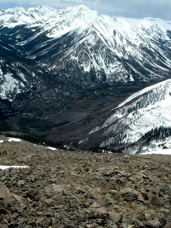
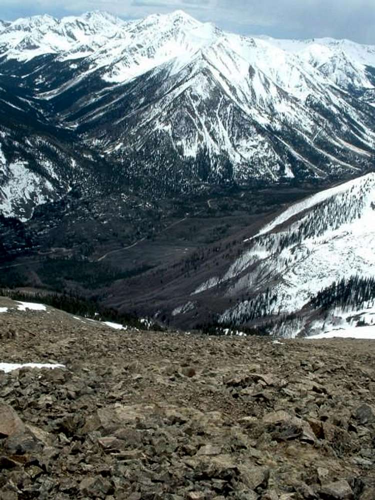
5/14/05: Looking down the southwest slopes of Quail Mountain. Huron Peak is in the background; Chaffee County road 390 runs through the valley. Sheep Gulch lies to the lower right.
« PREV
NEXT »
Brad Snider
on
May 15, 2005 1:20 pm
Comments & voting
Other parents
Lat/Lon:
39.01800°N / 106.3946°W
Image ID:
105114
2752 Hits
77.26
% Score
9
Votes
Log in to vote
Comments
No comments posted yet.
to post!
Don't have an account?
Quail Mountain
(Mountain/Rock)
You are at
the First
Image
Viewing
#1 of 1
GALLERY
You are at
the Last
Image
Brad Snider's Image Gallery
« PREV
Viewing
#138 of 700
GALLERY
NEXT »
Quail Mountain
(Mountain/Rock)
Loading....
×
You need to login in order to vote!
User Name
Password
Remember me
Forgot your password?
Log me out when I close my browser.
Keep me logged in all the time.
sign in as a user
Don't have an account?
Register now for FREE
Rating available
Suggested routes for you
People who climb the same things as you
Comments Available
Create Albums
Register Here


