
|
|
Mountain/Rock |
|---|---|
|
|
48.63816°N / 121.63383°W |
|
|
Skagit |
|
|
5587 ft / 1703 m |
|
|
Overview
Welker Peak is a 5587' summit located nine miles northeast of Concrete, and 11 miles northwest of Marblemount. It is bound on the north by Anderson Creek, on the east by Watson Creek, on the south by Thunder Creek, and on the west by Lake Shannon and Baker Lake.
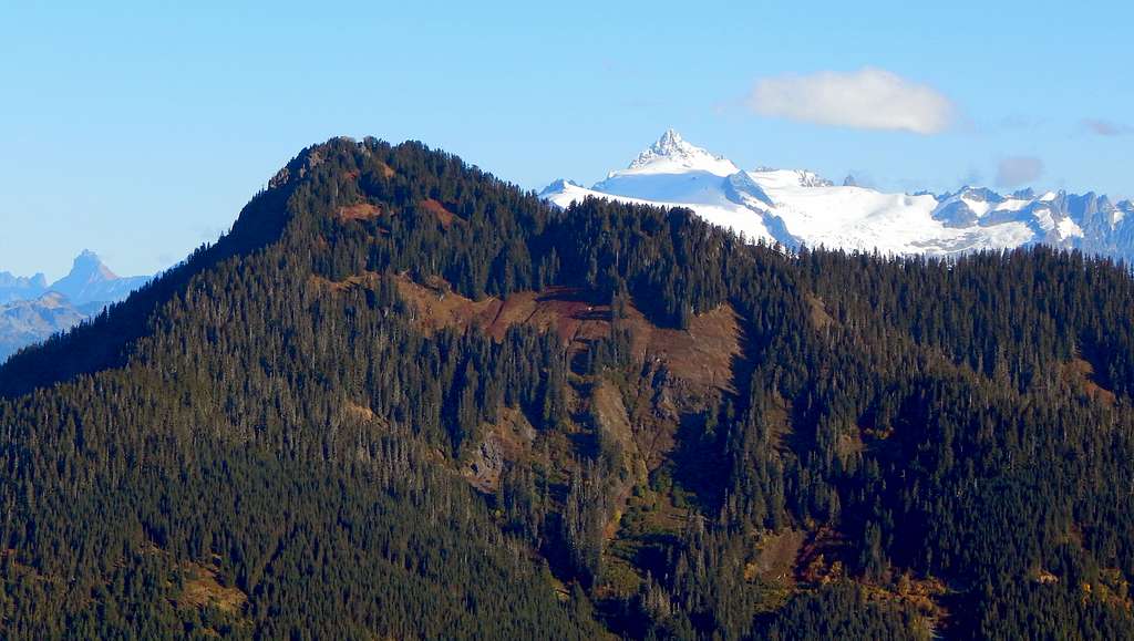
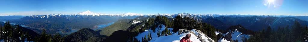
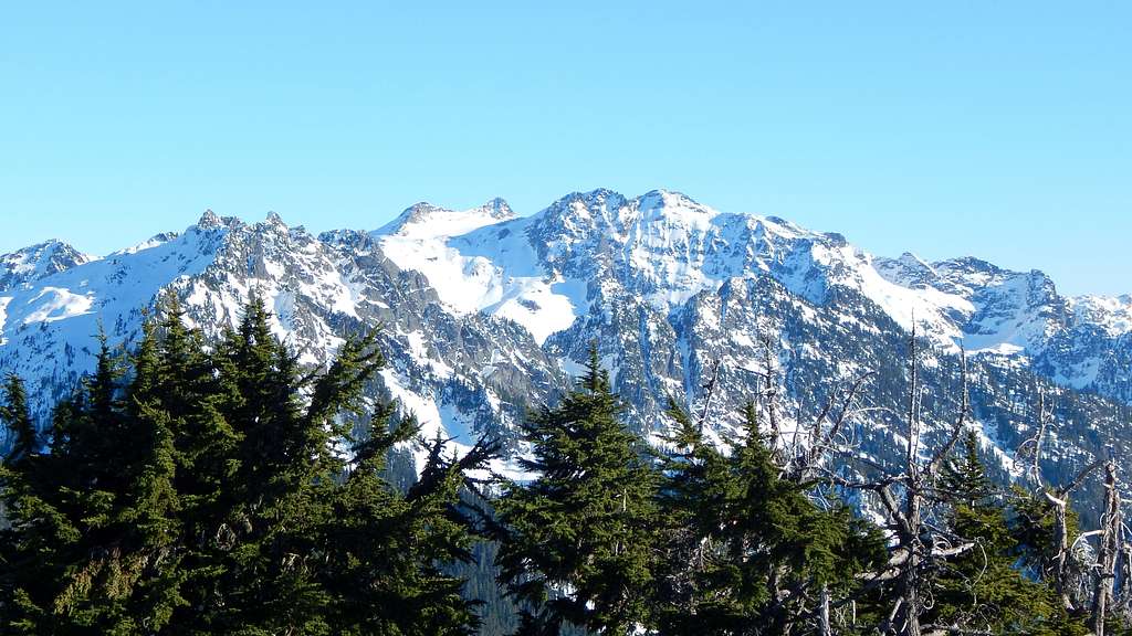
When quickly viewed from a distance, Welker Peak appears to have a forested summit, and therefore, not much promise as a viewpoint. Closer inspection, however, reveals a rocky promontory that rises just high enough to provide unrestricted 360 degree views. Additionally, numerous small meadows and rock slopes provide peakaboo views of the North Cascades while traveling via the 'standard' route.
For the peakbagger, Welker Peak offers a healthy 1167' of prominence. For those with extra time and energy, two extra peaks in the immediate vicinity may offer additional entertainment - 'Widgit' and 'Wobegone'.
Getting There
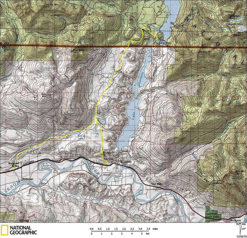
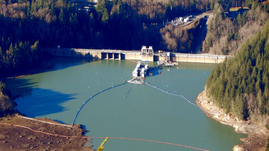
From Highway 20, turn north on Baker Lake Road, at a point 16.2 miles east of Sedro-Woolly (alternatively, one could take Burpee Hill Road out of Concrete). Follow Baker Lake Road for 13.7 miles, then turn right on the road to Baker Lake Dam. After crossing the Baker Lake Dam (1.7 miles), the road will turn to gravel and become Anderson Creek Road (FR1107). Follow FR1107 4.8 miles to the point marked as 2451T on USGS maps and park. This will be immediately before a fairly substantial tributary of Anderson Creek.
Route
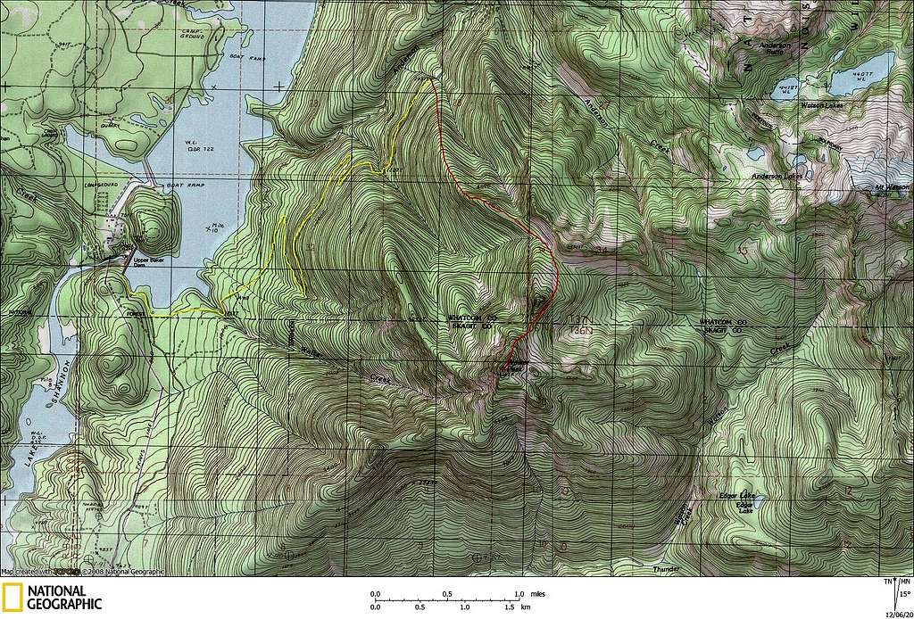
From the parking location, head straight uphill S/SE, keeping the aforementioned tributary creek within earshot on your left. Within 500 vertical feet, the ridge will be well defined, with one or two small cliff bands that are easily bypassed. Brush is minimal, and only rates a 2 or 3 on the Cascade Brushwhacking Scale. After 2000 vertical feet of climbing, you will encounter a 4480' high point on the ridge - go directly up and over. Here you will get your first good view of Welker Peak's summit.
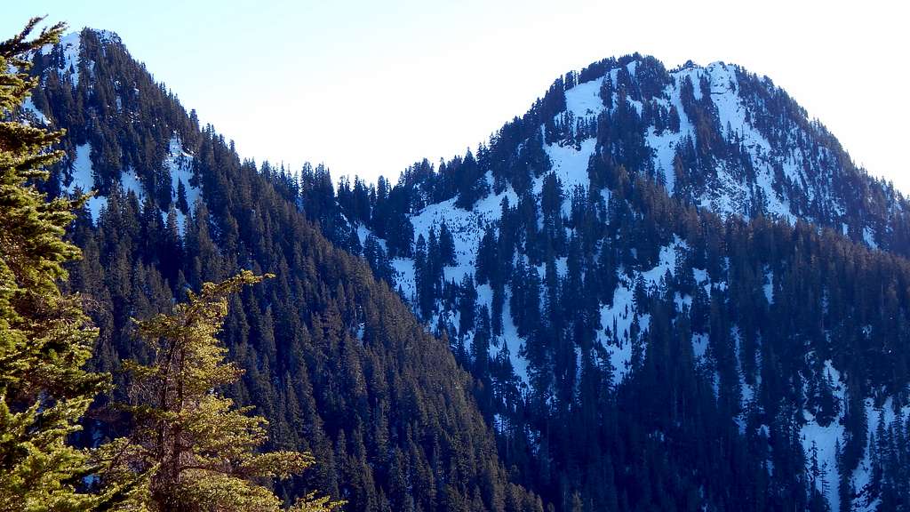
After dropping off the 4480' high point, ascend slightly SE to the 4620' saddle between 'Wigit' (5320'+) and 'Wobegone' (5202'). Now turn south and make an oblique traverse upwards, with the goal of passing around Wigit's east flank between 4800' and 5000'. From the saddle between Wigit and Welker Peak (4940'), head S/SW up Welker's north ridge, which will be a steep, forested slope. Pass over a small false summit at 5550', then continue a short distance to the true summit.
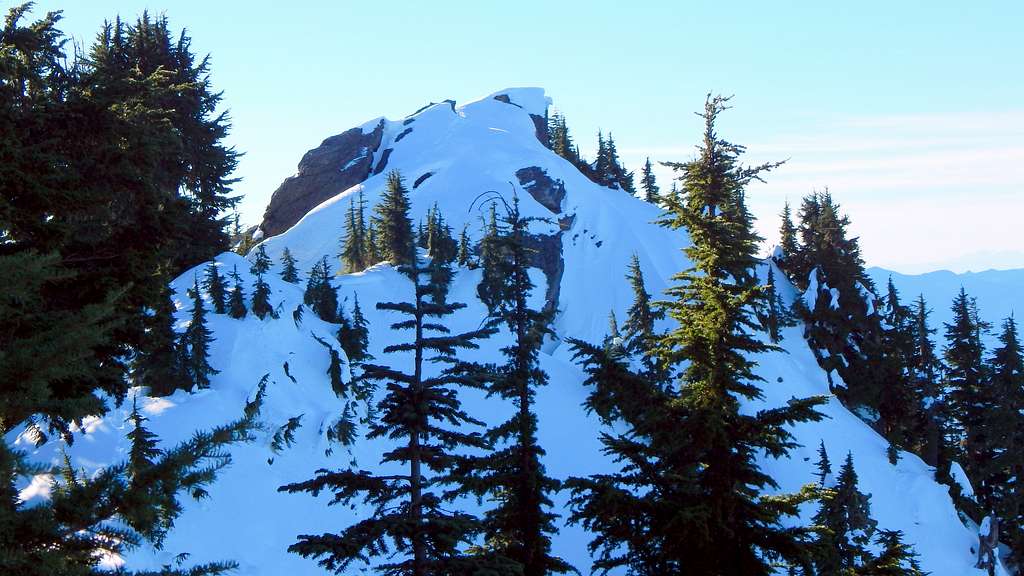
Depending on snow conditions, it may be advantageous to wrap around the summit clockwise and make the final ascent from the south. As is the case with so many other Cascade peaks, beware of the summit cornice as you near the top.
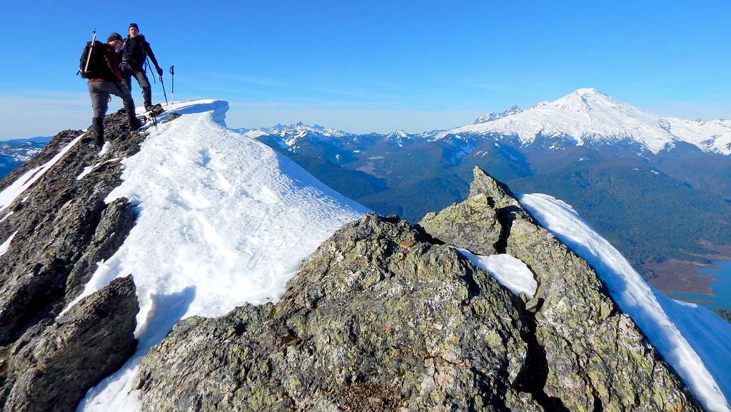
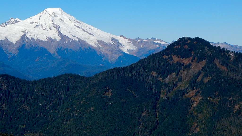
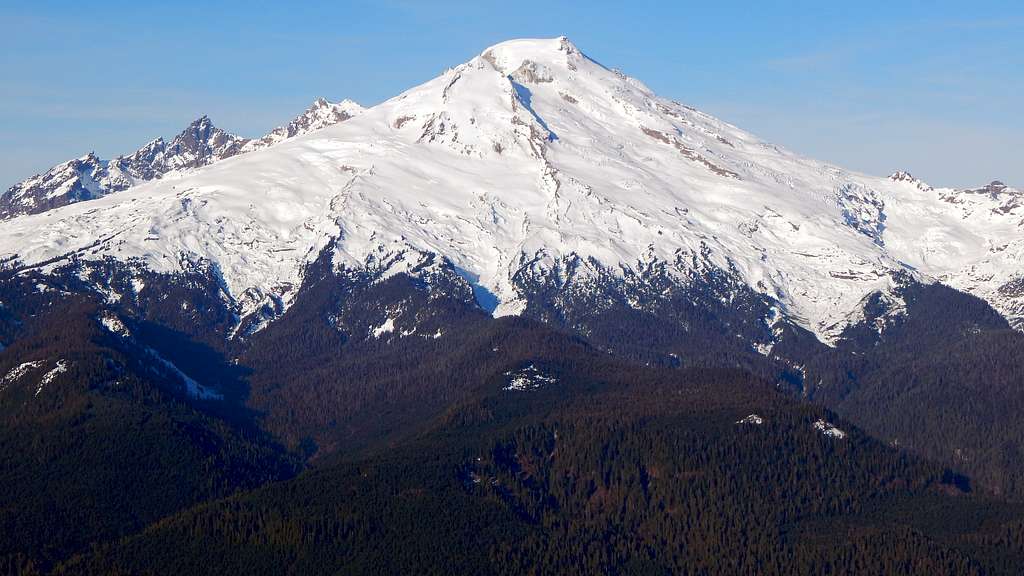
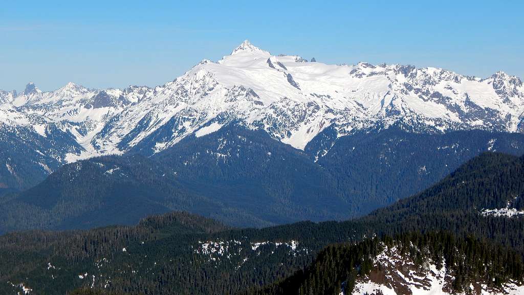
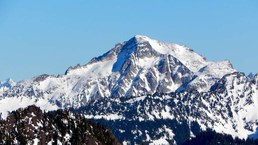
Welker Peak is well positioned for great views, with Mount Baker and Mount Shuksan dominating the skyline to the north.
Red Tape
A Northwest Forest Pass is not required at the starting location. In theory, a Snow Pass permit is required to drive up Anderson Creek Road in the winter.
When to Climb
Any time the Anderson Creek Road is driveable and the avalanche conditions are reasonable. Welker Peak makes a fine winter or spring ascent under the right conditions.
Camping
There are numerous camping opportunities in the Baker Lake area, which I will not attempt to describe here. For those wanting to camp on the mountain, the open areas between 'Wigit' and 'Wobegone' would probably make fine camp sites.