Toggle navigation
Mountains
Routes
Images
Trip Reports
Forum
What's New
People
Areas & Ranges
Articles
Trailheads
Canyons
Huts & Campgrounds
Albums
Logistical Centers
Fact Sheets
Lists
Custom Objects
Gear
Plans & Partners
WELCOME TO SUMMITPOST
SIGN IN
REGISTER
Ślęża Massif
Additional Parents
Image
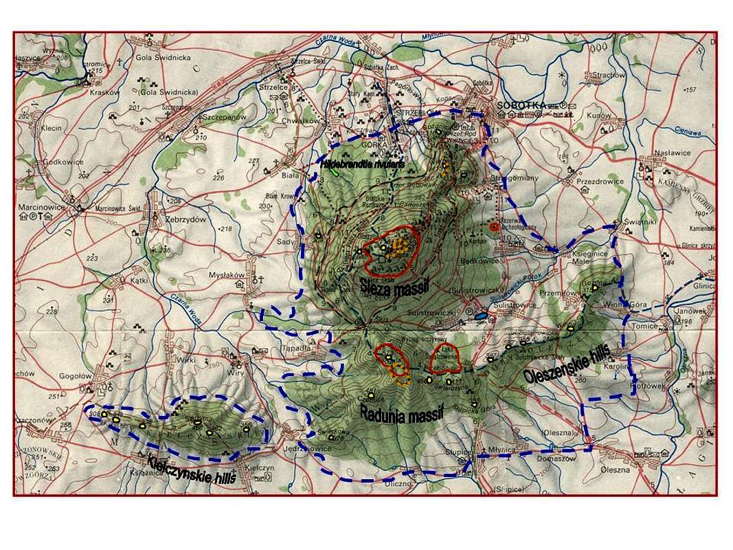
A map of the Sleza Massif
View High-Resolution Image
A map of the Sleza Massif
Borders of the Slezanski Landscape Park are blue outlined. Nature reserves are in red and stone cult circles in orange. Summits are yellow and outlined in black.
« PREV
NEXT »
Romuald Kosina
on
Feb 17, 2007 3:08 pm
Comments & voting
Other parents
Lat/Lon:
50.86209°N / 16.71175°E
Image Type(s):
Topo/Diagram
Image ID:
270492
3232 Hits
74.01
% Score
4
Votes
Log in to vote
Comments
No comments posted yet.
to post!
Don't have an account?
Ślęża Massif
(Area/Range)
« PREV
Viewing
#57 of 167
GALLERY
NEXT »
Romuald Kosina's Image Gallery
« PREV
Viewing
#933 of 3537
GALLERY
NEXT »
×
You need to login in order to vote!
User Name
Password
Remember me
Forgot your password?
Log me out when I close my browser.
Keep me logged in all the time.
sign in as a user
Don't have an account?
Register now for FREE
Rating available
Suggested routes for you
People who climb the same things as you
Comments Available
Create Albums
Register Here


