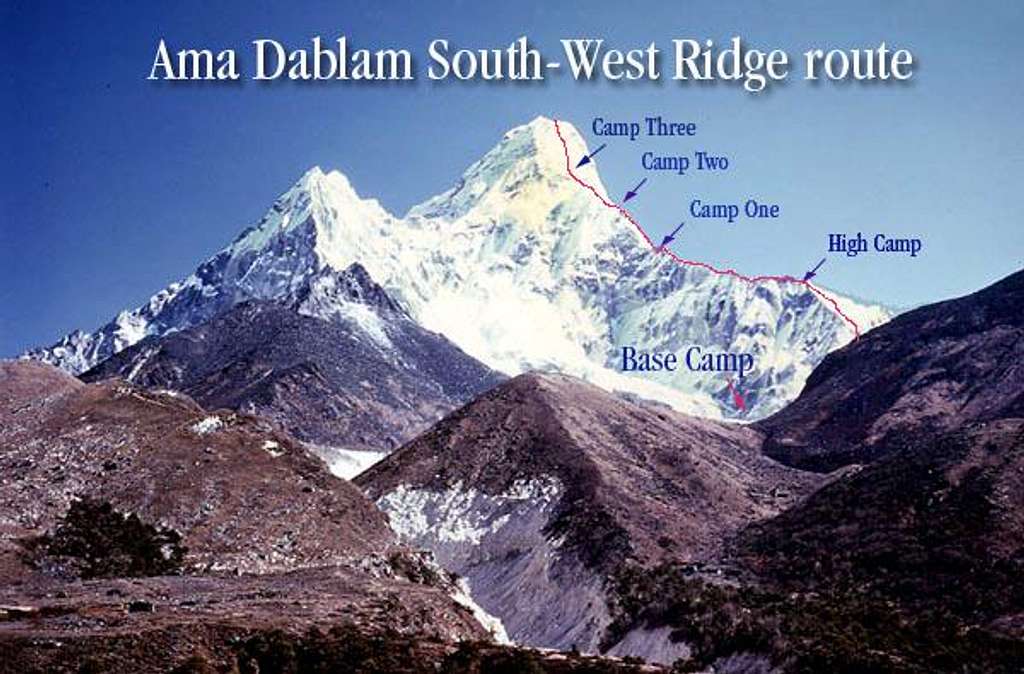
A rough outline of the...
A rough outline of the South-West Ridge route on Ama Dablam. Part of the route is hidden by the hill on the right. Base camp 15,200 ft., There is an intermediate camp called High camp (for some reason), Camp One 19,200 ft., Camp Two 19,790 ft. and Camp Three 20,098. All altitudes are approx. William Marler 1982


