Toggle navigation
Mountains
Routes
Images
Trip Reports
Forum
What's New
People
Areas & Ranges
Articles
Trailheads
Canyons
Huts & Campgrounds
Albums
Logistical Centers
Fact Sheets
Lists
Custom Objects
Gear
Plans & Partners
WELCOME TO SUMMITPOST
SIGN IN
REGISTER
Peak 10
Additional Parents
Image
A TOPO Route of the East...
View High-Resolution Image
A TOPO Route of the East...
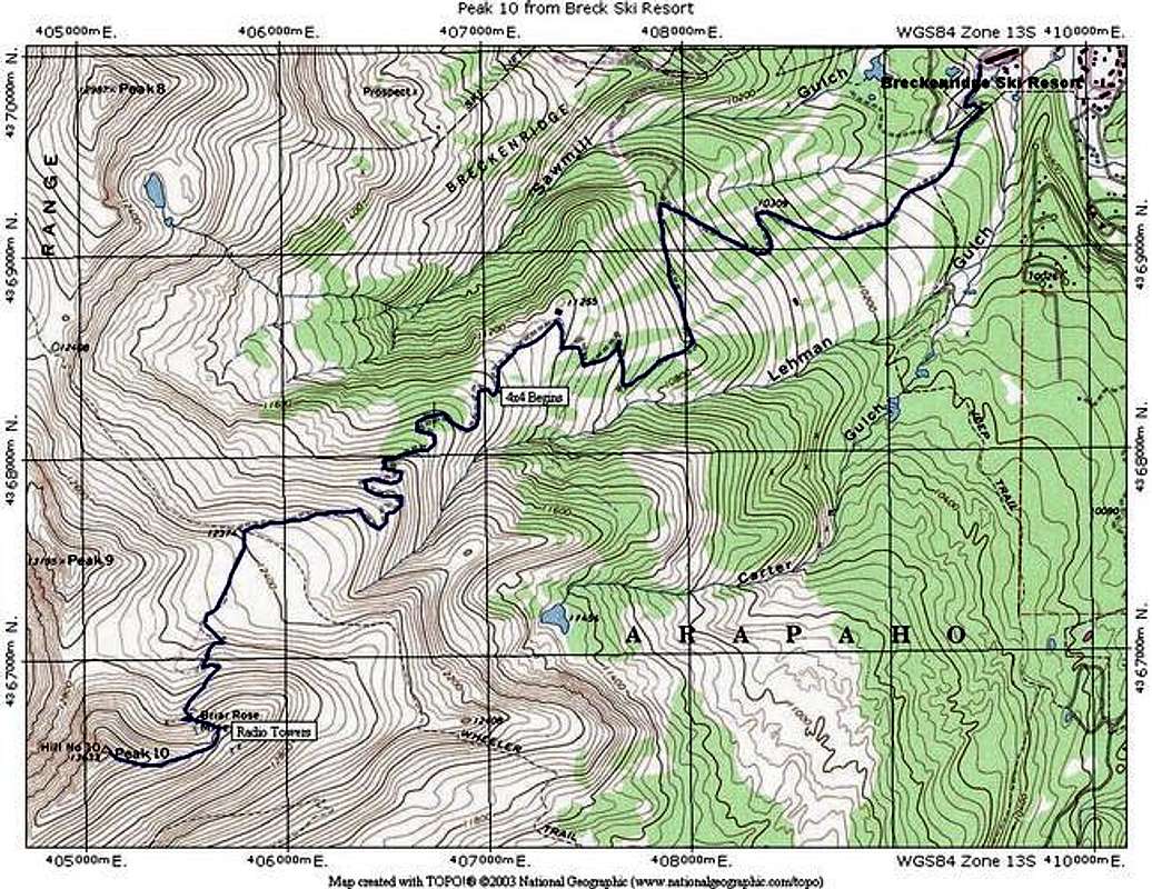
A TOPO Route of the East Ridge via Breckenridge Ski Resort Route. This TOPO shows the entire route from the bottom of Breck Ski Resort, assuming that the climber parks there.
« PREV
NEXT »
Ed F
on
May 17, 2005 1:41 pm
Comments & voting
Other parents
Lat/Lon:
39.44310°N / 106.102°W
Image ID:
105545
4022 Hits
71.06
% Score
1
Votes
Log in to vote
Comments
No comments posted yet.
to post!
Don't have an account?
Peak 10
(Mountain/Rock)
« PREV
Viewing
#41 of 50
GALLERY
NEXT »
Ed F's Image Gallery
« PREV
Viewing
#821 of 962
GALLERY
NEXT »
East Ridge via Breckenridge Ski Area
(Route)
Loading....
×
You need to login in order to vote!
User Name
Password
Remember me
Forgot your password?
Log me out when I close my browser.
Keep me logged in all the time.
sign in as a user
Don't have an account?
Register now for FREE
Rating available
Suggested routes for you
People who climb the same things as you
Comments Available
Create Albums
Register Here


