
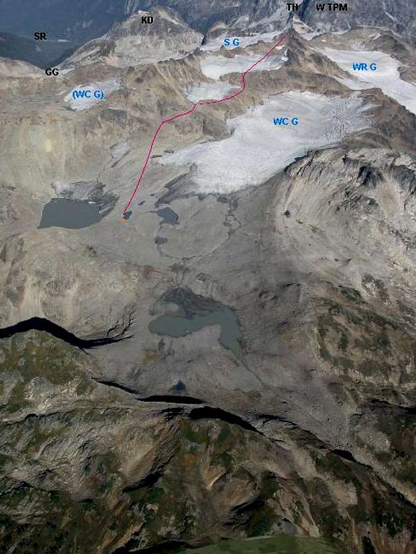
A view of the West Route to...
A view of the West Route to Kololo's summit (from my camp at the orange dot...note that I only came down this way).
Aerial photo by John Scurlock. Used with permission.
GG - Glacier Gap; SR - Suiattle River; SG - Suiattle Glacier; KD - Kopeetah Divide; TH - The Hive; W TPM - Tenpeak Mountain, West Peak; WR G - White River Glacier; WC G - White Chuck Glacier.


