
|
|
Mountain/Rock |
|---|---|
|
|
25.38833°S / 49.00222°W |
|
|
Parana |
|
|
Hiking, Mountaineering, Sport Climbing, Toprope, Bouldering, Scrambling |
|
|
Fall, Winter |
|
|
4757 ft / 1450 m |
|
|
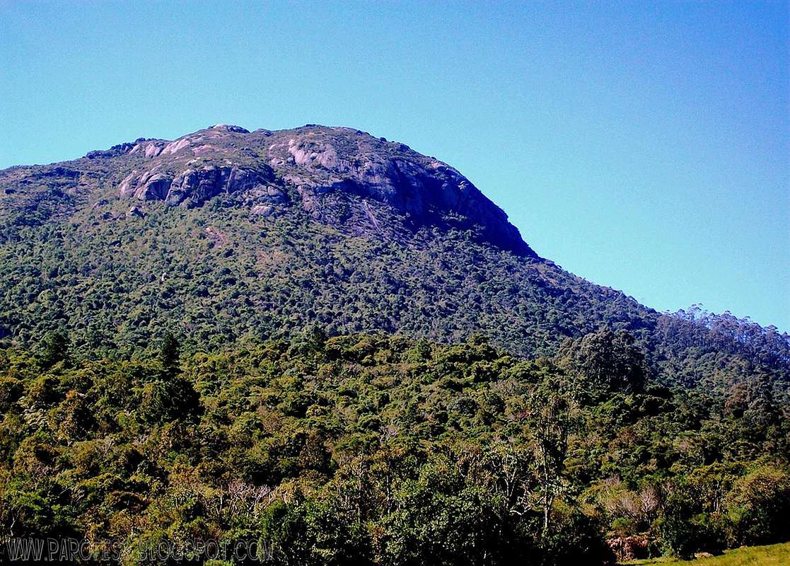
The name Anhangava means "Devil's house" in Tupi-Guarani and there is no news of the first ascent, but inside the Urubu Cave there are inscriptions of the XVII century. At the beginning of the century XX was established a Catholic pilgrimage to the creation of a "Via Crucis" composed of 14 crosses that ended in a chapel at the South Summit (in mid-1940), and began the exploration of the first rock climbing routes that would eventually transform the mountain in a true school for the sport. The extensive rock walls of its upper slopes offer several technical challenges, from simply walking up to the summit rock climbing classified as grade III to IXa.
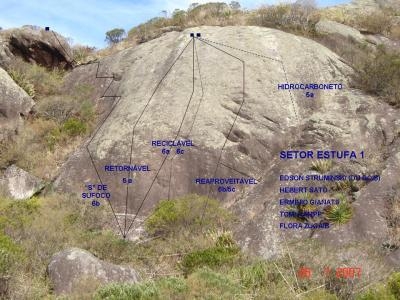
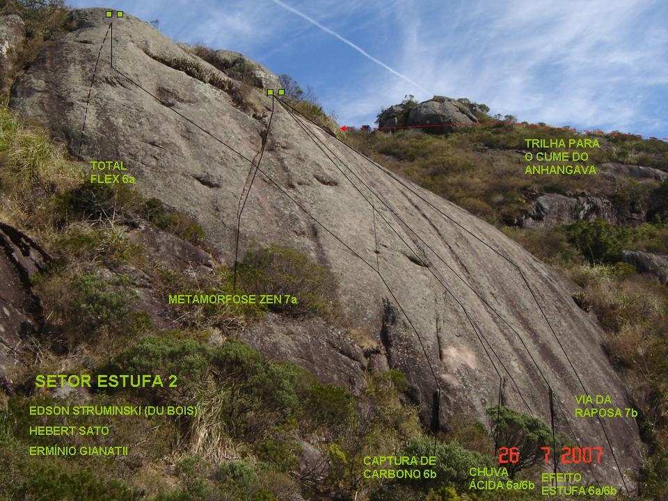
Besides the easy access, Anhangava has an excellent mountain hut called "5.13" at the base and a comprehensive manual that describes maps to 174 (one hundred seventy four) rock climbing routes, all of them sport routes, separated by difficulty, indicating access, care and needed gear.
Atop Anhangava you get rewarded with stunning views to several local peaks and cities. At night can be very cold and crowded (around 0°C. Chill of around -10°C). Take all care you possibly can. A couple years ago a small group got lost at Anhangava, so a group on voluntary work went to the mountain to help them. One voluntary guy didn't see a big hole by the trail. He suffered a fall of about 40ft and died inside the hole that barely could fit him. Even though, the trail leaving from 5.13 hut is very well marked, it takes about one hour from the hut to the summit. Anhangava is hiked daily by people from Clube Paranaense de Montanhismo (Paraná Mountain Club), and some local people. At weekends, probably a couple dozens of people should be expected at the summit.
 |  |
|---|---|
 |  |
Getting There
The biggest city and airport nearby is Curitiba. From there you need to take the bus Curitiba / Quatro Barras in Guadalupe Bus Terminal and arriving at Terminal at Quatro Barras, keep boarding the treeline. Anyone wishing to ride a bike, motorcycle or car, must take the BR-116 turning right when you reach the intersection that leads to Quatro Barras.Red Tape
At all costs, forbidden to make fire and deforest any area. Sometimes people get lost inside the woods for a long time, be advised, Paraná Sierras can be very tricky. It's always good to be with someone that knows the trails if you wish to walk around that area.Camping
At the very summit it's not possible, too many rocks and the ground is not even. At the base of the mountain there is a hut called "5.13", it offers hot meals, artificial wall 20ft tall for practive, slackline, fireplace, and sleeping place for at leats 30 people.The night costs R$ 20,00 (around 13 US$). You can cook yourself a meal or you can ask for a ready one inside the hut, or you can ask for pizza since the refuge and the mountain itself are very close to the city.
Of course, behind the hut is a great grassy area for camping, you can set up your own tent if you want to. But if you're gonna use the beds, bring your sleeping bag with you.
Access the website for the hut 5.13:

Weather forecast

Legal issues
To hike/ climb is a dangerous activity and requires proper equipment and clothing, the owner of this page cannot be blamed by injuries caused to anyone who read this page for its info about the mountain, and eventually got hurt by doing so with reckless behaviour or bad weather conditions.
Paulo Roberto Felipe Schmidt – AKA: PAROFES
External Links
My youtube channel: www.youtube.com/parofes - Now with 270+ videos online!The biggest brazilian website about climbing and mountaineering, for which I'm a columnist: