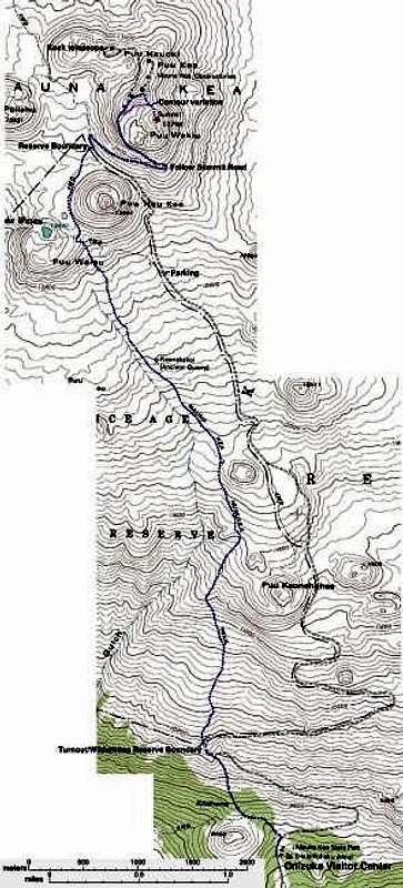
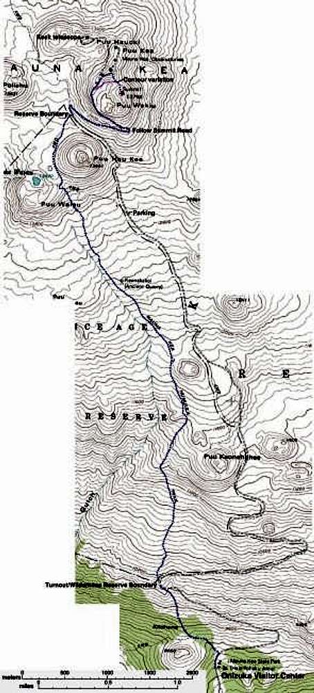
Annotated topographic trailmap of Mauna Kea trail. Trail follows abandoned dirt road from Visitor Center to Reserve Boundary at 10000. Trail ends at 13200'. Take paved road to summit. To avoid losing 100 feet of elevation, contour toward summit saddle from paved road at 13600'.
Much larger version here. Map made by Morgan Brown, with "help" from topozone.com.


