Also here the "Age of Romans" existed. Yes, because after the Celts from the North and Salassi by East or Provence came the Romans on their way to Gaul. But then, after trips to the Alps Graia Poenina up by the III° Century BC to fight Tigurini, they stopped by eliminating the Salassi and the ancient
between 25/23 BC, always before the New Age. So, inevitably, they have colonized the area by appropriating property and estates.
So it was also for the Villages of Aymavilles and Villeneuve, (respectively 7.4 and 10 miles to the West from Aosta City), where the Roman settlement has left obvious signs of a complete domination. And it seems that the first was founded by two Patricians or
"Aymus et Avilius", one from Verona and the other from Vicenza as stated in an ancient tradition in the Village of
"Pont d'Ael", currently Pondel. But on the inscription on the North side of the bridge dated 3 BC it reads so as acted in such a manner:
IMP CAESARE AVGVSTO XIII COS DESIG
C AVILLIVS C F CAIMVS PATAVINVS
PRIVATVM
Who entirely completed becomes unequivocally as
"Imperator Caesare Augusto XIII° Consul designatus Gaius Avillius Gaii filius Caimus Patavinus PRIVATUM", or else
"At the time the Emperor Augustus Caesar was appointed consul for the 13th time, Caio Avillio Caimo Padua, son of Caius, (It built this bridge) with private means".
A small humane settlement located in a horrible ravine, where the Grand'Eyvia Torrent, also collected waters from the Trajo or Traso and again Trayo Glacier below the
Grivola (3968m) and from Grand Nomenon Vallon just above the Villages
Sylvenoire and Vieyes, is wedged between high and smooth rock walls at the base of the Eastern Slope of Mont-de-Poignon
(1567m) at the end of the watershed, coming from La Grivola and
Grand Nomenon (3488m) and separating the Valleys of Cogne and Savara, ending just above Châtel Argent and the Municipality of Villeneuve. Going from Aymavilles, after the junction of the Church of St. Léger (to the right or West towards Villeneuve) and immediately after the beautiful
Aymavilles Castle built by the Counts of Challant in 1357, a long straight leads into the Valley of Cogne. After passing the locations of Creux, Champsolin, Caouz
(827m), Poyaz, with great views of Mont Blanc, it will come across a junction on the right which goes down (brown sign) to Pondel tiny Hamlet; a steep and narrow asphalt road reaches the village (
893m, parking) and with a small path the nearby bridge
(880m). An inscription outside the Northern center of the arc of the same shows
"Aimo and Avilio" as the builders of this work, probably in
750 "ab urbe condita", or 750 years since the founding of the Rome City, then in the
Third Century A.D.
This work is seen as of almost a relic all of the grandeur of Rome and is formed by an arch suspended
over fifty metres above the Grand'Eyvia, who hails from Cogne on the slopes of Gran Paradiso, and two passages, one covered and the other no, on the same; the second, it seems, was used for the passage of the waters for the irrigation of the fields while the first was intended to transit. Dual hypothesis that leaves many confusions and perplexities, as we shall see later. Its length amounts to
about fifty metres, while between the two steps there is a height of
4.12 metres and width is a
total of 2.26 metres, including lateral walls, and one destined to pass of
1.08 metres. But because we use the conditional? For the reason that this splendid work is linked to the near
Châtel Argent (just above Villeneuve) in a combination that appears to most as a real
Historical Mystery
Anche qui é esistita l'"Era dei Romani". Si, perché dopo i Celti dal Nord ed i Salassi dall'Oriente della Provenza sono arrivati pur i Romani in viaggio per le Gallie.
Ma poi, dopo i viaggi verso l'Alpe Graia e Poenina fino dal III° Secolo avanti Cristo per combattere i Tigurini, si sono fermati eliminando i Salassi e l'antico Borgo di
Cordelia e fondando
Augusta Praetoria Salassorum tra il 25 ed il 23, sempre prima della Nuova Era. Quindi, inevitabilmente, hanno colonizzato i dintorni appropriandosi di beni e poderi.
Così é stato anche per i Villaggi di Aymavilles e Villeneuve (rispettivamente a 7,4 e 10 Kilometri verso Occidente da Aosta Città), dove lo insediamento romano ha lasciato segni evidenti di una dominazione completa. Tanto che sembra che la prima é stata fondata da due Patrizi o
"Aymus et Avilius", uno proveniente da Verona e l'altro da Vicenza come recita un'antica tradizione presso la località di
"Pont d'Ael", attualmente Pondel. Ma l'iscrizione sul lato Nord del ponte datata 3 avanti Cristo recità così parlando d'un padovano:
IMP CAESARE AVGVSTO XIII COS DESIG
C AVILLIVS C F CAIMVS PATAVINVS
PRIVATVM
Che così completata diventa inequovicabilmente come
"Imperator Caesare Augusto XIII° Consul designatus Gaius Avillius Gaii filius Caimus Patavinus PRIVATUM", od
"Al tempo in cui l'Imperatore Cesare Augusto nominato Console per la 13ª volta, Caio Avillio Caimo da Padova, figlio di Caio, (ha costruito questo ponte) con mezzi privati".
Un piccolo insediamento umano collocato in un'orribile forra tra verticali e bagnate pareti rocciose, là dove la Grand'Eyvia, raccolte anche le acque provenienti dal Ghiacciaio del Trajo o Traso ed ancora Trayo sottostante la
Grivola e dal Vallone del Grand Nomenon sopra i Villaggi di
Sylvenoire e Vieyes, s'incunea tra alte e levigati dirupi rocciosi alla base del Versante Orientale del Mont-de-Poignon
(1567 m) al termine dello spartiacque che, arrivando dalla Grivola
(3968 m) e Grand Nomenon, separando Valli di Cogne e Savara, termina proprio su Châtel Argent ed il Comune di Villeneuve. Salendo da Aymavilles, dopo il bivio della Chiesa di Saint Léger (a destra od Ovest verso Villeneuve) nonché subito dopo il bel
Castello d'Aymavilles costruito dai Conti di Challant nel 1357, un lungo rettilineo in progressiva ascesa introduce alla Valle di Cogne. Superate le località di Creux, Champsolin, Caouz
(827 m) e Poyaz, con grandi vedute sul Monte Bianco, si incontra sulla destra un bivio che scende (cartello marron) a Pondel; una ripida e stretta stradina in asfalto raggiunge il Villaggio (
893 m; parcheggio) ed un sentierino il viciniore ponte
(880 m). Una iscrizione esterna al centro dell'arco del medesimo indica
"Aimo ed Avilio" come i costruttori di questa opera, Probabilmente nel
750 "ab urbe condita", ovverossia a 750 anni dalla fondazione di Roma e quindi nel
III° Secolo Anno Domini.
Quest'opera risulta come cimelio quasi integralmente conservato della grandezza di Roma ed é formata da un arco sospeso ad
oltre cinquanta metri sopra il Torrente Grand'Eyvia, proveniente dal Comprensorio di Cogne alle pendici Orientali del Gran Paradiso
(4061 m), nonché da due passaggi, uno ricoperto e l'altro no, sopra lo stesso; il secondo, sembra, servisse per il passaggio delle acque destinate all'irrigazione dei campi, mentre il primo par fosse destinato al transito di persone e bestiame. Un'ipotesi duplice che lascia perlomeno alquante perplessità, come vedremo in seguito nella nostra disamina. La sua lunghezza ammonta ad una
cinquantina di metri, mentre tra i due passaggi si registra un'altezza di
4,12 metri e la larghezza risulta di
complessivi 2,26 metri, due murature comprese, e quella atta al passaggio di
1,08 metri. Ma perché abbiamo utilizzato il condizionale? Perché questa splendida opera si lega al circondario del vicino
Châtel Argent, emblema di tutto questo territorio, in un connubio che appare ai più come un
Mistero Storico
But the mystery deepens going to Castle Châtel Argent, on a rocky promontory always under the Mont-de-Poignon, just above the Municipality of Villeneuve.
While Pont d'Ael is located on the Eastern slope of this mountain above the Grand'Eyvia, this manor is located on the North dominates the Dora Baltea. Two rivers that meet at the Municipality of Aymavilles, in turn dominated by its Castle.
Châtel Argent was built in XI° Century by the Lords of Bard who later shared the property with those of Saint Pierre until 1605 when it became the property of Baron Leonardo Roncas Aosta. So far nothing special, following a script normal for those times. Everything always under the control of the
House of Savoy. Instead it becomes interesting to find that the building has been built largely by removing the paving stones on the large
Consular Road of Mont Jovis, or of the Little St. Bernard, and from a bridge, always Roman, destroyed by the floods. What remains today is an area of
about 6300 square metres and contained by a wall of
90 x 70 metres. It is calculated that could hold 2,000 armed men, a guard more than enough, along with those of Montjovet Bard in
"Lower Valley", to control the Central as a strategic location.
But what danger? Logically from the barbarian invasions and were certainly not the Lords of Bard or St. Pierre, Counts Challant, tiny Barony Roncas or the Grand Duchy of Savoy, who had to defend themselves from these wild external forces. Only Rome could have a strategy so enlarged and a force so impressive.
But then the Romans were already long before in Châtel Argent? Of course, as they were in Pont d'Ael.
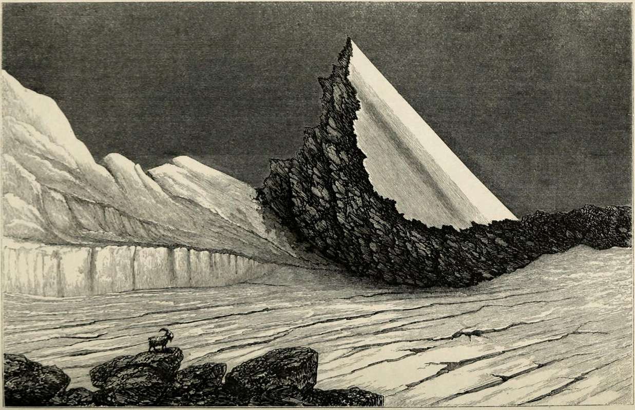
![]() Mont-de-Poignon a link between Aymavilles Villeneuve (Cogne/Savarenche Valleys),
Mont-de-Poignon a link between Aymavilles Villeneuve (Cogne/Savarenche Valleys),
by SalVal 2006
Ma il Mistero s'infittisce andando a Châtel Argent, in un promontorio roccioso sempre al di sotto del Mont-de-Poignon ed appena sopra l'abitato di Villeneuve.
Mentre il ponte di Pont d'Ael o Pondel é collocato sul Versante Orientale di questa montagna al di sopra del Torrent Grand'Eyvia, questo maniero sorge su quello più Settentrionale dominando il corso della Dora Baltea prima di arrivare ad Aymavilles e quindi ad Aosta Città. Appunto due fiumi che si riuniscono presso il Comune di Aymavilles, a sua volta dominato dall'omonimo Castello.
Châtel Argent é stato costruito nel XI° Secolo da parte dei Signori di Bard, che in seguito condivisero la proprietà con quelli di Saint Pierre fino al 1605 quando divenne proprietario il Barone Leonardo Roncas di Aosta. Fino a qui nulla di particolare, seguendo un copione piuttosto normale per quei tempi. Tutto ciò sempre sotto il ferreo controllo di
Casa Savoia. La cosa invece diventa interessante scoprendo che la costruzione é stata realizzata in gran parte asportando le pietre del selciato sulla grande
Via Consolare del Mont Jovis, ovvero del Piccolo San Bernardo, e da un ponte, sempre romano, distrutto dalle alluvioni. Quello che oggigiorno rimane consiste in una area di
circa 6300 metri quadrati e contenuta da una cinta muraria di
90 x 70 metri. Viene calcolato che poteva contenere 2000 uomini armati, un corpo di guardia più che sufficiente, insieme a quelli di Montjovet e Bard in
"Bassa Valle", per controllare tutta la Valle Centrale da una posizione strategica.
Ma da quale pericolo? Logicamente dalle invasioni barbariche e non erano certamente i Signori di Bard o di St. Pierre, i Conti di Challant, la piccola Baronia dei Roncas od il Granducato di Savoia che dovevano difendersi da queste selvagge e prorompenti forze esterne. Solo la grande Roma poteva possedere e mantenere una strategia così lata ed un forza così imponente.
Ma allora i Romani erano già da molto tempo prima a Châtel Argent? Certo, come lo erano a Pont d'Ael.
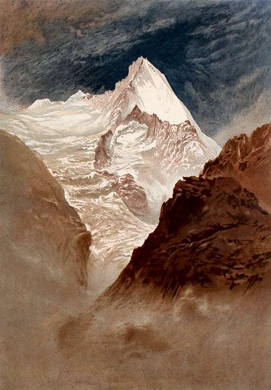
All at the feet of "Grivolayes & Noumenùn"
![]() "Grivolayes" above Sylvenoire, Crétaz & Pondel in Cogne Valley,
"Grivolayes" above Sylvenoire, Crétaz & Pondel in Cogne Valley,
by Elijah Walton - 1858 & submitted by om 2015
The Romans had come to Châtel Argent already in the Third Century BC, as the Pont d'Ael, Aymavilius, Juventanum, Gratianum and up to Augusta Praetoria.
If it is true that the castle ruins visible today date from the Thirteenth Century, namely the construction of the castle would date in 1275 by James of Saint Georges, architect of Count Peter II° of Savoy, is equally true found that the rocky-marble promontory on which stand the same was already occupied in prehistoric times. It occurs confirmation by the discovery of a proto-historic anthropomorphic stele, and subsequently was occupied in Salassian Age and Roman Epoch and then a fortification, as mentioned above, guarding the valley. Between the Church of St. Colomba, immediately to the East of the castle are still some traces of quarries bardiglio from Roman times, a marble in silicates, and other quarries of a later period, one of which, to the North of the headland, active between the Thirties and Seventies of Ttwentieth Century. According to scholars the name of Châtel-Argent is derived from existing brand, for
"argent" that in French It means money. In support of this view, recent surveys confirm that the name of
Castrum Argenteum was already in use around 1175. But the surprise of most
"revolutionary", which opens
a new stage curtain, which consists in the fact that Pont d'Ael Châtel Argent were connected by an ancient brook with
1 m wide and just as deep. The same, of which there are still traces, started from the vicinity of the Bridge of Laval
(1364m) on the Regional Road towards Cogne between the Faction of Vieyes (Aymavilles) and that of Epinel (Cogne) and continue through the valley reached Pondel Bridge. After crossing the covered lane on the same it was targeting to Côte Villeneuve and then Châtel Argent. But all this work and with a job so daring and dangerous, suspended above the here murky waters of Cogne's Valley, not to make an irrigation system and how they continue to tell scholars. But because on the bridge, stretching the
"lenzuola" (the sheets), they were sifted waters
in search if not least of gold nuggets surely of
small golden straws of which Grand'Eyvia was rich in this part of its course. The circle is closed by solving the
"busillis" or mysterious snag and explaining both the work of Pondel that the name of Châtel Argent, where the coins were minted by and for the Empire.
Down at the Farm of Patrician Petilio Saturnino, under the gaze of Grivola and at Châtel Argent. But this is a secret that I can not and I will not reveal to You ...
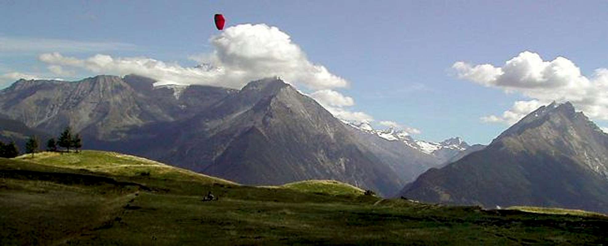
![]() Entrance on Cogne Savarenche Valleys up to Poignon-Bca Plana-Valletta-Favret-Nomenon & Grivola
Entrance on Cogne Savarenche Valleys up to Poignon-Bca Plana-Valletta-Favret-Nomenon & Grivola
by livioz 2002
I Romani erano giunti a Châtel Argent già nel III° Secolo avanti Cristo, come a Pont d'Ael, Aymavilius, Juventanum, Gratianum e fino ad Augusta Praetoria.
Se é vero che i ruderi del castello oggi visibili risalgono al XIII° Secolo, più precisamente la costruzione del castello daterebbe 1275 ad opera di James of Saint Georges, architetto del Conte Pietro II° di Savoia, é altrettatto accertato il fatto che il promontorio roccioso-marmoreo sul quale si ergono i medesimi era già occupato in epoca preistorica. La conferma avviena dal ritrovamento di una stele antropomorfa protostorica, e successivamente fu occupato nell'Età Salassa e poi in Epoca Romana da una fortificazione, come già detto, posta a guardia della valle. Tra la Chiesa di Santa Colomba, subito ad Oriente del castello ed in deciso stile romanico che si ritiene costruita quale chiesa castellana intorno al 1050-70, restano alcune tracce di cave di bardiglio di epoca romana, un marmo a silicati, e di altre cave di epoca successiva, di cui una, a Settentrione del promontorio, attiva tra gli Anni Trenta e Settanta del Novecento. A parere di quasi tutti gli studiosi il nome di Châtel Argent deriva dalla zecca esistente, poiché
"argent" in francese significa denaro. Infatti, a sostegno di questa tesi, indagini più recenti confermano che il nome di
Castrum Argenteum era già in uso intorno al 1175. Ma la sorpresa più
"rivoluzionaria", che và ad
aprire un nuovo sipario, consiste che Pont d'Ael e Châtel Argent fossero collegati da un antico ruscello largo
1 metro e profondo altrettanto. Lo stesso, del quale ancor oggi esistono le tracce, partiva dalle vicinanze del Ponte di Laval
(1364 m) sulla Strada Regionale per Cogne tra la Frazione di Vieyes (Aymavilles) e quella di Epinel (Cogne) e percorrendo tutta questa valle raggiungeva il Ponte di Pondel. Oltrepassato questo sulla corsia ricoperta s'indirizzava verso la Côte di Villeneuve e quindi al Châtel Argent. Ma tutto questo lavoro e con un'opera tanto audace quanto pericolosa, sospesa sopra le qui torbide acque di tutta la Val di Cogne, non per effettuare un impianto di irrigazione come hanno e continuano a raccontare gli studiosi. Bensì perché sul ponte, distendendo delle apposite lenzuola, venivano meticolosamente setacciate le acque, insin qui trasportate dal canale,
alla ricerca se non delle pepite d'oro almeno delle dorate pagliuzze delle quali il Torrente Grand'Eyvia era ricco in questo tratto del corso. Il cerchio si chiude risolvendo il
"busillis" e spiegando sia l'ardita opera di Pont d'Ael quanto il toponimo di Châtel Argent, dove venivano coniate le monete per l'Impero Romano.
Giù alla Fattoria del Patrizio Petilio Saturnino, sotto lo sguardo della Grivola ed al Châtel Argent. Ma questo é un segreto che non posso e non voglio rivelarVi ...
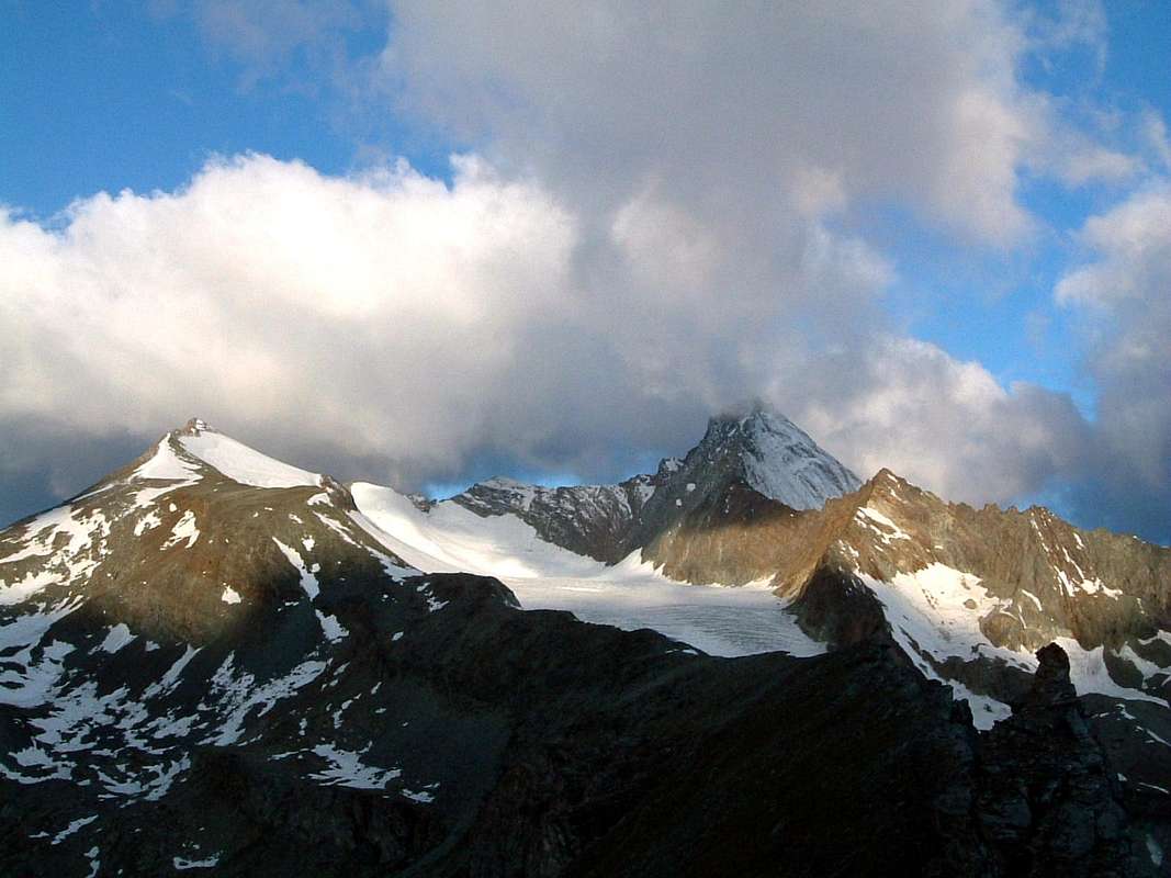
![]() "Grivolayes" over Cogne, Crétaz, Epinel & Vieyes in Cogne Valley,
"Grivolayes" over Cogne, Crétaz, Epinel & Vieyes in Cogne Valley,
by alpinbeta 2014
Comments
No comments posted yet.