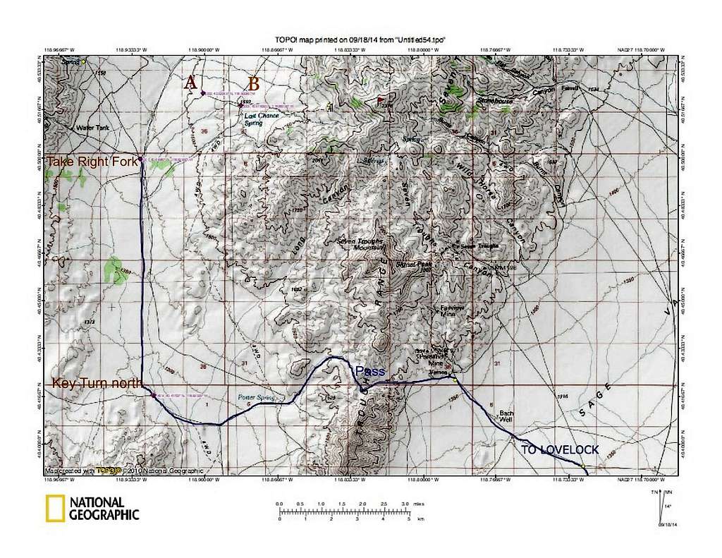
This map has some of the key waypoints that I used to get to where we started our hike from.
From the turnoff of Nevada highway 399 where you start on the dirt road, it is over 27 miles to where it says "take right fork" on this map.
The waypoints are in lat/long nad 27
Pass - At the top of the pass that goes over the Seven Troughs range, it is
about 5300 feet. 40.4207 118.8230
Key turn north - This road goes north almost 6 miles to the "take right fork"
waypoint. On Benchmark, the road that continues west becomes CR 7
although it isn't signed. The road turns north at 40.41722 118.9233
Take Right Fork - The road drops down and after 0.2 miles, take the road to
the right. It shortly heads uphill. The waypoint at the fork is
40.4988 118.9295
After going about 2 miles on this road, watch for a road going east at
waypoint A at 40.5226 118.9008
This road will go for about a mile and then drops down to the right and
reaches waypoint B at 40.5183 118.8836 At this point, the road
enters a sandy wash and heads east. Stay on this road all the way to
its end, almost 3 miles away. The end of the road is the trailhead.
