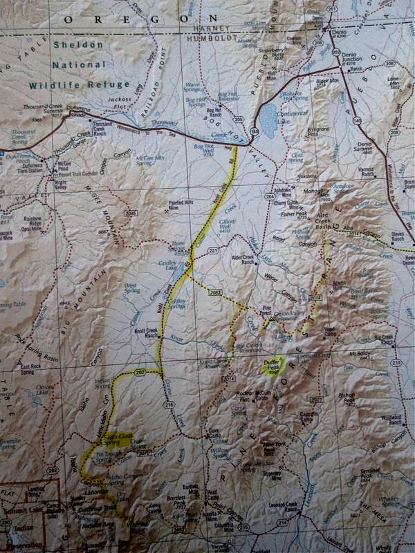
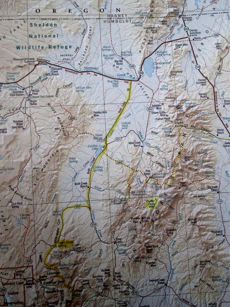
The northern route into the Stewart BM area is shown here on a "Benchmark" snapshot. The turnoff from Denio to Knotts Creek road is about ten miles.
This map is just for orientation only and I recommend a complete set of topos
of the area and the roads with waypoints. I've marked in yellow the route into Santa Claus Spring and beyond.


