Overview
This nice easy hike gives everyone something. The trail is easy to follow, there is scenery the entire way and the summit is interesting. On top is a benchmark and a triangulation structure as well. You may even find painted rocks from the Girls Camp below to the north. This summit is the biggest hike from that camp a trail comes up from that direction (private property of the camp marked in red on the map). I’ve stayed in the camp one weekend, it's got electricity, full outdoor kitchens and flush toilets/showers; I wouldn’t call it a camp, more like a retreat! Anyway, the views are very nice from the summit and other hiking/driving opportunities exist in the area.
![Bald Knoll View]() Bald Knoll from near trailhead
Bald Knoll from near trailhead![Bald Knoll]() Bald Knoll from Heber Mountain
Bald Knoll from Heber MountainGetting There
Take Utah Hwy 35 east of the Francis-Kamas area to the well signed Mill Hollow turnoff (Forest Road #054) and follow this road past the reservoir and campground. At the pass, just past the Duchesne Ridge turn-off, the road will drop but continue south instead, back on top of the ridge. As it does this, look for a road cutting right before the main road drops down even further. This road to the right traverses the north side of a knob, then along a ridge to the base of Bald Knoll. When the road ends (blocked by the Forest Service), this is the start.
![Bald Knoll Map]() Bald Knoll Map
Bald Knoll Map![Overview Map]() Area overview map
Area overview mapRed Tape
None, if there are restrictions, the Forest Service has done a good job posting them.
Heber Ranger District
Uinta National Forest
2460 South Highway 40
Heber City, UT 84032
Phone: 435-654-0470
Camping
There is primitive camping everywhere and some of the sites are quite nice. Mill Hollow Campground is an established campground on the approach near the reservoir just off the highway. Wolf Creek Campground is up highway 35 beyond the Mill Hollow turn-off.
Main Public Route
A hikers/ATV trail follows the old overgrown roadway all the way to the summit. The route is easy for kids until near the end where it climbs quite steeply up grassy slopes. There are several places with shade along the way. The distance is only 1 mile or so with 400 feet of gain.
![Currant Creek Peak]() View to Currant Creek Peak
View to Currant Creek Peak![Heber Mountain]() View to Heber Mountain
View to Heber Mountain![Provo & Cascade Mtns]() View toward Provo & Cascade Mountains
View toward Provo & Cascade Mountains![Strawberry Reservoir]() View toward Strawberry Reservoir
View toward Strawberry Reservoir

 Bald Knoll from near trailhead
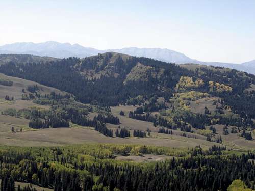 Bald Knoll from Heber Mountain
 Bald Knoll Map
 Area overview map
 View to Currant Creek Peak
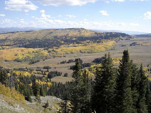 View to Heber Mountain
 View toward Provo & Cascade Mountains
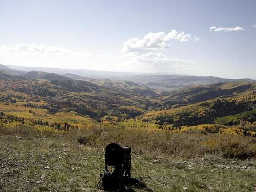 View toward Strawberry Reservoir