


-
 2615 Hits
-
 80.49% Score
-
 12 Votes
|
|
Route |
|---|---|
|
|
45.79730°N / 7.36306°E |
|
|
Hiking, Mountaineering |
|
|
Spring, Summer, Fall, Winter |
|
|
A long day |
|
|
I |
|
|
Note
|
La montagna chiama i suoi figli, ed essi rispondono fedelmente al suo appello… Osvaldo Cardellina, Diario alpinistico, 1964-65 Page texts: @ OsvaldoCardellina "Osva", passed away on May 2, 2022. Page owners: Christian Cardellina e Osvaldo Cardellina. Any updates from September 12, 2022: Antonio Giani, page administrator, friend and climbing companion. Testi della pagina: @ OsvaldoCardellina "Osva", scomparso il 2 maggio 2022. Proprietari pagina: Christian Cardellina e Osvaldo Cardellina. Eventuali aggiornamenti dal 12 settembre 2022: Antonio Giani, amministratore della pagina, amico e compagno di salite. |
Overview
A long but fairly easy is very rarely traveled; because the approach remains a little outside of the usual pathways.Of this crossing, there are no known performances except those made partially in November 1976 and fully in the great crossing until reaching the Croix de Fana (2.211m) of October 1992. In any case, the first part here described may be Quietly recommended to all, where they remain in good condition, ie without snow or ice. It is also advisable to depart from Saint Christophe-Sorreley, where a narrow but good road in asphalt reaches the above-mentioned small Village of Blavy (1.475m). This is a long but easy enough trip, but it requires a lot of attention in the winter, due to the danger for snowslides and avalanches; both in the approach phase and in the subsequent descent from the Colle di Viou (2.698/2.700m).
Lunga ma abbastanza facile traversata é percorsa assai raramente; anche perché l'avvicinamento rimane un poco al di fuori delle vie normalmente frequentate. Di questa traversata non si conoscono effettuazioni se non quelle fatte parzialmente a Novembre 1976 ed in modo completo nella grande traversata fino a raggiungere la Croix de Fana (2.211 m) dell'Ottobre 1992. In ogni caso la prima parte, qui descritta, può essere tranquillamente consigliata a tutti, laddove permangano buone condizioni, cioé senza neve o ghiaccio. Consigliabile, inoltre, la partenza da Saint Christophe-Sorreley, dove una stretta ma buona strada in asfalto raggiunge il soprastante Villaggetto di Blavy (1.475 m). Facile escursione, richiedente però molta attenzione in inverno, a causa delle slavine; sia nella fase d'avvicinamento che nella successiva discesa dal Colle di Viou.
Getting There from Roisan Aosta & St. Christophe
BY CAR:
- From TORINO, MILANO, etc: Motorway A5. Exit at IVREA or Quincinetto (PIEDMONT) From IVREA Town: in West to Pont Saint Martin, Donnas, Bard, Verrès, St. Vincent, Châtillon, Nus, Quart, St. Christophe, Aosta and Roisan Municipalities. From Courmayeur Resort: in East to Morgex, La Salle, Saint Pierre, Sarre, Aosta, Roisan and Saint Chistophe Municipalities.
- From Aosta Town to Roisan and to St. Christophe Municipalities
- 1) - From Aosta City with the State Road n°27 towards the Gran San Bernardo reaching the alternative (782m) near Vainey Fraction and following crossroads nearby Moulin locality (765m) and before Gignod Commune (994m). Turning right and with before Southeast, after North directions towards Roisan Commune (768/843m).
- 2) - From Aosta towards Saint Christophe-Prevot (about 640m), reached by Regional Road and to "Chief-town" Sorreley Village; from this, with Municipal, towards Veynes Fraction up to the junction 1.025 meters "Montagne". By the crossroads to the West reaching Parléaz or Parleyaz (1.274m) and Blavy (1.475m) small Villages.
- 3) - By Aosta towards Saint Christophe "Chief-town" by the National Road n°26 in East-northeast; from this before in Northeast after West with the Regional Road to alternative 730 meters below Thovex Village. Crossing West reach the fork 746 meters just below Quota Baden-Powell (792m); continuing Northwest and passing Serod, Porossan (754m, now in Aosta Municipality), Nayves, another Serod, Câche (764m), Closellinaz Dessus Fractions or Hamlets reach Roisan Commune.
- 4) - from the Commune of Roisan (Aosta adjacent but at the beginning of Great St. Bernard Valley or towards Valpelline; about 900 meters and immediately to North of Aosta City, on the road for the Hill of the Gran San Bernardo); in this case to use the dirt farms road "poderale" (prohibition, because dangerous, for the automobiles), that climbs to the Fraction of Champvillair (902m) and then it is addressed in opposite sense (North) to the Alp Bérrio Némoz (1.141m), but not to reach it. Turning, through always the same one, toward Southeast and through a rather long diagonal among the quotas of around 1.150/1.250 meters to reach the road asphalted for Blavy.
- From FRANCE: through the Mont Blanc Tunnel to Entrèves-crossroads to Vény/Ferret Valleys - Mountain Guides of Courmayeur - La Saxe Rock Gym - Courmayeur. By Little Saint Bernard Pass, closed since November until half May to La Thuile Valley - Pré Saint Didier - Courmayeur. It is not necessary to take Motorway A5: you can drive on SS.26, in the direction of AOSTA - IVREA - TURIN.
BY PLANE:
Aeroporto "Corrado Gex" Saint Christophe (Aosta).
Approaches & Routes Description
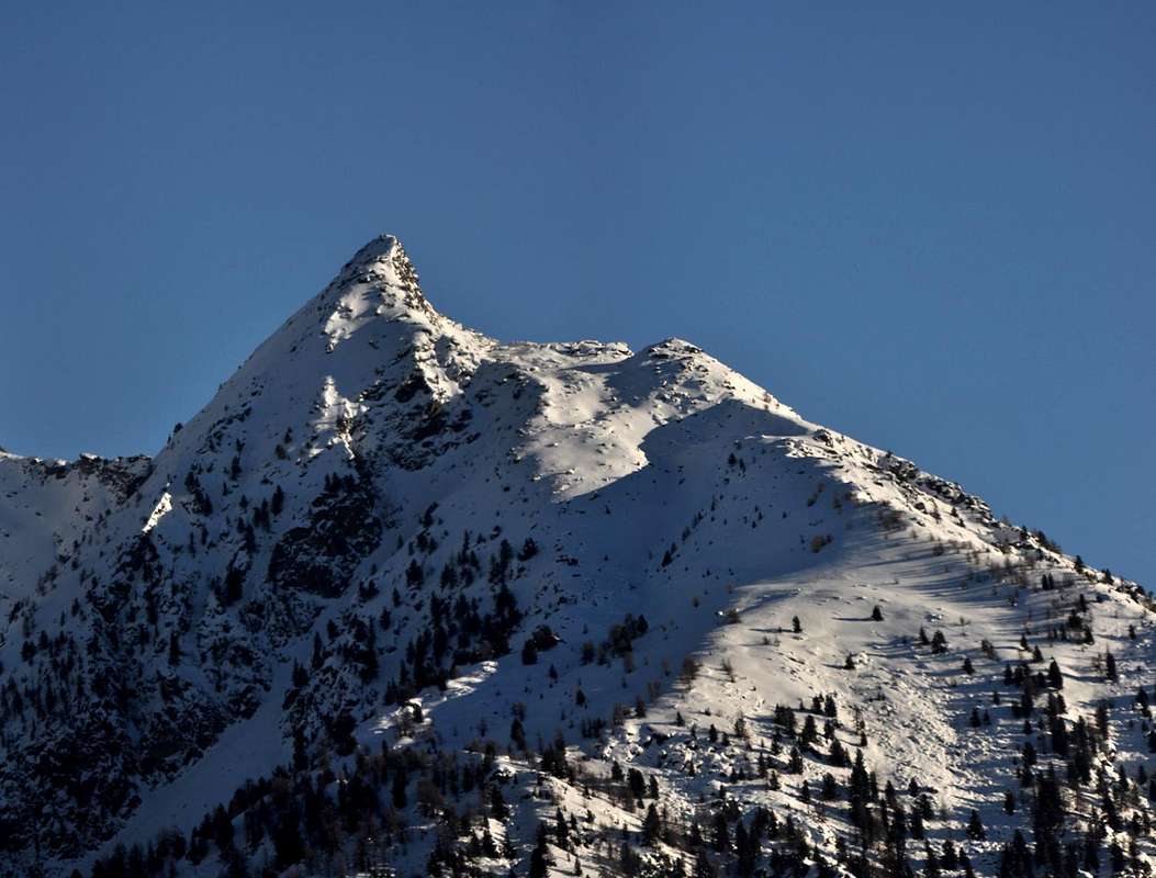
1) - From Roisan Common: to reach the Park at the beginning of the dirt poderal road (which is accessible only to authorized vehicles). Hike along the farms road that leads to the Praperia or Praperiaz Pastures (1.737m). To go back immediately through the prairies to the Southeast and, after behind the alpine Alpage, to an enclosure, taking a path that travels the East-northeast towards the dense and wide forest. To follow the same one for some time but, as soon as above a rudimentary and minuscule "kiosk" equipped to area Pic Nic from the inhabitants of the place, to abandon mostly moving him to it on the left (East and then Northeast). Reaching the superior and debris part with sparce boulders, gradually to go himself toward a great band of oblique rocks that you direct him toward an a little accented crest, that goes up again up to the inferior extremity of the short Western Ridge of the Becca of Roisan. To continue for a little basin very steep gorge on large blocks and great "clapeys" (in the local dialect also more great blocks) broken and rotten, in the shape of natural always steep stairway, reaching a small basin of large rocks and some snowcapped, just to the feet of the small as well as steep rocky wall that the mountain allows to fall toward Midday. From the same, and through always rotten rocks with grassy and debris slope, easily to go back the final small and short Southeast Crest, on the steep watershed among Roisan and Valpelline Municipalities, and to travel it until in Peak (EE/F; 2h'30/3h'00 from the Praperia or Praperiaz Alp).
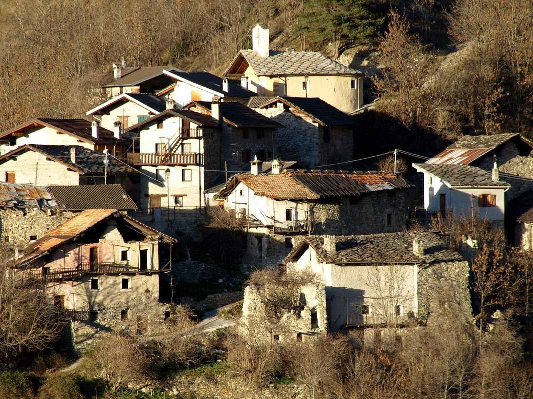
2) - From St. Christophe Common: immediately to the East of Aosta City, to reach with the Municipal Road throughout in asphalt the small isolated Village Parléaz or Parleyaz (1.274m; in winter or with snow, you have to park just before the short descent protected by iron railings to the village). From this, crossing the valley floor, the road improves amplitude and with more comfortable bends, goes up to the small Village of Blavy (1.475m), located in a beautiful and scenic grassy expanse at the edge of the nearby woods.
Note: here you can get with many ancient paths and old mule tracks starting from St. Christophe Common and Senin, Sorreley, Veynes Hamlets or, more to the West, from Aosta-Porossan. Also you can, starting from Parléaz, climb with the small unnumbered path that starts just behind the Chapel of St. Margaret, dates the Comba and, crossing the Torrent de Pareylaz, reaches Blavy. Otherwise, excluding this last small village, continue by the same until the ancient and abandoned Varbre Pasture (1.667m), just below the dirt road for Viou Alps, where he reunites with the n° 105 that starts even from Porossan-Serod and, after the small Village of Blavy, becomes n° 105/25 former 1A. From Varbre continue for a short time following the torrent to the interior of the forest until you reach the dirt road at an altitude of 1.962 meters; from this point, leaving to the East (right) the same, you have to continue following pathless a little one that is the boundary between the Municipalities of Roisan (West) and Aosta. Proceeding, not without difficulty, to the north in an devastated zone of the forest you reach the altitude of 2.218 meters, where it ends at the base of a great heap of stones in a small basin. Here and at the base of the small Southwestern Wall the same splits sending a branch at the left parallel to the wall and another in right in the direction of the Slope South-southeast and then almost against West-northwest Ridge of Becca di Viou. This precise point there are three different possibilities to climb just to the overhanging Becca de Blavy:
A) - go to the left, among sparce trees, along the quite steep stony slope reaching the Western Hill of Roisan (2.495m) and by the easy West-northwest Ridge to the Summit.
B) - use the opposite side, more or less with the same characteristics, and, rounding to the East the small wall to reach the rocky base of the inclined Slope Southeast. Overcome a grassy-rocky band reaching quite easily the Top. Or enlarging the ride further East to get to called Colle di Blavy Eastern (2.515m) and conclude with the easier East-southeast rocky Ridge (these routes are to be evaluated as EE/F+; 1h'00 from the base; 2h'15/2h'45 from the junction with dirt road 4h'00/4h'00 by Parléaz small Village).
C) - reached the base of the Southwest Wall, climb with several possibilities facing a series of steps with various difficulties and in respect of the coupling point (upper left, middle or further down diagonally from the right with passages that can vary from II° to IV°). It offers the same half a dozen solutions of beautiful rock slabs unfortunately alternating to ledges often covered by grass. Calculate two to five pitches according to the chosen path and keep in mind that the snow or ice conditions greatly increase both the difficulties and travel times. This is also true for approaches where, in the presence of high or fresh snow, the same becomes much harder because not always adaptable to Snowshoes.
Downhill to Blavy or Parléaz: for the descent should cross to the wide saddle or Colle di Roisan (2.495m) and reach the Becca di Roisan (2.546m); from this or from the saddle, descend directly between large blocks and, flexing slightly to Southeast, reaching the previous itinerary. In case of high snow better to continue with the farm dirt road.
3) - Crossing from Becca de Roisan towards Becca di Viou bypassing the Becca de Blavy, always trhrough West-northwest rocky Ridges: this is the most mountaineering part, not difficult but requiring some experience, especially in fresh or high snow conditions. When you reach the Roisan Becca, cross Eastward, possibly on the ridge until you reach the nearby Becca of Blavy or Quota I.G.M. 2.508 meters. A short crossing with uphill leads to overcoming the two Western and Eastern Pass coming to this end at the base of the real West Crest of Becca of Viou. Go up the same by encountering a few short rocky passes, avoiding generally on the left (North), even with short, easy and amusing climbs. In short, you will reach the Top, where since a period of about twenty years a large Crucifix with a stone base (inside Book of the Summit) has been placed. The descent takes place more easily along the East-Southeast Crest or Normal Via until you reach the "Penne Nere or Black Pens" Bivouac (2.730m; Always open, equipped but not guarded) and the nearby Colle di Viou (2.698m). From the latter you can go down to the Alps of Viou (to the South; Higher 2.202m, Lower 2.078m) and then to Blavy, or in Valpelline (towards North) via the picturesque Vallon of the Arpisson. (EE/A/F+/D-; calculate 2h'00/2h'30 for full and complete traverse and about 3h'00 to the Bivouac).
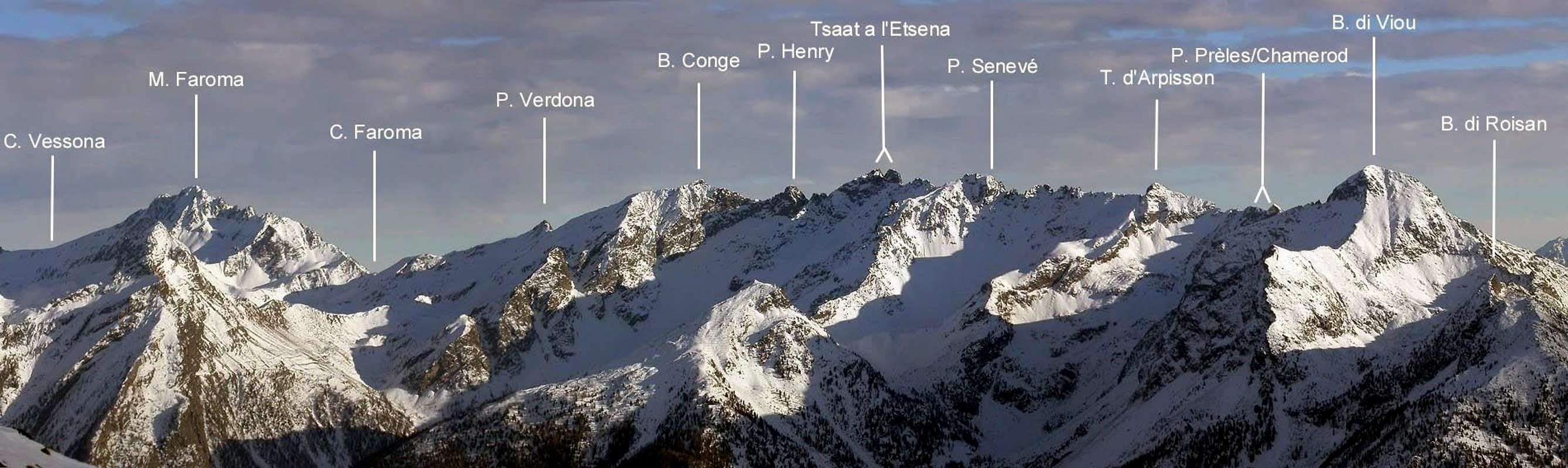
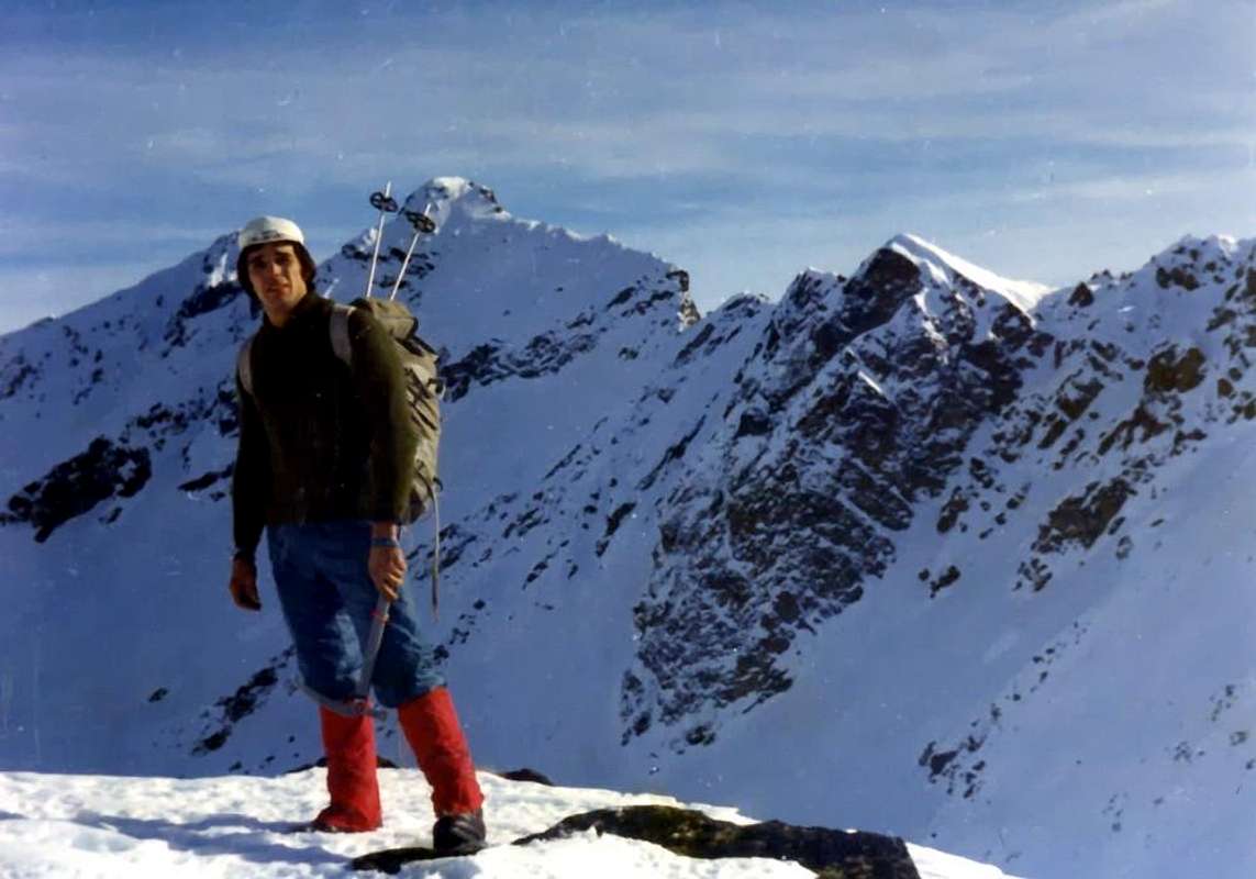
From left the approach by Blavy Village towards Becca de Roisan with crossing to the "Becche" de Blavy & Viou until the Viou's Pass
|
|
|
|
|
1) - Dal Comune di Roisan: raggiungere il parcheggio all'inizio della strada sterrata (oltre il traffico è consentito solamente ai mezzi autorizzati) lasciando l'auto e iniziare la salita a piedi lungo la strada sterrata poderale conducente al soprastante Alpeggio di Praperia(z) (1.737 m), collocato alle pendici Occidentali della Becca di Roisan. Risalire subito dopo dietro l'Alpe, prendendo un sentiero dapprima verso Sudest, attraverso i prati in direzione di una recinzione, e poi percorrente il bosco verso Est-nordest. Seguire il medesimo per un poco di tempo ma, appena al di sopra di un rudimentale e minuscolo "chiosco" attrezzato ad area Pic Nic dagli abitanti del posto, abbandonarlo spostandosi maggiormente sulla sinistra (Est e poi Nordest). Raggiunta, con percorso piuttosto ripido e faticoso, la parte superiore, detritica e con pietraie, gradualmente dirigersi verso una grande fascia di rocce oblique indirizzata verso un'appena accentuata crestina, che risale in fin dell'estremità inferiore della corta Cresta Ovest della Becca di Roisan. Proseguire per un valloncello-canalone molto ripido su grandi blocchi, conosciuti in dialetto locale come "clapeys", formanti una naturale ed altresì ripida scalinata, raggiungendo una piccola conca di grandi macigni ed alcuni nevati, proprio ai piedi della minuscola nonché ripida parete rocciosa, che la montagna lascia cadere verso Mezzogiorno. Indi, e tramite un pendio di roccette rotte con erba e detriti, risalire alla Crestina Sudest finale, sul ripido spartiacque tra i Comuni di Roisan/Valpelline, e percorrendola fin in Vetta (EE/F; 2h'30/3h'00 da Praperia(z)).
2) - Dal Comune di Saint Christophe: subito ad Oriente della Città d'Aosta, raggiungere con la Strada Municipale nonché asfaltata il Villaggetto di Parléaz oppure di Parleyaz (1.274 m; d'inverno oppure con neve bisogna parcheggiare appena prima della breve discesa protetta da ringhiera in ferro verso il villaggio). Da qui, attraversando il fondovallone, la strada migliora in ampiezza e con più comodi tornanti, salire fino al Villaggio di Blavy (1.475 m), sito in splendida ed (a 230° circa) panoramica distesa prativa al limite del bosco.
Nota: Qui si può arrivare con vari antichi sentieri e vecchie mulattiere partendo dal Comune di St. Christophe o da Senin, Sorreley oppure, più ad Ovest, da Aosta-Porossan. Inoltre si può, iniziando da Parléaz, salire con il sentiero non numerato che, partendo subito dietro la Cappella di Santa Margherita, risale la Comba ed, attraversato il Torrent de Pareylaz, raggiunge Blavy. Altrimenti, escludendo quest'ultimo villaggio, continuare per mezzo del medesimo fino all'Alpeggio abbandonato di Varbre (1.667 m), appena sotto la poderale per le duplici Alpi di Viou, dove si ricongiunge con quello n° 105 che parte addirittura da Porossan-Serod e, dopo il Villaggetto di Blavy, diventa n° 105/25 ex 1A. Da Varbre proseguire per breve tempo seguendo il torrente allo interno della foresta fino ad incontrare la strada poderane a quota 1.962 metri; da questo punto, abbandonando ad oriente la medesima, si deve proseguire senza alcun sentiero seguendo un pò quella che é la linea di confine tra i Comuni di Roisan (Ovest) ed Aosta. Procedendo, non senza difficoltà, verso Nord in una zona sconvolta della foresta si raggiunge l'altitudine di 2.218 metri, dove la medesima termina alla base di una grande pietraia in una conchetta. Qui ed alla base della piccola Parete Sudovest la medesima si sdoppia inviando un ramo a sinistra parallelamente alla parete ed un altra verso destra in direzione del Versante Sud-sudest e quasi contro la Cresta Ovest-nordovest della Becca di Viou. Da qui esistono tre differenti possibilità di salita alla soprastante Quota 2.508 metri detta Becca di Blavy:
A) - dall'ultimo tornante della poderale (1936 m), prima che questa s'indirizzi definitivamente verso Oriente per raggiungere l'Alpe di Viou Inferiore (2078 m), salire sulla sinistra (Nord-nordovest), con percorso faticoso e "fastidioso" tra radi alberi in mezzo a cespugli e rododendri, lungo l'abbastanza ripida pietraia raggiungendo, dopo un tratto di "clapeys" seguiti da un ripido pendio detritico, il cosiddetto Colle Occidentale di Roisan (2495m); tramite la breve, facile ed appena sinuosa Cresta Ovest-nordovest in Vetta.
B) - utilizzare il versante opposto, più o meno con le stesse caratteristiche, e, doppiando ad Est la piccola parete raggiungere la base rocciosa dell'inclinato Versante Sudest; superare una fascia erbosa-rocciosa raggiungendo abbastanza facilmente la Cima. Oppure allargando il giro più ad Est arrivare al Colle Orientale di Blavy (2515 m) e concludere con la facile Cresta Est-sudest (questi itinerari sono da valutare in EE/F+; 1h'00 dalla base; 2h'15/2h'45 dall'incrocio con la poderale 4h'00/4h'00 dal Villaggio di Parléaz).
C) - raggiunta la base della Parete Sudovest, salire con diverse possibilità affrontando una serie di passaggi con varie difficoltà e in relazione al punto di attacco (più in alto a sinistra, medio o più in basso in diagonale dalla destra); la stessa offre una mezza dozzina di soluzioni su belle placche rocciose ma, purtroppo, alternate a cengie spesso erbose. Calcolare da due a cinque/sei tiri di corda secondo la via prescelta e tenere ben presente che le condizioni di neve o ghiaccio aumentano notevolmente sia le difficoltà che i tempi di percorrenza. Ciò vale anche per gli avvicinamenti dove, in presenza di neve, il medesimo diventa molto più faticoso, anche perché non sempre adattabile alle Racchette da neve.
Discesa: per la discesa conviene attraversare verso la larga sella o cosiddetto Colle di Roisan (2.495 metri circa) e raggiungere la Becca di Roisan (2.546 m); da questa, oppure, anticipando, dalla sella medesima, scendere direttamente tra grandi blocchi con brevi residui di nevato e, flettendo leggermente a Sudest, raggiungere l'itinerario precedente. Con neve troppo alta, oppure dopo recente nevicata, meglio continuare ancora per un tratto lungo la strada poderale, sicuramente più comoda nonché sicura.
3) - Traversata dalla Becca de Roisan verso la Becca di Viou bypassando la Becca de Blavy, sempre tramite le Creste Ovest-nordovest: questa é la parte più alpinistica; non difficile ma richiedente una certa esperienza nonché prudenza, soprattutto in condizioni di neve fresca oppure alta. Raggiunta la Becca di Roisan, attraversare verso Oriente restando possibilmente sul filo di cresta, od appena al di sotto, fino a raggiungere la vicina Becca di Blavy o Quota I.G.M. 2.508 metri. Una breve traversata con saliscendi porta a superare i due omonimi Colli Occidentale ed Orientale (2.495/2.500 e 2.520/5 metri circa) arrivando in questa maniera alla base della vera e propria Cresta Ovest della Becca di Viou. Risalire la medesima incontrando qualche breve passaggio roccioso, in genere aggirabile sulla sinistra (Nord), ma anche divertente da superarsi direttamente. In breve si raggiunge la Vetta, dove da una ventina d'anni é stato posizionato un grande Crocefisso metallico con basamento in pietra (all'interno Libro di Vetta). La discesa avviene, più facilmente, lungo la Cresta Est-Sudest o Via Standard fino a raggiungere in breve tempo il Bivacco Penne Nere (2.730m; sempre aperto, attrezzato ma non custodito) ed il vicino Colle di Viou (2.698m). Da questo ultimo si può scendere verso le Alpi di Viou (Sud; Superiore o Dessus 2.202 m, Inferiore o Dessous 2.078 m) e quindi a Blavy, oppure in Valpelline (Nord) tramite il pittoresco Vallone dell'Arpisson (EE/A/F+/D-; calcolare 2h'00/2h'30 per l'intera traversata e circa 3h'00 al Bivacco e Colle di Viou).
First Ascents with crossings
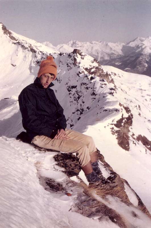
- West Arête (from the base of West Ridge): Marco Cossard and Giuseppe Lamazzi, (November 21th, 1976), in ascent from the more Eastern Saddle 2.520/5 meters about.
- Western Ridge (integral from Roisan Hill and Quota 2.508m or Becca de Blavy): Osvaldo Cardellina, and Camillo Roberto Ferronato, (November 28th, 1976), in ascent.
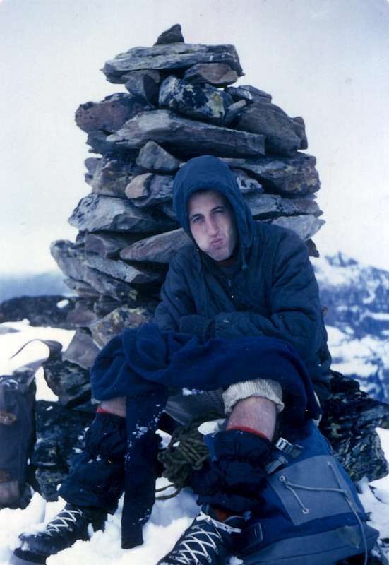
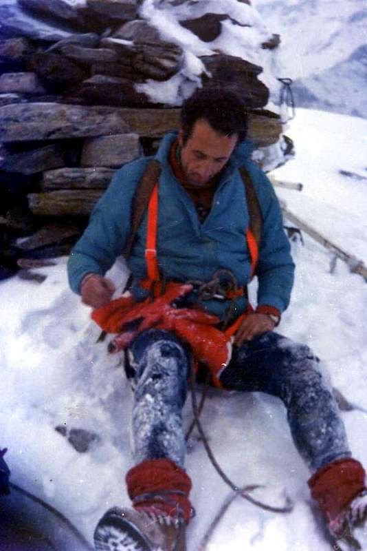
- Integral crossing from Becca de Roisan until the Croix de Fana (Becca de Roisan-Quota 2.508 meters or Becca de Blavy-Becca di Viou-Mont Mary-Quota 2.750/1 meters about o Punta di Chamerod-Quota 2.748/8m o Punta de Les Prèles-Tete d'Arpisson-Quota 2.888 meters-Quota 2.865/70m about also Senevé's Little Bell Tower-Punta di Senevé-Quota 2.945/50 meters about-Tsaat a l'Etsena West and East Summits-Becchi di Fana-Punta del Cornet-Croix de Fana): Osvaldo Cardellina, solo (Oct 11th, 1992).
Essential Gear & Difficulties
From F+ to PD- for the routes described on the three "Becche".Dal F+ al PD- per le vie descritte sulle tre "Becche".
Mountain Condition
- Meteo: you can find all the needed informations at the official site of the Valle d'Aosta Region:
- Valle d'Aosta Meteo
Books and Maps
- "Guida della Valpelline" de l'Abbè Joseph-Marie Henry - Societè Editrice Valdotaine 1925 II Edition e Collana Reprint Musumeci (1986).
- "Guida dei Monti d'Italia - Alpi Pennine (Vol. 2)" di Gino Buscaini - Club Alpino Italiano/Turing Club Italiano, Luglio 1970 (In Italian).
- "80 itinerari di Escursionismo Alpinismo e Sci Alpinismo in Valle d'Aosta", di Osvaldo Cardellina, Ed. Musumeci, Giugno 1977 (in Italian); seconda Ed. Luglio 1981; terza Ed. Luglio 1984; (in French), prima Ed. Febbraio 1978; seconda Ed. Marzo 1980.
- "Ascensioni 1964-1969" Diario Alpinistico di Ilario Antonio Garzotto (unpublished).
- "Diari Alpinistici" di Osvaldo Cardellina e Indice Generale accompagnato da Schedario Relazioni Ascensioni 1964-2019 (unpublished).
 |
 |
 |
- Kompass "Breuil/Cervinia-Zermatt" Carta turistica 1:50.000.
- I.G.C. Istituto Geografico Centrale "La Valpelline" (carta n° 115) Map1:30.000.
- I.G.M. Istituto Geografico Militare - Map1:25.000.
- L'Escursionista Ed. Rimini "Gran San Bernardo-Ollomont" (carta n° 5) 1: 25.000.
Important Information
- REGIONE AUTONOMA VALLE D'AOSTA the official site.
- FONDAZIONE MONTAGNA SICURA Villa Cameron, località Villard de la Palud n° 1 Courmayeur (AO) Tel: 39 0165 897602 - Fax: 39 0165 897647.
- SOCIETA' DELLE GUIDE DELLA VALPELLINE Etroubles-Strada Nazionale, n° 13 - Tel +39 0165 78559 - Valpelline-Loc Capoluogo, n° 1 - Tel +39 0165 713502 (AO) Italia.
- A.I.NE.VA. (Associazione Interregionale Neve e Valanghe).
Useful numbers
- Protezione Civile Valdostana località Aeroporto n° 7/A Saint Christophe (Ao) Tel. 0165-238222.
- Bollettino Valanghe Tel. 0165-776300.
- Bollettino Meteo Tel. 0165-44113.
- Unità Operativa di Soccorso Sanitario Tel. 118.