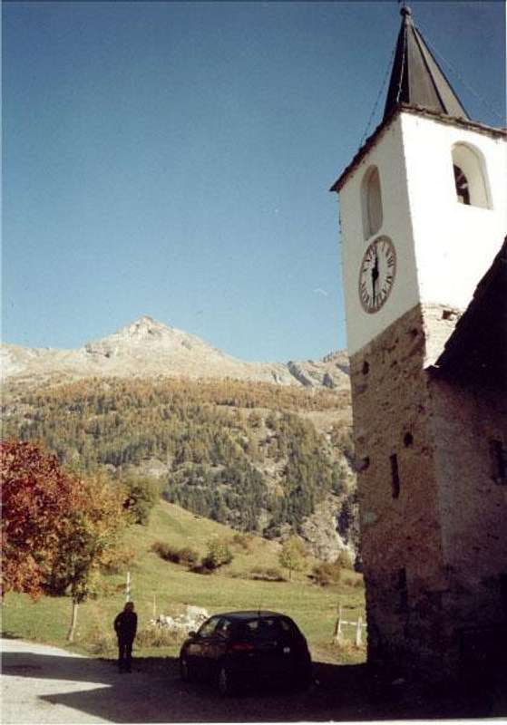
Let's see some of these excursions, which today are the approaches much more "comfortable". We go first to the Northeast of the Aosta City reached with the Regional Road the Municipality of Saint Christophe, adjacent to the East of the same. Moving on we find the Castle of the Alpine Military School of Aosta and just after that of Saint Christophe, privately owned and almost always closed. At the next roundabout do not turn left (Northwest; directions to the Fraction of Senin) but continue to the Northeast, reaching the bigger Fraction of Sorreley
(805m), near the Village of Veynes; three windings road and equally long diagonal the same reaches an important crossroads at locality of Lumian
(984m; sign saying "Mountagne"). Abandon the right branch that is directed towards the Villages Cretallaz, Jeanceyaz, Morgonaz and Prayon or Praillon Farm
(1266m), immediately under the entrance to the Basin Sénevé. Continue through the opposite and instead, leaving almost immediately right fork for the tiny Village Cerisolaz
(1189m), with the first route to the West-northwest and then North to reach Parléaz also Parleyaz (
1274m; small Church dedicated to Santa Margaret and Bernard; Napoleon fireplace in a house in front of the big fountain with shed), located at the center of a narrow valley secondary. Up to here, wanting to leave on foot from the valley floor, you can get there with the trail
n° 26 from Senin (
805/27m; Chapel of Santa Barbara and Michael; above Green Area for the popular games), or with the
n° 26A from Veynes Hamlet
(834m) and still, but more to the West, with the path
n° 26B from Porossan-Serod
(754m), now completely in the Common of Aosta. This last, passing the Village of Chanté de Parléaz
(1263m), is joined to the previous three precisely the hairpin where the Municipal road changes direction from West to North to reach Parléaz.
Remark: from the bend
1527 metres, in the private dirt road to the Pastures of Varbre and Viou (East), part towards the North a branch which, after passing the Alpe di Plasse
(1659m) reaches to Praperiaz
(1787m) on the slopes of the Western Becca Roisan. From here a path connecting
n° 22 first reaches the Rovon Pasture
(1744m) and then that of Chanté de Meyes
(1857m), now in Valpelline adjacent Valley. The same path, followed by a private road, in Grangettes
(1417m) and then to Lavod
(1045m), just to the East of the Municipality Valpelline
(952/996m). Is thus carried an ancient connection with the latter valley basin Praperiaz-Blavy, above the Commons of Roisan Aosta.
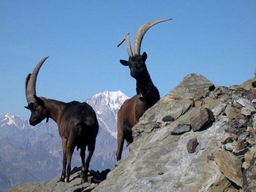
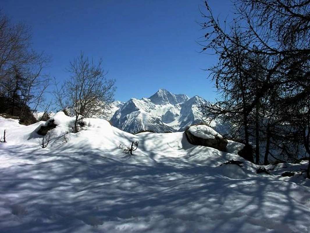
" Becca of Viou from valley floor ... , by Antonio, om, Salval & Corvus
Three beautiful walks that require, including round-trip, a half-day low and offer beautiful views of the city and surrounding villages. Parleyaz from the Municipal Road continues on the other side and, after crossing the Torrent de Parléaz, with first path to the West and then North reaches the Village Blavy (
1467/71m; small Church of San Bernardo and Bell tower and beautiful sundial on the Southern Face with inscription
"La Jeunesse et la Beauté sont un passage comme le soleil et son hombrage"; beautiful fountain with shed). Here comes, but more to the West and, from the Municipality of Roisan (
865/905m; Church of St. Fabian and Sebastian) the farm road to the South-southeast, or from the Village of Porossan-Tache
(764m), the trail
n° 25/105, which then continues to the interior of the walloon up to the Pastures of Viou
(2078m), the Tsa de Viou
(2202m) and finally the Hill of the same name
(2696m), located between Becca of Viou
(2856m) and Mont Mary
(2815 m), on which was placed the
Bivouac Penne Nere (
2730m; also Black Feathers; gas cooker, table, chairs and a dozen beds).
In this area most Western are also possible some easy and profitable ascents:
1)- Becca Roisan (2546m). From hairpin
1936 metres on the private dirt road to the Alpe di Viou
(2078m) towards Northwest pathless up to Colle di Roisan
(2482m), between Becca Roisan and nearby Quote
(2508m) or Becca of Blavy. From this through short Crest East-southeast. Or more to the West from Praperiaz Pasture
(1737m) and the next Alp
(1835m), at first through the forest path to the East-southeast and then to a small walloon at an altitude of
2200/2250 metres rejoining the previous route.
2)- Becca Blavy (2508m). Between the previous bend on the farm towards Viou and the next
1962 metres head, with no path and in the midst of a wild wood, further North along the imaginary line between the Commons of Aosta Roisan; through the altitude
2218 metres and through stony sunny achieve wide Blavy Pass
(2561m), between this small Hilltop and Becca Viou. Turning left and taking the easy Crest East soon to Top, very scarcely popular but with unusual views. Moreover, following the previous itinerary up to Roisan Pass, you can also go up from this with the opposite Crest West-northwest, but the way it is more exposed and demanding. It requires a bit of experience.
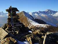
3)- Becca of Viou (2856m). From Colle di Viou or Penne Nere Bivouac through easy Cresta East-southeast on a small path trail and some easy small rocks in the final part.
4)- Mont Mary (2815m). From the hill or from the bivouac turn right (East) and climb along the easy Crest Northwest overcoming some rocky steps or circumventing the same immediately to the North. It is also possible, starting from the Village of Valtolanaz
(1492m), accessible by dirt road from the junction just before Parleaz, or, if desired, yet to be lower (Villages Porossan, Senin, Sorreley) walk the easy but long "Crestone" South-southwest that almost reaches Aosta City. Tired but good training trip in early season.
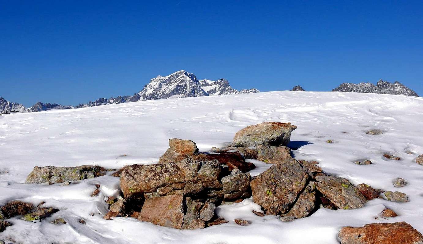
"... Penne Nere Bivouac (2730m) & Becca Viou...", by Antonio
Vediamo dunque alcune di queste escursioni, che oggigiorno presentano degli avvicinamenti molto più "comodi". Andiamo dapprima a Nordest della città raggiungendo con la Strada Regionale il Comune di Saint Christophe, adiacente ad Est alla medesima. Passando troviamo il Castello della Scuola Militare Alpina di Aosta e subito dopo quello di Saint Christophe, privato e quasi sempre chiuso. Alla rotonda successiva non svoltare a sinistra (Nordovest; indicazioni per la Frazione di Senin), bensì continuare a Nordest raggiungendo quella più grande di Sorreley
(805 m), vicina al Villaggio di Veynes. Con tre tornanti ed altrettanto lunghi diagonali la stessa raggiunge un importante bivio presso Lumian
(984 m; cartello con scritto "Montagne"). Abbandonare il ramo di destra (Est) che s'indirizza verso i Villaggi di Crétallaz, Jeanceyaz, Morgonaz e Prayon o Praillon
(1266 m), all'ingresso della soprastante Conca di Senevé. Continuare invece tramite l'opposto e, lasciando quasi subito a destra il bivio per il piccolo Villaggio di Cerisolaz
(1189 m), con percorso prima ad Ovest-nordovest e poi a Settentrione raggiungere quello di Parléaz o Parleyaz (
1274 m; piccola Chiesa dedicata a Santa Margherita e Bernardo; camino napoleonico in una casa a fronte della grande fontana con tettoia), situato al centro di uno stretto valloncello secondario. Sino a qui, volendo partire a piedi dal fondovalle, si può arrivare con il sentiero
n° 26 dalla Frazione di Senin (
805/27 m; Cappella di Santa Barbara e Michele; soprastante Area Verde per i giochi popolari), oppure con il
n° 26A da Veynes
(834 m) ed ancora, ma più ad Ovest, con il sentiero
n° 26B da Porossan-Serod
(754 m), ormai completamente nel Comune di Aosta. Quest'ultimo, passando il Villaggio di Chanté de Parléaz
(1263 m), si ricongiunge ai tre precedenti proprio al tornante dove la Strada Comunale cambia direzione da Ovest a Settentrione per raggiungere Parléaz. Tre passeggiate richiedenti, tra andata e ritorno, mezza giornata scarsa ed offrono belle vedute sulla città, sui villaggi circostanti e sul Gr. San Bernardo.
Nota: dal tornante
1527 metri, sulla strada poderale per gli Alpeggi di Varbre e di Viou (Est), parte verso Settentrione una diramazione che, oltrepassata l'Alpe di Plasse
(1659 m) raggiunge quella di Praperiaz
(1787 m) alle pendici Occidentali della Becca di Roisan. Da qui un sentiero di collegamento
n° 22 raggiunge prima l'Alpe di Rovon
(1744 m) e poi quella di Chanté de Meyes
(1857 m), ormai in Valpelline. Lo stesso sentiero, seguito da una poderale, conduce a Grangettes
(1417 m) e poi a Lavod
(1045 m), appena ad Est del Comune di Valpelline
(952/996 m). Viene così effettuato un antico collegamento di quest'ultima vallata con il bacino di Praperiaz-Blavy sopra i Comuni di Roisan ed Aosta.
"... Most Recent Walks, Hikes & Promenades ...", by emilius and p-mike
Da Parleyaz la Strada Municipale continua sul versante opposto e, dopo aver guadato il Torrent de Parléaz, con percorso prima ad Ovest e poi a Nord raggiunge il Villaggio di Blavy (
1467/71 m; Chiesetta di San Bernardo con Campanile e bella meridiana sulla faccia Meridionale con iscrizione
"La Jeunesse et la Beauté sont un passage comme le soleil et son hombrage"; bella fontana con tettoia). Qui giunge, ma ancor più ad Ovest e partendo dal Comune di Roisan (
865/905 m); Chiesa di San Fabiano e Sebastiano) la strada poderale verso Sud-sudest, oppure dal Villaggio di Porossan-Tache
(764 m), il sentiero
n° 25/105, che poi prosegue all'interno del vallone sino a raggiungere gli Alpeggi di Viou
(2078 m), la Tsa
(2202 m) ed infine il Colle
(2696 m), posto tra la Becca di Viou
(2856m) ed il Mont Mary
(2815 m), sul quale é stato collocato il
Bivacco Penne Nere; 2730 m; fornello a gas e 10/12 posti letto).
In questo settore più Occidentale sono possibili anche alcune facili e remunerative ascensioni:
1)- Becca di Roisan
(2546 m). Dal tornante
1936 metri sulla poderale per l'Alpe di Viou
(2078 m) verso Nordovest nella foresta e senza sentieri fino al Colle di Roisan
(2482 m), tra la Becca di Roisan e la vicina Quota
(2508 m) o Becca di Blavy. Da questo tramite la breve Cresta Est-sudest. Oppure più ad Ovest dall'Alpe Praperiaz
(1737 m) e la successiva Alpe
(1835 m), prima con sentiero nella foresta verso Est-sudest e poi per un ripido valloncello ricongiungendosi alla precedente a quota
2200/2250 metri circa.
2)- Becca di Blavy (2508 m). Tra il precedente tornante della poderale verso Viou ed il successivo
1962 metri dirigersi, senza alcun sentiero ed in mezzo ad un bosco selvaggio, più a Settentrione lungo l'immaginaria linea di confine tra i Comuni di Aosta e Roisan; passando per l'altitudine
2218 metri e tramite pietraie assolate raggiungere il largo Colle di Blavy
(2561 m), tra questa Cimetta e la Becca di Viou. Voltando a sinistra e percorrendo la facile Cresta Est in breve tempo alla Vetta, con panorama inconsueto. Inoltre, seguendo il precedente itinerario fino al Colle di Roisan, é possibile anche salire con l'opposta Cresta Ovest-nordovest, ma la via risulta più esposta ed impegnativa.
3)- Becca di Viou (2856 m). Dal Colle di Viou o dal Bivacco Penne Nere tramite la facile Cresta Est-sudest su di una piccola traccia di sentiero e qualche roccetta nel finale.
4)- Mont Mary (2815 m). Dal colle o dal bivacco voltare a destra (Est) e salire lungo la facile Cresta Nordovest superando alcuni gradoni rocciosi od aggirando gli stessi subito a Nord; Inoltre é possibile partendo dal Villaggio di Valtolanaz
(1492 m), raggiungibile tramite poderale dal bivio subito prima di Parlèaz, o, volendo, ancora da più in basso (Porossan, Senin, Sorreley) percorrere il facile ma lungo Crestone Sud-sudovest che quasi raggiunge la Città di Aosta. Faticosa ma buona gita di allenamento d'inizio stagione.
"... Most Recent Walks, Hikes & Promenades ...", by emilius and Antonio
More to the East ( St. Christophe & Quart Municipalities)
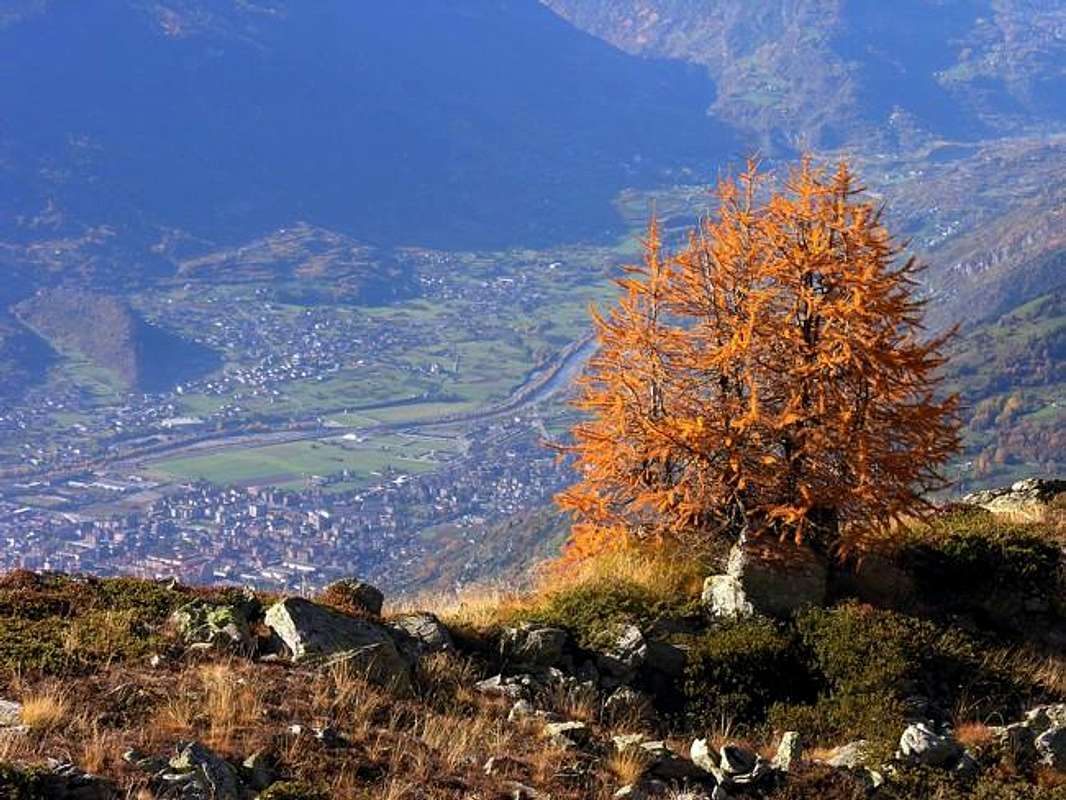
"... Admiring the Emilius...", by Antonio
Approach from the Hamlets of Crétallaz-Jeanceyaz-Morgonaz-Prayon through the Municipal Road by Saint Christophe: from Prayon Farm (1128m), almost at the end of the Municipal Road that goes by St. Christophe Common, along the farms private dirt road, at the hairpin bend just over the water intake concrete, towards Les Ayettes
(1463m) and Bor(r)elly
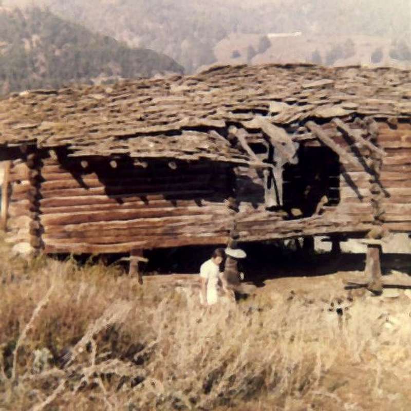
(1477m) Pastures at the entrance on Senevé Basin, Western side or Chamerod's, reaching, always towards the North, this ancient village where once (until the Seventies) there were two wonderful wooden
"Rascards"with stone base (
1615m,
E; 1h'15/1h'30, the sign ban immediately after the water intake concrete of Prayon Farm). If you want you can avoid reaching the same continuing left on hairpin before of
200 metres about on the above dirt road that, after a wide subsequent hairpin bend crossing two unimportant torrents and passing over the Alp Tsamp Dèsott or Tsamp des Eaux (
* * * for an existing source just above
1660/70 metres about GPS; private and always closed, owned by Aldo Barmasse that in winter
"beats" the farm road with the snowmobile), to Alp Les Preyes or Les Prèles and also, on the spot, Priles
(1802m), just beyond which is terminated. From this point to the North part of a small path
unnumbered that, almost immediately past right (East) an ancient ruin, is introduced into the overhanging more steep forest; climbed the same with tight bends (path not easy to detect in the presence of snow) and with a final hairpin a slightly steeper out on the lawns and finally with a right diagonal in the midst of these towards the Alp Cénevé (
2206m; source immediately to the West at a water intake concrete;
E; 2h'30/ 2h'45, increasing by about an good hour in the event of snow). This approach is more direct but also more tiring than with long diagonal from Avisod of Trois Villes.
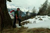
Remark: also this approach is already in a splendid outing with snowshoes usually starting from just above Prayon and passing through the alps above or with shortcuts.
Also in this area most Eastern are also possible some easy and rewarding hikes or excursions that we see from West to East:
1)- Mont Mary
(2815m). From the Alp Sénevé or Cénevé
(2199m), reached by the path connecting
n° 22 from Tsa de Viou
(2002m), or from the old Village of Chamerod
(1614m) via the path
n° 1 and again from Trois Villes-Avisod Hamlet
(1398m) with the path
concomitant with dirt road, go up to the Northwest through traces gradually taking over the Southeast Slope. A final part, in the midst of large blocks scattered between debris and grassy, easily leads on the ridge immediately to the East of the Summit.
2)- Punta of Chamerod (2750 metres around). More or less the same with the previous route, turning in the final at North and reaching a large saddle or Col Chaudière Southwest
(2710/20 metres about), between this small Hilltop, seldom visited, and the Mont Mary; finally, through the easy South Crest, formed by easy rocks and debris.
3)- Tips of Prèles or Preyes (2760 metres about). Keeping the right-most of the two previous routes, reaching the base of the rocky summit twins against some easy rock is easily surmountable towards one or the other; or almost straight from Northeast Chaudière Pass by Crest Northeast or in crossing from Punta Chamerod through West Crest.
4)- Chaudière Northeast Pass (2746m). By Sénevé long boring climb rocks and blocks to the North-northwest; a final steep section and soil leads to the narrow carving.
Important note: the very old and small path
n° 22, which connected the Tsa de Viou (
2002m; Upper) in West above the eponymous alp
(2078m) from Sénevé East, in practice it is not nearly the most viable: the progressive abandonment of the first mountain pasture, now reduced to accommodate only steers, has meant that over the last forty years has gone to progressive deterioration. There remains a small track, not always easy to find, that, after the long and rounded
"Crestone" South-southwest of Mary, goes beyond a squalid little walloon that descends over the Villages Rachau, Voltolanaz, Cerisolaz and Lumian. The same has a source, albeit it is not readily available. On the opposite side, just before the
2362 metres, returns to be more identifiable and viable reaching the Alp of Sénevé, renovated and re-production of the cows in the pasture.
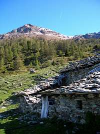
Chamerod "Rascard", destroyed and today restructured, by Osw
Avvicinamento dai Villaggi di Crétallaz-Jeanceyaz-Morgonaz con la Strada Comunale da Saint Christophe: dalla Fattoria di Prayon (1128 m) tramite la strada poderale, presso il tornante a gomito appena oltre la presa d'acqua in cemento, per i successivi Alpeggi di Les Ayettes
(1463 m) e Bor(r)elly
(1477 m) all'ingresso nel Bacino di Senevé, settore Occidentale o di Chamerod, raggiungendo, sempre verso Settentrione, questo antico villaggio, dove una volta (fino agli anni Settanta) esistevano due splendidi
"Rascards" in legno con basamento in pietra (
1615 m,
E; 1h'15/1h'30 dal cartello di divieto di transito subito dopo la presa d'acqua). Volendo si può evitare di raggiungere il medesimo svoltando a sinistra al tornante appena
200 metri circa prima sulla soprastante poderale che, dopo un successivo largo tornante, superando due torrentelli secondari e passando sopra l'Alpe Tsamp Dèsott o Tsamp des Eaux (
* * * per una sorgente esistente poco sopra
1660/70 metri circa GPS di proprietà di Aldo Barmasse che in inverno
"batte" la strada poderale con la motoslitta), raggiunge l'Alpe di Les Preyes o Les Prèles ed anche, in loco, Priles
(1802 m), poco oltre la quale essa termina. Da questo punto s'indirizza verso Nord un sentierucolo
non numerato che, passando quasi subito accanto ad un rudere, si introduce progressivamente nel bosco. Risalito lo stesso con stretti tornanti (percorso non facile da individuarsi in presenza di neve) e con un ultimo tratto un pò più ripido si esce sui prati ed infine con un diagonale verso destra in mezzo a questi verso l'Alpeggio di Cénevé (
2206 m; sorgente subito ad Ovest presso una presa d'acqua in cemento;
E; 2h'30/2h'45, aumentando di circa una buona ora con neve).
Nota: anche quest'avvicinamento consiste già in una spledida gita con racchette da neve in genere partendo da Prayon, passando dalle alpi di cui sopra o con mini scorciatoie.
Anche in questo settore più Orientale sono possibili anche alcune facili e remunerative escursioni od ascensioni che vediamo da Ovest verso Est:
1)- Mont Mary
(2815 m). Dall'Alpe di Senevé
(2199 m), raggiungibile con il sentiero di collegamento
n° 22 dalla Tsa de Viou
(2002 m), oppure dal Villaggio di Chamerod
(1614 m) tramite il sentiero
n° 1 dalla Tsa de Viou
(2002 m) ed ancora da Trois Villes-Avisod
(1398 m) con il sentiero
concomitante con la poderale, salire a Nordovest per mezzo di tracce portandosi progressivamente sopra il Versante Sudest. Un'ultima parte, in mezzo a grandi blocchi sparsi, conduce facilmente sulla cresta appena ad Est della Cima.
2)- Punta di Chamerod (2750 metri circa). Più o meno con lo stesso precedente itinerario, deviando nel finale a Nord e raggiungendo una larga sella o Col Chaudière Sudovest
(2710/20 metri circa), tra questa piccola Sommità, ben raramente visitata, ed il Mary; infine per la facile nonché Cresta Sud formata da facili roccette e fine detrito.
3)- Punte delle Prèles o Preyes (2760 metri circa). Tenendosi più a destra dei due precedenti itinerari, raggiungere la base rocciosa delle due gemelle Sommità contro alcune facili rocce superabili agevolmente sia verso l'una che l'altra; oppure per la quasi rettilinea Cresta Nordest dal Col Chaudière Nordest od in traversata dalla Punta di Chamerod.
4)- Col Chaudière Nordest (2746 m). Dall'Alpe Senevé salire lungo noiose pietraie e blocchi verso Nord-nordovest; un ultimo tratto più ripido e con terriccio conduce al colle.
Nota importante: l'antichissimo sentiero
n° 22, che collegava la Tsa de Viou
(2002 m) sopra l'omonima alpe ad Ovest da quella di Senevè ad Est, in pratica non é più quasi percorribile: l'abbandono progressivo del primo alpeggio, ormai ridotto ad ospitare esclusivamente i manzi, ha fatto si che negli ultimi quaranta anni sia andato in progressivo deterioramento. Rimane una piccola traccia, non sempre facilmente rintracciabile, che, dopo il lungo ed arrotondato "Crestone" sud-sudovest del Mary, oltrepassa uno squallido valloncello discendente sopra i Villaggi di Rachau, Voltolanaz, Cerisolaz e Lumian; lo stesso possiede una sorgente, pure essa non facilmente reperibile. Sul lato opposto, appena prima della quota
2362 metri, ritorna ad essere più individuabile e percorribile raggiungendo l'Alpe di Senevé, ristrutturata e nuovamente produttiva nel pascolo delle mucche.
"... Old Walks, Hikes & Promenades ...", by Dario Cardellina, Walter & Camillo Roberto Ferronato and Osw 

 4027 Hits
 78.27% Score
 9 Votes