La montagna chiama i suoi figli, ed essi rispondono fedelmente al suo appello…
Osvaldo Cardellina, Diario alpinistico, 1964-65
Page texts: @ OsvaldoCardellina"Osva", passed away on May 2, 2022. Page owners: Christian Cardellina e Osvaldo Cardellina. Any updates from September 12, 2022: Antonio Giani, page administrator, friend and climbing companion.
Testi della pagina: @ OsvaldoCardellina "Osva", scomparso il 2 maggio 2022. Proprietari pagina:Christian Cardellina e Osvaldo Cardellina. Eventuali aggiornamenti dal 12 settembre 2022: Antonio Giani, amministratore della pagina, amico e compagno di salite.
Overview
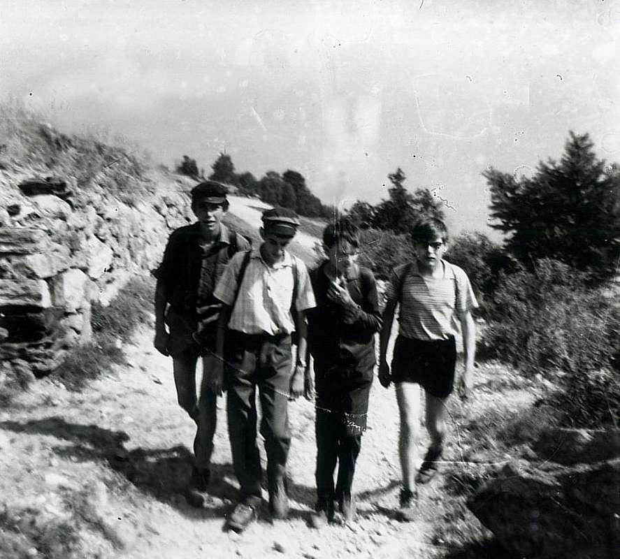
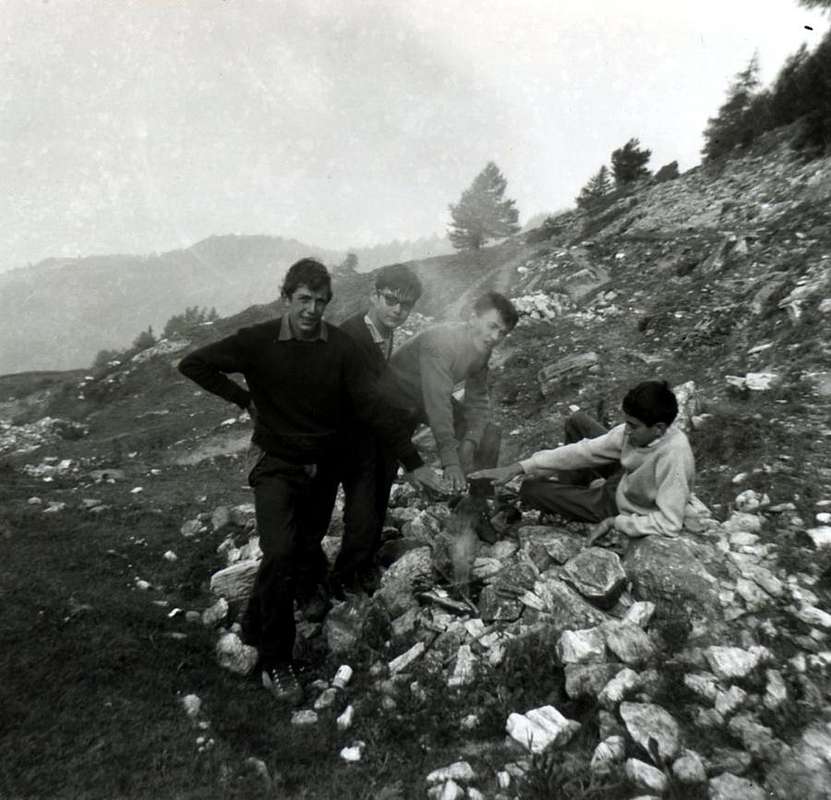
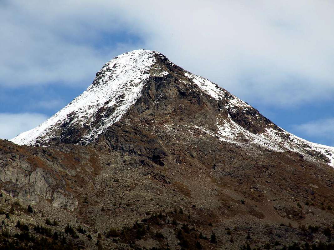
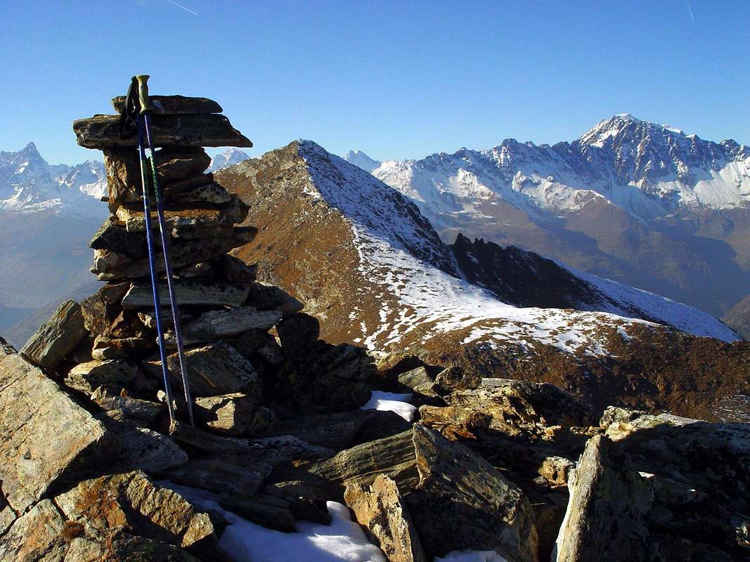
This small but very panoramic Summit is "suspended" between Dora Buthier, just above Central Valley of Baltea Valpelline. An ancient road that marks, in addition to transport livestock over the pastures of North Hill of Aosta, also the transition to the North from these into the adjacent Val Pelline. But also a beautiful hike that boys then carried out of the city along the dusty roads of the Sixties, or in winter climbing up to the Hamlet of Sorreley (790m) by bike and then continuing with the same reaching the ancient Villages of Parléaz or Parleyaz (1.274m) and Blavy (1.475m), now braving the cold and the increasingly deep snow through the dense forest. Poignant memories that back in a not too distant past, but they do understand how the world has considerably changed. At least apparently, because in today's revisiting of these places we found that these old paths are back in fashion again, experiencing a new era of exploration and mountain races.. The growing need to move itself has led people to rediscover an old way to maintain physical fitness, leaving aside the car and returning to the old and healthy habits to use your own body. They are so returned to live the old paths and muletracks has long abandoned. By young and old as well as young women lone hikers. Indeed, with great pleasure, we found that some youths are climbing in foreground on South Face Becca Viou (2.856m). Where once, except for us, did not see nobody ...
Questa piccola ma alquanto panoramica Cima risulta "sospesa" tra la Dora Baltea ed il Buthier, appena al di sopra della Valle Centrale della Dora e la Valpelline.Una antica via che segnava, oltre al trasporto del bestiame sopra i pascoli della Collina Settentrionale di Aosta, anche il passaggio da questi verso l'attigua a Nord Val Pelline. Ma anche una bella escursione a piedi che i ragazzi effettuavano lungo le polverose strade degli anni Sessanta, od in inverno salendo fino a Sorreley (790m) in bicicletta per poi continuare con le stesse raggiungendo i Villaggi di Parléaz o Parleyaz (1.274 m) e Blavy (1.475 m), ormai sfidando il freddo e la neve sempre più alta attraverso la foresta. Ricordi struggenti che riportano indietro in un passato neppure troppo lontano, ma che fanno capire come il mondo sia notevolmente cambiato. Almeno apparentemente, poiché nelle odierne rivisitazioni di questi luoghi abbiamo scoperto che questi vecchi sentieri sono tornati nuovamente di moda, vivendo una nuova epoca di esplorazioni e di corse in montagna. Il bisogno sempre più necessario di muoversi ha portato la gente a riscoprire un vecchio modo per mantenere l'efficienza fisica, lasciando da parte l'auto e ritornando alle vecchie e sane abitudini di utilizzare il proprio corpo. Son così tornati a vivere vecchi sentieri e mulattiere ormai da tempo abbandonate. Da parte di giovani e meno ed anche d'escursioniste solitarie. Anzi, con sommo piacere, abbiam scoperto che alcuni giovani del posto vanno ad arrampicare sulla Parete Meridionale della Becca di Viou (2.856 m). Là dove una volta, ad eccezione di noi, non vedevi proprio nessuno ...
First Ascents
First on Summit (through the East-southeast Crest or Normal Via by Viou Hill?): unknown.
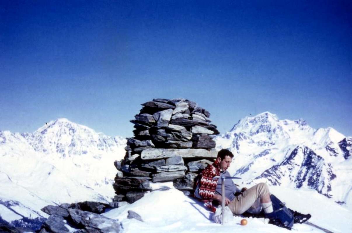
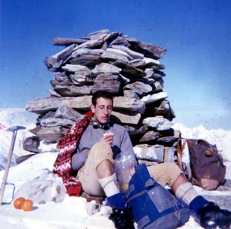
In winter (Southern Slope): Osvaldo Cardellina, Armando and Rino Poli; January 21th, 1968, in ascent and descent through the E-SE Ridge to Viou Hill (Standard Route). * Second: Ilario Antonio Garzotto and Osvaldo Cardellina; March 19th, 1968; ** Third: Osvaldo Cardellina, Marco Ceccarelli and Armando Poli; March 19th, 1969.
Getting There
BY CAR:
From TORINO, MILANO, etc: Motorway A5. Exit at IVREA or Quincinetto (PIEDMONT).
From IVREA Town: in West to Pont Saint Martin, Donnas, Bard, Verrès, St. Vincent, Châtillon, Nus, Quart, St. Christophe, Aosta and Roisan Municipalities.
From Courmayeur Resort: in East to Morgex, La Salle, Saint Pierre, Sarre, Aosta, Roisan and Saint Chistophe Municipalities. From Aosta Town to Roisan and to St. Christophe Municipalities
1) -From Aosta City with the SS.27 towards the Gran San Bernardo reaching the alternative (782m) near Variney Fraction and following crossroads nearby Moulin locality (765m) and before Gignod Commune (994m). Turning right and with before Southeast, after North directions towards Roisan Commune (768/843m).
2) - From Aosta towards Saint Christophe-Prevot (about 640m), reached by Regional Road and to "Chief-town" Sorreley Village; from this, with Municipal, towards Veynes Fraction up to the junction 1.025 meters "Montagne". By the crossroads to the West reaching Parléaz or Parleyaz(1.274m)Blavy (1.475m) small Villages.
3) -ByAosta towards Saint Christophe "Chief-town" by the SS.26 in East-northeast; from this before in Northeast after West with the Regional Road to alternative 730 meters below Thovex Village. Crossing West reach the fork 746 meters just below Quota Baden-Powell (792m); continuing Northwest and passing Serod, Porossan (754m, now in Aosta Municipality), Nayves, another Serod, Câche (764m), Closellinaz Dessus Fractions or Hamlets reach Roisan Commune.
From FRANCE: through the Mont Blanc Tunnel to Entrèves-crossroads to Vény/Ferret Valleys - Mountain Guides of Courmayeur - La Saxe Rock Gym - Courmayeur. By Little Saint Bernard Pass, closed since November until half May to La Thuile Valley - Pré Saint Didier - Courmayeur.It is not necessary to take Motorway A5: you can drive on SS.26, in the direction of AOSTA - IVREA - TURIN.
BY PLANE:
Aeroporto "Corrado Gex" Saint Christophe (Aosta).
Routes Description
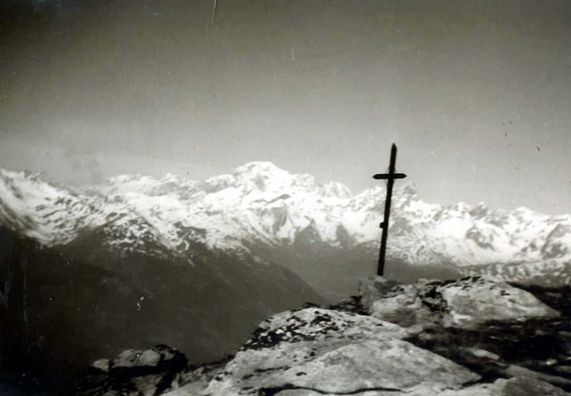
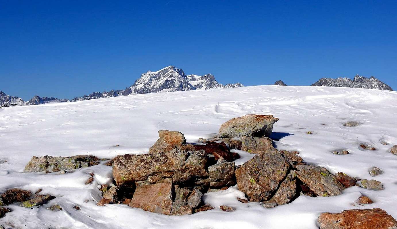
In general, the route's main thoroughfares shows the n° 105/1A/25 (numerous reports in yellow). This applies to departures from the Southwestern slope above the Dora Baltea or Buthier, while from the North, above Valpelline, you must use the n° 5/105. All reach the Colle di Viou (2.696m), just above where since a few years ago was positioned the "Bivouac Penne Nere or Black Feathers" (2.730m).
Parléaz/Blavy/Viou Basin
Approach from Blavy Village: park at the beginning of the dirt road (which is accessible only to authorized vehicles). Before with hike along the farm road that leads to the Praperia Pastures (1.737m). After short time the dirt private road forks; keep right (East) and reach the Viou Lower and Upper Pastures (2.078m, 2.202m; E/F; 1h'30/1h'45). Right behind the pastures starts the well-marked trail 25/105 for Colle di Viou (2.716m) nearby a comfortable fixed Bivouac "Penne Nere" (2.730m) was opened recently (Jul 16th, 2005) near the wide saddle just below a Summit called "Mont Trembloz". From this climb by small unnumbered and unreported path followed by traces on the short and easy East-southeast Crest up to the grat Cross of the Summit (E/F; 0h'40 from Viou Hill; 4h'00/4h'30 by Blavy Village). Direct Variant by Blavy: from Blavy goes up along the forest through path 25/105 reaching the private dirt road on Eastern diagonal route immediately before the Viou Lower Alpage (E/F; in less than half an hour).
In generale le vie più frequentate sono riportate dai sentieri n° 105/1A/25 (numerose segnalazioni in giallo).Questo vale per le partenze dal Versante Sudoccidentale sopra la Dora Baltea od il Buthier, mentre da Settentrione, sopra Valpelline, bisogna utilizzare il n° 5/105. Tutti raggiungono il Colle di Viou (2.696 m), appena sopra del quale da pochi anni é stato posizionato il "Bivacco Penne Nere" (2.730 m).
Bacino di Parléaz/Blavy/Viou
Avvicinamento dal Villaggio di Blavy: parcheggiare all'inizio della strada sterrata (che è accessibile solo ai veicoli autorizzati). Dapprima con escursione lungo la strada poderale che conduce agli Alpeggi Praperia (1.737 m). Dopo breve tempo la strada si biforca; prenderne il ramo di destra (Est) e raggiungere le Alpi di Viou Inferiore e Superiore (2.078 m, 2.202 m; E/F; 1h'30/1h'45). Subito dietro entrambe le alpi inizia il sentiero 25/105 ben segnalato verso il Colle di Viou (2.716 m) vicino al comodo bivacco fisso "Penne Nere" (2.730 m), inaugurato recentemente (16 luglio 2005) in prossimità della larga sella ed appena al di sotto della Sommità chiamata "Mont Trembloz". Da questo risalire su sentierucolo non numerato né segnalato seguito da tracce la breve e facile Cresta Est-sudest sino alla grande Croce della Cima (E/F; 0h'40 dal Colle di Viou; 4h'00/4h'30 da Blavy). Variante diretta da Blavy: da Blavy salire verso Settentrione in mezzo alla foresta con il sentiero 25/105 raggiungendo la poderale (E/F; 3h'30).
Essential Gear & Climbing Time
Difficulty
This route can be considered E or EE/BSA (Experts Hikers or Good Skiers-Montaineers) in winter by Ski-Mountaineering or Snowshoeing.
L'itinerario è classificato E oppure EE/BSA (Buoni Sciatori Alpinisti) in inverno tramite Sci-Alpinismo od in Racchette da neve.
Equipment
Hiking gear or in winter with ski and snowshoes (better with ARVA).
Da Escursionismo oppure in inverno tramite Sci oppure in Racchette da neve (meglio con ARVA). Times
Calculating an average between the 400/50 meters per hour or in winter by Ski or Snowshoe of 250/300).
Time basis: by Blavy Village 3h'00/4h'00.
Calcolare una media tra i 400/50 metri all'ora oppure in inverno tramite Sci o in Racchette da neve di circa 250/300).
Tempo base: dal Villaggio di Blavy 3h'00/4h'00.
Mountain Condition
Meteo: you can find all the needed informations at the official site of the Valle d'Aosta Region:
"Guida della Valpelline" de l'Abbè Joseph-Marie Henry - Societè Editrice Valdotaine 1925 II Edition e Collana Reprint Musumeci (1986).
"Guida dei Monti d'Italia - Alpi Pennine (Vol. 2)" di Gino Buscaini - Club Alpino Italiano/Turing Club Italiano, Luglio 1970 (In Italian).
"80 itinerari di Escursionismo Alpinismo e Sci Alpinismo in Valle d'Aosta", di Osvaldo Cardellina, Ed. Musumeci, Giugno 1977 (in Italian); seconda Ed. Luglio 1981; terza Ed. Luglio 1984; (in French), prima Ed. Febbraio 1978; seconda Ed. Marzo 1980.
"Ascensioni 1964-1969" Diario Alpinistico di Ilario Antonio Garzotto (unpublished).
"Diari Alpinistici" di Osvaldo Cardellina e Indice Generale accompagnato da Schedario Relazioni Ascensioni 1964-2019 (unpublished).


 1893 Hits
 77.48% Score
 8 Votes