
|
|
Mountain/Rock |
|---|---|
|
|
39.75951°N / 120.11526°W |
|
|
Lassen |
|
|
Hiking, Scrambling |
|
|
Spring, Fall, Winter |
|
|
6420 ft / 1957 m |
|
|
Overview
Beckwourth Pass Benchmark from the south
Two distinct summits rise on the south side of Beckwourth Pass in Northeastern California, about 25 miles northwest of Reno, Nevada. Both are prominent, with the highest, Beckwourth Pass South Summit, having a prominence of 666’, and the lower Peak 6402 (“Beckwourth Pass Benchmark” on Topographic Maps) having a prominence of 487’.
These summits are often overlooked because they aren’t really near anything. They are far north of Lake Tahoe and far out of town from Reno, and not located in a common source of traffic into Reno. Despite all this, they are surprisingly accessible, less than 30 minutes drive from Reno, and offering a pleasant hike during cold weather months.
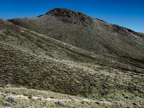
With the deserts of Nevada to the east and the forests of Plumas County to the west, along with a view of Sierra Valley, the views are excellent. Hiking both summits can be accomplished in a little over 5 miles, albeit gaining nearly 2,000’. The Beckwourth Pass Benchmark is adorned with boulders. The higher Beckwourth Pass South Summit is much more gentle.
The Beckwourth Pass area is best hiked in fall, winter, and springtime. As with most of the lower summits in this area, summer hiking is not recommended due to heat and rattlesnakes.
The coordinates for both summits are below:
Beckwourth Pass South Summit: 39.759510, -120.115263
Beckwourth Pass Benchmark 39.759628, -120.115585
Getting There
From Reno, Nevada head north on US 395 and enter California. Take US 70 West at Hallelujah Junction for 2 miles to Scott Road. Take a left on Scott Road, cross the train tracks and turn right on Hallelujah Drive, then the road curves around and becomes Dutchman Road. Drive under the base of Beckwourth Pass Benchmark, and find a place to park on the side of the road. You will be about 1.5 miles from US 70 to the starting point. These are well-graded dirt roads accessible by any 2WD. Just watch out for muddy conditions.Route Information
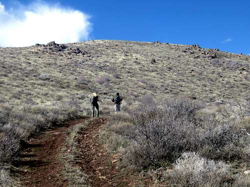
Off the main road below the peak just down the hill, there is road heading west up the slope. Start at the road, and take it up on the south side of Beckwourth Pass Benchmark. Then head right and hike up the steep rocky mountainside to the summit. While it is steep, it is pretty straightforward, and not very hard terrain to navigate.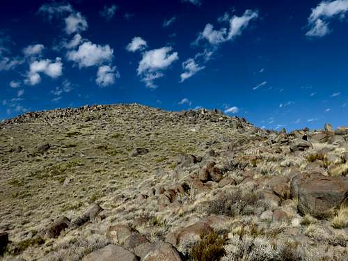
Looking up towards the summit area
To reach the higher summit, the Beckwourth Pass South Summit, you need to head down to the ridge below. That entails heading around the right side of Beckwourth Pass Benchmark, and then down a steep hillside to the ridge.
Heading up the side road towards the plateau
Once on the ridge, it is easy walking along a road along the ridge. Eventually a side road heads steeply up towards the top of the southern high point. Swing around the top of the plateau. Pass over a pile of rocks (Peak 6410 on topographic maps) and head up the final knob to the true summit.
To descend, you can head back down to the ridge, and descend steeply into the valley, and then back to the main road.
Red Tape
The Beckwourth South summits are on federal lands and there is no red tape. The starting points described above are also on federal lands.