Overview
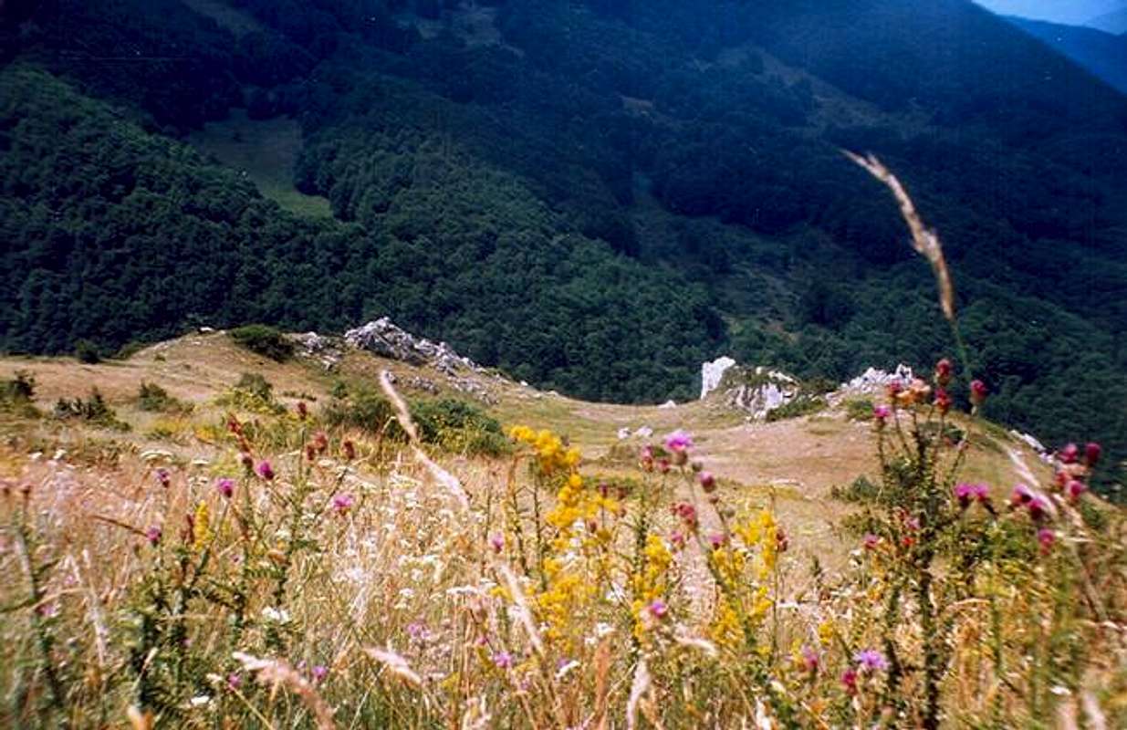
![Bistra mountain]() Bistra landscape in summer, on the road from Mavrovi Anovi to village Galichnik
Bistra
Bistra landscape in summer, on the road from Mavrovi Anovi to village Galichnik
Bistra is one of the most stunning
Macedonian mountains. The name
Bistra (eng: clear mountain) origin from the relatively clear climate conditions ruling on this mountain.
Bistra is one of the most accessible mountains in Macedonia (unlike the neighboring mountains of
Korab, Deshat, Krchin...). Thus, climbing Bistra to enjoy this excellent mountain landscape is much easier.
The vast meadows and pastures, immense forests, numerous sheepfolds and large herds of sheep are quite common. Bistra is also a kingdom of mountain tea.
The range is situated in the north-western part of the Macedonia, which is the largest mountainous part of the country. Bistra is mainly consisted of limestone rocks. One of the most interesting features of the mountain are the
karst fields. There are fourteen karst fields and the most important ones are:
Tonivoda, Govedarnik, Bardaš, Sultanica, Solomunica, Suvo Pole, Chukni Topanica, Lower and Upper Poljce, Tri Bari, Tri Groba etc.
Bistra has beautiful rivers and the most important ones are:
Galichka, Selechka, Tresonechka, Belichka, Zaeshka, Studenica etc. Bistra is full of many springs, particularly near the villages of
Galichnik, Janche, Selce and
Rosoki.
![]() A map of the Bistra mountain
A map of the Bistra mountain
Peaks
|
Bistra provides numberous peaks that are higher than 2000 meters and a number of peaks between 1500 and 2000 meters:
• Medenica (2163 m)
• Trebishka dupka (2151 m)
• Kjurkov dol (2110 m)
• Bistra (2101 m)
• Jarochkach (2015 m)
• Govedarnik (2011 m)
• Mali Shar (1993 m)
• Sandaktash (1981 m)
• Veli vrv (1916 m)
• Usin (1890 m)
• Jastrebec (1723 m)
For more info about the Medenica summit, please click on the following link:Medenica
|
![Brzovec peak on Bistra mountain]() Brzovec peak on Bistra mountain
Brzovec peak on Bistra mountain |
The ridge
The
NW part of the mountain is higher than the SE part. The peak of
Mali Shar (1993 m) is connecting these two separated parts of the mountain. From this peak in the
NE direction a separation from the main ridge is stretching just to the town of
Gostivar. The most important peak on this separation is
Sandaktash (1981 m).
In the
SW direction the ridge from the peak of
Mali Shar is approaching the peak that is high 1937 meters.
From there one separation goes eastern from the lake of
Mavrovo.
In the
NW direction another separation reaches the peak of
Usin (1890 m). The peak of Usin is famous because one ski-lift belonging to the ski center of Mavrovo is going just near to the peak.
If you continue from the peak of
Usin in the same (NW) direction, you will reach the point of separation of two ridges, one going in the
SW direction rising to the peak of
Velivrv (1916 m).
The north separation goes along the western shore of the lake of
Mavrovo. The most important peak on this ridge is
Jastrebec (1723 m).
The main ridge of the
NW part of Bistra passes the road to the village of
Galichnik, one of the most beautiful villages in the Macedonia.
The ridge there forms the ridge of
Chaushica. Chaushica includes several summits higher than 2000 meters: the highest peak on Bistra -
Medenica is situated in the southern part of the ridge, also the summit of
Govedarnik (2011 m) is situated above the village of Galichnik. In the nortern part of this ridge the highest peak is
Jarochkach (2015 m).
One important separation goes from the peak of
Medenica in the NW direction. This separation is stretching along the gorge of
Barich, a stunning landscape around the
river of Radika. This ridge is called
Ostrovo and it represents a wild and inaccessible area. Its impressive vertical slopes and immense forests are home to some of the rarest plants and animals of the region. The second highest peak of the mountain -
Trebishka dupka (2151 m) is situated on this ridge.
The
SE part of the Bistra mountain is beginning from the above mentioned peak of
Mali Shar. The beautiful summit of
Kjurkov dol (2110 m) is accessible in the south direction from the peak of Mali Shar.
From the peak of Kjurkov dol one separation goes in the western direction, the second one goes in the eastern direction and the third one reaches the peak of
Bistra (2101 m).
From the peak of Bistra one separation goes in the SE direction, and the other reaches the
Jama pass (1507 m).
Rivers
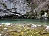
![Waterfall on the Tresonechka river]() Waterfall on the Tresonechka river
Waterfall on the Tresonechka river
|
One of the most impressive parts of the park are the striking gorges of the Radika river. Radika separates Bistra, Korab and Shara mountains and is a typical mountain river with rapids and clean water, rich in trout.
The central part of the National Park of Mavrovo is located in the valley and river basin of Radika River, where numerous interesting geomorphological forms can be found: gorges, high slopes, rocks in various forms, caves, etc. the Radika Valley is distinct with its significant landscape values and is very accessible for picnics.
The most dramatic is the Baric gorge. The horizon in front of the observer completely closes leaving open only the blue sky and the steep ascending rocks, in some places 1,500 m high.
First bigger Radika's tributary is Adzina river; the biggest left tributary is Mala river, which is formed from Tresonechka and Jadovska rivers.> |
Caves
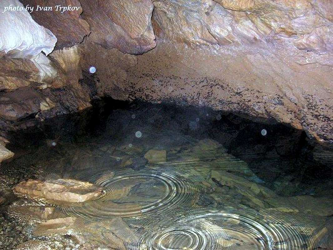
![Underground lake in the Alilica cave]() Underground lake in the Alilica cave
Underground lake in the Alilica cave
Bistra has also beautiful
caves. The most important ones are
Alilica, Kalina dupka, Sharkova dupka etc.
Alicica is the biggest cave on the mountain. It is situated near the village of
Tresonche. The cave can be easily reached from the village.
The route leads along the
Tresonecka river, surrounded by rich vegetation. The river is famous by its wonderful waterfalls.
From the village of Tresonce the cave can be reached in about 30-40 minutes by walking. The entrance is not very big. Once in the cave, in a short time an underground river can be reached, but in order to reach the river, the visitor must descend a steep rock for about 4-5 meters. Here the cave is widening, representing beautiful ornaments. If you follow the underground river, you will shortly come near an underground lake. According to many experienced cave explorers in the country, this cave is one of the most beautiful in whole country.
The cave of
Kalina Dupka is situated between the villages of
Rosoki and village of
Lazaropole. It is actually near the route that connects this two beautiful villages. From both sides, there is approximately between 30 and 40 minutes in order to reach the cave.
The entrance is again narrow. After that, the cave is widening, presenting some of its beauties. Soon a very narrow tunnel leads deeply in the cave, but unfortunately I hadn't have a chance to continue with the explorations. I was told that also a river and even an underground lake can be reached in the cave.
Mavrovo National Park
Big part of the mountain is included into the boundaries of the
Mavrovo national park.
The National Park Mavrovo is characteristic for its extremely rich flora and fauna. The park embraces a variety of plants and animal life including over 300 kinds of birds and 45 types of vertebrates, 1200 types of plants (divided into 295 classes and 87 families), over 52 mountain tops that are within the territory of the park, and which have the height of over 2000 m.
Besides the presence of several floral elements from different climatic regions, the most important feature of the floral-geographical position of the park is the presence of several endemic and relic forms.
Of special interest is the presence of the elements from the original vegetation: the tertiary and glacial relics.
In the region of the park, there are over 140 species of birds and over 45 species of other vertebrates. Characteristic birds are:the gray falcon, eagle, large owl, large cormorant, the white-headed vulture, white stork, partridge and the wild pigeon. The most important verterbrates are:the wild goat, bear, lynx, pine marten, otter, squirrel etc. In the river Radika and its mountain inflows there is a presence of the Radika trout. Lots of fishermen come to fish at Mavrovo lake during the weekend.
The beautiful artificial lake of
Mavrovo is long 12 km and wide 3 km. It is deep approximately 50 meters and is situated on 1200 meters above the sea level.
The villages of
Mavrovo, Leunovo and
Nikiforovo are important tourist centers in Macedonia for the summer, as well in winter. The famous ski center of
Mavrovo offers excellent conditions for enjoying the lots of snow during the winter.
Mountain monasteries
Monastery of
St. Jovan Bigorski is situated above the river of
Radika, near the road from the town of
Debar to the
Mavrovo lake. It is built in the distant 1020 year. It has one of the most beautiful walnut iconostasis in the country and in the Balkan peninsula (the process of iconostasis creation took more than 10 years of hard work). It is true master-piece of the carvers from this region, carved by the Filipovski brothers. The masters, apart from motifs of the Bible, represented some of the flora and fauna of the beautiful region from the Radika gorge to Debar.
The monastery is dedicated to
St. Jovan Krstitel (Saint John the Baptist). Today, the monastery lives again actively as a religious center with a brotherhood of monks. The monastery inns have been adjusted for modern use and are rented as inns for the numerous visitors. The monastery services, the baptisms, and weddings are part of the monks life in the monastery, and at the same time they are a great attraction for the tourists.The monastery ambient is redeemed with the old mansions with the spacious wooden balconies and the dining room furnished with authentic furniture from the time of its construction, the late 17th and early 19th century.
The monastery is also famous for the Icon of St. John Bigorski which is believed has a mysterious power. The Icon was found by the monarch Jovan in the year of 1020, on the same place where the Monastery was built later on, and it was floating over the river Radika.
Mountain villages
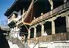
Bistra has ones of the most beautiful villages in the country. The villages are famous by its unique architecture and churches. Especially interesting are the customs performed during the celebration of the Orthodox holidays Vodici, Vasilica, Epiphany, Easter, and especially the wedding ceremony.
The village of
Galichnik is situated on 1350 meters above the sea level. There are more than 500 houses in the village, but there are only a few inhabitants during the winter (the village is visited mainly during the summer months). The village is famous by the
Galichka wedding ceremony that is occurring annually on 12 of July (Orthodox Christian holliday of St. Peter's day, called Petrovden). Thousands of tourists from the country and from the other countries, as well as politicians, diplomats etc are visiting Galichnik for this occasion. Several beautiful churches are available for visiting in the village.
On a plateau at Mount Bistra, surrounded by beech and oak forest, at 1,350 m altitude, is situated one of the highest settlements in Macedonia, the village of
Lazaropole, the second largest in the region of Mijach. There are about 400 houses in the village. The older ones reveal the traces of the Mijach highland building style. The village was the birthplace of numerous Macedonian authors, educators, carvers, teachers, fresco and icon painters, and constructors. Especially picturesque are the village church of
St. Gjorgi, built in 1838, and the small churches in the forests near the village.
A visit to Lazaropole will adorn the soul with an unusual peace and calmness, will fill the eyes with the view from Sokolica of the summits of Krchin, Korab, and Stogovo. It will make you sense the odours of the mountain flowers of Koritnik and it will clean your lungs with the unpolluted crisp air of Bistra. It is wonderful to visit Lazaropole in June, when the whole area is filled with the narcissuses' odours, or in September, when the entire forest is bathed with the rainbow colours of yellow, brown, reddish, green, pink... Or in winter, wit the icicles glittering from the village's roofs. The main annual gathering of the people which origin from this beautiful village is at
2 August (the orthodox christian holiday of Ilinden).
Accomodation
Unfortunately, there is only one mountain jut on the mountain (surprising fact, regarding the importance of this mountain and the conditions for climbing it provides). It is the mountain hut
Kitka near the village of
Tajmishte. It has approximately 30 beds, and kitchen.
However, the
Mavrovo region offers excellent conditions for accomodation regarding the numerous hotels that are functioning there throughout the year.
One of the best hotels there is the Bistra hotel.
The ski center named
Zare Lazareski is part of the National Park of Mavrovo and it's situated 41 km from Gostivar, while from the capital of Macedonia,
Skopje is 106 km away. It has two double lift chairs, and one single lift chair with over 1100 person capacity per hour, and several ski lifts with synchronized connection and over 5000 person capacity per hour. The ski center was renovated recently, so the capacity of the ski lifts and the ski chairs is increased. The ski trails start at 1960m and end at 1250m above sea level. The Mavrovo’s neighboring villages Leunovo and Nikiforovo also provide private accommodation and hotels.
Accommodation can be also obtained in the village of
Galichik: a private accommodation or in the “Neda” hotel. Also, the visitor can stay at the monastery of
St. Jovan Bigorski.
Getting There
Bistra is accessible from several directions.
The
northern approach to the range can be made using the good connection road that begins at the capital of Macedonia - Skopje. The road goes near the cities of
Tetovo and
Gostivar and reaches the lake of
Mavrovo, that is already part of the mountain and National park Mavrovo.
From there the villages of
Galichnik and several other villages can be used as an starting point for climbing the north-western part of the Bistra mountain.
The
western approach can be made from the town of
Debar, village of
Janche and other villages, but the western mountain slopes are very steep and the routes for climbing are quite limited.
The
southern approach can be made from the Miyak villages of
Lazaropole, Rosoki, Selce, Tresonche etc.
From
east the mountain can be explored beggining from town of
Kichevo, the villages of
Izvor, Ehlovec, Ivanchista etc.
Red Tape
The permits are not required. A special attention should be made regarding the preservation of wildlife and plants in the National Park Mavrovo boundaries.
When To Climb
The mountain can be easily climbed in the period from
June to September. The months of March and April are not recomended for climbing, regarding the lots of snow that are present in the higher parts of the range.
Also, many of the roads within the mountain boundaries are cleared from snowfalls periodically in winter (not on regular basis) and the visitor that wants to reach the villages of
Galichink, Lazaropole and other villages on the mountain in winter should obtain additional informations about the conditions on the roads.
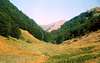
![Area around the Skrka peak]() Area around the Skrka peak
Area around the Skrka peak
Maps
 22564 Hits
 83.69% Score
 17 Votes
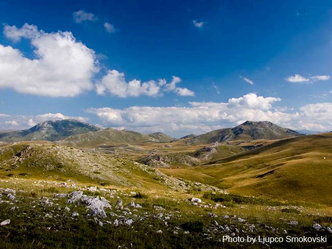 Bistra landscape in summer, on the road from Mavrovi Anovi to village Galichnik
Bistra is one of the most stunning Macedonian mountains. The name Bistra (eng: clear mountain) origin from the relatively clear climate conditions ruling on this mountain.
Bistra is one of the most accessible mountains in Macedonia (unlike the neighboring mountains of Korab, Deshat, Krchin...). Thus, climbing Bistra to enjoy this excellent mountain landscape is much easier.
The vast meadows and pastures, immense forests, numerous sheepfolds and large herds of sheep are quite common. Bistra is also a kingdom of mountain tea.
The range is situated in the north-western part of the Macedonia, which is the largest mountainous part of the country. Bistra is mainly consisted of limestone rocks. One of the most interesting features of the mountain are the karst fields. There are fourteen karst fields and the most important ones are: Tonivoda, Govedarnik, Bardaš, Sultanica, Solomunica, Suvo Pole, Chukni Topanica, Lower and Upper Poljce, Tri Bari, Tri Groba etc.
Bistra has beautiful rivers and the most important ones are: Galichka, Selechka, Tresonechka, Belichka, Zaeshka, Studenica etc. Bistra is full of many springs, particularly near the villages of Galichnik, Janche, Selce and Rosoki.
Bistra landscape in summer, on the road from Mavrovi Anovi to village Galichnik
Bistra is one of the most stunning Macedonian mountains. The name Bistra (eng: clear mountain) origin from the relatively clear climate conditions ruling on this mountain.
Bistra is one of the most accessible mountains in Macedonia (unlike the neighboring mountains of Korab, Deshat, Krchin...). Thus, climbing Bistra to enjoy this excellent mountain landscape is much easier.
The vast meadows and pastures, immense forests, numerous sheepfolds and large herds of sheep are quite common. Bistra is also a kingdom of mountain tea.
The range is situated in the north-western part of the Macedonia, which is the largest mountainous part of the country. Bistra is mainly consisted of limestone rocks. One of the most interesting features of the mountain are the karst fields. There are fourteen karst fields and the most important ones are: Tonivoda, Govedarnik, Bardaš, Sultanica, Solomunica, Suvo Pole, Chukni Topanica, Lower and Upper Poljce, Tri Bari, Tri Groba etc.
Bistra has beautiful rivers and the most important ones are: Galichka, Selechka, Tresonechka, Belichka, Zaeshka, Studenica etc. Bistra is full of many springs, particularly near the villages of Galichnik, Janche, Selce and Rosoki.
 A map of the Bistra mountain
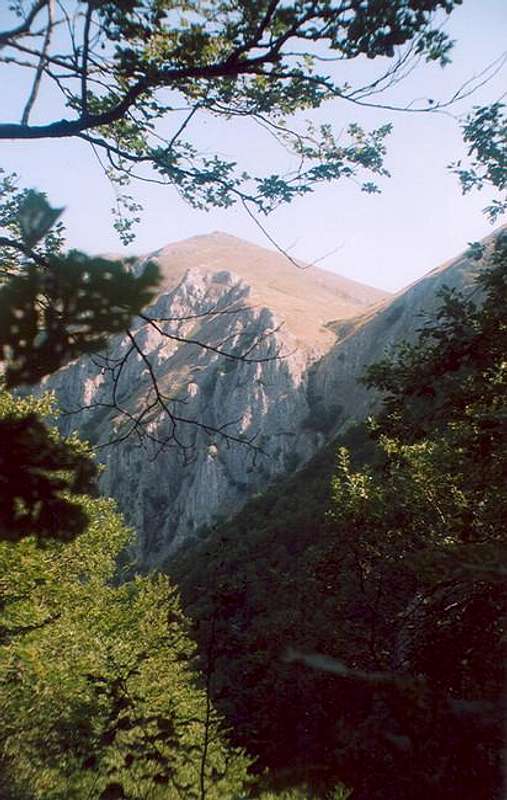 Brzovec peak on Bistra mountain


 Waterfall on the Tresonechka river


 Underground lake in the Alilica cave
Bistra has also beautiful caves. The most important ones are Alilica, Kalina dupka, Sharkova dupka etc.
Alicica is the biggest cave on the mountain. It is situated near the village of Tresonche. The cave can be easily reached from the village.
The route leads along the Tresonecka river, surrounded by rich vegetation. The river is famous by its wonderful waterfalls.
From the village of Tresonce the cave can be reached in about 30-40 minutes by walking. The entrance is not very big. Once in the cave, in a short time an underground river can be reached, but in order to reach the river, the visitor must descend a steep rock for about 4-5 meters. Here the cave is widening, representing beautiful ornaments. If you follow the underground river, you will shortly come near an underground lake. According to many experienced cave explorers in the country, this cave is one of the most beautiful in whole country.
The cave of Kalina Dupka is situated between the villages of Rosoki and village of Lazaropole. It is actually near the route that connects this two beautiful villages. From both sides, there is approximately between 30 and 40 minutes in order to reach the cave.
The entrance is again narrow. After that, the cave is widening, presenting some of its beauties. Soon a very narrow tunnel leads deeply in the cave, but unfortunately I hadn't have a chance to continue with the explorations. I was told that also a river and even an underground lake can be reached in the cave.
Underground lake in the Alilica cave
Bistra has also beautiful caves. The most important ones are Alilica, Kalina dupka, Sharkova dupka etc.
Alicica is the biggest cave on the mountain. It is situated near the village of Tresonche. The cave can be easily reached from the village.
The route leads along the Tresonecka river, surrounded by rich vegetation. The river is famous by its wonderful waterfalls.
From the village of Tresonce the cave can be reached in about 30-40 minutes by walking. The entrance is not very big. Once in the cave, in a short time an underground river can be reached, but in order to reach the river, the visitor must descend a steep rock for about 4-5 meters. Here the cave is widening, representing beautiful ornaments. If you follow the underground river, you will shortly come near an underground lake. According to many experienced cave explorers in the country, this cave is one of the most beautiful in whole country.
The cave of Kalina Dupka is situated between the villages of Rosoki and village of Lazaropole. It is actually near the route that connects this two beautiful villages. From both sides, there is approximately between 30 and 40 minutes in order to reach the cave.
The entrance is again narrow. After that, the cave is widening, presenting some of its beauties. Soon a very narrow tunnel leads deeply in the cave, but unfortunately I hadn't have a chance to continue with the explorations. I was told that also a river and even an underground lake can be reached in the cave.


 Area around the Skrka peak