Toggle navigation
Mountains
Routes
Images
Trip Reports
Forum
What's New
People
Areas & Ranges
Articles
Trailheads
Canyons
Huts & Campgrounds
Albums
Logistical Centers
Fact Sheets
Lists
Custom Objects
Gear
Plans & Partners
WELCOME TO SUMMITPOST
SIGN IN
REGISTER
Black Lassic
Additional Parents
Image
Black Lassic Map
View High-Resolution Image
Black Lassic Map
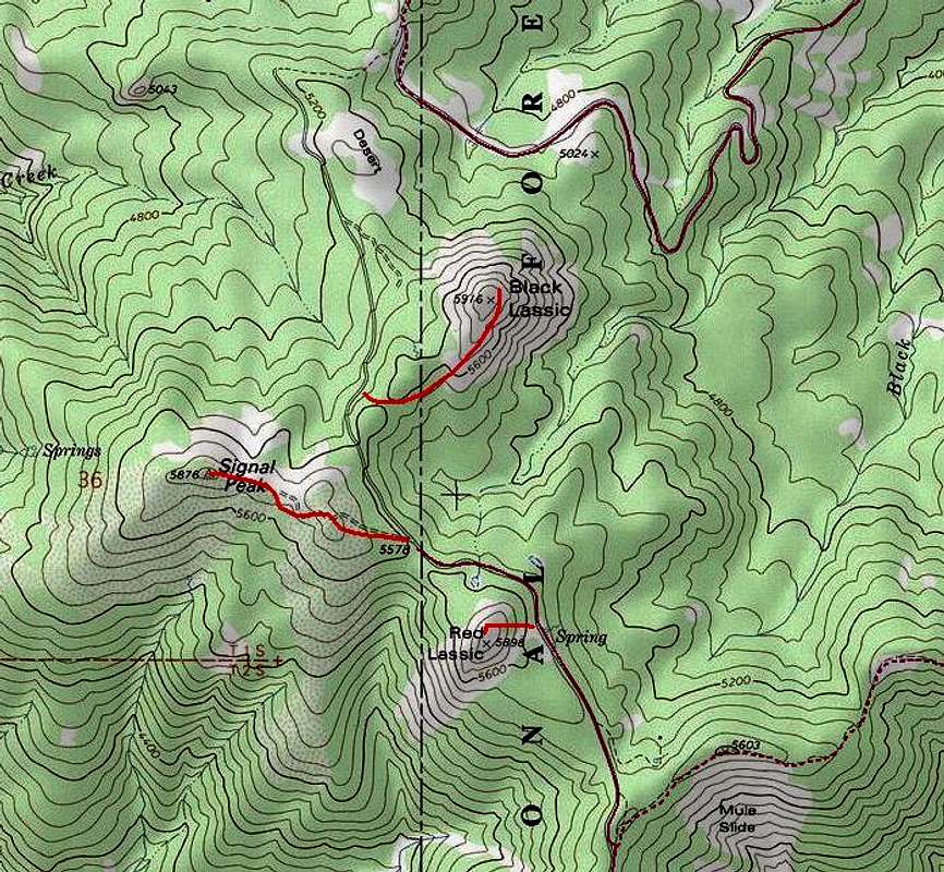
Area surrounding Black Lassic. The red line at the top of the map is Six Rivers NF Forest Route 1S07. The vertical black line is the county line separating Humboldt Co. (on the left) from Trinity Co. (on the right)
« PREV
NEXT »
mlarkin2002
on
May 6, 2008 2:21 am
Comments & voting
Other parents
Image Type(s):
Topo/Diagram
Image ID:
401609
3488 Hits
72.08
% Score
2
Votes
Log in to vote
Comments
No comments posted yet.
to post!
Don't have an account?
Black Lassic
(Mountain/Rock)
« PREV
Viewing
#11 of 15
GALLERY
NEXT »
mlarkin2002's Image Gallery
« PREV
Viewing
#20 of 24
GALLERY
NEXT »
×
You need to login in order to vote!
User Name
Password
Remember me
Forgot your password?
Log me out when I close my browser.
Keep me logged in all the time.
sign in as a user
Don't have an account?
Register now for FREE
Rating available
Suggested routes for you
People who climb the same things as you
Comments Available
Create Albums
Register Here


