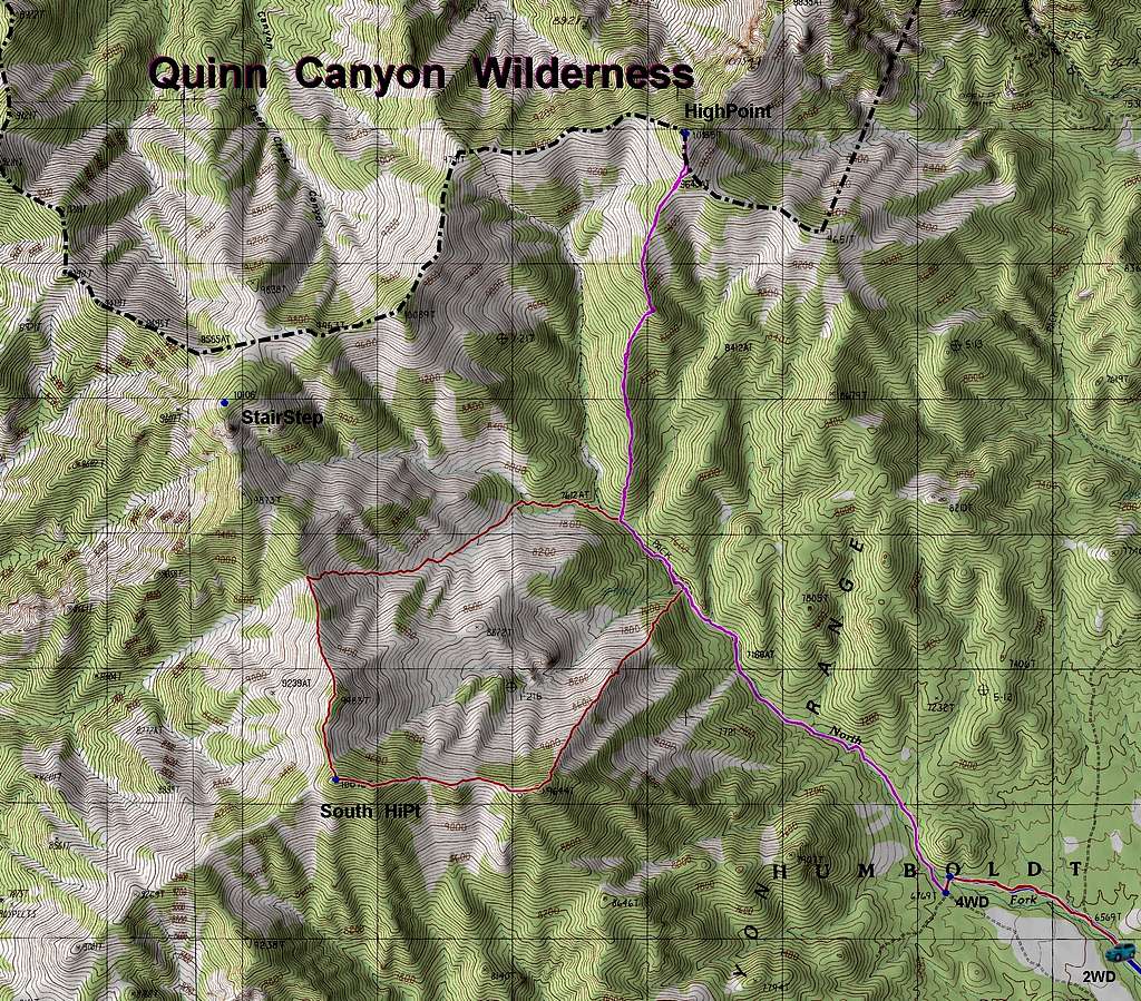
The Quinn Canyon High Point sits right on the boundary for the wilderness area. "2WD" denotes the last place to camp/park with a modest-clearance vehicle; with a burly 4WD drive, one can go at least a mile farther up the road (FS651). Another road, FS411, also goes to at least 7500', east of the high point; this road appears good from afar, but I've never tried to drive it. There is no motorized vehicle access within the wilderness.
At least three of the 10k peaks (including the highpoint) can be accessed without crossing the wilderness boundary (which is north of the dash-dot line on the map). There are 1-3 (depending how you measure prominence) 10k peaks on the ridge N of the highpoint, which are within the wilderness area; one of these is 10181', and is (within error) about the same elevation as the official highpoint.
The UTM grid is 1 km x 1 km for each cell.
A word to the wise: stay out of the low, sage-covered canyons. Even though these canyons look like tempting descent routes, the sage gets waist-high as one descends, and you will be restricted to deer/cow trails, which are infested with ticks. The wooded ridges have some brush, but are much more pleasant for travel. The upper sage-covered areas -- particularly ridges, or above 9000' -- are generally pleasant, since the brush is only ankle-high.


