
Viewing: 1-2 of 2

Dundeel - Nov 10, 2009 4:06 pm - Voted 10/10
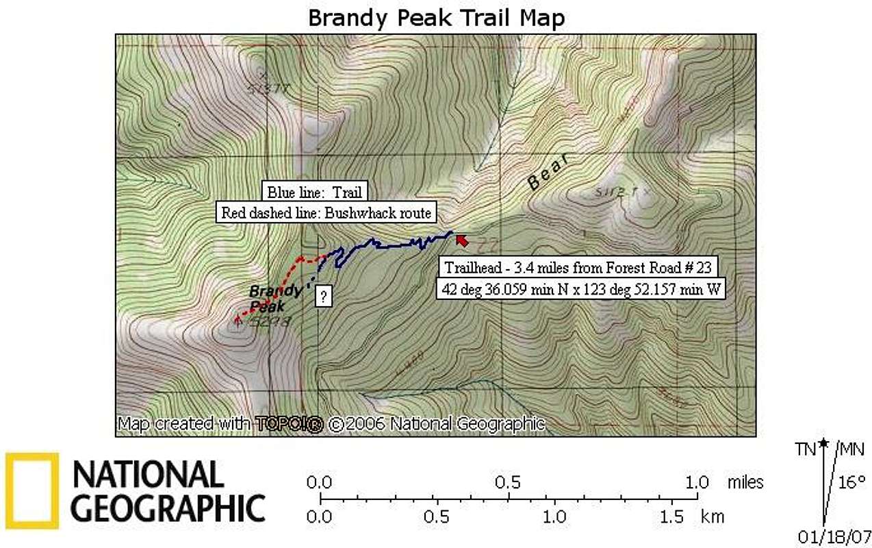
Summit way trailStay on the Bear Camp Ridge Trail as it leaves the flat area and after a 100 yds or so, you'll find a way trail branching off to the right that will take you to the summit.

Don Nelsen - Nov 10, 2009 10:53 pm - Hasn't voted
What!You were in OR and didn't call?
Hey, how about putting together an expedition to put an end to the Klickitat Kwestion: Something that all would believe in. Question: It's about 1,600' from point 5819 to point 5823 and about 450' farther to the Pinnacle: How accurate is sighting that far? I can do some fine tuning on my survey pole and probably get it to work up to 40 feet or so - we just need an expert to give the final analysis and a professional instrument to sight with..... um, you, maybe?
Hope all is well,
Don
Viewing: 1-2 of 2


Comments
Post a Comment