
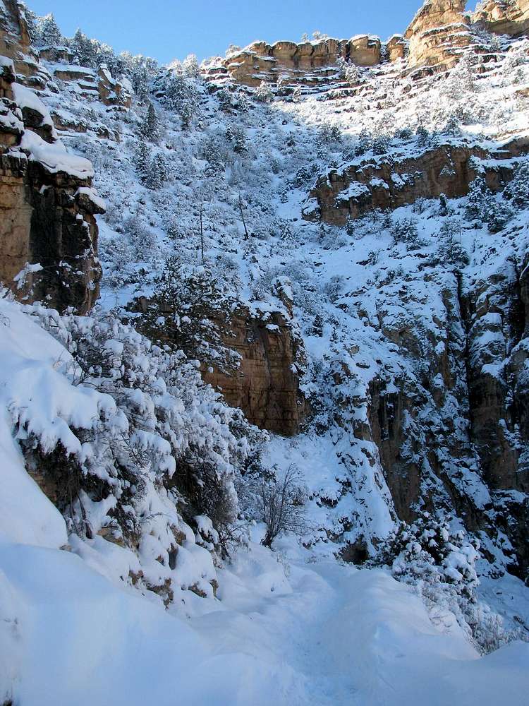
On the Bright Angel Trail, looking back up at the South Rim, 23 December 2009.
This is the location of the Bright Angel Fault that cuts across the canyon roughly northeast to southwest. On the north side, Bright Angel Creek flows in the very large tributary canyon along this fault line. The North Kaibab Trail follows this creek and takes advantage of the nice gradual slope.
On the south side, Garden Creek forms the drainage along this same fault, and this is where much of the Bright Angel trail was constructed. This photo shows where the fault meets the South Rim. The broken terrain and rubble from the fault form a nice sloping area where the trail can pass the thick Kaibab Limestone, Coconino Sandstone, and Redwall Limestone layers that are high vertical walls elsewhere in the canyon.
These sedimentary rock layers were originally all in continuous horizontal bands, of course. But the fault has shifted the western (right) side up about 150 feet higher than the eastern (left) side. This is not apparent in this photo, but it is a quite obvious and interesting feature in views from the canyon's north side.


