Toggle navigation
Mountains
Routes
Images
Trip Reports
Forum
What's New
People
Areas & Ranges
Articles
Trailheads
Canyons
Huts & Campgrounds
Albums
Logistical Centers
Fact Sheets
Lists
Custom Objects
Gear
Plans & Partners
WELCOME TO SUMMITPOST
SIGN IN
REGISTER
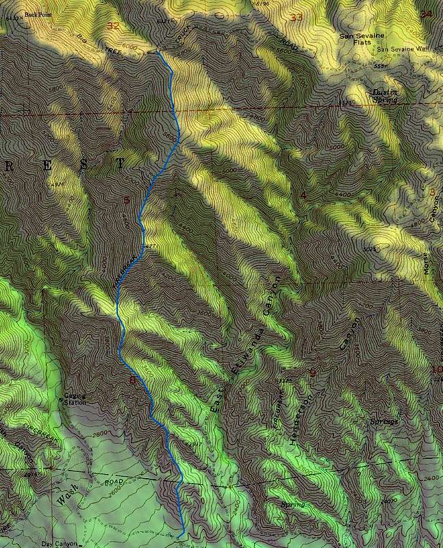
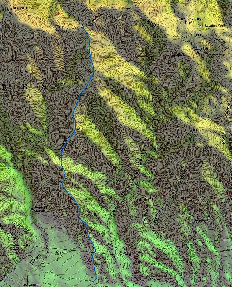
San Sevaine Lookout, San Gabriel Mountains
Additional Parents
Image
Buck Point from the South
View High-Resolution Image
Buck Point from the South
Possible hiking route from the end of Etiwanda Ave.
« PREV
NEXT »
Travis_
on
Jan 12, 2008 12:41 am
Comments & voting
Other parents
Lat/Lon:
34.21730°N / 117.4902°W
Image Type(s):
Topo/Diagram
Image ID:
372180
1906 Hits
71.06
% Score
1
Votes
Log in to vote
Comments
No comments posted yet.
to post!
Don't have an account?
San Sevaine Lookout, San Gabriel Mountains
(Trip Report)
« PREV
Viewing
#3 of 10
GALLERY
NEXT »
Travis_'s Image Gallery
« PREV
Viewing
#278 of 451
GALLERY
NEXT »
×
You need to login in order to vote!
User Name
Password
Remember me
Forgot your password?
Log me out when I close my browser.
Keep me logged in all the time.
sign in as a user
Don't have an account?
Register now for FREE
Rating available
Suggested routes for you
People who climb the same things as you
Comments Available
Create Albums
Register Here


