Toggle navigation
Mountains
Routes
Images
Trip Reports
Forum
What's New
People
Areas & Ranges
Articles
Trailheads
Canyons
Huts & Campgrounds
Albums
Logistical Centers
Fact Sheets
Lists
Custom Objects
Gear
Plans & Partners
WELCOME TO SUMMITPOST
SIGN IN
REGISTER
San Sevaine Lookout, San Gabriel Mountains
Additional Parents
Image
Buck Point from the South
View High-Resolution Image
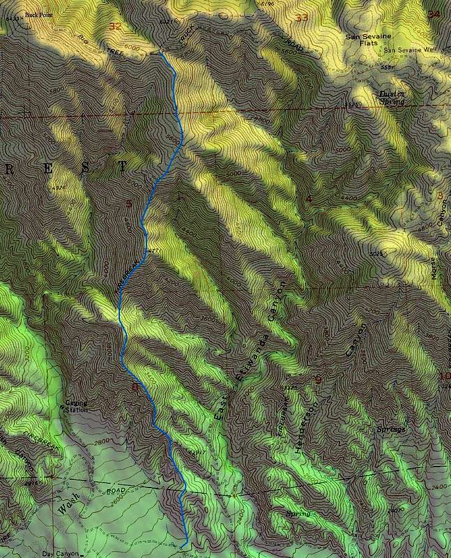
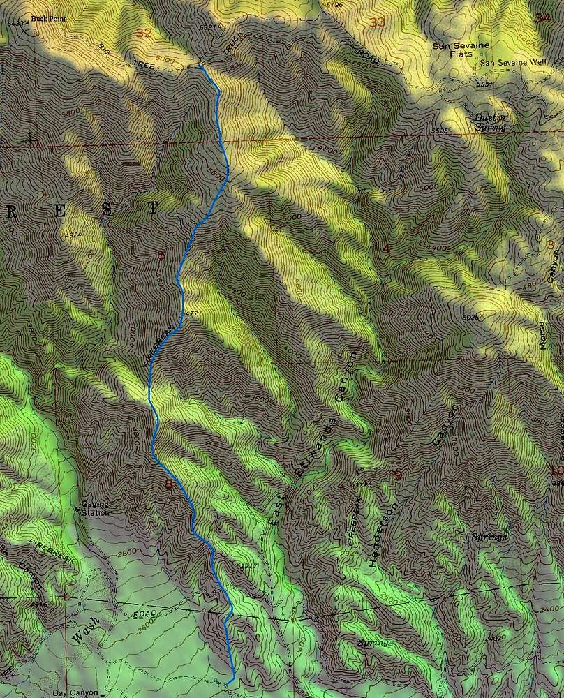
Buck Point from the South
Possible hiking route from the end of Etiwanda Ave.
« PREV
NEXT »
Travis_
on
Jan 12, 2008 12:41 am
Comments & voting
Other parents
Lat/Lon:
34.21730°N / 117.4902°W
Image Type(s):
Topo/Diagram
Image ID:
372180
1931 Hits
71.06
% Score
1
Votes
Log in to vote
Comments
No comments posted yet.
to post!
Don't have an account?
San Sevaine Lookout, San Gabriel Mountains
(Trip Report)
You are at
the First
Image
Viewing
#1 of 1
GALLERY
You are at
the Last
Image
Travis_'s Image Gallery
« PREV
Viewing
#278 of 451
GALLERY
NEXT »
×
You need to login in order to vote!
User Name
Password
Remember me
Forgot your password?
Log me out when I close my browser.
Keep me logged in all the time.
sign in as a user
Don't have an account?
Register now for FREE
Rating available
Suggested routes for you
People who climb the same things as you
Comments Available
Create Albums
Register Here


