Toggle navigation
Mountains
Routes
Images
Trip Reports
Forum
What's New
People
Areas & Ranges
Articles
Trailheads
Canyons
Huts & Campgrounds
Albums
Logistical Centers
Fact Sheets
Lists
Custom Objects
Gear
Plans & Partners
WELCOME TO SUMMITPOST
SIGN IN
REGISTER
Buckhorn Lakes
Additional Parents
Image
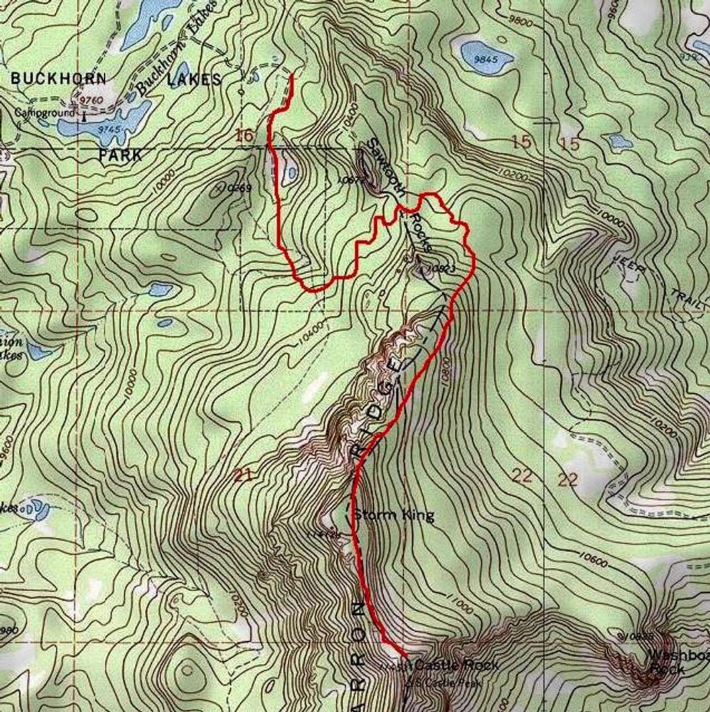
Buckhorn Lakes Route
View High-Resolution Image
Buckhorn Lakes Route
TOPO! map with route marked in red. Due to poor visibility, my red line is approximate. Fortunately, a road and then a trail leads you through the initial, most confusing portion of the route.
« PREV
NEXT »
Larry V
on
Oct 5, 2006 3:23 am
Comments & voting
Other parents
Lat/Lon:
38.30900°N / 107.633°W
Image Type(s):
Topo/Diagram
,
Informational
Image ID:
232033
3420 Hits
0
% Score
0
Votes
Log in to vote
Comments
No comments posted yet.
to post!
Don't have an account?
Buckhorn Lakes
(Route)
« PREV
Viewing
#8 of 8
GALLERY
You are at
the Last
Image
Larry V's Image Gallery
« PREV
Viewing
#482 of 488
GALLERY
NEXT »
×
You need to login in order to vote!
User Name
Password
Remember me
Forgot your password?
Log me out when I close my browser.
Keep me logged in all the time.
sign in as a user
Don't have an account?
Register now for FREE
Rating available
Suggested routes for you
People who climb the same things as you
Comments Available
Create Albums
Register Here


