
|
|
Mountain/Rock |
|---|---|
|
|
35.25690°N / 82.8011°W |
|
|
Transylvania |
|
|
Mixed |
|
|
Spring, Summer, Fall, Winter |
|
|
4056 ft / 1236 m |
|
|
Overview
Cedar Rock Mountain rises in the vicinity of two more famous local mountains: John Rock and Looking Glass Rock. Although it's not quite as visible and prominent as those two peaks, it's well worth the hike to visit the summit and the vast amount of exposed rock on its flanks.
Looking Glass
In addition, this is classic southern hiking territory. The slopes are
Waterfalls
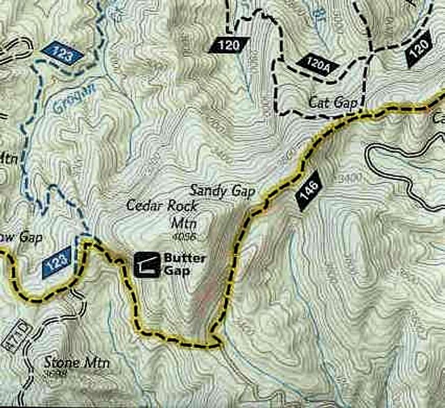
The trail system around Cedar Rock is dominated by the well known and well maintained Art Loeb Trail. This is a great hiking and backpacking trail that even has its own series of trail shelters. Cedar Rock Mountain is well positioned to offer a fair amount of solitude if you choose the right time. Mid-week and in cooler weather will generally guarantee that you will see few (or no) other hikers.
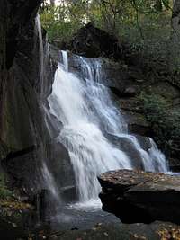
This area is also the location of a number of impressive waterfalls. Many of these are easily accessed along the same trails that will take you to Cedar Rock Mountain.
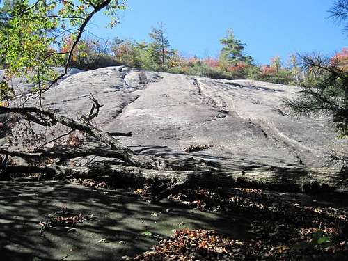
Slabs
Getting There
Best access to Cedar Rock Mountain is along the same trail system that's popularly used to hike to the summit of John Rock. Once at the summit of John Rock, just continue on until you hit the intersection with the Art Loeb Trail and follow that north to Sand Gap where you will find the manway to the top of Cedar Rock Mountain.From Asheville, take I-240 west to I-26 east to the exit for the Asheville Airport (exit 40). Turn right onto NC 280; follow this 4-lane highway for 16 miles toward Brevard. At the intersection with US highways 276 and 64, turn right onto US 276 west (follow signs for Pisgah National Forest). Follow US 276 for 5.2 miles; turn left onto FR 475. Go 1.4 miles to the Center for Wildlife Education and Fish Hatchery. Turn left, cross the bridge and park in the parking lot.
Cedar Rock Off Trail
Red Tape
None. Pisgah National Forest lands. Back country campsites in abundance. Springs and streams aplenty. I know of no restrictions for hiking, backpacking, camping, etc.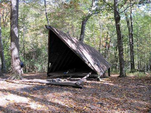
Butter Gap Shelter
Camping
Many, many back country campsites all around this part of the Pisgah National Forest. There are several trail shelters along the Art Loeb Trail.
There is developed camping at the nearby Davidson River Campground, which is part of the National Forest Service but administered by a concessionaire.
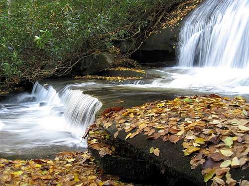
Waterfalls abound
External Links
Davidson River Campground.The Art Loeb Trail.
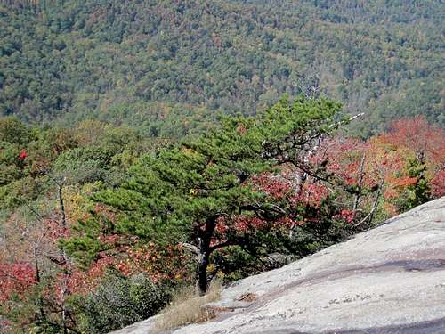
Scenery