-
 1777 Hits
-
 0% Score
-
 0 Votes
|
|
Route |
|---|---|
|
|
16.19518°S / 71.53221°E |
|
|
Hiking |
|
|
Spring, Summer, Fall, Winter |
|
|
Half a day |
|
|
F |
|
|
Overview
And yes, while atop of the mountain, sun in my back, no wind, temp near 0C/32F, I could not really think of an "easier" 6000m!
Getting There
You have, speaking of logistics, two ways to get to the basecamp (5175m), named Inka camp:- organize the trip with an agency. Agencies are found basically on every street in the city center in Arequipa. After a quick search in town, we got deals around 100USD for transportation to the Pass/end of the dust road for a small group, without guide. Negociation might be the key here. Driver takes you there, and picks you up the next day.
- do it yourself, using local transportation only. This implies to walk all the way from any point on road 34A and back. Note that unsealed AR-116 does not seem to see mush traffic except private 4WDs full of climbers. This is straightforward to organize (buy food, collect water and buy a bus ticket), fairly easy to hike, and definitely adds a flavour of adventure to this otherwise straighforward and relatively short climb (for a 6000). Below are some useful info. You need to be fully autonomous and carry all the water. We took 3.5L per day, and that was just enough.
*1. Get to Laguna Blanca (or Laguna de Pampa Blanca) (4070m): 2 hours by bus
Starting the walk from Laguna Blanca seemed logical, as it was the shortest point on road 34A and Laguna Blanca is a very scenic, dramatic spot. Getting there is fairly easy. Dozens of Cusco-, Puno-, Juliaca-, Chivay-bound buses pass through. We simply went to Terrapuerto and Terminal Terrestre to find a bus that left soon and with a driver who agreed to stop there. Laguna Blanca is not a standard stop. The closest regular stop is Pampa Canahuas, around 6 km away (more on this below). The trip is 2-hour long, traffic depending. Note that we payed the full price for our Puno-bound bus (13 soles each).
*2. From Laguna Blanca to Basecamp (5175m): 7.5 hours (from LB to the new road) + 1.5 hour (along the new road to the Pass/end of the dust road) + 1 hour (from Pass to basecamp)
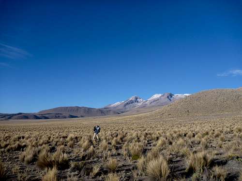
This is a delightful walk across wide-open terrain and in low vegetation. Only imagination (and topographic map if you have got one) tells you which way to go. Below is the route we have taken. Note that we started with our backpack absolutely full of water, food and camping gear; we walked very slowly almost all the way!
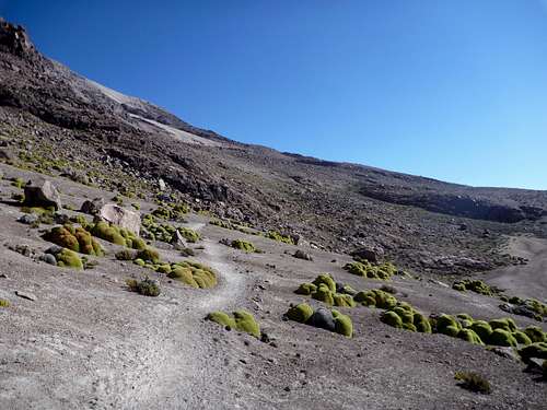
- 0.0h . 16.07511S/71.48106W ; 4068m: Laguna Blanca, start of the hike. We got there by 2.30pm.- 2.5h . 16.12118S/71.46808W ; 4245m: We camped there for the night. This is a flat area where you can technically camp anywhere. Vicunas are numerous !- 5.5h . 16.15586S/71.48070W ; 4510m: This is roughly the entrance of the valley (see picture below) we walked up to reach the dust road.
- 7.5h . 16.17165S/71.49139W ; 4820m: We reached the dust road there by hiking up the little ridge on our left.
From there, navigation is straighforward: follow the road up to the Pass!
A less boring possibility is to stick to the valley up to the where it opens (about there: 16.16771S/71.49426W ; 4900 m). Then, the road is easy to find. This option might be a bit longer anyway.
On this first part of the hike, close looks of vicunas are almost guaranteed . We spotted a fox around 4700m. Birds are very few there.
- 9h . 16.16736S/71.51247W ; 5080m: The road ends at a very scenic (and very windy) Pass.
From this point, the trail to the basecamp is obvious (during daylight !). Simply follow the well-marked, mostly flat, west-south-west path.
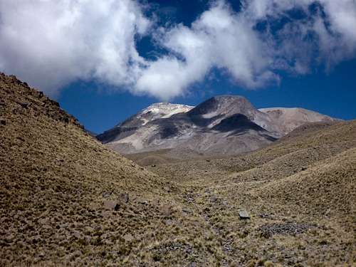
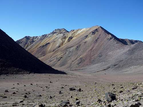
Landscape is amazingly scenic with great views over Huacullani and Nevada Calcha.
Beware that if you attempt to walk the trail by night, although it is very well marked almost everywhere, the boulder area (15 to 20 minutes) that starts at 16.17174S/71.52061W can reveal very challenging. I would not try it. Past this area, white arrows clearly indicate the way to the basecamp:
- 10h . 16.17739S/71.53111W ; 5175m: Basecamp, known as Inca camp.
To split this long hike, here are a few camping spots you can try:
+ 2.5h; 16.12118S/71.46808W ; 4245m: see above.+ 8h: once you reached the road to the Pass, several spots are possible for camping, like the very open areas at 16.16700S/71.50256W and 16.16703S/71.50505W, or the smaller area at 16.16717S/71.50788W. You can also camp at the Pass.+ 9.5h: we found a very nice, albeit small, area close to the trail right after the boulder area at 16.17151S/71.52181W. A last possibility may be found there: 16.17260S/71.52285W.
*3. The climb proper and back: anywhere from 2.5 hours to 8 hours
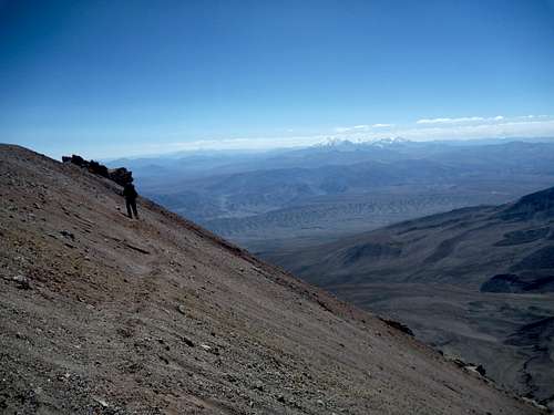
For the way up, 2.5 hours is probably for very well-trained climbers willing to push it. It took us 4 hours (reasonably fit trekkers, very well acclimatized, reasonably heavy backpacks with all our camping gear, perfect weather, no snow on the trail). Six or seven hours is a possibility I guess in bad weather. Return (if trail is snow-free) should not take more than one exhilarating hour of scree-skiing.
See below "Route description"
*4. From basecamp back to Pampa Canahuas (4080m): 1 hour (to the Pass/end of the dust road) + 0.5 hour (along road) + 4.5 hours (all the way from the dust road to P. Canahuas)
The way back is mostly identical to a reverse step 2. The trick is that we have been told drivers would not usually stop for people trying to flag a bus at Laguna Blanca. To close the deal, we would anyway reach the road by night. We then had to walk to P. Canahuas to catch a bus, where they all stop. In day light, you can obviously try your luck at Laguna Blanca to save you a few kilometers of extra-hike.
- from basecamp to the pass is about an hour (2.5 km)
- we then walked along the road down to this point: 16.16771S/71.49426W ; 4900 m. We think it is a fairly good choice as walking down the valley was almost exactly the right direction and was fairly easy to walk, mainly in sand, small rocks and bushes.
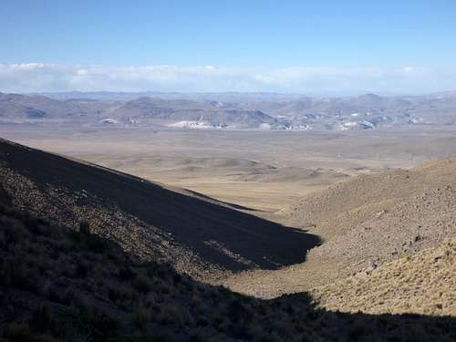
- We followed the valley until terrain was open enough to point exactly P. Canahuas. It is a nice stroll down, with fewer and fewer vegetation as you walk down. We then simply aimed straight at P. Canahuas (thanks to GPS, compass will help too as it will soon be hidden by small hills that are 8km from P. Canahuas).
- Beware that about 8.3 km from Pampa Canahuas, you need to descend a small hill. It is probably not the best idea to be there in the dark. We did it in dim light, and felt not comfortable in this relatively steep slope down moderately unstable terrain. During daylight, this is no brainer.
- Last 8 km are very easy stroll over the mostly flat sandy terrain. Note that this plain is almost flat but P. Canahuas is in a small depression and will be visible directly only from time to time. By nighttime, the dim lights of P. Canahuas were visible low over the horizon over the 5 last kilometers. GPS or compass can sure help. Otherwise, use your sixth sense -- it is strictly impossible to get lost anyway (unless blizzard hits you)!
*5. Back to Arequipa: 2 hours
Reaching to P. Canahuas on foot is an interesting experience. It is a toll and a lunch/dinner/restroom stop for buses and trucks. We have been advised to flag an Arequipa-bound bus as they stop for the police control on the eastern end of the restaurant line. Dozens of buses pass there everyday. It should not be hard to find one, except maybe late at night (?).
All in all, it is a 20-hr hike + 4 hr bus trip. You can split it up to your imagination and needs.
Route Description
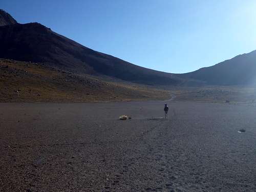
The major game changer here is definitely snow. We reached the top on Aug. 18, 2014 without having to make a single step on snow or ice. Because of this, navigating our way to the summit was a piece of cake, even with only a vague idea of where we were going. Picture below is a view from the Base Camp.
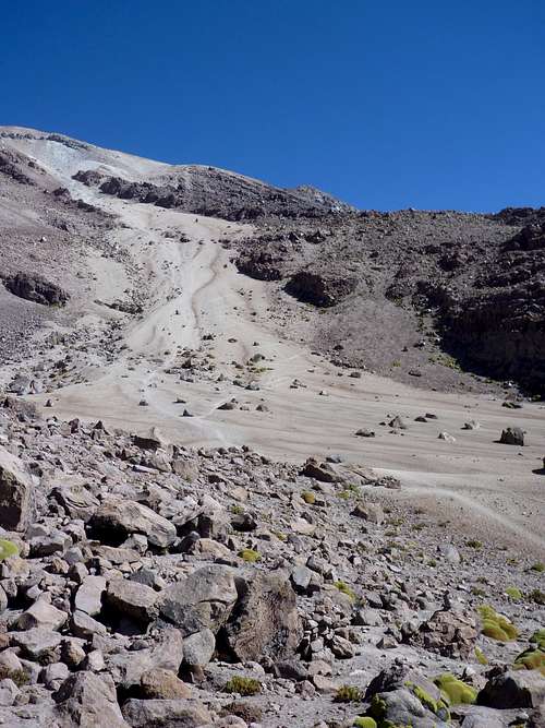
- From Base Camp (16.17739S / 71.53111 W; 5175m), trail is obvious as it climbs straight up south-south-west.
- Soon, it gets fainter (but still very easy to follow under decent conditions) and starts to zigzag in the sand. Note there is an alternative trail up along the crest to the right. We followed it for a while, but we quickly felt this rock scrambling was far more demanding than the easy walk-up sandy trail.
- Not too long after passing (16.18655S / 71.53387W; 5600m), the trail heads (west-)south-west to reach (16.19095S / 71.53594W ; 5870m).
- After that, it is a short south-east traverse, almost straight to the top.
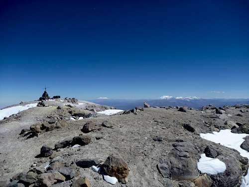
- At (16.19374S / 71.53294W ; 6005m), you enter the crater. Great spot! Summit is in view! There are (relatively sheltered) camping possibilities there for the best acclimatized! The last south-south-east 200 meters aim almost straight at the cross at the summit (16.19517W / 71.53221S ; 6075m).
Essential Gear
Besides cold, altitude, possibility of snow fall, no gear is required in season.
External Links
No permit is required. You can basically camp anywhere.