
|
|
Mountain/Rock |
|---|---|
|
|
46.45132°N / 10.88260°E |
|
|
Hiking, Mountaineering, Scrambling |
|
|
Summer |
|
|
8648 ft / 2636 m |
|
|
Overview
Cima Trenta - Walsherberg 2636 m
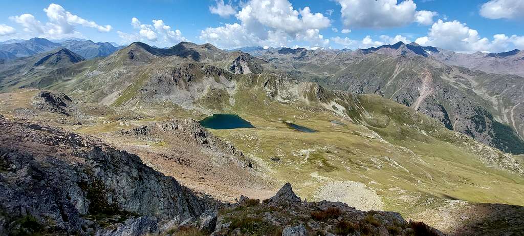
Cima Trenta 2636 m belongs to the Maddalene, a fine and wild mountain group shared between the provinces of Trento and Bolzano, which more or less separates the upper Val di Non (Trentino) from the Val d'Ultimo (South Tyrol). Cima Trenta (or Walscher Berg) constitutes a fine panoramic point on the valleys below. The panorama from the top ranges from the nearby peaks of the Gioveretto-Sternai group to the distant groups of the Dolomites.
Getting There
The starting point to climb is Malga Bordolona di Sotto 1806 m.
Road acccess
From Trento take the Val di Non road (SS43), reach Cles and continue through Val di Sole as far as Mostizzolo, where you leave the main road and continue to the right towards Cis and Bresimo. Here you continue along the namasake Val di Bresimo along a narrow paved road reaching Malga Bordolona di Sotto 1806 m. (8 km beyond the village of Bresimo).
Route
Cima Trenta Normal route report
Summit altitude: 2636 m
Difficulty: hiking and scrambling
Vertical gain: 830 m from the parking lot at Malga Bordolona di Sotto 1806 m
Starting point: Malga Bordolona di Sotto
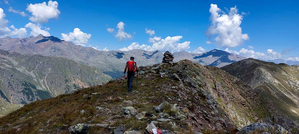
Beautiful well-signposted itinerary up to Passo Alplaner, then to be followed carefully along the ridge up to the summit.
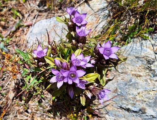
From Malga Bordolona di Sotto 1806 m, take the small road (sign. 136) with the possibility of some shortcuts which, in about 40 minutes, reachs Malga Bordolona di Sopra 2084 m. Here we are at an important crossroads of paths: we ignore the path 133 which climbs towards Passo Palù, choosing instead to turn right following the signpost to Lago Trenta or Lago Alplaner along the path SAT 136 (after about twenty meters from the starting point there is a signpost with indications to the Alplaner lake). The path is easy and clear, well dug into the grass. It continues diagonally ascending with a moderate slope and crossing meadows full of blooms with particular reference to orchids.
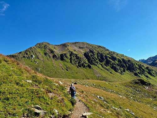
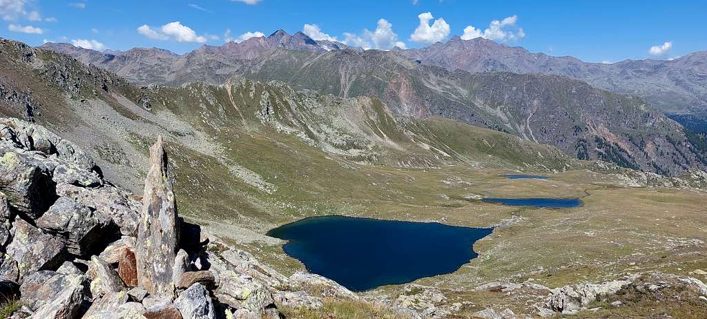
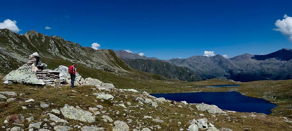
We reach a wide shoulder where the path, for a short stretch, turns left, then we cross a small stream and continue to head to the right with the path that runs under some rocky walls. The meadows gradually give way to stony grounds and debris fields. We enter the small valley that opens immediately below the Alplaner Pass. After some large rocks, we face the final climb which allows us to access the wide Alplaner Pass (2424 m - 2.20 hours from the start).
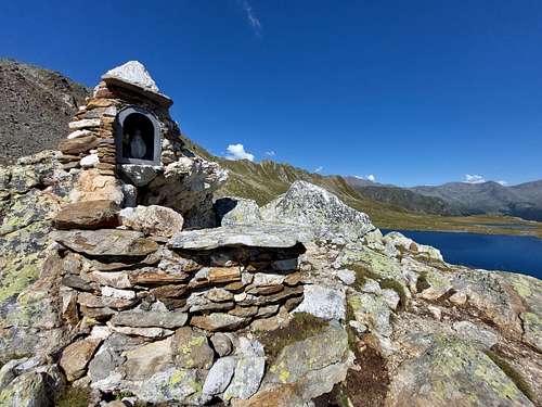
We are on the provincial border between Trento and Bolzano. Below the pass on the opposite slope it opens the magnificent Lago Alplaner 2387 m. in the territory of the Province of Bolzano.
At this point there are two possibilities:
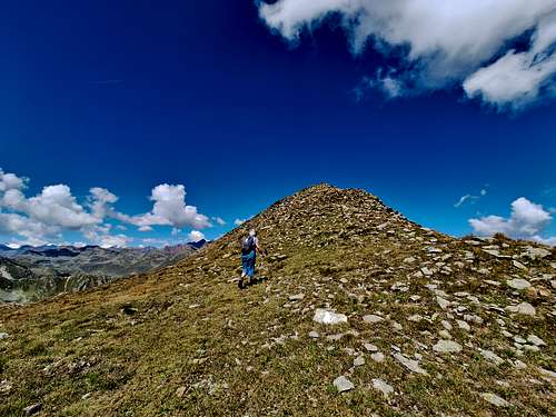
- from the pass immediately turn right and look for a trail marked by cairns, more uncertain at the beginning, then more clear, which goes up the ridge on partly rocky ground, reaches the top of the hillock, then turns left, descending slightly and reaches on the left a slightly exposed rocky ridge that leads to the summit (shorter).
- go down to the Alplaner lake and first follow the signposts in a Northerly direction. At the first signpost, do not turn right, but continue along the path n. 12.
The route then begins to climb turning East in the direction of the saddle 2502 m, located between Monte Mattonara and Cima Trenta. Here take the path n. 14 in a Southerly direction which steeply climbs the crest of Cima Trenta and reaches the summit via easy rocks (longer)
Descent: you can descend reversing the route followed uphill, alternatively the two itineraries can be combined to create a loop
Red Tape
No permits no fees for climbing are required.
When to Climb
From June to October
Accomodation
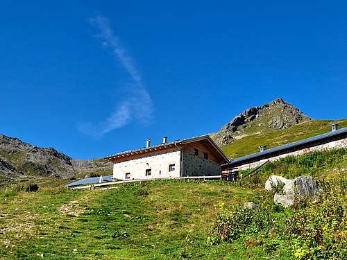
Different opportunity of accomodation in Cles and surroundings
Bibliography
Maps
- Val di Non 4land Scala 1:25.000 2020 ISBN 978-8-88982-390-3
- Kompass n. 53
- Tabacco n. 42
Meteo forecast
The weather conditions could be proofed here: