
|
|
Mountain/Rock |
|---|---|
|
|
47.58140°N / 116.6895°W |
|
|
4439 ft / 1353 m |
|
|
Overview
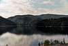
Mount Coeur d'Alene (and Caribou Ridge Trail 79 in the Coeur d'Alene National Forest) are close to the Spokane (Washington) metropolitan area. A half a million people live within a hour's drive, but this is a quiet refuge just south of Beauty Bay on Lake Coeur d'Alene, ID.This is a kid-friendly area in which to hike. If you want to "get away" for a while but don't have a lot of time to drive to higher peaks further east, then try this out. It's a nice stroll through the forest, and offers a good springtime training hiking opportunity when other peaks are still snowbound. One can easily snowshoe this trail.
The trail rises from about 2,150 feet elevation to 4,439 feet elevation in 5 miles. It's the "Caribou Ridge National Recreation Trail" 79 accessible from the Beauty Creek Campground. The old fire lookout at the overgrown summit is long gone, but it's a good place to camp.
 |  |  |
Getting There
From Coeur d'Alene, Idaho, drive east on Interstate 90 to Exit 22 (Wolf Lodge Bay). Drive south on Idaho Highway 97 for 2-1/2 miles to Beauty Creek Road No. 438. You'll pass the trailhead for Mineral Ridge; go a bit further. Take a left (east) on Road 438 for 3/4 mile to the Beauty Creek Campground and trailhead. |
Red Tape
No permits are required to hike, but if you want to camp, log onto the Beauty Creek Campground website of the U.S. Forest Service. No mountain biking is allowed (due to erosion issues), but there are often tire tracks on the trail nevertheless.When To Hike
For snow-free hiking, hit this trail from early April through the end of October. One could hike this in the winter with snowshoes (although clouds will obscure views of Lake Coeur d'Alene).Trail & Summit Description
After many switchbacks up the steep hill south of the Beauty Creek Campground, the trail flattens and heads west. You can peer down several hundred feet at your starting point. There's a distant view of Lake Coeur d'Alene through the fir forest before the trail heads southwestward.From here upwards, the trail is quite easy and you can make good time. About 4 miles up, a dirt road crosses the trail; use it to help out-of-shape people get closer to the summit campsite.
There's no view from the summit, but there's a nice campsite clearing. Motorists and mountain bikers can gain access from the logging roads coming up from the southwest.
 |
Topo Map
In the "Photos" page, click on the topo map for the route of Caribou Ridge Trail 79. The 5-mile (one-way) route from the north is shown in red. Note that a logging road crosses the trail 4/5 of the way up at elevation 4,000 feet. The summit campsite is accessible from a spur of this road, and from the south.Camping Opportunities
A nice U.S. Forest Service campground is available at the trailhead at Beauty Creek Campground. One can also camp at the summit (which is accessible via logging roads from the south and northwest). |  |
Local Weather Conditions
The National Weather Service has an automated weather station on the Vets Memorial Bridge (on I-90), near Wolf Lodge Bay on Lake Coeur d'Alene. Click on Weather Station 55.Also, you can call the Coeur d'Alene River Ranger District of the U.S. Forest Service in Fernan, ID (near Coeur d'Alene) at (208) 769-3000 for area weather conditions.
External Links
- Beauty Creek Campground
U.S. Forest Service campsite description lists camping fees and contact information.
Scott - Apr 28, 2005 11:09 pm - Voted 10/10
Untitled CommentHi Dluders,
To enter the correct coordinates, go to the edit mode at the top of the main page. You can change the coordinates that way in the proper section.
PS, the coordintes are these:
47.581
-116.690
Here is an easy way to find these. Go to Topozone.com and type in the name search they will appear.
CLICK HERE TO SEE
Let me know if you have any other questions.
dluders - Apr 28, 2005 10:44 pm - Hasn't voted
Untitled CommentThe correct Latitude and Longitude for the summit of Mount Coeur d'Alene, Idaho, USA is Latitude 47 degrees 35 minutes North and Longitude 116 degrees 41 minutes West. I don't know how to fix the Topozone Map coordinates, since there's no "edit" function for this information.
Also, this is my very first post. People were rating my incomplete site even though I was in the middle of a 2-hour uploading session. I'll know next time to put "Under Construction" on my postings.
Scott - Apr 28, 2005 11:09 pm - Voted 10/10
Untitled CommentHi Dluders,
To enter the correct coordinates, go to the edit mode at the top of the main page. You can change the coordinates that way in the proper section.
PS, the coordintes are these:
47.581
-116.690
Here is an easy way to find these. Go to Topozone.com and type in the name search they will appear.
CLICK HERE TO SEE
Let me know if you have any other questions.
locke456 - Oct 7, 2013 11:11 pm - Hasn't voted
Campground Charged A Parking Fee 9/2012Maybe we got fleeced, but we parked at the campground (not in a site, but by the bathrooms) and were told we had to pay a $5 parking fee by the campground manager. Just a heads up.