Toggle navigation
Mountains
Routes
Images
Trip Reports
Forum
What's New
People
Areas & Ranges
Articles
Trailheads
Canyons
Huts & Campgrounds
Albums
Logistical Centers
Fact Sheets
Lists
Custom Objects
Gear
Plans & Partners
WELCOME TO SUMMITPOST
SIGN IN
REGISTER
Wahweap
Additional Parents
Image
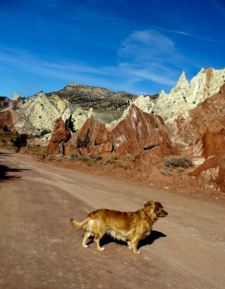
Cottonwood Canyon Road
View High-Resolution Image
Cottonwood Canyon Road
30 miles of well-graded clays turn into a slippery trap for jeeps when wet. This angular formations grace the road some 5 miles South of Grosvenor Arch junction. 11/15/07
« PREV
NEXT »
GeoPooch Sobachka
on
Nov 19, 2007 10:21 am
Comments & voting
Other parents
Lat/Lon:
37.16015°N / 111.71203°W
Image Type(s):
Hiking
Image ID:
358112
1637 Hits
74.01
% Score
4
Votes
Log in to vote
Comments
No comments posted yet.
to post!
Don't have an account?
Wahweap
(Canyon)
You are at
the First
Image
Viewing
#1 of 1
GALLERY
You are at
the Last
Image
GeoPooch Sobachka's Image Gallery
« PREV
Viewing
#210 of 304
GALLERY
NEXT »
×
You need to login in order to vote!
User Name
Password
Remember me
Forgot your password?
Log me out when I close my browser.
Keep me logged in all the time.
sign in as a user
Don't have an account?
Register now for FREE
Rating available
Suggested routes for you
People who climb the same things as you
Comments Available
Create Albums
Register Here


