|
|
Mountain/Rock |
|---|---|
|
|
33.46459°N / 113.36136°W |
|
|
Trad Climbing, Scrambling |
|
|
Spring, Fall, Winter |
|
|
2874 ft / 876 m |
|
|
Overview
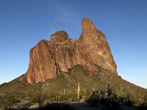
The Eagletail Mountains are a rugged and remote range in Central Arizona between Phoenix and Quartzite. The range is named for its’ highest mountain, the technical Eagletail Peak with twin summit spires looking like a pair of namesake Eagle Feathers. The infrequently visited range and wilderness area has a few other technical summits, with the most popular by far being Courthouse Rock. The massive blocky summit dominates the open desert south of the I-10 on the drive between Phoenix and California. One of Arizona's classic adventure climbs, the easiest route to the summit is 5.5 and at least 6 pitches. There are several other more challenging climbs on a buttress on the SE face, however these all top out on the plateau halfway up the mountain, with some hiking, scrambling and a final pitch of climbing to reach the high point.
Getting There
This is directly from the excellent Dankat trip report:
"About 65mi west of Phoenix, Arizona, leave Interstate 10 at Exit 81, marked Salome Road and Harquahala Valley Road. Follow the paved Harquahala Valley Road south (it travels west for a short way, paralleling the Interstate, before turning south) for 5.0mi and then turn right onto the marked Courthouse Rock Road whose roadsign also reads Centennial Road. Go due west for 7.0mi on the good dirt road heading directly for the rock itself. Then veer right and drive in a WNW direction along a rougher but still 2WD road that parallels a buried gas pipeline. Courthouse Rock now looms high overhead on the left and from the road you should examine the broad northeastern aspect of the monolith. The peak itself is on the right; near the left end you should be able to identify a deep dark gully that reaches all the way up to the long lefthand shoulder of the rock.
Three rough approach roads (high clearance) turn left off the gas pipeline road and provide fairly convenient access to the Rock. From the point where you veered right at the end of Centennial Road, drive 2.1mi along the gas pipeline road where you will encounter a lone pole. The first of the three approach roads, and the one that takes you closest to the climb, turns off to the left at a point (33o28.82'N 113o19.34'W) which is 0.4mi beyond the lone pole. It is 2.3mi along this first approach road to the wilderness boundary where you should park (33o27.62'N 113o20.93'W). Respectively another 0.6mi and 1.6mi further along the gas pipeline road or 3.1mi and 4.1 from the end of Centennial Road are the second and third approach roads. The third has a sign indicating access to the Eagletail Mountain Wilderness Area and is probably the most reliable of the three approaches; it is 1.5mi along it to the Ben Avery Trailhead entrance to the Eagletail Wilderness. However it involves a longer hike to the climbing route."
Route
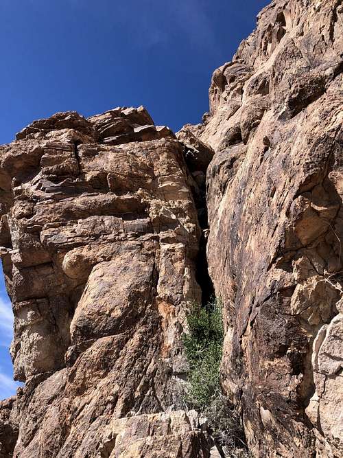
From the parking area, locate the deep gully on the SE face. Hike through easy desert cross country to the base of the gully. The standard route about 30' to the right of the gully itself up a low angled rib of rock.
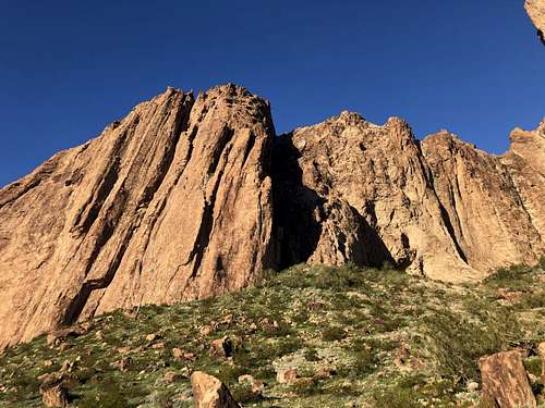
The first two pitches are generally run together and will be described as such:
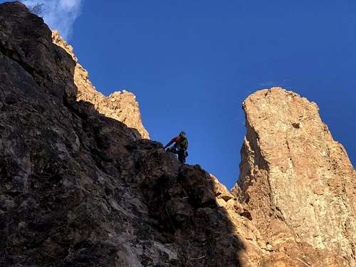
Pitch 1: Climb up the low angeled rib of rock about 50' before stepping out right onto the arete. You will quickly reach the first belay station of two pitons. Continue past on class 4 terrain to a headwall. Climb an easy ledge-ramp system to the left to reach a two bolt belay station with rap anchors.
Pitch 2: Climb the low angeled groove/ crack system out left, up a short chimney to a large platform with another two bolt anchor.
Pitch 3: Continue climbing the dry watercourse direct up, climbing a good 160 feet to reach another platform. I found the easiest climbing to keep right at the ramps below the next two bolt belay station, although left is possible.
Pitch 4: The crux pitch. Climb directly up from the anchors to a useless bolt below an easy step. I felt like this first bolt only created drag and I wouldn't recommend using it. Locate two additional bolts on the dark rock above and slightly to the right. Continue up to the final of the three bolts, clip and extend the heck out of it, and downclimb a few feet and traverse far out right. Do not be tempted to go left, as you'll completely miss the belay. Continue the traverse until you reach a short crack system that you can climb another 20' up to the two bolt belay station tucked behind a large leaning flake.
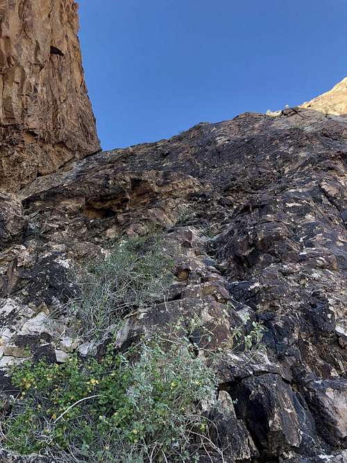
Pitch 5: Don't be tempted by any tat you see out to the left! Follow the right corner of the flake directly up to find the final set of anchors before the midway plateau.
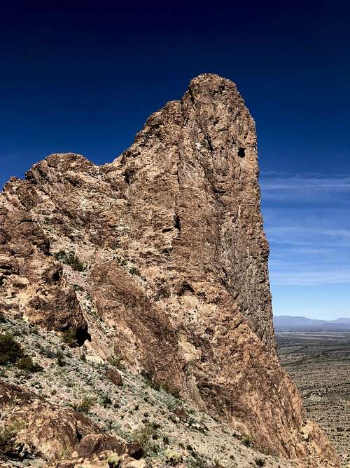
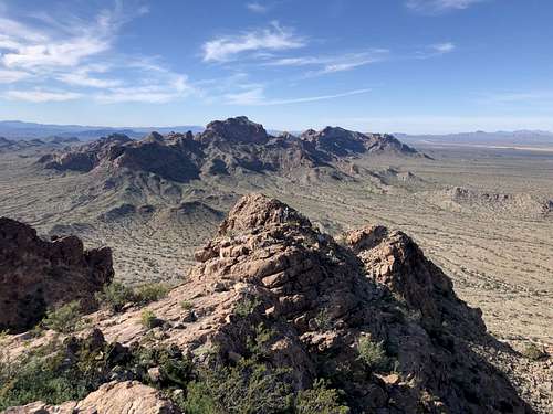
Untie here and put the gear away. The summit is still high overhead to the north. Follow sheep trails, dropping slightly around an intermediate rocky peak on the ridgeline to a wide class 2 gully that runs beneath the summit rocks. You'll be aiming for a notch up and to the right but don't climb all the way up! Instead traverse out right just below the level of the main high saddle on some narrow exposed ledges (occasional cairns) to find the start of the final pitch.
Pitch 6: Climb the chimney up to a ledge with a single bolt. Step out left onto the arete and climb straight up to another ledge about 5' deep. Perform an easy but exposed traverse to the right to reach the summit anchors, or climb straight up a 10' crack, providing an opportunity for protection but more difficult climbing.
From the final belay/ rappel station, scramble onto the broad saddle below the summit rocks. The final ~100' is easier than it looks, mostly class 3 with a short but exposed class 4 chimney/ dihedral that some may want a belay for. At the top of this last bit of scrambling is an easy hike to the high point.
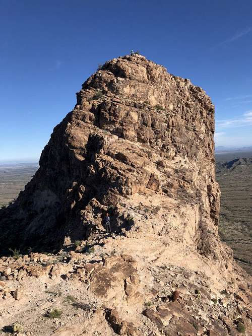
For the descent, reverse course and rappel the route. All rappels require two 60 meter ropes aside from the first rappel off the plateau halfway up the mountain.
Red Tape
No motorized vehicles in the wilderness area.
When to Climb
Summer would be ungodly hot with no water sources, late fall to early spring are the best bets.
Camping
There are great at-large campsites at any of the various trailheads or dirt roads around the wilderness area.
External Links
The original Dankat trip report: http://www.dankat.com/swhikes/courth.htm
My own trip report with more images: The Mountains Are Calling
Desert Mountaineer trip report, however the beta to find the final pitch is a bit off: https://www.desertmountaineer.com/2018/06/08/courthouse-rock/
