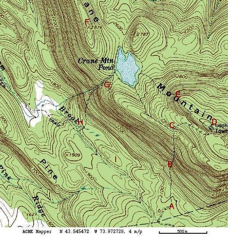
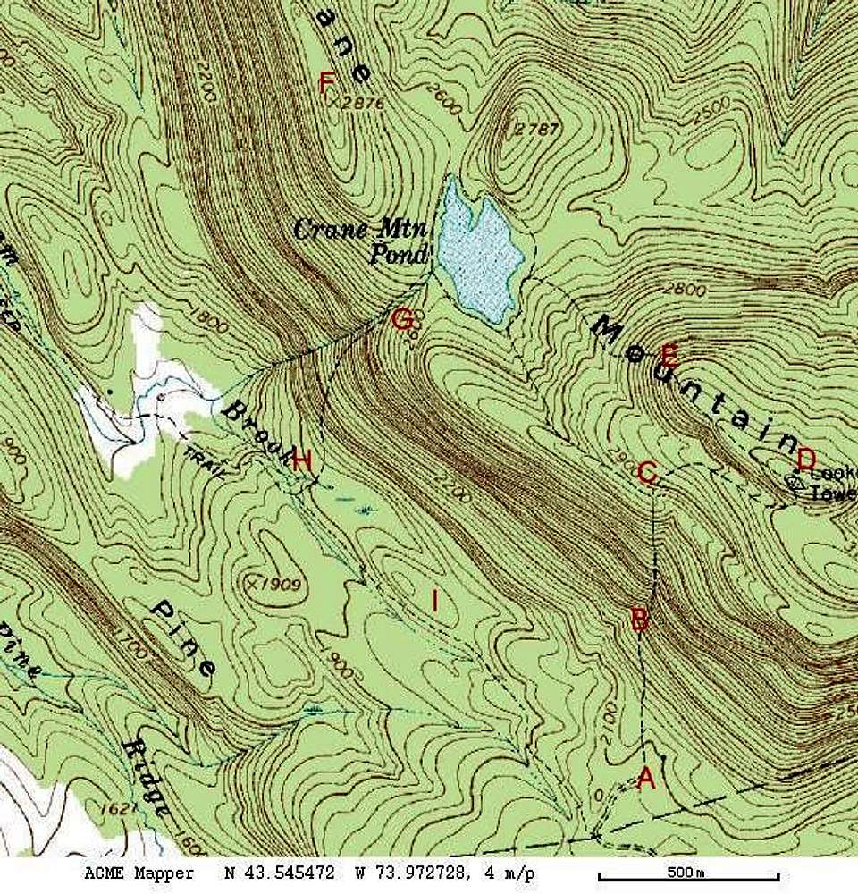
Route is counter clockwise starting at A
A would be the trailhead (if you can get your vehicle all the way in to the parking area, otherwise you'd start back down the road at nearest pulloff)
B The shortest route to the summit
C Junction with side trail to the pond that avoids the summit
D The summit
E Trail connecting summit and the pond
F The Northwest Ridge (no trail...bushwack from the pond outlet at Putnum Trail (G)
G Putnum Trail connecting the pond to the old fire road
H Location of Stone bridge over Putnum Brook
I Route to trailhead via old fire road


Comments
Post a Comment