
|
|
Mountain/Rock |
|---|---|
|
|
39.89531°N / 120.45009°W |
|
|
Plumas |
|
|
Hiking |
|
|
Spring, Summer, Fall |
|
|
7499 ft / 2286 m |
|
|
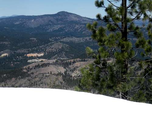 Crocker Mountain seen from Beckwourth Peak 4/16/2016
Crocker Mountain is a fairly accessible mountain in Plumas County, California. It is situated east of the Lake Davis reservoir in the Plumas National Forest, north of the town of Portola.
It is a wide mountain with a long north-south ridge. It isn’t commonly hiked, although there are some good jeep trails around the mountain.
The summit itself is a rocky area with views to the east. Roads lead up to within a quarter mile of the summit. The shortest route to the summit is less than 3 miles.
Crocker Mountain is best hiked in spring or fall months, in dry periods. The mountain can get snow, but snow levels vary depending on winter, and snow typically melts by early spring.
Getting There
Crocker Mountain is most easily approached from the west. However, 4WD can make it up Crocker Mountain Road easily to within three miles of the summit and approaches from the east.
To reach Crocker Mountain Road,take Highway 70 to Grizzly Road, which leads to Lake Davis. Grizzly Road is about 2 ½ miles east of Portola, California.
Crocker Mountain Road is on the east side of the road about 5 miles up the road. The western approach trailhead is another mile further, also on the east side of the road. There is a Plumas National Forest sign in front of the road. There is ample parking.
Route Information
The western approach is the easiest to access because 2WD vehicles can park at the trailhead, which is under 3 miles from the summit. Start by taking the road that passes an old building. The road soon deteriorates. The road to the summit can be confusing at times. At times, it is just an open area in the forest. The road heads directly east, and then curves around heading north. Eventually, the road improves and it cuts back south towards the summit. Take the road until it basically ends. Crocker Mountain is at the south edge of the ridge. The summit is about 250’ above the road, and is reached in about a quarter mile of steep bushwhacking. In total expect just under 3 miles of hiking distance to the summit, gaining about 1,650’.
The eastern approach is from Crocker Mountain Road. The intersection of Grizzly Road and Crocker Mountain Road is about 6 ½ miles from the summit. The road is decent for the first 3 ½ miles, as it winds around the mountain and actually descends. The road up the mountain is across from a small pond. The road winds to the north and then cuts back south, ending at about 7,330’. The summit is about a quarter mile and 270’ above it.
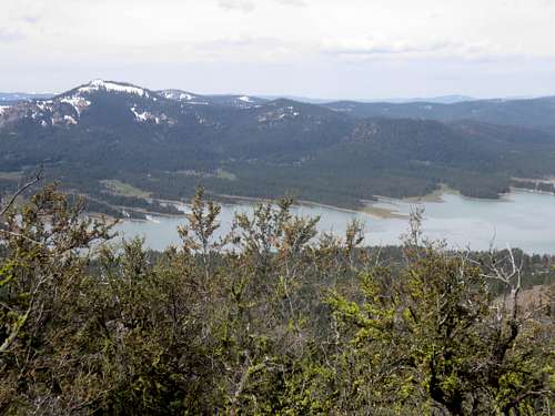 Lake Davis
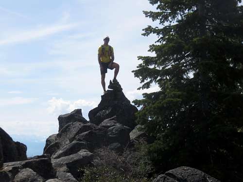 Dean standing on the summit of Crocker Mountain
Red Tape
There is no red tape or restrictions for hiking in this area. The lands are within Plumas National Forest.