
-
 11753 Hits
-
 79.77% Score
-
 11 Votes
|
|
Mountain/Rock |
|---|---|
|
|
36.56536°N / 4.89797°W |
|
|
Hiking, Scrambling |
|
|
Spring, Summer, Fall, Winter |
|
|
3878 ft / 1182 m |
|
|
Overview
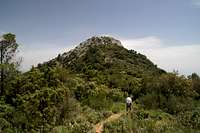
 Cruz de Juanar as seen from the north-east Cruz de Juanar as seen from the north-east |
The Sierra Blanca is one of Spain's (and therefore Europe's) southernmost mountain ranges. It doesn't rise much higher than 1200 - 1300m but since it does so right above the Costa del Sol, its peaks are rather impressive. Moreover from each of them you have picture perfect views of the coast, of the City of Marbella underneath and - on a good day - of the north African coast on the other side of the Mediterranean. Of particular interest is the southernmost ridge, which is composed of for mountains: La Concha, Cerro del Lastonar, Cerro del Salto del Lobo and Cruz de Juanar. The latter - being the easternmost of the four summits - is the easiest accessible one. Two routes lead to its summit, both starting near Rifugio de Juanar, a mountain hut turned hotel & restaurant in the north-east of the range.
Like its brethren, Cruz de Juanar has a rocky summit, which rises out of the high plateau like a big cone. Flat topped itself, it wears a cross which gave it its name. Moreover there must be pilgrimages to the cross and the Madonna to its side since the whole area around the two is covered with candle wax. Of the two routes the north-eastern one is the more strenuous since it directly climbs the slopes of the mountain. The normal route, however, also first part of the normal route to La Concha, avoids the steep NE slopes and heads towards the mountain from a saddle directly to its west. Both routes are steep on brittle, scree like underground and towards the top they get outright rocky. None of them are difficult though the last few metres are rather exposed.
 Cruz de Juanar Cruz de Juanar |  Cruz de Juanar Cruz de Juanar |
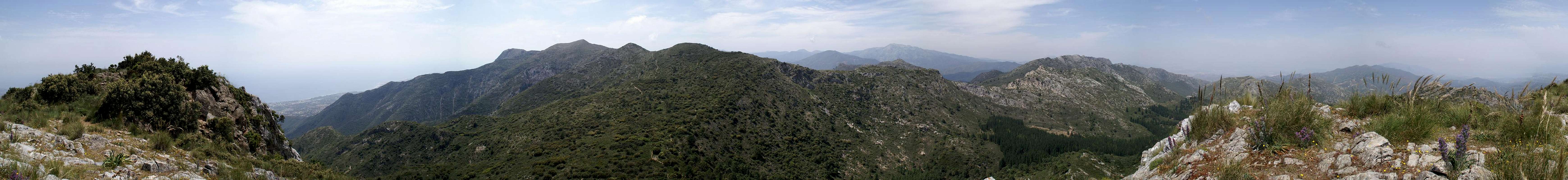
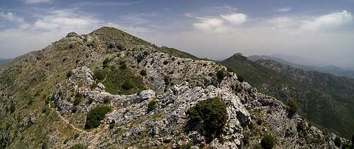
From the top of Cruz de Juanar you have nice views towards Sierra de Canucha and Sierra de las Nieves in the north. The whole Sierra Blanca Ridge is visible in the west with La Concha and Cerro del Lastonar rising above everything else. And, of course, the city of Marbella is visible right underneath on the Costa del Sol.
The 360° Summit Panorama
  |
Getting There
 |
The closest international airport is the one at Malaga, which is served by all charter carriers. From Malaga, simply take motorway A7 in direction Marbella. At Torrebianca the motorway splits in two, the Autovia del Mediterraneo, A7, which is free of charge and runs close to the coast and the Autopista del Mediterraneo, AP7, which is a toll road and runs through the plains closer to the mountains.
At Marbella switch to A355 north in direction Ojen. Just before reaching the town, a narrow mountain road turns off in direction of Rifugio de Juanar (signs). The parking lot at the Rifugio is reserved for its visitors but you can drive on for several 100m until you reach a gate and an associated parking lot.
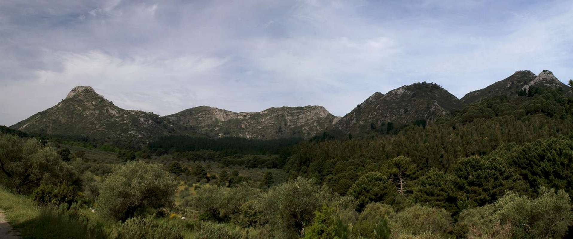
 Cruz de Juanar west face Cruz de Juanar west face | 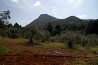 Cruz de Juanar Cruz de Juanar | 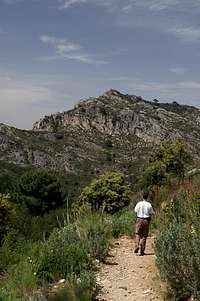 Sierra de Canucha Sierra de Canucha |
Red Tape
 3 - 2 - 1 - Ready for takeoff: Papillo machaon
The Sierra Blanca belongs to UNESCO’s Biosphere Reserve Sierra de las Nieves since 1995. Therefore the usual restrictions for natural parks apply.
The first part of the normal ascent runs across a dirt road to a farm building across a plain. The plain is private property, belonging to the farm and since part of the western route to the mountain runs through farm property you are requested to stay on the trails.
Accommodation
 Cerro del Lastonar (1275m) and Cruz de Juanar (1182m)
The Costa de la Sol is one of Europe's major vacation getaways and there are all types of accommodation to be found. Hotels, apartments, fincas can be booked from any tourist office all over Europe and there are many sites on the net which deal with the area.
Obviously, Marbella is the closest town, where you can find everything: hotel rooms, apartments, campgrounds. The closest restaurant / hut / hotel is Rifugio de Juanar, located directly at the trailhead.
Weather Conditions
Maps & Books
There are several digital maps available, which cover the whole of Spain. The basis is the mapping of the Servicio Geográfico del Ejército of the Spanish Military, who offer the maps on a set of CDs with scales 1:125000 and 1:800000.Alternatively there is a Garmin MapSource Topo Map, based on maps scaled 1:25000.
As for regular maps, there is the following one, which, however, is quite hard to come by:
- Mapa Militar de España 15-45 (1065), Marbella
Servicio Geográfico del Ejército
1:50000
As guidebook I can recommend the following one which is available in German and English
- Andalucia South / Andalusien Süd
Costa del Sol – Costa de la Luz – Sierra Nevada
Bernhard Plikat (translation: Gill Round)
Rother Verlag
ISBN 978-3-7633-4824-4 (English)
ISBN 978-3-7633-4147-4 (German)