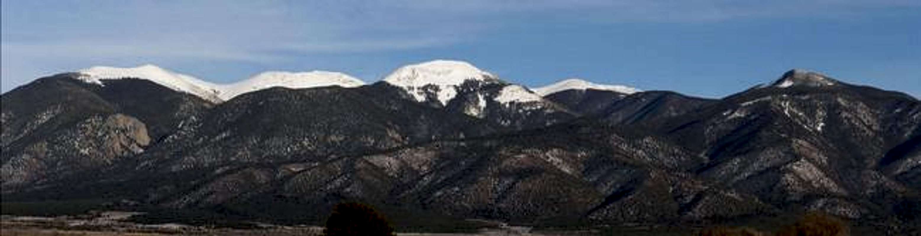
DATE AND TIME: 112504, 1537;
LOCATION: A dirt road that goes directly north from Cerro to Sunshine Valley (just north of NM-378);
CAMERA: Olympus C-740 Ultra Zoom, 10x optical, 3x digital, 3.2 megapixel;
DESCRIPTION: A panoramic image of the peaks in the Latir Peak Wilderness, facing east.
FROM LEFT TO RIGHT: Virsylvia Peak (12,594') is at the left 1/4, while Venado Peak (12,734') is left of center. Cabresto Peak (12,448') is the large peak in the center. Cabresto Sur Este (a.k.a. "Pt. 12,456" and/or "Mt. Questa") is the snowy peak just to the right of Cabresto Peak. Pinabete Peak (11,948') is the treed summit at the right 1/4.
Contrary to many beliefs, Latir Peak is NOT visible in this photo. From this angle, it is hidden somewhere behind the ridge connecting Virsylvia and Venado peaks, and Venado Peak is the one often misidentified as "Latir Peak."
Here are closer views of
Venado Peak,
Virsylvia Peak (Virsylvia Peak page) and
Cabresto Peak/Cabresto Sur Este (Cabresto Peak page).


