Toggle navigation
Mountains
Routes
Images
Trip Reports
Forum
What's New
People
Areas & Ranges
Articles
Trailheads
Canyons
Huts & Campgrounds
Albums
Logistical Centers
Fact Sheets
Lists
Custom Objects
Gear
Plans & Partners
WELCOME TO SUMMITPOST
SIGN IN
REGISTER
Aiguille Noire de Peuterey
Additional Parents
Image
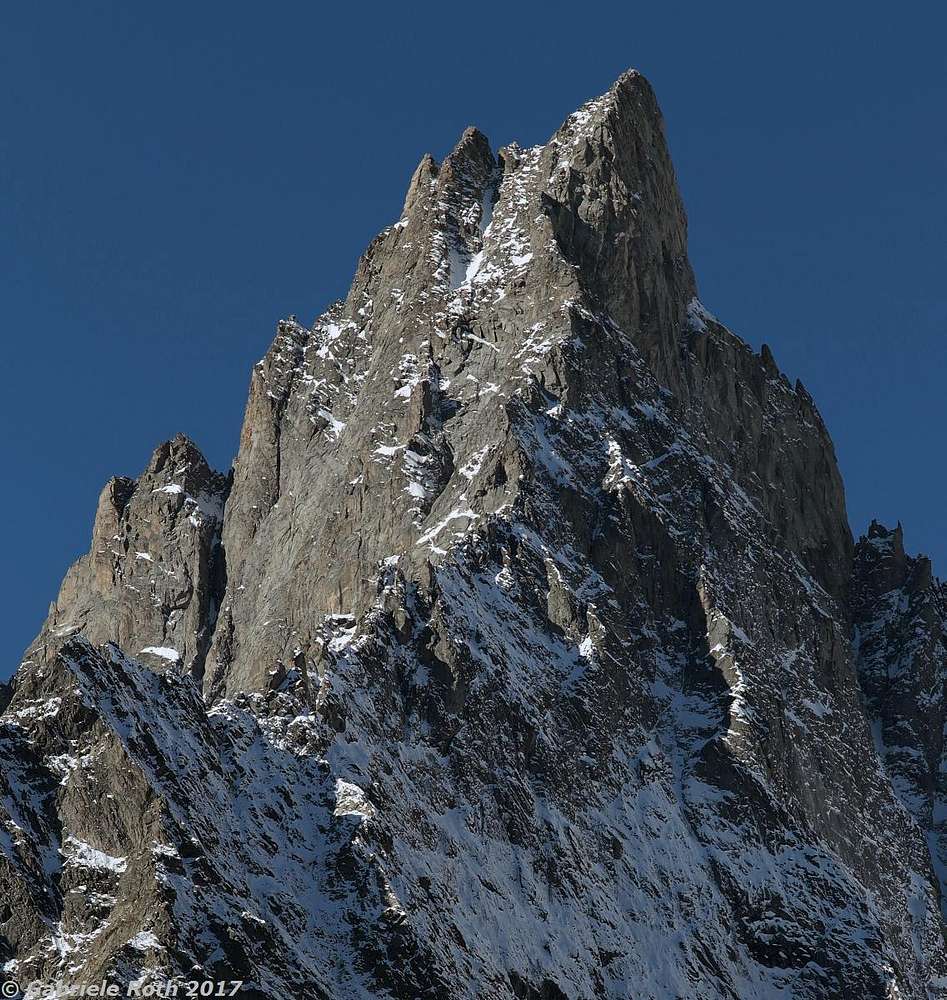
detail of the descent route
View High-Resolution Image
detail of the descent route
the upper part of the E ridge, normally used to come down captured (using a 200mm lens) from the beginning of Val Ferret
« PREV
NEXT »
Gabriele Roth
on
Aug 24, 2017 5:38 am
Comments & voting
Other parents
Lat/Lon:
45.81474°N / 6.89378°E
Image ID:
1005578
1650 Hits
74.01
% Score
4
Votes
Log in to vote
Comments
No comments posted yet.
to post!
Don't have an account?
Aiguille Noire de Peuterey
(Mountain/Rock)
You are at
the First
Image
Viewing
#1 of 1
GALLERY
You are at
the Last
Image
Gabriele Roth's Image Gallery
« PREV
Viewing
#2045 of 3232
GALLERY
NEXT »
×
You need to login in order to vote!
User Name
Password
Remember me
Forgot your password?
Log me out when I close my browser.
Keep me logged in all the time.
sign in as a user
Don't have an account?
Register now for FREE
Rating available
Suggested routes for you
People who climb the same things as you
Comments Available
Create Albums
Register Here


